|
January 2014
January 1 - the New Year began stormy with coastal damage and flooding in many places. Pressure 986 mb was falling with a low and triple point SW Ireland 973 mb tracking NE bringing a warm front over the Irish Sea. There had been heavy rain in the night and it was raining at 0900 GMT as pressure continued to fall. A wet morning with a SE'ly breeze backing E'ly then picking up, gusts of 30 mph and 52 in Llandegfan, and veering SW'ly by 1400 GMT the temperature being 11.2C continuing mild (it was 21.3C in Malaga today). Pressure began to rise from a low of 972.8 mb at 1700 GMT and a cold front passed over around 1900 GMT with gusty wind followed by moderately heavy rain. Sunless; [5.3 mm]. Bude 13.1C; Cardinham [34.2 mm] , Kenley/ Sennybridge [25.8 mm], Capel Curig [20.8 mm]; Messina, Sicily [54 mm]; Kinloss 3.8h. The 2nd began brighter with a line of backlit cumuli over the Snowdonia Mountains as pressure rose. We were in a clearer slot in a W'ly airflow and there was some sunshine through to afternoon. Spots of rain around 1600 GMT and light rain later as the wind strengthened as yet another low tracked N off SW Ireland 950 mb. A gust of 57 mph was recorded at Gorwel Heights 2056 GMT and a burst of heavy rain here 59 mm/h at 2340 GMT. Gale force winds affected exposed and coastal areas all night. A very blustery morning on the 3rd the SW'ly force 7 and gusting to 45 mph and 70 mph at Aberdaron. A little snow was seen along with older snow patches around the highest mountain summits. At 1024 GMT there was a shower of ice pellets then a burst of 9 mm hard hail (H5). Blustery into the afternoon with more showers of rain and mostly small ice pellets heavy at 1645 GMT (33 mm/h). Tyndrum {68.0 mm}, Tredegar {21.2 mm}. , and more damage and further flooding was expected. Students had been evacuated from University accommodation facing the sea at Aberystwyth where damage had already occurred. An active band of heavy squally showers moved in off the Irish Sea and at 0908 GMT here there was heavy rain, small ice pellets and rumbles of thunder. Thunder got louder up to 0926 GMT as the storm-cells approached - a house in Llanfachraeth, Anglesey, was struck by lightning destroying the roof. Very windy all day with strong gusts. Manston 12.5C; Achnagart {66.8 mm}, Capel Curig [8.8 mm]; St Athan 5.5h
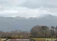
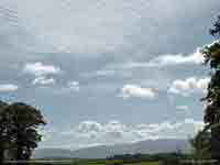
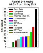
At 09 GMT on the 11th 5 oktas cloud cover cumulus and contra overhead, mostly dark looking with mist on the Snowdonia mountaintops, but clearing sky.
At 0900 GMT on the 24th the sky was overcast and the temperature had risen to 8.0C the maximum of the past 24-h. Pressure 1008 mb was falling with low 956 mb S Greenland while pressure was high over the Azores 1039 mb and the Adriatic 1003 mb. A trough was over W Britain. The rain and drizzle was dying out and the day was drier, but sunless, until late afternoon and evening when a warm front arrived introducing showery rain. The temperature rose to 9.9C at 1800 GMT in Llansadwrn and at Gorwel Heights to 11.6C at 1900 GMT one of the highest in Britain on this day. Killowen 11.5C, Rhyl 11.1C; Llansadwrn [6.2 mm], Milford Haven {25.2 mm} and Cardinham {34.8 mm}. On the 25th we were still in the warm moist airstream at 0900 GMT 8.4C (dewpoint 6.4C) 87% RH rising to 9.3C by 1000 GMT; Gorwel Heights 11.6C.
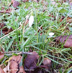
A wet morning on the 28th with 15.1 mm measured in the raingauge and standing water around the garden. Local roads were awash with runoff from fields and in places deep water was across the road. Pressure was steady on 974.6 mb up a little from the lowest 974.1 mb at 0707 GMT, not as low as the 972.8 mb on the 1st. The local free-draining soil here has been near saturation point (72%) and today A cloudy morning on the 29th with continuous slight rain giving way to showery rain at 0900 GMT. Pressure 993 mb was rising in low pressure 988 mb Wales and N France. A light E'ly breeze, good visibility with low cloud and mist surrounding the mainland mountaintops. Mostly dry; s few spots of rain early in the afternoon. Sky clearing in the evening with ground frost developing. A fine and bright morning on the 30th with overnight ground frost little whiteness, mostly clear ice on the grass ( min -4.3C) and slight air frost (-0.2C Stevenson screen). With a bank of cumulus cloud over the Snowdonia Mountains the sun took a few more minutes to appear. Poor visibility with smoke haze, slightly coloured, viewed again the mountains and out over Red Wharf Bay. Sunny at first, maximum 5.8C, lowest of the month, plenty of snowdrops out now in the garden and several lesser celandines and one dandelion spotted along the hedgerows; cloudier by afternoon with temperature falling there was slight ice crystal precipitation. The month ended with rainfall of 146.2 mm (140%) & [143%] of averages, largest since 2008 rank 15 since 1929. The mean temperature was 6.1C (+0.8) & [+1.0] of averages. Dull, sunshine at Valley 36.9 h was lowest since 1995, ranking 9th on my K&Z adjusted Anglesey record. .
February 2014
The wind moderated after a further spell of rain ending about 02 GMT and the morning of the 6th was a light SW'ly. The sky was clearing over Anglesey with moderate hazy visibility. Pressure 989 mb was rising slowly as low 977 mb and associated fronts brought further rain into SW England and Brittany. Yesterdays low was 972 mb heading for the S Norwegian Sea. Showery rain in the afternoon. Maximum 7.5C, East Malling 11.0C; Rain [4.8 mm, 11 h duration], Lake Vyrnwy {23.4 mm}. Although misty the 7th began fine and sunny with pressure 991 rising as a ridge crossed from the west. The 9th dawned overcast and dull with cloud low over snow on the mountains. The soil remains soft and muddy with little sign of drying through the cloudy day. A glimpse of weak sunshine just before sunset as the sky began to clear from the west. Broken cloud during the evening and night. A brighter cooler morning on the 10th with a wintry shower of snow pellets and small flakes of snow before dawn traces still on the ground at 0900 GMT. The air minimum was 1.5C, just 0.1C greater than the lowest on the 1st, and -3.0C on the grass. Pressure 989 mb was rising with low 983 mb over Cardigan Bay with a ridge of high-pressure to the west. There was snow on the mountains, sprinklings as low as 1000 ft with lying snow above 2500 ft on the Carneddau: Road conditions at Cerrigydrudion were described as treacherous. A sunny morning becoming cloudier in the afternoon with high cirrostratus encroaching. A partial 22 deg solar halo with weak sundogs was seen for about 30 minutes or so from 1415 GMT. Kew Gardens 10.8C, Llansadwrn 9.0C. Morecambe 7.4h. Some broken cloud overnight (grass minimum -1.8C) and showery rain around 03 - 06 GMT [4.3 mm] on the 11th a gusty wind Gorwel Heights 51 mph at 0438 GMT marked passing of a weak frontal system. Cold enough on the mountains for a little more snow generally above 1800 ft with some at 1250 ft around Ogwen. At 0900 GMT; 3.3C (dewpoint 1.2C RH 86%) overcast, hazy good visibility, light SW'ly breeze. Cloud soon beginning to thin with small breaks appearing by 1030 GMT and soon sunny turning cloudier again by afternoon. There was a shower of snow and snow pellets at 1530 GMT. Rising water levels on the River Thames resulted in flooding of the Thames Valley inundating many properties. Maximum 8.0C, Wiggonholt 9.2C. Rain [4.3 mm], Tredegar {25.6 mm}.
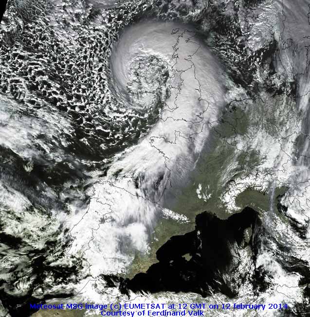
The 13th began bright with a little sunshine breaking through from time to time. The ground was strewn with twigs and small branches blown from trees and the shattered remains of a slate blown off the roof. The wind was light so opportunity was taken to get the ladders out and replace the slate. Job done. The breeze did pick up in the afternoon, but there was a little sunshine with a maximum of 6.3C, lowest of the month. Thousands were still without electricity as engineers struggled to make repairs. A bright moon in the evening with a touch of ground frost (-1.0C). A dry day in Llansadwrn; S and W-facing windows were encrusted with sea salt blown here off the sea by the gale. Writtle 9.7C, Kinlochewe {64.6 mm}, Hawarden 6.1h. A grey morning on the 14th with pressure 988 mb falling rapidly once again with low 958 mb and triple-point off SW Ireland lining up for another assault. The warm front was over SW England where there was heavy rain. A wall of cloud was building up to the S of the mountains with snow falling on the tops; there was old snow lying across the range at 2500 ft, some a little lower at 2250 ft. At 0900 GMT the temperature was 5.0C (dewpoint -0.3C) RH 69%, indicating a 35% chance of ice precipitation; with the SE'ly breeze strengthening to force 4 there were some spots of precipitation here by 1030 GMT temperature 3.8C (dewpoint 2.2C), RH 78% the chance of seeing ice precipitation here receding at 20%. At Gorwel Heights the SE'ly wind was gusting to 58 mph and at Gorddinog to 66 mph (Valley 40 mph) and there was heavy sleet the precipitation falling as snow in blizzard conditions on the tops of the Carneddau. Strong cross winds off the mountains on to the A55 made for difficult driving conditions to Bangor. The 17th was another mostly cloudy day with spots of rain at times and slight showers in the afternoon. The wind which began the day SE'ly veered SW'ly by 1800 GMT with further showery rain in the evening and overnight. Max 10.1C, Gorwel Heights 10.8C, Gorddinog 11.1C, Gravesend 12.0C. A brighter morning on the 18th, good visibility but cloud on the mountaintops. A sunny day. Another sunny start on the 19th with just 1 okta cumulus and lenticular altocumulus cloud over the mountains at 0900 GMT; the temperature was 6.7C (dewpoint 6.3C) 97% RH and rising to 9.1C at noon. . Turning cloudier by midmorning with precipitation in sight at 1100 GMT, Slight rain and or drizzle at times in the afternoon. During the evening the temperature began to rise in warm sector air from 8.5C at 2100 GMT to 10.1C (92% RH), the day's maximum, from 2340 GMT to midnight. In a Föhn-like force 5 SSW'ly wind the temperature at 2210 GMT reached 13.1C (74% RH) at Gorwel Heights, highest of the month. Hereford 13.3C, Gorwel Heights 13.1C, Gorddinog 13.0C, Hawarden 12.3C. On the 20th an earthquake Mag 4,3 in the Bristol Channel was widely felt in S Wales and SW England. Today's minima 6.6C here and 7.4C at Gorwel Heights were highest of the month. After some early showers of rain a clearance in the west arrived and gave some sunshine for a while in the morning before turning cloudier again with freshening wind and spots of rain. The afternoon had some sunny spells and it was less windy by dusk. There was clear sky by 2100 GMT. The 21st began blustery with showery with small ice pellets at 0900 GMT. There were some bright spells during the morning and sunny spells in the afternoon before a line of blustery showers passed over with more ice pellets at 1540 GMT. The 22nd was bright with 4 oktas cumulus cloud mostly over the mountains and a veil if cirrus overhead. Mostly sunny. With a warm front passing in the night the 23rd began in warm sector air with a strong to gale-force SSW'ly winds. High gusts were recorded in Llandegfan 66 mph, Gorddinog 55 mph and Gorwel Heights 53 mph. Showery rain at first turning moderate to heavy at times with a slow-moving frontal system over the Irish Sea. A cold front passed through in the early hours of the 24th with gusty wind 49 mph at Gorwel Heights; bursts of heavy rain here 21 mm/h at 0315 GMT and a temperature fall of 5.7C while at Gorddinog the temperature fell 7.1C from 10.9C to 3.8C. Rainfall in Llansadwrn was [27.5 mm] while at Gorddinog [36.5 mm] was recorded in the 24-h to 09 GMT. Pressure 1000 mb was rising slowly with complex lows 964 mb W of Ireland. A bright day, windy at times with a little sunshine. Max 10.0C, St James Park 14.9C, Manston 7.0h.
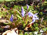
Heavy blustery showers of rain in the early hours of the 25th with ice pellets at 0519 GMT, but a bright enough morning with hazy sunshine and a strong SSE'ly breeze. At 0900 GMT pressure 989 mb was falling slowly with low 971 mb off the Western Isles of Scotland, the temperature was 7.3C (dewpoint 3.3C) 76% RH and rose to 9.0C in the afternoon. Cardiff 11.6C, Achnagart {28.8 mm}, Libanus {17.8 mm}. A few clear spells overnight, but no ground frost the minimum 0.2C on the morning of the 26th. Mostly cloudy with precipitation in sight and a moderate SW'ly breeze. Soon the rain shower arrived then brightening there were sunny spells (maximum 10.3C) through to the afternoon that was breezy. Valley reported 5.7h of sunshine and here solar radiation was 10.50 MJ m -2 , highest of the year so far. Turned cloudier later. Gravesend 12.5C, Achnagart{41.4 mm}, Wattisham 8.7h. Overnight it was windy at Gorwel Heights gusting to 50 mph at 0121 GMT (Llansadwrn 31 mph). The morning of the 27th was bright with a clearing sky with pressure 1004 mb rising quickly. The temperature at 0900 GMT was 5.6C (dewpoint 4.2C) and in another spring-like day rose to 11.2C in the afternoon. With light breezes and sun on the rockery banks 3 first-of-the-season large bumblebees were spotted on flowering red heather along with several honeybees. A few native primroses were out on the rockery banks as well as gromwell Lithodora (Lithospermum) and with snow still on the mountains the first glory-of-the-snow Chinodoxa. Shoeburyness 12.0C, Tyndrum {21.0 mm}, Tredegar {18.0 mm}. On the last day of the month (28th) there was an early shower of ice precipitation finely marking the hailometer. An overnight minimum of 3.2C and ground frost (-2.0C) and a fairly dull morning soon brightening with sunny spells developing and a sunny afternoon (max 9.2C). Clear in the evening and a rare chance to see green and red coloured aurora in the northern sky from about 2145 GMT to 2210 GMT. Spectacular sightings were seen as far south as the Scilly Isles and Norfolk to Scotland. Killowen 11.8C, Aboyne -4.1C min, Culdrose {20.0 mm}.
March 2014
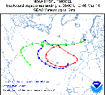
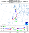
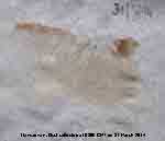
The 6th began overcast with some drizzle and spots of rain; traces of a pale brownish-white dust were being deposited. The origin of the dustfall was investigated by backward trajectory analysis using the HYSPLIT dispersion model, courtesy of the NOAA ARL Website. Parcels of air arriving over Anglesey between 1000 and 1300 m AGL at 0900 GMT showed that the dust was likely to have come from a pool of Saharan dust over the Atlantic off the Channel Islands. By a remarkable coincidence there was a dustfall here last year 6 March 2013. Anglesey remained dull all day, the sky was brighter looking towards Conwy in the afternoon. In Llanfairfechan Föhn-effect led to a temperature of 14.9C being recorded at Gorwel Heights at 1320 GMT, highest in Wales, and 14.6C at Gorddinog. The best that Llansadwrn could offer was 11.0C and Hawarden 12.2C. The highest UK temperature on the day was 15.5C at Gravesend. Showery rain began just before midnight and turned moderate to heavy on the 7th in the small hours, 13 mm/h at 0521 GMT. Rainfall in the 24-h 09-09 GMT was 16.8 mm. Hardly a cloud in the sky at first before a few convective clouds began to form during the morning. Very good visibility and a light SW'ly breeze. Cool in the breeze, but warm enough for bumblebees and honeybees to put in an appearance (max 11.1C). Clear sky at first in the evening (grass min -3.5) before cloud encroached. St James Park 16.9C, Aberporth 8.0h. Breezy (S'ly f5) on the 8th with overcast sky and mountaintops obscured, good visibility and pressure steady on 1019 mb. Low 948 mb was S of Iceland and with high-pressure persisting over Germany chart isobars were tightly packed in the western-fringe. By 1030 GMT cloud was thinning and there was some weak sunshine the temperature rising to 13.1C (RH 64%) at 1430 GMT. In Llanfairfechan in another Föhn wind the temperature rose at Gorwel Heights to 15.4C, with a low RH of 31%, and at Gorddinog to 15.3 C 34% RH. The afternoon continued bright and the wind strong into the evening. St James Park 16.6C, Gogerddan 15.4, Llanfairfechan 15.4C and 15.3C. After a glimpse of the rising red sun in the east earlier on the 9th a dull morning with low cloud, drizzle and poor visibility in Llansadwrn at 0900 GMT with a cold front over the Irish Sea. Bradbury's formula gave the cloud height as 317 ft which seemed about right. The air minimum temperature 8.8C was highest of the month. Pressure 1019 mb was rising slowly with low 960 mb filling over Iceland and high 1038 mb intensifying over Poland. By 1000 GMT the drizzle had stopped and the cloud lifted and thinned giving some clear sunshine for a while in the afternoon (max 13.4C). Cloudier again by evening. The weak cold front passed just after midnight with just a small temperature fall, light to moderate rain (1.2 mm) and change of wind direction SW to NE. On the morning of the 10th there were some breaks in the cloud and very good visibility with some mist in the eastern end of the Menai Strait. Pressure 1031 mb was rising and it was calm with smoke rising vertically . The jetstream was stationed off N Scotland. Soon with cloud clearance it was sunny with a maximum of 10.3C. Solent 17.7C. Hawarden 10.9C, Gorwel Heights 8.9C. The 11th began fine and sunny with just a little cloud seen to the NE. At 0900 GMT in a light E'ly breeze the temperature was 7.5C, with a low dewpoint 0.1C and RH of 59%, and rose to a maximum of 14.3C here and Gorddinog and 13.4C at Gorwel Heights. Local low relative humidity values were 36% at Gorddinog, 34% at Gorwel Heights and 42% in Llandegfan. A lot of bees were seen on massed red, pink and white flowering heathers in the garden where the temperature in sheltered places was >15C. Large and medium sized bumblebees (15) and to many to count honeybees. Aboyne 15.4C, Whitechurch (Pembs) 13.6C Valley 10.9h sunshine.
Fog persisted overnight, but on the morning of the 14th had cleared, allowing sunshine to break through at 0800 GMT, before returning. At 0900 GMT visibility was 500 m (moderate fog) and persisted most of the day. There was 0.2 mm in the raingauge and the drosometer recorded 0.15 mm overnight. The temperature range was from a minimum of 3.3C through 6.1C at 09 GMT to 8.3C at 2013 GMT. The 15th began brighter as the clear started to clear and good visibility. At 0900 GMT the temperature 8.5C was highest of the past 24-h; nil precipitation. Pressure 1030 mb was rising with Atlantic-high 1039 mb to the SW and low 972 mb over the Gulf of Finland. Some weak hazy sunshine with brief spells of bright sunshine in the afternoon. A flock of 20+ redwings was seen on an adjacent field S of the weather station - the first we have seen here this year. The sticky buds of horse chestnut were breaking. St James Park 19.3C, Llansadwrn 11.2C; Bala 8.3h, Valley 4.1h. The 16th was overcast and dull with intermittent drizzle and poor visibility. A mistle thrush was singing. Low stratiform cloud/ fog was covering the Irish Sea while to the north orographic cloud formations were prevalent. Quite a contrast in temperature and sunshine SE-NW today - St James Park 20.1C, Llansadwrn 11.9C; Manston 11.4h, Valley nil.
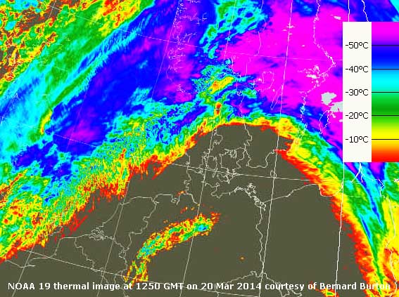
The 19th began with thin moderately high cloud, moderate hazy visibility and a freshening SSW'ly wind. Sometimes bright with glimpses of sunshine in the morning, thickening cloud with drizzle and slight rain by the end of the afternoon. A maximum today of 12.3C with 14.4C reported at Gorwel Heights and 14.6C at Gorddinog. Kew Gardens 17.3C, Trawsgoed 13.8C, ; Kinlochewe 56.0 mm; Morecambe 7.0h. The wind continued to freshen in the night and gales were reported around the north-west of Wales at Aberdaron, Valley and Capel Curig. Gusts of 73 mph were reported in Capel Curig, 61 mph in Llandegfan and 53 mph at Gorddinog on the morning of the 20th.
Hazy sunshine under a little thin high cloud on the morning of the 25th. Visibility was moderate temperature 7.7C (dewpoint 5.0C) 83% rising to 10.1C in the afternoon. Pressure 1007 mb was rising quickly with an occlusion clearing eastward. Low 998 mb was N of Scotland and there was a frontal wave 1002 mb near Cork, Ireland. We were in a small clear slot and it was sunny until late afternoon with rain later as the front returned westward. Killowen 13.9C, Leek {13.2 mm}, Magilligan 9.7h, Valley 8.7h. A fine morning with hazy sunshine on the 26th with a few clouds, low-lying mist was slow to clear in some places. The returned frontal cloud was clearing westward. Pressure 1007 mb was rising, a light NE'ly breeze and a temperature of 7.0C rising to 9.8C by afternoon. Max temp today 14.2C at Kinlochewe and 12.2C in Porthmadog and sunniest in Lerwick 11.9h (Valley 5.3h).
April 2014
The murky weather was back on the 2nd with grey skies, moderate hazy visibility and a trace of light coloured dust collected. A light ESE'ly breeze and a temperature of 12.2C (dewpoint 8.2C) 76% RH. Atlantic-low 983 mb was off SW Ireland and we were in warm sector air, the temperature rising to 14.8C at 1530 GMT, with frontal cloud to SW over Pembrokeshire to N Ireland, and NW over Scotland. The salt-loving ivy-leaved scurvy grass Cochleria danica was spotted in flower along the A5025 near Merddyn-y-groes and a few flowers had appeared on out plum tree. A pair of hares was seen in one of the fields near the weather station. The cloud was thick enough for a little drizzle (trace) around midday that deposited some more Saharan dust. Sunless. Frittenden 21.0C, Tredegar {7.8 mm}; Stornoway {11.7h}. 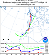
Much of the same on the 3rd, overcast and dull little (NE'ly air) or no wind, intermittent fine drizzle and poor visibility. I collected a light deposit of the coloured dust deposited over the last 24h. A little brighter just before noon with the sun trying to break through for a few minutes. Drizzle and rain continued through the afternoon with visibility <500 m (moderate fog) and more Saharan dust was deposited. Backward trajectory analyses using HYSPLIT, courtesy of NOAA ARL, indicated that during the afternoon air over Anglesey had passed over Western Sahara and Morocco on the 31st March, where it is likely to have picked up dust, before crossing the Straits of Gibraltar, Spain and France. The day was sunless. Max 14.6C; rain [5.3 mm]. Northolt 20.0C; Sudeley Castle {14.8 mm}; Manston 3.6h Valley nil.
Overcast and poor visibility with slight rain on the 6th, the ground was soggy with some small puddles. No dust was detected this morning. Blustery at times in the morning and a rapid clearance to sunny in the afternoon with a maximum 11.9C at Valley, 13.1C here and 15.9C at Gorwel Heights. Boulmer 18.5C; Capel Curig {35.4 mm}; Aldergrove 6.4h, Valley 4.5h. Back to an overcast sky on the morning of the 7th, poor visibility and moderate rain. No dust was detected this morning. A large number of puddles around the garden and the road was awash surprising as the rainfall was just [9.4 mm]. A cool day the maximum 11.0C here, lowest of the month, and 11.7C at Gorwel Heights. Capel Curig had [20.6 mm] and it was wet in the S England with [25.6 mm] at Herstmonceux and [14.6 mm] at Manston. The 8th began a little brighter with good hazy visibility and a cool night air minimum 3.9C and a touch of ground frost -0.3C. Some sunshine in the morning with cumulus clouds developing around noon and dispersing during the afternoon. Flowers have opened on the wild cherry on lower branches and herb Robert is flowering in the wood. Pollen was seen, no dust. A dry day and in the sun and out of the cool breeze the 13.0C seemed pleasant enough; Gorwel Heights recorded 12.6C. St James Park 14.6C; Bude 11.5h, Valley 10.3h
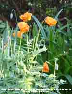
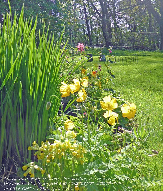
Dull and grey on the 12th, but no rain to measure. At 0900 GMT pressure was 1017 mb with low 969 mb E Iceland and high 1029 mb Azores. There was a cold front over Scotland and the N Channel with remnants over the Irish Sea. Temperature 8.7C (dewpoint 5.6C). Cloud thinned in the afternoon with some weak sunshine and glimpses of bright sunshine by evening. Maximum 12.0C. Highest were 16.3C at Frittenden and 14.1 at Hawarden. A slight ground frost overnight -1.2C introduced similar weather on the 13th, starting cloudy and dull and brightening up in the afternoon with the sky clearing in the evening with a ground frost developing. Another dry day with a maximum of 11.1C. St James Park 17.4C, St Athan 12.8h. Overnight air temperature 3.3C and -1.8C on the grass and a sunny (hazy) morning with just a few cumulus clouds around on the 14th. Pressure 1027 mb was rising, within high 1028 mb SW Ireland, and 9.3C (dewpoint 6.1C) rose to 13.8C in the afternoon. Another dry day. Solent 18.1C, Boulmer 13.0h. Ground frost again (-1.0C) on the morning of the 15th and with hardly a cloud in the sky a temperature of 12.2C (dewpoint 4.8C) RH 61% at 0900 GMT rose to 16.6C. The soil surface was dry. Visibility was good with light inversion haze, a combination of pollutant aerosols and some dust. Sunny and dry all day with a maximum of 16.6C. Magilligan and Trawsgoed 17.2C; Lyneham 13.1h, St Athan 13.0h. The 16th continued the spell of settled weather. Pressure steady on 1026 mb as the high 1032 mb drifted E over the Netherlands. There were twin cold fronts over Ireland and Scotland, but the morning was sunny with very good visibility. With the soil surface drying under the grass soil moisture measured today was 55% dry mass. Turning cloudier and breezier in the afternoon and overcast by evening. Maxima today 14.9C, Gorwel Heights 16.8C. Northolt 18.2C; Wattisham 13.1h. With cloud cover overnight there was no ground frost on the morning of the 17th. Variable cloud before 0900 GMT with convective clouds tending to increase; visibility was good though hazy. Pressure was 1020 mb with low 995 mb SE Norwegian Sea with an associated cold from over the Irish Sea. Showers kept away from here although Valley reported light showers in the evening. Saw holly blue and orange tip butterflies around the garden. A cool day with the maximum temperature 11.9C. Frittenden 19.4C; Stornoway 10.8h. Overnight there were some clear spells with bright moonlight at times with a touch of ground frost. With the sky clearing at dawn on the 18th there was hardly a cloud in the sky at 0900 GMT when 9.7C (dewpoint 5.1) in a SE'ly air. Pressure was steady on 1023 mb and we had a sunny day with the temperature rising to 14.1C. Aboyne 17.4C, Porthmadog 15.0C; Tulloch Bridge min -4.3C; Leuchars 13.5h. After being cam from 03 GMT it was much the same on the 19th with pressure unchanged 1020 mb. Sunny and clear with a little cirrus and partial contrails seen to the NE. Temperature at 0900 GMT was 10.5C (dewpoint 4.0C) RH 64% rose to 14.0C in a Föhn wind here and 12.3C at Gorwel Heights. The first Welsh poppies are out in the garden and flowers on apple trees are opening too. Saw our first swallow while at Penmon Point. Achnagart 18.6C, Whitechurch (Pembs) 13.9C; Valley 12.2h.
Overnight the sky became cloudier, thick enough for some fine drizzle, and the 20th in contrast to yesterday was overcast. Pressure 1014 mb was falling with complex low-pressure over France and a warm front SE England moving W. There had been a moderate deposition of a yellowish-brown dust the source of which would be investigated. There was a moderate NE'ly breeze and some thinning of the cloud and weak sunshine in the morning before drizzle and slight rain fell around noon. The afternoon was a little brighter. Max 14.1C; trace. Aviemore 19.0C; Kinloss 14.1h; Dunkeswell {25.6 mm}. A fine morning on the 21st with a few altocumulus including lenticularis and cirrus. Visibility was good with slight smoke haze. Pressure was 1008 mb with a low 999 mb over the Celtic Sea and a warm front moving SW over Cumbria. A temperature of 12.7C (69%) RH here while at Gorddinog it was 15.0C (61%). Mostly sunny and feeling warm as the temperature rose to 17.9C and the 18.7C at Gorwel Heights was highest of the month. The evening was cloudier with a few spots of rain later. Bridgefoot 20.9C; Altnaharra min -2.0C; Heathrow {16.4 mm}, Stornoway 13.2h.
Cloud encroached just before 06 GMT on the 25th and became overcast with altostratus before 0900 GMT. Overnight before the cloud cover the grass minimum had fallen to 1.5C. Visibility was poor in thick haze. Pressure was 1015 mb with low 996 mb off SW Ireland and there was a thundery low 1009 mb over Normandy. Another fine day on the 28th starting with hazy sunshine through altostratus and cirrus with moderate visibility in smoke haze. Pressure was 1012 mb with declining low 1007 mb over Normandy. Pressure was high 1003 mb over Greenland and 1023 mb Atlantic W of Iberia. Some clear sunshine at times in the afternoon when the temperature rose to 17.0C, breezy at times. With rainfall on the low side this month the soil surface has been dry at times and has cracked where undisturbed on the bare plot and vegetable plot. Some cracks are 1 cm wide in places. Soil moisture under grass just below a layer of roots and organic matter is 57% dm where as on bare soil has fallen to 28% dm which is 13% above the permanent wilting point for the local patch of soil which is a stony free draining glacial drift. Aviemore 22.0C; Hurn {17.6 mm}; Aberdeen 13.7h. Fine and sunny on the 29th with pressure steady on 1023 mb. Low 997 mb W of Ireland with developing frontal-wave low 1011 mb at 0900 GMT over the Charente Maritime, France. The temperature was 15.7C (dewpoint 10.2C) RH 70%; hazy, but good visibility. Cumulus clouds were forming to the S over the Llyn, otherwise blue sky especially to the N. Haze increased in the afternoon along with the temperature that reached 18.8C, highest of the month. The sky became very murky and threatening, but passed without any precipitation brightening in the evening. Portglenone 20.0C, Llansadwrn 18.8C, Rhyl 18.3C; Reading Uni. {14.4 mm}, Valley 13.2h. Fog developed in the early hours of the 30th and increasing at 06 GMT became thick <100 m by 07 GMT. At 08 GMT for had started to reduce and it was brighter but was still < 200 m at 0900 GMT with sky obscured when 10.8C (dewpoint 10.2C) 96% RH. With low 1000 mb W of Ireland pressure here was steady on 1012 mb and we were positioned between 2 occluded frontal systems aligned NW - SE. Further thinning occurred by 10 GMT when the sun began to burn through and there were some sunny spells by afternoon. There were spots of rain at 17 GMT and rain after midnight with 6.6 mm measured in the morning. Maximum today 16.6C. Gravesend 20.7C; Heathrow 11.0h.
May 2014
Dull and overcast on the 3rd with moderately high cloud. A dry raingauge again this morning with the soil looking very dry and cracked. The grass was slightly wet from guttation, not dew. Pressure was steady on 1028 mb with high 1030 mb over Wales and England. There was a warm front over the western Irish coastline. The sun broke trough briefly in the morning then more grey for the afternoon. Maximum 13.3C. Aviemore 16.6C, Topcliff min -3.9C; Heathrow 13.3h. A narrow band of light showers cross Anglesey off the Irish Sea after midnight on the 4th and produced just 0.2 mm. It made no difference to the ground that was dry in every respect. Temperature 11.5C (dewpoint 6.7C) 72% RH. Pressure was 1022 mb with the high 1026 mb over the English Channel. Low 986 mb was SE Greenland and westerly parts with tight isobars on the chart had strongest winds. Visibility was very good so it was possible to monitor the small snow patches remaining on the tops of the mountains. A breezy morning the SSW'ly force 4 to 5 blowing the trees around a bit and bringing off white petals, from horse chestnut trees, that were falling like snow - more to clear up along with the sticky bud scales that have eased a little. With cloud from mid Wales northwards it was dull all day, no sunshine with a maximum 12.9C. Not everywhere was cloudy, St Athan had 10.8h sunshine and nearby Cardiff had 15.7C, and it was wet in N parts of Scotland. Aberdeen 18.0C, Santon Downham min -1.8C; Achnagart 12.6 mm, Wattisham 12.9C. On the 5th the sky between 04 and 06 GMT was clear and with a SSE'ly breeze there were a few altocumulus lenticularis clouds to the S of the weather station in the lee of the Snowdonia Mountains. By 0900 GMT with pressure 1010 mb falling quickly the sky was overcast. High 1018 mb was over the Med and low 979 mb S of Greenland. But a developing frontal low 983 mb was W of Ireland and with the jetstream poised for action the weather looks like being unsettled over the next days. Grass is growing at 5.5g per square metre each day and the underlying soil, still drying out, had a moisture content of 44% dry mass. Soil on the bare climatological plot at has shown cracking since 20th April, being subject to greater evaporation missing the grass layer and larger organic matter content, was drier at 31% dry mass. The day remained dull, but dry until the evening when a few spots of rain were seen on a W-facing window. Max today 15.2C with 16.2C at Gorwel Heights. Cambridge 19.8C; Wattisham 9.9h. The 7th began breezy and overcast with light showers of rain. With low 993 mb near Rockall pressure here was steady on 1004 mb. A few breaks in the cloud appeared by 0900 GMT (temperature 10.3C, dewpoint 8.0C & 86% RH, but the light showers continued. The afternoon was drier with a bright spell and glimpse of sunshine and further slight showers. Drier in the evening and less windy. Northolt 18.0C; Dunstaffnage {26.8 mm}; Shawbury 7.3h. Little change on the 8th skywise, overcast and dull. Calm at 0900 GMT, not a leaf was moving on the tall trees, and continuous light rain. The sunless day continued very dull and during the afternoon lights were needed indoors, and on passing vehicles, as solar radiation dropped to a remarkably low, for daylight hours, 13 W/sq m at 1350 GMT. Max 13.9C & 15.3C at Gorwel Heights, Rain [9.4 mm]. Leuchars 3.8h sunshine. The 9th began mostly cloudy with mountaintops obscured in fog. Pressure 1008 mb was rising with low 998 mb NE Scotland while Atlantic-low 996 mb was S of Iceland. Pressure remains high 1022 mb in Mediterranean regions. Breezy the WSW'ly force 4 increasing force 5, but brighter with sunny spells developing during the morning. In the afternoon cloud had lifted from the mountains, where there were some snow patches persisting, and for a while it was mostly sunny. Breezy in the evening and overnight. Manston 18.0C; Lusa {19.8 mm}, Bala {9.4 mm}; Wittering 9.6h.
A dull morning with a shower of rain just before 0900 GMT on the 12th with spots continuing after then brighter with sunny spells by 10 GMT. The lowest minimum here was 8.4C, but frosty in places with Braemar -1.6C. The jetstream was S of the Channel over France and Spain, and to the N low 997 mb was over Denmark with pressure here 1009 mb. All was to change as high 1026 mb was developing NE of the Azores forcing a break in the jetstream and lead to pressure rising over Britain. More sunshine later in the afternoon with a maximum of 13.8C & 15.1C at Gorwel Heights with the highest 18.0C in St James Park, London. Rain just [0.2 mm], Mona [10.2 mm]. Beginning mostly cloudy the sky on the 13th was slow to clear with a N'ly airflow blocked by the mountains. Pressure 1019 mb was rising quickly as a ridge developed from the high developing off Cap Finisterre. Eventually the sky cleared and with visibility very good it was possible to see the last remnants of winter snow on the mountaintops. A fine sunny evening. Max 16.5C & 15.2C at Gorwel Heights. Solent 18.7C, Aviemore min -1.4C; Nantwich {13.0 mm}; Tiree 15.1h. High pressure 1032 mb here had arrived on the 14th centred 1036 mb over the SW Approaches. Cloud on a warm front associated with low 1007 mb near Greenland was not far away over W Ireland. A complex sky, including contrails, cirrocumulus, cirrus and cumulus, was clearing and visibility improving from moderate to good at 0900 GMT. The temperature was 12.9C (dewpoint 9.4C) with 79% RH. A few cumuli were building, but dispersed by afternoon that was mostly sunny as the temperature rose to 15.9C & 17.4C at Gorwel Heights. Later cloud on the warm front encroached from the W and the evening was overcast. Soil moisture measured today under grass was 59% dm while on the bare climatological plot it was 35% dm up, after the 16.8 mm rain on the 10th, from the 44% mb and 31% dm respectively on the 5th. Solent 19.9C, Altnaharra min -3.0C; Bude 14.0h. The 15th began overcast and at 0900 GMT there were large spots of rain falling. Pressure was steady on 1036 mb with high 1037 mb over the southern Britain, A warm front was over the Irish Sea. The morning was dull with poor visibility at first with some drizzle around western coasts. By afternoon the cloud began to clear, visibility was good and it was sunny and warm the temperature rising to 18.8C & 17.3C at Gorwel Heights. Helen's Bay 21.6C, Hawarden 18.3C, Gorddinog 18.0C, Rhyl 17.4. Manston 14.1h.
Low lying mist on the fields overnight soon cleared the morning brightening as hole appeared in the moderately high cloud on the 16th. With a veil of cirrostratus across the sky a solar halo was seen at 0920 GMT .
It was overcast, dull and calm with slight rain on the morning of the 20th. Pressure 1004 mb was rising and the temperature 13.9C(dewpoint 13.5C) RH 97%. The cloud was moderately high, but thickened in the afternoon with showers developing. There was a heavy shower on the A55 near Gaerwen at 1530 GMT, but just a few spots in Llansadwrn. A muggy day with the maximum 18.9C & 19.7C at Gorwel Heights. The evening was dry, but kept dull. Weybourne 24.9C, Porthmadog 22.0C; Aviemore 8.9h. The sky had cleared by midnight on the 21st and the temperature on the grass dropped to 4.5C and in the air to 8.8C at 0400 GMT. It was a bright morning with convective clouds starting to form at 0900 GMT near the mountains. Visibility was very good and cloud diminished during the afternoon leaving a line of cumuli along the tops of the Snowdonia Mountains; the temperature in afternoon sunshine reached to 17.1C, 17.4C at Gorddinog & 17.8C at Gorwel Heights. Bramham 21.0C; Valley 15.2h.
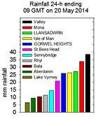
The 22nd was overcast, dull with poor visibility at dawn. Pressure was on 1002 mb and we were between slow-moving frontal systems affecting Ireland and central England. There was a little drizzle and slight rain around noon and although the afternoon was drier it turned wet and breezy in the evening. There was localised in heavy rainfall Llanfairfechan from 1230 GMT at Gorwel Heights that was continuous moderate to heavy through the night. Episodes of very heavy rain were at 2000 GMT (up to 21 mm/h) and from 0600 GMT (up to 10 mm/h) to 0900 GMT on the 23rd when 23.0 mm had fallen. Kew Gardens 19.7C; Cranwell [36.4 mm]; Tiree 7.9h, Valley nil. Another dull and wet day on the 23rd especially in on the mainland and in Llanfairfechan where at Gorwel Heights 37.2 mm fell in the 24-h 00-00 GMT. Rainfall 09-09 GMT was 23.0 mm the total 48-h fall being 45.4 mm. Rainfall at Gorddinog was 17.2 mm on the 22nd and 20.3 mm on the 23rd with the 48-h total 37.5 mm. Heavy rain also affected mountains eastward; the Conwy Valley AWS (data accessed at 07z on the 24th) reported a 'storm' total of 47.2 mm compared with Gorwel Heights 45.2 mm and Gorddinog's 25.4 mm. The westbound carriageway of the A55 between Abergwyngregin and Talybont became flooded late in the afternoon and caused tailbacks to the Conwy Tunnel that was closed: westbound traffic had to take a long tortuous diversion via Llanwrst to joint the A5 at Betwsycoed. The road was not reopened until next midday. The flooded section was on an original section of dual carriageway adjacent to a section where £3m was spent to alleviate similar recent (November 2012) flooding. It is ironic that the sign before this section of road stating 'road liable to flooding' has been there for many years. Weybourne 19.1C; Pennerley {27.2 mm}, St Catherine's Point [25.4 mm]; Tiree 11.9h, Valley nil. The sky had some clear patches around dawn on the 24th, but before 0900 GMT these had closed over again. Pressure 1009 mb was rising, but this did little to improve the weather. The day here was mostly dull with showers. Weybourne 18.2C; Hurn {27.2 mm}; Tiree 14.0h, Valley 0.3h. The temperature on the grass had fallen to 2.3C on the morning of the 25th. The day began bright enough, with very good visibility, but soon turned cloudier as convective clouds developed over this part of the island. As the temperature rose to 15.3C in a burst of sunshine there was soon a heavy shower of rain (51 mm/h) at 1430 GMT, more light showers and another heavy on at 2100 GMT (60 mm/h). Rainfall for the 24-h 09-09 GMT was [22.1 mm]. Edinburgh [27.8 mm]; Weybourne 19.5C; Heathrow 13.0h, Valley 11.3h. Continuing rather dull after a few spots of rain the 26th brightened a little with a few glimpses of sunshine later. There were some dark well developed cumulus clouds around: there was a moderately heavy shower in Llanfairfechan, but it kept dry here. Max 16.2C. Away from the mountains coastal parts in the W were sunnier, Mona 16.5C. The evening sky was clearer and less breezy. Charsfield 19.9C; Shoreham 20.2 mm; Boulmer 12.0h, Valley 9.8h. Similar on the 27th, starting overcast and dull with drizzle and slight rain then brightening and was drier the sun only appearing in the evening. Max 14.8C, trace of rain. Achnagart 20.8C; Wattisham 48.8 mm; Bude 14.2h. Some broken cloud with a little weak sunshine on the morning of the 28th gave a somewhat brighter start. Visibility was moderate in smoke haze that may have also contained some Saharan dust. As the cloud thickened there was drizzle and slight rain at times from noon through the afternoon. Max 14.6C that was the temperature at 0900 GMT; Rain 0.3 mm. Thomastown 20.9C & 11.1h; Bridlington {24.2 mm}. Another grey and very dull day on the 29th with moderate misty visibility. Spots of rain at time died out then returned in the afternoon. Kew Gardens 20.3C; Pershore College {11.4 mm}; Kirkwall 11.4h. A sunny day on the 30th with pressure 1024 mb rising and a clearing sky in the morning. The temperature was 14.0C (dewpoint 10.2C) and 70% RH rising to 16.7C by afternoon. Some cloud appeared around noon, then dispersed again. Aviemore 20.1C, Porthmadog 19.6C; Kinloss 14.0h, Valley 11.8h. A cloudy start on the 31st with some weak sunshine then the cloud cleared before noon and solar radiation in the hour after noon 879 W was brightest of the month. The temperature rose to 19.1C at 1300 GMT, highest of the month. A clear evening, but cloud encroached later. Helens Bay 22.8C; Morecambe 14.4h.
June 2014
A brighter day on the 5th with Valley reporting 13.5h of sunshine with 23.56 MJ m -2 solar radiation in Llansadwrn. Foula again reported a high max of 19.7C, but Manston today was highest on 20.3C. Kinloss had [17.2 mm] of rain. A clear sky in the evening and overnight in a ridge of high-pressure; the air minimum fell to 6.3C and the temperature on the grass to 2.3C. Cloud was beginning to encroach by dawn on the 6th and was 6 oktas at 0900 GMT. The temperature had risen to 15.6C (dewpoint 10.6C) and pressure was 1012 mb. Complex low 989 mb was over sea area FitzRoy with a warm front moving over Wales. By 0930 GMT the sky was overcast and thickening cloud brought spots of rain from 1045 - 1100 GMT. The warm afternoon has some sunshine when the temperature rose to 19.7C between 1530 - 1610 GMT, Gorwel Heights 20.7C and at Gorddinog 21.2C highest of the month, and did not fall below 13.7C overnight. St Hellier 25.6C, Northolt 24.2C; Crosby [22.3 mm]; Wattisham 14.8h.
Following 'une canicule' heatwave (temperatures of 33/34C observed in the Charente on the 8th) early in the season in France there were violent thunderstorms in western France overnight 9/10th. Brilliant intra-cloud 'sheet' lightning lit up the sky for several hours in the Charente Maritime then as the storms moved NE into the Cognac region thunder was heard and very large hail fell. One stone shown on French TV was palm sized, looked at least 10 cm. Car windscreens and tiles on houses were smashed by the hail that was accompanied by 130 km/h (81 mph) winds. A tornado was mentioned, but the image reproduced in the newspaper Sud Ouest was a funnel cloud. Trees were brought down, vehicles and property damaged. And 'une catastrophe' considerable damage was done to the vines in the Médoc region! Some early showers of rain on the 10th and at 0900 GMT (14.1C, dewpoint 11.7C). A day of sunshine and showers with a heavy one at 1620 GMT (3.8 mm falling at up to 109 mm/h) including some 4 mm ice pellets; light showers continued into the evening. Pptn [4.6 mm] and max 18.1C. Weybourne 23.4C; Altnaharra [18.8 mm]; St Hellier 14.7h, Valley 11.2h. The first 15-d of June had a mean temperature of 14.6C (+0.3) & [+0.7] based on the monthly averages. Rainfall was 37.8 mm (61%) & [70%] of averages. It had been sunny at Valley with 120.6h recorded so far (61%) & [70%] of the monthly total. The 16th continued the settled spell with pressure on 1030 mb. Calm or variable light airs at first settling to light NE'ly. Sunny with cirrus and a line of cumuli over the mountains and very good clear visibility. We had northern British weather weather as southern weather was cloudier. The max today was 19.4C with the highest seen in Thomastown 22.6C with 15.7h of sunshine while Valley reported 13.3h. Soil moisture measured today under grass averaged 52% dm in the range 45 - 58% dm; moisture on the bare met plot had fallen to 19%, the top 2 cm to 16%. Vegetables are needing irrigation to maintain optimal growth. Accumulated yield of grass this year had reached 6 tonnes per hectare which is close to the average. Recent years, with colder winters and cool springs, have seen lower than average yields. This year following the warmer spring the yields up to normal. Harvesting grass from local fields for silage and hay had already begun. After a mostly cloudy start on the 17th the day soon brightened as clouds melted away with plenty of sunshine and a maximum of 20.8C in the afternoon. Similar, but warmer on the 18th the temperature at 0900 GMT already 18.7C (dewpoint 16.3C) rising to a sustained 23.2C AWS and 23.3 screen in the afternoon, highest of the year so far. Good or very good visibility, haze increasing through the day. A rabbit (perhaps Peter?) had been eating lettuce plants on the vegetable plot! Mr McGregor, alias the observer, chased with his rake then put up wire netting to try and protect them, there is plenty of grass on the lawns at the moment. Strathallan 26.5C, Porthmadog 25.1C; Morecambe 15.3h, Valley 14.5h. The 19th was cloudier and cooler. At 0900 GMT 13.7C (dewpoint 12.1C), with some weak sunshine and moderate hazy visibility, rising to 18.1C later. Hurn 25.7C, Cardiff 24.2C; Glasgow 15.5h, St Athan 12.5h
A bright, but mostly cloudy morning on the 25th. Pressure was on 1018 mb with an area of low-pressure W of Ireland and fronts moving across the Irish Sea during the day. The temperature at 0900 GMT was 18.0C (dewpoint 14.5C and 80% RH) rising to 19.0C and 17.8C at Gorwel Heights. Whitechurch (Pembs) 22.6C; Stormont Castle 17.6 mm; Camborne 13.9h. A mostly cloudy day on the 26th with complex low-pressure SW of Ireland giving a wet day in SW England. A few sunny spells here and a little showery rain in the afternoon with a spell light rain mostly after midnight [3.5 mm] . Maximum 18.6C here and 19.1C at Gorwel Heights. Northolt 22.6C, Porthmadog 22.3C; Camborne 21.6 mm; Stornoway 16.4h. The 27th intermittent light rain had died out by 0900 GMT becoming a little brighter through the morning. Pressure was 1012 mb with a low 1008 mb over S Ireland with slow moving front over N Wales. There was a heavy shower of rain rain from 1530 GMT falling at a rate up to 36 mm/h. Further slight rain and or drizzle in the evening then a spell of light to moderate rain from 2150 GMT to 0030 GMT then showery rain until morning. A total of [20.6 mm] rain and [19.2 mm] at Gorwel Heights , both largest falls of the month. Writtle 23.9C, Market Bosworth 28.2 mm; Prestwick 11.6h. The 28th was a very dull sunless day recording the 2nd lowest solar radiation 8.17 MJ m -2 . At 0900 GMT with a cold front over N Wales pressure was on 1011 mb and as it cleared a cooler N'ly airflow was introduced 11.6C (dewpoint 11.3C RH 97%) rising to 14.4C one of 2 days (with 4th) lowest maxima of the month while the 13.6C at Gorwel Heights was lowest of the month. Frittenden 20.9C, Tyndrum 3.4C min; Okehampton 31.8 mm; Aberporth 12.9h. The 29th was fine and sunny, very good visibility with 3 oktas of cloud cover at 0900 GMT. Pressure 1016 mb had risen and with Atlantic high-pressure to the W 1020 mb and low to the E - Baltic 1003 mb - we had a cooler NE'ly airflow. Under almost clear skies the temperature rose from an overnight of minimum of 9.4C to 17.5C, a dry day. Thorney Is. 22.1C, Tulloch Bridge 2.0C min; Hull 18.2 mm; Tiree 15.5h, Valley 12.5h. Pressure had risen a little more 1017 mb on the 30th as the high 1018 mb drifted across central Britain. Starting fine and sunny with hardly a cloud in the sky, air minimum a cool 8.1C and 4.4C on the grass, the temperature 15.3C at 0900 GMT rose to 18.8C in the afternoon under a little cloud (range 10.0C), 19.9 at Gorwell Heights; another dry day. Castlederg 22.7C, Capel Curig min 2.0C; Wisley 27.0 mm, Magilligan 15.4 h, Valley 15.2h. It was the sunniest June on Anglesey on record since 1931 at Valley with 263.9h duration recorded at RAF Valley. Rainfall in Llansadwrn of 62.5 mm was (86%) of the last decade and [92%] of the 30-y average. The mean temperature 18.4C was (+0.4) & [+0.8] of averages.
July 2014
July 1 - was fine and sunny, good visibility with a light N'ly breeze and a temperature at 0900 GMT of 18.8C, highest of the past 24-h, (dewpoint 13.5C) rising to a maximum of 21.0C and 21.9C at Gorwel Heights. Glasgow 23.9C, Keswick 23.5C, Tulloch Bridge min 2.0C; Tiree 15.5h, Valley 15.3h.
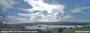
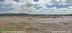
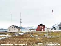
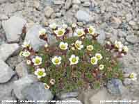
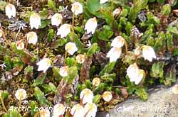
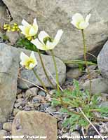
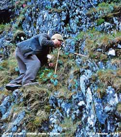
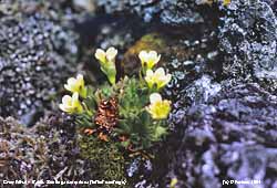
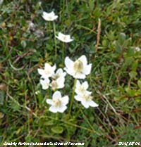
In Svarlbard at Ny Alesund (panorama above) - said to be the most northern settlement in the World (now a mostly scientific community) - pressure 1020 mb was rising, temperatures today after a minimum of 2.9C the maximum was 8.1C, a f3 SE'ly breeze and partly cloudy skies with broken frontal cloud to the west. At noon local time the temperature was 5C in air and sea water. Several weather stations are in use, the photo left is one of them. The photo right is purple saxifrage one of the Arctic plants found growing prolifically there; it is very rare in Snowdonia, but can be found at Cwm Idwal (below). But, I particularly wanted to see and photograph the tufted Saxifrage (below left) as I had photographed it in Cwm Idwal 50-years ago; I was not disappointed. A bright start to the day on the 6th on Anglesey with 5 oktas cloud cover and a temperature of 15.1C (dewpoint 12.0C RH 82%) at 0900 GMT. A funnel cloud (variously described as a 'whirlwind' and 'twister') was reported by the Daily Post as 'towering over Anglesey and the Menai Strait' seen from Caernarfon, Deiniolen at 0745 GMT and Anglesey. Breezy in the afternoon with a partly cloudy evening, S'ly wind and very good visibility. A bright day as cloud cleared 21.52 MJ m -2 over Llansadwrn, while convective clouds persisted over the Snowdonia mountaintops; Valley reported 13.3h of sunshine.
Under thin broken cloud the 7th began brightly with good, but hazy visibility. At 0900 GMT pressure 1014 mb had risen as low 1000 mb NW of Scotland was filling. In a SSE'ly breeze the temperature was 16.0C in the Stevenson screen with wet bulb 13.4C (dewpoint 11.2C 73% RH). Cloud remained patchy and thin before thickening, especially over the mountains, later in the afternoon with showery rain in Pentraeth around 1700 GMT. [Max 18.2C (18.4C in screen). Gravesend 23.7C, Altnaharra 2.5C min; Exeter AP 17.2 mm; Valley 11.2h]. Starting with much the same patchy thin cloud cover on the 8th with pressure risen to 1017 mb. The temperature at 0900 GMT was 15.8C (dewpoint 11.9C 78% RH) reaching a maximum of 17.3C at 1110 GMT in a S'ly breeze. Soon convective clouds built up quickly with rain starting to fall from 1105 GMT with thunder and lightning in the vicinity from 1205 to 1230 GMT rain turning heavier briefly falling at a rate up to 6 mm/h [2.8 mm]; conditions were calm between 1140 and 1420 GMT. The temperature had fallen to 11.8C at 1300 GMT (dewpoint 10.7C). The afternoon was brighter, and cooler the breeze then NNE'ly and turning sunny from 16 GMT onwards into the evening. [Coningsby 21.7C, Cairngorm min 4.3C; Kenley 15.2 mm, Capel Curig 5.6 mm; Stornoway 15.0h]. A fine day on the 9th, starting rather dull the morning soon brightened and with cloud clearing the afternoon and evening were sunny. Maximum temperature 19.5C and no rain. [Carlisle 23.9C, Altnaharra min 3.8C; Prestwick 14.5h].A clear night and after lowest of the month an overnight air minimum of 10.1C, and 5.4C on the grass wet with dew, the temperature at 0900 GMT on the 10th had risen to 16.4C. Persistent mostly thin moderately high cloud associated with frontal cloud over Ireland made for a duller day. Maximum temperature 19.6C, no rain. [Solent 26.7C, Tulloch Bridge min 2.9C; Wainfleet 29.0 mm; Leuchars 16.0h, Valley 11.5h]. The 11th began very warmly with a temperature of 17.7C (dewpoint 16.1C 90% RH) and to rose to 22.7C and 68% RH in the afternoon. One of the brightest day's of the month 23.84 MJ m -2 of solar radiation. Another dry day. [Edinburgh 25.1C, Foula Is. 23.6C, Tulloch Bridge min 2.9C; Herstmonceux 10.2 mm; Aberdeen 14.5h, Valley 11.4h]. A fine and dry start to the day on the 12th, but cloud amounts (6 oktas) were increasing as frontal cloud encroached from the west. The SSW'ly wind freshened and there were slight rain in the afternoon as a warm front passed over. The wind freshened again around midnight on the approach of a (cold, little temperature change) front; there were bursts of rain and a few ice pellets (5 mm/h at 0100 GMT on the 13th) recorded by the hailometer, thereafter becoming calm for a few hours [Pptn 3.4 mm]. [Heathrow 27.7C, Aboyne min 7.5C; Wattisham 30.4 mm; Bristol 8.4h, Valley 0.2h]. The 13th was mostly cloudy again with a dominant NNE'ly breeze; no precipitation was recorded. Maximum 16.7C. [St James Park 25.5C; Wattisham 36.4 mm; Camborne 12.0h]. After an overnight minimum of 11.0C, and 6.2C on the grass, a little early morning sunshine the sky became overcast on the morning of the 14th, with good, but very hazy visibility. Pressure here was 1011 mb with low 999 mb was off NW Ireland with associated frontal systems moving across the Irish Sea. Showery rain with a little brightness and glimpses of sunshine through the day as orographic waves developed. Breezy the SSW'ly force 4/5 at times; at 1410 GMT a moderately heavy shower and another shower around 1830 GMT (a few ice pellets were detected by the hailometer). [Max 15.7C, Pptn 2.3 mm. Heathrow 25.2C, Gorwel Heights 21.8C, Hawarden 21.4C; Capel Curig 16.6 mm; Manston 12.1h, Valley 1.3h. A bright morning on the 15th with pressure 1019 mb rising as a ridge of high-pressure moved across from the west. With a few clouds around the temperature rose to 20.3C [Heathrow 26.5C; Islay 9.6 mm; Valley 13.2h]... The first 15-d were on the cool side with the mean 15.2C (-0.6) & [-0.5] of monthly averages, but they were relatively dry with rainfall 29.7 mm (31%) & [43%] of the July averages. A damp start on the 16th with overcast skies and slight rain from 06 GMT. Low 1004 mb was off NW Scotland with associated fronts crossing the Irish Sea. Overcast with a light SSW'ly wind and rain soon after 0900 GMT turning light to moderate through to the early afternoon. With the fronts cleared away the rest of the afternoon was bright with some sunshine developing later. [5.5 mm] . [Gravesend 27.8C; Eskdalemuir 15.0 mm; St. Helier 14.3h] In contrast a fine and sunny morning on the 17th with few clouds and very good visibility. Pressure was 1022 mb in a ridge from southern Baltic-high 1023 mb. At 0900 GMT the sunshine with the temperature 16.6C, in a light N'ly breeze, rising to 18.9C with a few more clouds and high cirrus developing through the afternoon. Hampton WW 29.5C, Cardiff 26.6C; Leconfield 14.4h, Aberporth 14.0h, Valley 12.9h. On the 18th with overnight temperature not falling below 15.8C and at 0600 GMT with the temperature 16.3C (dewpoint 15.4C 89% RH) distant thunder was heard for about 15 minutes. At 0900 GMT it was warm and sunny and 23.1C (dewpoint 18.4C) 75% RH and soil temperature at 5 cm was 22.5C reducing to 15.8C at 1 m depth. There was a light SE'ly breeze. By 1100 GMT the temperature had risen to 24.9C and was to rise in the afternoon to 26.0C (67% RH), highest of the month. Soil moisture determined today was 48.5% under grass and 20.2% on the bare met plot. Gravesend 32.3C, Hawarden 27.5C; Stornoway 14.2h, Valley 9.5h. In the early hours of the 19th there was fog and by 0900 GMT visibility was still poor and the sky overcast with
continuous light to moderate rain [1.6 mm]. The rain soon ceased but the day remained overcast, sultry and sunless. Maximum temperature 17.8C & rainfall [3.6 mm]. During the evening mist formed on the adjacent fields. St James Park 28.5C; Pershore [26.4 mm]; Wattisham 6.2h, Valley 0.0h. A brighter day on the 20th, but foggy around western coasts at first. Pressure was steady on 1011 mb and there was a little sunshine at times. The temperature at 0900 GMT was 18.4C (dewpoint 16.9C 91% RH) and rose to 19.6C in the afternoon keeping rather humid, but no rain. Solent 27.3C, Usk2 25.4C; Shoeburyness [30.0 mm]; St Athan 13.2h . A bright start on the 21st and with cirrus and cirrostratus overhead a solar halo was seen at 0900 GMT, some cumuli developed later. Fine and mostly sunny with a maximum of 23.6C in the afternoon. Thorney Is. 27.7C, Usk2 26.6C; Morecambe 14.4h, Valley 13.8h.
Another warm generally sunny day on the 22nd with pressure 1024 mb rising. Visibility was very good and clear in the morning as convergent cumulus clouds forming overhead. The breeze here was NE'ly and was SW'ly in western parts of the island until 1300 GMT. There were clouds on the mountaintops at times with sunny spells on N-facing slopes and cloudier in S Snowdonia. Maximum today rising from a minimum of 13.6C to 23.3C in the afternoon. Solent 29.9C, Hawarden 26.5C; Boulmer [14.5 mm]; Morecambe 15.6h, Valley 9.7h. There was clear blue sky on the morning of the 23rd - no clouds - and after a warm night with an air minimum of 15.1C at 0423 GMT it was another warm sunny day. Despite a few small cumulus clouds in the afternoon, and a NE'ly breeze off the sea, the temperature rose to 24.7C, but in the lee reached 27.9C at Valley in the west of the island. Heathrow 29.8C, Porthmadog 29.2C; Tiree 15.2h, Valley 13.9h. A warm night: at 0000 GMT on the 24th it was 18.2C falling to a minimum of 17.0C at 0530 GMT in Llansadwrn, highest of the month. In Llanfairfechan it was even warmer - in a persistent SE'ly Föhn-like breeze off the mountains, through the evening of the 23rd to morning of the 24th, minima were 21.0C (screen) at Gorddinog and 20.5C (AWS) at Gorwel Heights. Mean wind speeds reached 18 mph at Gorddinog and 14 mph at Gorwel Heights gust speeds attaining 32 mph and 26 mph respectively. The mean relative humidity at Gorwel Heights from 2000 GMT on the 23rd to 0900 GMT on the 24th was 60%. In contrast it was calm in Llansadwrn from 1930 GMT on the 23rd to 0620 GMT on the 24th with mean relative humidity of 80% . Another clear sky was recorded at 0900 GMT in Llansadwrn with good, but hazier visibility due to smoke and perhaps a little Saharan dust. The temperature rose to 24.8C in the middle of the afternoon. Solent 30.6C, Porthmadog 29.3C; Aberdeen 14.6h, Valley 14.1h. And for the third consecutive morning a clear sky was recorded at 0900 GMT on the 25th - fairly unusual here - and with clearer air very good visibility. In a light NE'ly breeze the temperature rose to 24.9C and did not fall below 20C until evening. Solent 29.2C, Blackpool 29.1C; S Farnborough 19 mm; Kinloss 15.2h, Valley 14.2h. Another warm night - 17.5C at 0000 GMT on the 26th with a minimum of 16.3C at 0145 GMT. Well, it couldn't last - the sky overcast early on the 26th had cleared to 6 oktas by 0900 GMT when the temperature was 20.7C (dewpoint 16.7C RH 78%). Mostly cloudy, but bright with a little sunshine the temperature rose to a maximum of 24.9C at 1027 GMT. Cloudier later as a cold front moved down from the N with light to moderate rain from 1745 to 2000 GMT [3.7 mm] the first for a week. Cavendish 29.9C; Lossiemouth [17.6 mm]; Aberdeen 11.6h, Valley 3.3h. After fog between 05 & 06 GMT on the 27th visibility improved by 0900 GMT and was good. There was a light shower of rain in progress and it was cooler after an overnight minimum of 12.5C it was 15.8C (dewpoint 15.0C 95% RH). Much of the morning was cloudy with glimpses of sunshine clearing up in the afternoon with clear sunshine (maximum 20.6C) until 16 GMT with rain coming along later [2.4 mm]. The fine hot weather continued in S Britain. Thorney Is. 26.3C, Katesbridge min 5.3C; Loch Glascarnoch [32.8 mm]; Leconfield 12.8h. The 28th began misty with showery rain and a little drizzle, but at 0900 GMT with pressure 1017 mb rising the sky started to clear. Low 993 mb was SW Iceland and low 1014 mb was over the Solway Firth with an occluded front clearing N Wales. Mostly sunny in the afternoon with a maximum 20.6C and a fine evening. Church Lawford 25.3C; Northolt [45.2 mm]; Leconfield 13.0h. On the 29th with a low 998 mb over the Faeroes and high 1029 mb W of Biscay pressure here was steady on 1018 mb. With an occluded front moving SE across Anglesey the sky was overcast with a fine drizzle, moderate visibility and mist on the lower slopes of the Snowdonia Mountains. Visibility deteriorated to moderate fog in drizzle and light rain (not shown on the rain radar). The afternoon was dry with sunny spells late in the afternoon into the evening. Maximum 18.1C & [2.2 mm]. Thorney Is. 27.5C; Tiree [3.6 mm]; Yeovilton 12.8h. Another overcast and dull morning on the 30th as the low 995 mb lingered near the Faeroes with frontal cloud over the Western Isles. Before noon the sky brightened with sunny spells developing. The afternoon was mostly sunny, but breezy. Max 20.2C. St James Park 26.5C; St Athan 13.4h. As frontal cloud moved S overnight there was a little rain around 0100 GMT on the 31st. Pressure was 1013 mb with low 992 mb over S Norway. Soon brighter with weak sunshine then sunny spells with the temperature rising to 19.2C. Before evening the sky turned cloudier and there were heavy showers of rain falling at a rate up to 39 mm/h at Gorddinog at 2114 GMT and 26 mm/h here at 2123 GMT. Still warm in southern Britain. Gravesend 26.2C; Herstmonceaux 11.6h. The month ended with a mean temperature of 16.7C (+0.8) & [+0.9] of averages and rainfall of 58.6 mm (62%) & [84%] of averages. It was the 4th sunniest July on the Anglesey record since 1931.
August 2014
August 1 - was a shock to the system after the fine weather we have had in the latter part of July. After heavy rain shower 50 mm/h at 0148 GMT and then fog in the early hours (0400z) under thick layers of cloud the morning was dull and wet with poor visibility with an occluded front over Wales. Conditions looked unsettled for the neat few days with developing frontal-wave lows poised over Ireland to track our way. Pressure 1005 mb was falling with low 1003 mb off the Western Isles of Scotland The afternoon was better the rain having stopped and there were some brighter spells, but little in the way of any sunshine. Very wet in parts of south & west Wales. [Max 17.3 mm, Rain 13.3 mm]. Coningsby 26.1C; Aberporth [44.6 mm,Trawsgoed 36.0 mm, Sennybridge 24.8 mm]; Manston 11.6h. The 2nd began very dull under thick layers of cloud and continuous moderate to heavy rain, heaviest 0840 GMT 10 mm/h. Pressure was low over Llansadwrn 997.7 mb and still falling slowly at 0900 GMT. At 0915 GMT a break in the clouds, moving over from the west, brought some respite and glimpses of sunshine. Breezy in the afternoon with a sunny spell then cloudier with rain later [5.2 mm]. Wet in S Norway, Stravanger [81.6 mm], Ireland Ballypatrick Forest [49.8 mm], NW Wales Valley [14.6 mm], & Scotland West Freugh [28.0 mm]. Weybourne 25.8C, Camborne 11.3h. Continuing unsettled on the 3rd with intermittent or showery rain after midnight. Low 998 mb was filling W of Scotland and pressure here 1003 mb was rising. Beginning dull and windy the SW'ly force 4/5 and only brief brighter spells and a few glimpses of sunshine in the afternoon. Continuing warm and sunny away from the north-west. Cranwell 24.5C, Hawarden 21.8C; Shawbury 13.1h, Aultbea [31.0 mm]; Aberporth 12.4h. A much better day on the 4th with pressure risen to 1015 mb. Just a few diminishing clouds in the sky at 0900 GMT and a temperature of 16.7C, a light SW'ly breeze and very good visibility. Sunny and dry all day the temperature rising to 20.8C and 22.1C at Gorwel Heights. A fine and clear evening. The soil surface was still moist this morning after recent rain. Soil moisture content determined today 2 - 8 cm under grass was 37.7% dm and the top 2 cm including plant bases and roots was 72.6% dm. On the bare met plot it had risen to 26.2% dm. Writtle 25.2C, Cardiff 22.4C; Cardinham [22.8 mm]; Valley 14.3h.
The 7th was a mostly sunny day with pressure 1016 mb rising. Beginning with rather dark threatening cumulus clouds in the vicinity gave way to a thin sheet of cirrostratus cloud with a solar halo, with coloured edges, visible most of the afternoon. Cumulus clouds persisted over the mountains. A fine evening and a dry day Max 19.8C. St James Park 27.2C, St Athan 13.5h. The 8th was another mostly fine day, not as sunny, but warmer. Beginning mostly cloudy, with pressure 1009 mb falling slowly, and 18.0C (dewpoint 13.0C RH 72%) at 0900 GMT rising to 21.3 C during sunny spell in the afternoon. Thicker cloud drifted across later and there were a few spots of fine rain. Wellesbourne 25.7C, [Wainfleet 59.0 mm, Marham 57.4 mm, Cranwell 46.8 mm, Spadeaham 38.2 mm; Lerwick 13.9h. A bright, but blustery day on the 9th with cumulus clouds in the vicinity in the morning. Windy in the afternoon with the approach of ex-hurricane BERTHA. Moderate to heavy rain from 2200 GMT through the night until 0700 GMT on the 10th when [11.3 mm] had fallen. Coningsby 23.9C; [Fair Isle 136.8 mm, Baltasound 72.2 mm]; Tiree 13.8h, Valley 10.6h. After the rain visibility across to the mountains and Llyn was very good. The wind had backed SE'ly in the night and was mostly calm here and at 0900 GMT was a light air from the NE. It had been windy in Llanfairfechan where at Gorddinog at 0622 GMT there was a gust of 40 mph. A better day here than in most places in the UK and particularly in Scotland where again large amounts of rain were reported. There had been heavy rain with flooding in places. Here, occasionally bright with spells of slight rain [0.4 mm] with a max of 15.9C. St James Park 22.7C; [Lossiemouth 87.6 mm, Kinloss 59.4 mm]; Kirkwall 9.8h. With low 977 mb E of the Faeroes we were in a brisk W'ly airflow on the 11th bringing showery weather off the sea. On the high tide large waves were impacting on NW-facing shores of the island. Pressure here 1003 mb was steady and there were 6 oktas cover of cumulus clouds. Cloud was piling up against the Snowdonia Mountains. Bright with sunny spells between the passing clouds; convection increased in the afternoon with several cumulonimbus clouds spotted. There was a showers of rain in Beaumaris at 1500 GMT, that sent holidaymakers hurriedly seeking shelter as clouds moved along the Menai Strait. There was no sign of there being any precipitation at the weather station and a dry day was recorded. Min 12.0C, Max 17.7C. Coningsby 22.8C; Odiham [22.8 mm; Valley 11.7h.]. Another breezy day with 'puffy' cumulus clouds on the 12th as the low 980 mb filling moved over the S Norwegian Sea. Air was being drawn down from the region of the North Cape. Still very windy on the NW side of the island with large waves at South Stack and Rhosneiger; campers reported 'terrible conditions' with tents blown down and poles snapped. The day continued breezy with spots of rain at times and a spell of drizzle and slight rain later in the afternoon. Although enough to dampen the ground the amount was unmeasured by any raingauge, so trace. There were extensive thunderstorms in Normandy and the Baltic region. Writtle 21.5C; Loch Glascarnoch [30.6 mm]; Manston 10.5h.
Overcast and dull on the 13th with recent slight rain just before 0900 GMT. pressure 1004 mb was rising with slow-moving low 989 mb S Norwegian Sea; pressure was high 1027 mb over the Azores. Any brightness or sunshine was in short supply today with a slight shower of rain around 1345 GMT. The broad beans had developed a chocolate coloured rust on the leaves, seen only 2 or 3 times in 40-years. There are still a lot of bumblebees in the garden together with several species of butterflies including 1 rather battered painted lady and 1 or 2 blue. Cavendish 23.1C; Loch Glascarnoch [6.8 mm]; Heathrow 10.1h. The 14th was fine and dry with sunny spells, max 18.5C. Tiree 11.5h, Valley 10.9h. After a dull start, with a slight shower of rain at 0945 GMT, the 15th with pressure 1018 mb rising brightened through the morning; a light NNE'ly breeze lessened through the day becoming calm at times then turning SW'ly by 2100 GMT. Sunny spells then sunny at the end of the afternoon. Max 18.5C. Soil moisture measured today was 36.7% dm under grass and 32.5% dm on the bare plot. Swanage 21.7C; ; [Baltasound 7.0 mm, Manston 6.8 mm, Bala 3.6 mm]; Yeovilton 11.5h... The first 15-d with 43.2 mm of rain were (42%) & [50%] of the monthly total averages. The mean temperature 15.4C was (0.0) & [-0.2] of averages. The W'ly breeze felt cool on the morning of the 16th with the air temperature at 0900 GMT 14.1C. Pressure was steady on 1020 mb as low 992 mb N of Scotland drifted SE. Pressure was high 1029 mb over sea area FitzRoy Starting dull, but with very good visibility in clean air, and remaining mostly cloudy with one of two brightish spells no sunshine was observed. Max struggled to 16.1C. Heathrow 21.8C, Aboyne min 5.9C; Loch Glascarnoch [12.4 mm]; Odiham 8.3h. Around 0300 GMT on the 17th a cold front moved S across N Wales resulting in a small temperature fall of 2C and a little rain [1.5 mm]. By morning the sky was clearing in a WNW'ly breeze. Low 990 mb was off Wick, Scotland while pressure here was 1008 mb. Near the mountains it was mostly cloudy with cumulus clouds in the vicinity, sometimes towering, we caught a shower at 1430 GMT [0.8 mm] with sunshine returning later. It was sunny and dry on the west coast with Valley reporting 10.7h, highest in the UK today. Max 17.6C. Hurn 21.5C; Loch Glascarnoch [21.0 mm], Capel Curig 7.8 mm. A dull cool morning on the 18th after a showery night, an occluded front was moving S over Wales. Pressure 1011 mb was rising with low 988 mb over S Norway and high 1029 mb S Greenland. We were in an Arctic- airstream directly from Svarlbard; the temperature at 0900 GMT was 12.9C (dewpoint 10.7C) 86% RH. There were many housemartins flying overhead, chattering away, when I was making the observations. Breaks did start appearing in the cloud after 10 GMT and with sunny spells developing the temperature rose to 17.1C in the afternoon. There was a sharp shower of rain at 1758 GMT (up to 19 mm/h) one of the few to pass over here of the several passing over the North Channel, over the Irish Sea on to N Wales. Thorney Is. 21.9C; [Capel Curig 14.4 mm], Mona 4.6 mm, Llansadwrn 3.8 mm]; St Athan 9.5h, Valley 6.2h. A rather cool morning on the 19th the temperature after a minimum of 8.4C was 11.7C at 0900 GMT and 5C on the top of Snowdon. I did check for snow, just in case, but I did not see any! Very good visibility with some cloud at times on the mountaintops. Cumuli were in the vicinity, a few towering and the odd cumulonimbus was seen far to the NE over Liverpool Bay possibly heading for the Cheshire Gap. Pressure 1014 mb was rising; low 990 was over S Norway, sea offshore was on the rough side, and high 1028 mb over Greenland. Short sunny spells, maximum 16.6C, and the odd light shower of rain during the day and further showers overnight. 16.6C. All UK maxima reported so far were sub 20C today, the first time for a while. Thorney Is. 19.7C; Trawsgoed [10.2 mm]; Prestwick 13.0h. Another cloudy morning on the 20th with light, calm at times, N'ly breeze. We were still in the cool showery airstream and there was a shower at 0900 GMT. The temperature 9.9C (dewpoint 9.0C, 94% RH) and on the summits of Snowdon about 5C. Some brighter spells and a glimpse of sunshine later in the afternoon with the temperature rising to 16.1C. Hurn 20.4C; Aultbea [24.2 mm]; Yeovilton 11.9h. Similar again on the 21st, but more in the way of a breeze with the SW'ly force 4/5. Frontal low over N Scotland with frontal bands moving SE through the day. Showers of rain with a heavy one associated with an occluded front at 1830 GMT here at 46 mm/h, 62 mm/h at Gorwel Heights and 55 mm/h at Gorddinog. Showers continued through the night. Max 15.1C, Rain [8.9 mm]. Cavendish 19.8C; Lerwick 10.0h. With frequent light showers of rain after midnight and more of the same leading up to 0900 GMT on the 22nd with cloud amassed against the mountains in the N'ly airflow. Pressure 1011 mb was rising with slow-moving low 1002 mb S Norway. High 1023 mb was over sea area FitzRoy seemingly reluctant to head our way. Occasionally bright with small patches of blue moving slowly across the sky giving glimpses of sunshine. Slight showers of rain. Max 16.5C; Rain [0.9 mm]. Thorney Is. 21.2C; Lossiemouth [7.8 mm]; Morecambe 11.7h, Valley 7.1h. With low 1001 mb slow-moving S Norway on the 23rd pressure here was 1016 mb. Similar weather as yesterday, marine open cells to the north-west with cloud off the Irish Sea in a NW'ly airflow rising over the mountains gave a mostly cloudy morning with light showers of rain. Drier and brighter in the afternoon with some sunny spells later; cool Max 15.9C; Rain [0.8 mm]. Thorney Is. 20.5C; Albemarle [11.2 mm]; Morecambe 11.5h, Valley 6.5h. A brighter morning on the 24th with a S'ly breeze. There was very good visibility under 6 oktas cover of cirrus, altostratus and cumulus clouds. At 0900 GMT with a buzzard overhead the station the temperature was 13.4C (dewpoint 10.2C) and rose in mostly weak sunshine to 16.4C in the afternoon. There was a shower of rain at noon and more showers and rain later [5.6 mm]. Gravesend 20.1C; Plymouth [13.2 mm]; Tiree 13.8h, Valley 4.1h. On the morning of the 25th it was bright at times at dawn after overnight rain then cloud thickened to give a very dull and sunless day being quite dark at times. Pressure 1005 mb was falling with low 986 mb to the W off Shannon at 0900 GMT with the first of a succession of frontal bands passing over through the day. The temperature was 14.9C (dewpoint 14.3C) 96% RH this rising to 16.3C by 1120 GMT in the warm front. Light rain in the morning led to heavy rain (up to 50 mm/h) in the afternoon being very wet over much of southern Britain. Exeter AP 21.1C, Herstmonceux [38.8 mm, St James Park 38.4 mm, Thorney Is 31.4 mm, Capel Curig 29.4 mm, Manston 28.4 mm, Hawarden 22.4 mm, Llansadwrn 18.0 mm, Mona 14.0 mm]; Tiree 13.8h, St Athan 1.3h. Another mostly cloudy day on the 26th, but much drier with just a trace recorded in the morning, Dull and misty with low cloud in the morning, brighter later becoming sunny later in the afternoon and evening. Max 17.3C. Bude 22.5C; Larkhill [14.2 mm]; Tiree 13.9h. On the 27th pressure was steady on 1014 mb with high 1018 mb Shetland, but developing low 995 mb was off SW Ireland. At 0900 GMT there was weak sunshine through 5 oktas of cirrus, encroaching cirrostratus and a few small cumuli to the south. Visibility was very good. In the afternoon a solar halo was seen from 1400 GMT onwards. Cloud thickened later, but it kept bright and warm; max 18.3C. There was rain from 2200 GMT to midnight [2.1 mm]. Santon Downham 21.2C, Valley 20.3C; Tyndrum min -0.6C; Plymouth [15.6 mm]; Kinloss 13.4h, Valley 7.3h. The 28th dawned bright and sunny with a temperature of 17.2C at 0839 GMT, but by 0900 GMT the sky was mostly cloudy with showers of rain and poor visibility; the temperature dropped to 15.7C (dewpoint 13.2C). Low 985 mb was W of Ireland, but pressure 1006 mb was rising. Max 18.3C; Rain [1.6 mm]. Gravesend 23.2C; Keswick [19.6 mm]; Bude 10.0h. Slight rain and drizzle from 0430 on the 29th with moderate visibility and fresh to strong SSW'ly wind at 0900 GMT. Pressure 1006 mb was rising with low 993 mb over the Western Isles. Mostly cloudy and sunless with intermittent slight rain and slight showers through the day. The sea was very rough on western shores; a 12-y old boy was swept out to sea and lost at Aberffraw beach despite efforts of family, helicopters and lifeboats to find him. Max 15.6C, rain [2.7 mm]. Murlough 21.6C; [Capel Curig 29.4 mm, Sennybridge 15.6 mm]; Aldergrove 6.0h. A little brighter to start the day on the 30th with weak sunshine, but with misty low cloud on the mountains it kept a dull and damp day with slight wetting rain of little volume in the afternoon. Max 15.6C, rain [0.4 mm]. Shoreham 21.9C; Aultbea [10.2 mm]; Leconfield 11.3h. Ex-hurricane Cristobal was SW Iceland 964 mb on the 31st with high 1023 mb Iberia extending a ridge towards Wales. Pressure was on 1019 mb and there were sunny spells in the morning and afternoon the sky clearing to being very blue later in the afternoon the temperature rising to 18.4C. Several butterflies were seen in the garden including comma, speckled wood and small tortoiseshell; there were plenty of small and large bumblebees and honeybees. By evening cloud was encroaching from the W and there was rain from 2300 GMT light to moderate around midnight [4.9 mm]. Shoreham 23.3C; Waddington 11.9h, St Athan 11.8h. A sunny month at RAF Valley the 184.3 h duration most since 2005. Cool in Llansadwrn the mean 14.5C (-0.9) & [-1.1] of averages. Rainfall 95.1 mm was lowest since 2005 and close to August averages (93%) & [109%].
September 2014
September 1 - Early showers of rain, misty and dull. Pressure 1021 mb was rising as low 979 mb was filling S of Iceland and high 1023 mb was over NW France. Glimpses of sunshine started to appear later in the morning and the afternoon was sunnier. A dry day, max 18.7C. Usk2 22.5C, Santon Downham min 7.2C; Kinloss 7.1h. Overcast with heavy dew on the grass with the minimum showing 5.5C on the morning of the 2nd. Pressure had risen to 1025 mb in the high over the UK. It was sunny south of here, but the sky here kept mostly cloudy with bright spells and a little sunshine at times.
A fine day again on the 5th and calm overnight and dawn Cirrus covered sky and poor visibility likely to be due to a combination of smoke haze and Saharan dust. Very heavy due on the grass, minimum 7.8C. Sunny day; max 21.7C. Myerscough 23.2C, Usk 22.5C; Tiree 9.9h. A weak cold fronts made passage S in the early hours of the 6th leaving 0.5 mm of rain to measure. There was a good scattering of dark orange coloured leaves beech on the lawns this morning and with most leaves on trees beginning to develop autumn colours, especially the horse chestnuts. Recent slight rain had stopped and the sky beginning to clear by 0940 GMT. Sunny spells, but cloudy at times with the breeze alternating between SW and NE. Max 17.7C. Exeter AP 23.2C, Tulloch Bridge min 0.5C; Glasgow 8.3h, Valley 7.9h. A bright morning on the 7th with a light N'ly breeze. Pressure was 1018 mb with high 1022 mb W of Malin Head and high 1017 mb France. The sky clearing from 5 oktas gave a sunny afternoon and evening. A the maximum 18.1C here today and 16.2C at Gorwel Heights. House martins and swallows are still around. Solent 23.6C; Aberporth 11.9h, Valley 10.2h. The 8th began mostly cloudy with moderate visibility in haze. Clear sky at first overnight resulted in a grass minimum of 3.7C and moderately heavy dew leaving a trace in the raingauge this morning. With high 1023 mb W of Shannon pressure here 1021 mb was rising. The morning remained dull with a few sunny spells developing later in the afternoon. Little or nor wind. Hampton WW 23.0C, Katesbridge min -0.1C; St Athan 12.0h, Valley 4.7h. A bright and dry day on the 9th with good sunny spells developing in the afternoon - max 18.2C. Pressure was high 1023 mb. Soil moisture determined today was 47.9% dry mass under grass with the top 2 cm of grass stubble, roots and soil there was 45.2% moisture. On the bare plot that has less organic matter it had fallen 10 17.2% dry mass. Grass was still growing well at a rate of 8.8 g per sq metre and so far this year the total yield is 1044 g per sq metre that translates to 10.44 tonnes per hectare. The field adjacent to the weather station that had barley cropped this year was ploughed today. Hampton WW 23.2C, Cardiff 21.8C; Bude 11.6h, Valley 7.2h. Pressure 1021 mb had fallen a little, but was steady on the 10th that was again fine and sunny the temperature rising to 21.4C. Bala 22.9C, no significant rain (NSR) anywhere; Thomastown 12.2h, Valley 11.5h. Similar day on the 11th mostly sunny with a veil of thin cirrus clouds the temperature rose to 19.4C. Rhyl 21.0C, Gorwel Heights 20.3C, Capel Curig 20.1C. Castlederg 23.0C, NSR; St Helier 11.7h, Valley 7.4h. Starting again with weak sunshine on the 12th and poor hazy visibility soon brightening in a moderate SW'ly breeze then turning cloudier in the afternoon. Pressure here was 1025 mb with the high intensifying 1028 mb over the North Sea. At Ny Alesund there was a hint of the beginning of the Arctic winter with the minimum down to 0.3C there had been a little snow, but the maximum was 5.8C. [Northolt 23.6C, Aviemore 23.2C, NSR, St Helier 11.6h, Aberdeen 9.1h, Valley 8.3h]. A cloudy day on the 13th with good, but hazy visibility and a light N'ly breeze. Pressure had risen to 1027 mb With the sun trying to break through in the morning the temperature rose to 20.4C and 20.9C at Gorwel Heights. [Solent 23.3C, NSR, Tiree 11.2h, Valley 1.1h]. The 14th was mostly thinly cloudy with moderate to good hazy visibility. After an air minimum of 10.8C and 6.7C on the grass the temperature rose to 17.7C in occasional sunshine in the afternoon. [Solent 22.1C; NSR, St Helier 10.6h, Valley 4.3h]. The 15th began brightly with a little sunshine, but by 0900 GMT the sky was overcast; pressure had fallen to 1021 mb. There was a light breeze from the N and moderate visibility. Pressure had risen to 1028 mb with high pressure 1031 mb established over the N Sea and Scandinavia. A detached occluded frontal mass moving N covered much of central and northern Britain. One or two glimpses of sunshine around noon and the temperature rose to 17.7C, but 20.3C at Gorwel Heights. [Gravesend 23.0C; NSR; Stornoway 10.3h] The first 15-d were dry and warm with just 0.5 mm of rain and a mean temperature 15.3C (+1.3) & [+1.5] of the monthly averages. Early mistiness on the 16th was burnt away and the morning was sunny under 4 oktas of cloud cover with a detached frontal cloud mass to the north. Visibility was moderate to good, just possible to make out the outlines of the mountains. Pressure was 1016 mb while pressure was high 1031 mb over Scandinavia with a low 994 mb off Cap Finisterre. Calm at first with a light NE'ly breeze off the sea in the afternoon. A few convective clouds developed at times in the afternoon especially over Snowdonia, but it was mostly sunny and the temperature rose to 21.6C and 22.6C at Gorwel Heights. Temperatures had risen again at Ny Alesund min 2.2C & max 8.9C and there had been 16.3 mm of rain. [Charlwood & Middle Wallop 24.5C, Valley 22.2C; St Helier 10.1h, Manston 8.5h, Valley 8.2h]. Arctic sea ice coverage hit its annual minimum on the 17th, continuing a trend of below-average years. According to the NASA-supported National Snow and Ice Data Center, Arctic sea ice coverage in 2014 is the sixth lowest recorded since 1978. Another fine day on the 17th with hazy sunshine and moderate to good visibility. The was a light to moderate NE'ly breeze off the sea and this moderated the temperature that rose to 20.3C here, 21.6C at Gorwel Heights and 21.3C at Valley. [Porthmadog 24.1C, Aviemore min 3.2C; Tiree 11.8h, Valley 9.9h]. A bright morning on the 18th with 6 oktas cloud cover cirrus and altocumulus (a mackerel sky). The coast and offshore E Britain was covered with a low cloud fog all day. Here the day brightened up with warm sunshine the temperature reaching 23.7C here and 24.0C at Gorwel Heights, both highest of the month. Porthmadog reported 24.1C and Gorddinog 24.2C (screen 24.3C), Valley 23.8C. Wiggonholt 26.3C; Lerwick [15.0 mm]; Manston 9.5h, Valley 8.1h. A fine and mostly sunny, but very hazy morning on the 19th with moderate visibility early mist and fog at low level burning off slowly except on the west coast and other parts were it remained most of the day. The overnight minimum temperature 14.9C was 2nd highest of the month and it had been no lower than 12.3C on the grass. A light S'ly breeze and the temperature rose to 22.0C here and 23.4C at Gorwel Heights. Charlwood 25.9C, Porthmadog 22.2C; Exeter [34.2 mm]; Herstmonceux 5.6h, Valley 1.7h. A dull overcast morning on the 20th with a moderate NE'ly breeze that had brought down a lot of leaves from the trees. Smoke haze was moderately thick partially obscuring the mountains. A dull day with no sunshine and with solar radiation 3.18 MJ m -2 lowest of the month and a maximum temperature of 16.1C. Herstmonceux 23.7C; Tiree 9.8h. At Ny Alesund the Arctic re-freeze had started max -3.3C min -5.4C. On the 21st with pressure 1027 mb within the UK-high the cloud had cleared and it was back to sunshine when the sun had risen above the Carneddau at 0801 GMT. Visibility was good and there was a light N'ly breeze. The overnight minimum was 9.7C and on the grass the temperature had fallen to 4.2C lowest of the month so far. The maximum today was 19.1C and 17.7C at Gorwel Heights. Porthmadog 21.4C, Tyndrum min -0.6C; Glasgow & Aberporth 11.4h, Valley 10.7h. And continuing the fine sunny weather the 22nd had a maximum of 18.7C. It was the 17th day without measurable rain - the month so far having just 0.5 mm rain. The soil surface was very dry, but there was no sign of trees wilting. Coton-in-the-Elms 20.8C; Achnagart {7 mm}; Lyneham 10.9h, Valley 9.3h. The dry conditions were relieved on the 23rd by 9.6 mm of rain. Pressure 1020 mb had been falling and the day began mostly cloudy and as a cold front moved across in the afternoon introducing a narrow band of showery rain 15 mm/h fell at 1640 GMT and 26 mm/h at 1720 GMT. It was a dull day the 3.41 MJ m -2 solar radiation second lowest of the month and the maximum temperature 15.9C lowest of the month. Donna Nook 19.5C; [Stornoway 11.0 mm, Llansadwrn & Mona 9.6 mm]; Bude 8.7h, Valley 0.0h. After some light showers of rain the morning of the 24th was bright and sunny, with cumulus clouds mainly over the Snowdonia Mountains, but soon turned cloudy again. Pressure 1016 mb continued to fall slowly and visibility was good. Maximum temperature 17.0C. Solent 20.2C; Emley Moor [10.2 mm]; Bude 8.4h, Valley 4.7h. The 25th began overcast with drizzle. A warm front was over the Irish Sea the day was cloudy and dull the solar radiation 4.12 MJ m -2 third lowest of the month and Valley reported just 0.2h of sunshine. Helens Bay 21.1C; Skye [7.2 mm]; Manston 7.9h. The 26th began much of the same, with low cloud and rain as a cold front passed over. Pressure 1022 mb at 0900 GMT had risen and once cleared the day was bright and sunny with a maximum temperature of 18.7C and a fine evening. St James Park 22.2C; Kirkwall [10.4 mm]; Leuchars 9.7h, Valley 8.0h. The overnight minimum on the 27th was 9.3C, but the temperature on the grass had dropped to 3.4C, lowest of the month. A cloudy start then turning sunny as the sky cleared around Irish Sea coasts leaving convective clouds over the mountains of Snowdonia. Cloud encroached from the W in the afternoon. A dry day with a maximum of 18.4C and 19.9C at Gorwel Heights. Monks Wood 22.3C; Leuchars 7.4h, Valley 5.0h. A bright start on the morning of the 28th, but cloud had increased at 0900 GMT to 5 oktas. Pressure was 1022 mb with low 977 mb N of Scotland over the Norwegian Sea with associated frontal bands receding to the north-west. The breeze was S'ly and the temperature 15.8C, rising to 19.0C. A dry day. Northolt 24.7C; Stornoway [4.6 mm]; Aberporth 8.3h, Valley 6.3h. The 29th began brightly with weak sunshine through thin increasing cloud. With a light S'ly breeze and very good visibility the temperature rose to 19.0C. Turning cloudier and dull in the afternoon. Coton-in-the-Elms 21.7C; Trawsgoed {11 mm}; Tiree 8.9h, Valley 3.6h. It was a mostly cloudy start to the 30th with a strengthening S'ly wind. Some bright and sunny spells in the morning, with cumulus clouds developing in the vicinity and mountains, cloudier later in the afternoon with a spell of light rain from 2230 GMT [3.3 mm]. Maximum 18.8C, but rising to 21.6C at Gorwel Heights. Northolt 23.0C, Cardiff 20.9C; Scarborough {10.0 mm}; Edinburgh 7.4h, Valley 2.6h. A fourth consecutive sunny month, well above average, at RAF Valley the 174.2 h duration, just 10h less than August, most since 1949 and third highest in September on the Anglesey record (K&Z adjusted) since 1931! Temperatures in Llansadwrn were highest since 2006, second highest since before 1979; the mean 15.3C was (+1.3) & [+1.5] of averages. A dry month too the 14.7 mm rainfall just (13%)& [15%] of averages was least since 1986 (11.7 mm) and second lowest on record since 1928.
October 2014
October 1 - after some overnight rain the day dawned mostly cloudy and dull, brightening a little by 0900 GMT. Cloud, associated with a cold front was moving over the Irish Sea. The temperature 14.4C (dewpoint 14.0C) rose to 15.9C at 1010 GMT falling to 13.1C with [1.7 mm] of rain. The afternoon was brighter with a little sunshine (Valley 2.5h) as cloud persisted over the mountains. Frittenden 22.0C; Tiree min 8.9C with 9.1h sunshine; Stornoway [3.0 mm]. On the 2nd pressure had risen to 1030 mb in a transient high over Britain. It was a fine, dry and sunny day with the temperature rising to 18.0C in the afternoon. Shobdon 22.7C, Redesdale min -2.1C; Skye [20.0 mm]; Valley 10.4h. In contrast the 3rd began mostly cloudy with pressure fallen to 1018 mb as deepening complex low 967 mb N Iceland introduced strong to near gale-force SSW'ly winds and a slow-moving frontal system to the north-west. Overcast and dull, but dry during the day with a maximum of 18.1C here rising to 20.8C at Gorwel Heights. In the early hours of the 6th sustained strong SE'ly winds off the mountains were experienced in Llanfairfechan. At Gorddinog David Lee reported 3 house tiles removed, a mature Laburnum tree felled and other damage to trees. From 0250 to 0430 GMT the SE'ly averaged 39 mph (gale force 8) with a maximum mean of 43 mph and high gust of 71 mph at 0400 GMT. Conditions at Gorwel Heights were similar - the mean wind speed was 36 mph (near gale force 7), there were two 10-min means of 40 mph and one of 41 mph occurred; gusts averaged 51 mph and a high gust of 58 mph at 0340 GMT . The S'ly wind in Llansadwrn during the same period was light - mean wind speed was 9 mph with a peak gust of 21 mph. At 0900 GMT pressure was 995 mb rising from a low 993 mb around 0400 GMT and the frontal system had passed. After rain the morning started cool and damp, but brightened through the morning with sunshine developing in the afternoon. Lossiemouth 18.2C; St Catherine's Point [34.2 mm]; Aberporth 7.8h, Valley 7.1h. Another dull and damp morning on the 7th with continuous light to moderate rain at 0900 GMT [7.2 mm] accumulated since 0430 GMT. Pressure had fallen to 993 mb with low 991 mb over Morecambe Bay part of complex low-pressure associated with deep low 973 mb S Iceland. As the frontal cloud moved away to the NE the rain petered out here [0.7 mm], the sky brightened through the morning and there was some sunshine in the afternoon. Cooler than of late the maximum 12.7C. St Helier/ Exeter 15.8C, Shap min -2.5C; [Kinloss 54.2 mm, Hawarden 25.2 mm, Bala 11.6 mm]; Tiree 9.6h, Valley 4.2h. A breezy morning on the 8th with pressure 992 mb falling at 0900 GMT with low 976 mb slow-moving SW Ireland with shower troughs and frontal cloud in its circulation. Not much in the way of brightness or sunshine (Valley 1.3h) today, but the morning was dry. There was rain at times in the afternoon and with thickening cloud thunder was heard from 1830 to 1832 GMT and there was torrential rain with small hail at 1950 GMT (falling up to 46 mm/h) and thunder and lightning passing closeby from 1958 to 2208 GMT and more heavy rain at 2210 GMT. Kew 18.4C; [West Freugh 33.2 mm, Llansadwrn 30.1 mm, Capel Curig 21.4 mm, Mona 16.8 mm], Tiree 9.9h, Valley 1.3h. Storms continued after midnight on the 9th with vivid lightning seen and thunder heard to the S at 0245 GMT and closeby heavy thunder and lightning from 0300 to 0310 GMT moving away northwards last heard around 04 GMT Associated spells of spells of heavy rain fell through the night and were very heavy from 0500 to 0530 GMT falling at rates of up to 75 mm/h and at 0850 GMT 36 mm/h. Rainfall accumulated 24-h to 0900 GMT was [30.1 mm] recorded over 19 h duration. Low 984 mb was over the Irish Sea with pressure here 988 mb rising slowly, the wind was SSW'ly force 5 and cumulus clouds were in the vicinity. There was another heavy shower with small hail (69 mm/h) at 1040 GMT; the day kept mostly cloudy, with just glimpses of sunshine, and a maximum temperature of 11.9C. Rainfall was [5.0 mm]. St James Park 18.1C; Walney Island [28.4 mm] ; Wattisham 7.7h, Valley 0.5h. On the 10th there was low cloud, mist and rain in sight on the Snowdonia Mountains. Overhead some patches of blue through layers of stratocumulus and there were spots of rain. Pressure 1005 mb was rising slowly at 0900 GMT in complex low-pressure over the UK with low 999 mb Western Isles and low 989 mb S Norwegian Sea. The temperature was 10.7C rising to 12.9C at 1033 GMT. With a showery trough aligned over the west it was a day of sunshine and showers, some heavy and prolonged with a few ice pellets continuing into the night. Rainfall [11.1 mm]. Kew Gardens 18.7C; [Charlwood 29.8 mm, Capel Curig 16.0 mm]; Waddington 8.8h. Overcast at dawn on the 11th the sky began to clear before 0900 GMT and was then 3 oktas of cumuli and cirrus. Visibility was good as the cloud lifted, but the sky remained darker in the west. Complex low-pressure remained over the UK; pressure here was 1009 mb with low 1008 mb Severn Estuary. Trough and fronts were around, but we missed any showers that were about. Clear sky here in the afternoon, maximum 15.1C, as a line of cumuli persisted over the mountaintops of Snowdonia. Around 1800 GMT (temp 9.4C, dewpoint 8.4C) low mist formed on the adjacent 'old cricket field' to the W as the sky turned peach coloured topped by azure blue after sunset. Soil moisture, somewhat restored after recent rainfalls, determined today 2 - 10 cm deep under grass was 60% dry mass. On the bare met plot s oil 0 - 10 cm deep containing less organic matter moisture was 29% dry mass. The top 2 cm of turf, roots and soil having most organic matter had retained 93% moisture. Frittenden 17.1C; Manston {23.6 mm}, Fair Isle [12.8 mm], Morecambe 9.1h, Valley 5.9h.
Cloudy skies in the E with crepuscular rays along the coast near Abergwyngregin while the sky was clearing from the W (below) on the morning of the 14th as pressure 1010 mb was rising. Atlantic-low 951 mb was S of Greenland, with a more local low 999 mb over the NE entrance to the English Channel with the western edge of the spiral of occluded frontal cloud over NE Wales. A sunny morning in Llansadwrn before cloud moved over in the afternoon, but rain kept away the NE'ly breeze moderating. Charsfield 18.8C, Porthmadog 15.4C, Llansadwrn 13.5C; Fylingdales {40.0 mm} [ 22.6 mm]; Thomastown 7.4h, Valley 6.2h.
Mostly cloudy again beginning the day on the 15th with pressure 1003 mb falling slowly. The large Atlantic-low 965 mb was almost lying coast to coast on the charts. Frontal cloud mass over Brittany and W France with heavy rain was moving across the Channel and encroaching Cornwall. A mild night (minimum 9.4C) and there were dewdrops on the grass (minimum 5.5C) the result of guttation rather than dew. In an ESE'ly breeze lee holes developed in the cloud overhead and the morning was mostly sunny the temperature rising to 15.1C. The afternoon turned dull and cloudier and there was slight rain from 1320 GMT. As the cloud thickened there was a heavy shower (9 mm/h) at 1500 GMT [8.3 mm]. Chivenor 17.6C, Porthmadog 16.8C, Braemar min -1.5C; [Cardinham 21.8 mm, Capel Curig 21.6 mm]; Stornoway 8.7h, Valley nil. The first 15-d of the month were wet having 119.1 mm of rainfall (79%) & [93%] of averages. The mean temperature 11.5C was spot on the decadal average, but [+0.6] based on the 30-y average. Sunshine at Valley 59.3h was (63%) & [61%] of the monthly averages. A heavy shower up to 30 mm/h fell at 0237 GMT on the 16th, but a bright morning with a line of cumuli over the mountaintops with cirrus to the north-east. Pressure 990 mb was rising, visibility was moderate with mist on the lower slopes of the mountains to the south, and there was a gentle ESE'ly breeze. Mostly sunny in the morning before a band of showers approached from the W bringing light rain at 1210 GMT and another heavy shower (15 mm/h) at 1455 GMT. Showers and sunny spells continued during the afternoon and there was a very heavy shower (62 mm/h) at 2114 GMT. [Max 16.6C, Rain 12.3 mm]. Ryhill 20.9C, Rhyl 18.5C; Capel Curig [27.8 mm]; Manston 5.7h. Much of same as showers continued after midnight on the 17th (36 mm/h at 0236 GMT) and after dawn contributing 2.8 mm to the total of 12.3 mm 24-4 to 09 GMT today. The sky had more or less cleared, it was sunny and pressure 1005 mb was rising rapidly. Large Atlantic-low 967 mb W had moving NE and was W of Ireland and encompasses the UK. As a result isobars had tightened and the SSW'ly wind was freshening force 4/5. The air was warm 14.1C (dewpoint 13.1C) and moist 94% RH - visibility was poor. The morning continued sunny, but cloud encroached by noon making for a rather dull afternoon with a strengthening blustery S'ly wind and rain later. Warm air from mid-Atlantic resulted in rising temperatures during the evening reaching a maximum of 17.7C at 2226 GMT and 18.9C at Gorwel Heights at 2310 GMT. Writtle 20.2C, Hawarden 18.8C; Capel Curig {28.6 mm}; Leconfield 6.6h. The temperature at midnight on the 18th was 16.9C just before a cold front passed over. There were blustery very heavy rain showers (46 mm/h at 0237 GMT) and more lighter showers in the morning. At 0900 GMT the temperature was 15.6C up from the minimum of 14.8C at 0516 GMT. Rainfall was [10.8 mm] and further showers were in sight in poor visibility. Pressure 1002 mb was rising as the filling Atlantic-low made its was NE past Ireland, it was 972 mb W of the Western Isles Scotland at 0900 GMT. A blustery day f5/6 SSW'ly wind (restricted to 30 mph on the Britannia Bridge) with glimpses of sunshine and showers during the day. Frittenden 21.7C, Hawarden 20.2C; Shap {42.0 mm} [26.8 mm]; Tiree 6.8h. Bright and breezy (gusting 35 mph) on the 19th with pressure 1006 mb rising as filling low 980 mb tracked N of Scotland. Some sunshine (maximum 14.9C in the morning) and showers a heavy one falling at a rate up to 15 mm/h at 1654 GMT [3.2 mm]. Heathrow 20.7C, Hawarden 18.2C; Cluanie Inn {61.2 mm} [Shap 22.4 mm, Capel Curig 18.0 mm]; Yeovilton 7.0h. The most intense hurricane of the 2014 season Gonzalo (category 4) that hit Bermuda on the 17th of the month has been tracking just S of Nova Scotia at midnight on the 20th and was heading our way. Now reduced in power the remains was a low 991 mb (ex-Gonzalo) at 0600 GMT was S of Greenland. At 0900 GMT pressure was steady on 1013 mb and the morning dull. The SW'ly light at first picked up during the day and the afternoon was bright with glimpses of sunshine. At 1800 GMT ex-Gonzalo had deepened again 987 mb W of Shannon, Ireland and the wind was strengthening gusting to 35 mph. There was rain from 2300 GMT. St James Park 17.9C; Manston 6.7h. After midnight on the 21st the wind strengthened further (gusting 39 mph here and Gorwel Heights) as a cold front passed over, then moderated. The temperature that had been hovering around 13C fell slowly to the minimum 8.7C at 0645 GMT. Pressure was lowest 995.1 mb at 0231 GMT and rain heaviest 15 mm/h at 0336 GMT [12.9 mm]. At dawn there was little of no wind here, at 0900 GMT pressure 995 mb was rising and the wind backing W'ly had picked up to force 4/5. Some gusts around 70 mph had been recorded in Scotland, 58 mph at Aberdaron and 52 mph at Valley where a gale was reported 00 to 02 GMT Some bright spells with glimpses of sunshine and a light shower of snow pellets at 1032 GMT. More sunshine in the afternoon with cumulus clouds in the vicinity. A butterfly appeared briefly when the sun was out and a hedgehog was spotted crossing the lawn. Clear sky for a while around 2000 GMT. Shoeburyness 16.1C; Cluanie Inn {50.6 mm};[Loch Glascarnoch 14.4 mm, Llansadwrn 12.9 mm]; Edinburgh 8.0h, Valley 4.3h. Clear sky yesterday evening resulted in the temperature on the grass falling to 1.1C. A cloudy morning on the 22nd with showers of rain beginning 0810 GMT and turning into continuous slight rain later. Pressure was steady on 1025 mb with slow-moving low 982 mb Denmark Strait and warm front Western Isles and Irish Sea. Cloudy, but dry in the afternoon (sunless day) the temperature at 1500 GMT 12.0C dropping only a little to 11.7C at midnight. Gorwel Heights [15.3C]; Swanage {15.1C}; Lusa [40.4 mm]; Manston 4.8C. Birds continue to be few and far between in the garden continuing the September low; little of the supplied food has been taken and some peanuts had to be removed as they had turned mouldy and were unfit for consumption. We have seen a few greenfinches, 1 or 2 sparrows and some chaffinches. Even the resident blackbirds appear only rarely, but robins were singing this morning. So it was another cloudy and dull day on the 23rd with mist, poor visibility and fine drizzle. We were under a mass of warm wavy frontal cloud stretching from the North Channel over the Irish Sea. Very dull day - maximum today was 13.8C, but reached 17.0C at Gorwel Heights. Spell of rain from 2300 GMT [2.5 mm]. Leeming 17.6C, Hawarden 17.3C; {Achnagart 35.6 mm, Lake Vyrnwy 16.8 mm}; Boulmer 3.4h, Valley nil. Brighter at first on the 24th as the sky with orographic cloud waves was clearing. Visibility was very good, but soon clouds developed again with a showery trough in the vicinity, but kept dry. Clearing again later, sunny and breezy. Gravesend 17.9C; Kinbrace min 2.9C; Achnagart {29.4 mm}; Kirkwall 5.5h, Valley 2.5h. Overcast morning on the 25th with rain in the hour up to 0900 GMT [1.6 mm]. Moderate visibility in continuing showers of rain under grey skies. There was a warm front slow-moving over NE Scotland with a shower trough (cold front) approaching the Western Isles and Malin Head with marine convection following. Soon turning brighter and breezy. The grass, still growing strongly (3.6 g dry mass per m sq per day), that was very wet soon dried off enabling the management team to mow it off. Soil moisture was 52% dry mass under grass and 34% on the bare plot. Then cloudier with a light shower coming along at 1430 GMT. Gravesend 16.4C, Shobdon min 2.5C; Kinlochewe {47.0 mm}; Wattisham 8.9h. Overcast again on the morning of the 26th with showers in sight - mountaintops covered in cloud and mist. Windy, S'ly force 5/6 with gales reported at Aberdaron and strong gusts on the mountains. Slow-moving frontal systems over Scotland with continuing large falls of rain. Low 970 mb was anchored in the vicinity of Iceland and the jetstream is firmly lodged over N Britain. A grey and dull day with drizzle at times and a maximum of 14.4C around noon. Temperatures had risen again at Ny Alesund Max 5.6C, min 1.7C. After rather unsettled late summer weather it is now settled, sunny and warm in S France. Llanfairfechan, Gorwel Heights 17.5C, Gorddinog [17.1C], {Murlough NI 16.7C, Hawarden 16.0C; Kinlochewe 106.2 mm, Capel Curig 21.6 mm; Kinloss 3.9h}. Much of the same on the 27th with ragged low clouds over Anglesey, intermittent slight rain and continuous fine drizzle. The sky was brighter towards Conwy and the sun was shining in Llandudno in the lee of the Snowdonia Mountains much of the day. Breezy, the SSW'ly force 4/5 at times gusting 25 mph, visibility poor earlier was moderate. The temperature after overnight minimum of 12.6C was a mild 14.8C (dewpoint 13.7C). A very dull and sunless day, maximum 14.9C in Llansadwrn and a warm 18.2C at Gorwel Heights. The afternoon was drier after 1500 GMT and after a slight dip to 14.1C at 1630 GMT began to rise again in the evening. In Llansadwrn the temperature, in a SSW'ly breeze gusting to 27 mph, hovered around 15.1C for 6-hours from 2130 to 0330 GMT [Valley 15.4C] . In the Föhn-like wind the temperature rose to 18.6C at Gorddinog at 0320 GMT, 19.3C at Gorwel Heights and a remarkable 21.1C further downwind in the nearby village of Dwygyfylchi, both readings higher than those reported in Wales. Hawarden 19.2C, Rhyl 17.2C; [Lusa 74.2 mm, Aultbea 53.4 mm]; Heathrow 8.1h. The morning of the 28th was dull under overcast skies; in the warm breeze the grass had dried overnight. A cold front was lying to the NW and this arrived at 1500 GMT in the afternoon bringing moderate to heavy rain with the temperature falling to 9.0C; the wind moderated and backed to NE'ly. Some clearer sky at night. Winter is on hold at the moment even in the Arctic at Ny Alesund [ Max 2.4C min 1.1C]. Hull 20.1C; Eskdalemuir 38.0 mm, [Capel Curig 16.6 mm, Llansadwrn 9.5 mm]; Wattisham 8.6h, Valley nil.
Overnight grass minimum reading on the morning of the 29th was 2.2C and 6.2C air temperature. A bright start with weak sunshine through cirrus clouds. Very good clear visibility, good view of the Llyn mountains, but Bardsey Island was invisible. Pressure 1017 mb was rising slowly with large Atlantic-high to the west. A warm front over S England moved N during the day bringing rain from 21 GMT heavier at 23 GMT. Temperature at 0900 GMT 7.7C (dewpoint 5.0C) rose to 15.7C at 1024 GMT. Bude 17.1C and min at Eskdalemuir was -2.0C; [Isle of Portland 16.6 mm, Valley 4.6 mm, Llansadwrn 3.3 mm]; Valley 7.2h. The 30th began mostly cloudy with mist and drizzle then with showers of rain just before 0900 GMT with a warm front over Anglesey and Irish Sea. Briefly the cloud lifted from the mountains. Pressure 1014 mb was rising slowly and the temperature 14.3C (dewpoint 13.6C 96% RH). Gravesend 20.2C; S Uist 12.2 mm; Herstmonceux 6.2h.
The month ended with a total rainfall of 203.5 mm largest since 2008 and 9th largest in Llansadwrn since 1928. The 57.1 mm on the 3rd was the 2nd largest daily fall in October recorded at this station. The mean temperature 12.2C ranked 7th highest since 1979. Temperatures on the 31st were highest on record. Provisional sunshine at RAF Valley indicated 88 h.
November 2014
November 1 - felt fresh after the warmth of the 31 October. At 0900 GMT the temperature was 10.9C and the morning bright with a light to moderate SSW'ly breeze. In developing sunny spells the temperature rose to 13.0C in the afternoon then to 13.4C the maximum for the day at 2014 GMT. Pressure 1011 mb stated falling as a developing frontal-wave off SW Ireland; there rain with strengthening SW'ly wind from 1400 GMT. A gust of 42 mph was recorded at Gorwel Heights at 1753 GMT and 52 mph in Llandegfan at 1900 GMT. The daily mws here was 10.4 mph, highest of the month.[Rain 13.0 mm]. Writtle 18.7C; [Cardinham 28.4 mm, Capel Curig 25.4 mm]; Leconfield 6.5h. A bright and fine morning on the 2nd with weak sunshine from the start. Cooler at 8.8C at 0900 GMT with good hazy visibility. Fine and sunny in the afternoon at first with cumulonimbus clouds passing moving over Snowdonia. Eventually one passed over here giving 3 peels of thunder and heavy rain at 1608 GMT. Further showery rain later. [Rain 10.5 mm]. Gravesend 16.9C; Achnagart {41.6 mm}; Edinburgh 5.4h, Valley 5.3h. The 3rd began bright enough with some sunshine, but soon cloud began to increase and sunshine was infrequent. Soon darker clouds had developed in the west and there were moderate to heavy showers of rain with a few small ice pellets (24 mm/h at 1030 GMT). Low 983 mb was over here at 1400 GMT. With an occluded front over the Irish Sea showers continued in the cooler and very dull afternoon. [Max 10.3C; Pptn 13.4 mm largest of the month]. Mumbles Head 13.3C; Capel Curig {29.8 mm} [18.4 mm], Magilligan [24.8 mm]; Leconfield 7.4h.
A bright morning on the 5th after a recent slight shower of rain, good hazy visibility. Pressure 1009 mb was rising g quickly and after some more light showers in the morning had cleared a fine sunny afternoon, a line of cumuli over the mountains diminishing later as sky cleared over Anglesey. Clear at first in the evening with air min down to 3.7C between 20 & 21 GMT GMT and -1.5C on the grass when little or no wind. Pressure 1009 mb began falling at 2100 GMT with cloud encroaching and wind strengthening before midnight. Scolton CP {13.6C & 15.2 mm}; Morecambe 8.4h. [Nice, France 159.7 mm] Mostly cloudy and breezy on the 6th SSE'ly force 5/6 bending the trees and taking off remaining leaves. Pressure 1000 mb falling quickly with developing frontal-wave 974 mb W of Malin Head moving towards the Western Isles. A dull day, but mostly dry with gusty drying winds; a 30 mph speed restriction was on Britannia Bridge most of the day. At 1315 GMT a sudden gust 33 mph on the roof set up a whirlwind of dried leaves in the garden 15 ft high lasting several minutes. Temperatures continued to rise in the evening; here 13.6C at 2008 GMT (screen 13.7C) and 15.3C in the Föhn-like wind at Gorwel Heights at 2010 GMT. Further high gusts were recorded at Gorwel Heights 49 mph and Gorddinog 55 mpg at 2107 GMT. Light rain at times. [Max 13.6C; Rain 6.9 mm; PI 2.2 mm]. Gorwel Heights 15.3C, Scilly Isles 14.7C, Mumbles Head 14.5C; Manston 6.2h, Valley nil. After midnight on the 7th the temperature at Gorwel Heights at 0206 GMT was 14.8C (13.0C in Llansadwrn), pressure 982.9 mb was lowest of the month at 0216 GMT then, as a cold front passed over and the wind moderated, the temperature fell to 10.0C. At 0900 GMT pressure in Llansadwrn 986.3 mb was rising and it was a dull and damp morning with cloud and mist on the lower slopes of the Snowdonia Mountains. The warmth had melted all snow and even on Cairngorm it was reduced to patches. With heavy overnight rain in S and mid-Wales there was extensive flooding with Cardigan being worst hit. St Mary's Street was under 2 ft of water; the Angel Hotel was flooded for the second time this year. [Max 9.9C; Rain 0.3 mm]. Santon Downham 14.2C; Whitechurch {44.0 mm}, [Aberporth 29.0 mm, Lake Vyrnwy 26.4 mm, Milford Haven 23.4 mm; Magilligan 6.4h, St Athan 0.7h.
The temperature rising over a 3 h period around midnight reached 12.8C at Gorwel Heights and RH down to 69% (00017 GMT) and Gorddinog AWS 12.8C at 0014 GMT. A dull overcast day on the 11th with misty cloud on the lower slopes of the Snowdonia Mountains. Pressure was steady on 991 mb. A light SE'ly breeze with the temperature 11.7C (dewpoint 9.9C) 89 % RH at 0900 GMT. A few spots of rain were felt during the morning with a shower around noon. The afternoon kept sunless with shower at times later . The temperature in a Föhn-like breeze continued to rise reaching 12.8C here at 1915 GMT, but in Llandegfan 14.0C was recorded at 1827 GMT. Wisley 14.5C, Valley 13.5C; Glenanne 30.2 mm, Liscombe 23.6 mm; Manston 6.1h, Valley nil. Layered clouds with a few breaks overhead on the morning of the 12th. Visibility was good and clear, but with some darker cumuli in the vicinity rain was in sight and there were a few slight showers during the morning. Pressure 988 mb was rising slowly and there were a few bright spells with glimpses of sunshine in the afternoon between more slight showers. Minimum temperatures occurred during the afternoon and early evening 8.8C at 1733 GMT thereafter they began to rise again to 11.1C around midnight. [Max 12.2C; Rain 0.7 mm]. Lusa 14.6C; [Tulloch Bridge 18.3 mm, Bournemouth 17.4 mm]; Bude 6.6h. Just after dawn on the 13th there was a red sky in the E, but at 0900 GMT the sky was overcast. Pressure 996 mb was falling slowly the large Atlantic-low 963 mb enveloping the UK. A frontal low 986 mb was off Brest tracking N to the Celtic Sea and there was an occluded front over Ireland. Another dull day, but visibility was good, with a little sunshine appearing late in the afternoon as the sun set under the sheet of cloud. Temperature at Gorwel Heights at 1530 GMT was 14.5C. Rain shadow area here in lee of the mountains, wet in places including Ireland, Cork 35.9 mm, Dublin 30.9 mm (00-00z). [Max 14.0C; Rain 2.2 mm]. Chivenor 15.8C, Mumbles Head 15.1C; [Lyneham 29.8 mm, Capel Curig 25.4 mm]; Lerwick 3.2h, Valley 0.2h. After midnight the temperature continued to rise reaching 14.0C between 0400 and 0420 GMT by convention this the maximum of the 13th . An unpromising morning on the 14th with mostly cloudy skies, but a narrow band of blue sky in the west expanded to give a mostly sunny morning and a fine sunny afternoon with a temperature maximum of 12.5C. Some more of this weather please! [Rain 0.2 mm]. Lusa 15.5C, Cardiff 14.4C; Leuchars [20.8 mm], (Knock S. Ireland 26.0 mm); Yeovilton 6.1h. A very fine and bright morning on the 15th with hardly a cloud in the vicinity although there were towering Cu and a Cb diminishing far in the W before 0900 GMT. Pressure 998 mb was rising and the temperature was 6.9C (dewpoint 5.7C ). A pleasant fine day, warm in the sunshine with a light ESE'ly Föhn-like breeze. The maximum today here was 14.4C around noon highest of the month and 68% RH, lowest of the month, highest of the month, 13.4C at Gorwel Heights and 11.7C at Gordinnog AWS early in the afternoon. Hurn 14.8C, Mona 14.4C; [Exeter 31.8 mm, Aberdeen 20.2 mm]; Valley 7.6h.
There was a golden sunrise over the Carneddau Mountains on the 16th and a bright morning developed with weak sunshine through 5 oktas cover of cirrus, cumulus and lenticular altocumulus. A bit misty especially at low levels and there had been heavy dew and a slight frost on the grass (min -0.5C) with an air temperature of 4.0C with a trace deposit in the rain gauge. Ravens were calling nearby and there was a lot of bird twittering and not to be out done a pheasant heard as well. Overnight minima on the 18th where 5.2C in the air and -0.5C on the grass with a slight white frozen deposits after dawn. An almost clear sky with a few cumuli appearing over mountains to the south. Pressure was 1011 mb with an Atlantic-low 969 mb to the SW and a small low 1003 mb over Brittany with a shower trough lingering over the English Channel. Another very sunny day on Anglesey with a maximum of 11.4C, but in a sheltered lane nearby warm enough to find 2 red admiral butterflies out on full flowering hedgerow ivy, one of the last plants to flower in the year. One was pale coloured and had a damaged wing, but the other looked in better condition (above right). A dry day. Hampton WW 14.9C; St. Catherine's Point [8.0 mm]; Valley 7.8h. The 19th began brightly with a light SSE'ly breeze with some sunny spells developing in the morning. The afternoon was dull but kept fine so was pleasant enough for working in the garden. There was showery rain later between 21 & 01 GMT [Max 11.3C; Rain 1.7 mm]. Solent 14.0C; Culdrose [8.0 mm]; Stornoway 4.3h. On the 20th pressure had risen to 1025 mb and it was another fine and calm morning. Visibility was moderate and misty with inversion seen early in the NE Menai Strait; 5 oktas cloud cover with crepuscular rays looking towards the Nant Ffrancon Pass. A mistle thrush was singing intermittently in trees around the garden. Becoming mostly sunny with the mist dispersing. With a SSE breeze developing another Föhn-like temperature rise here to 13.8C AWS (RH 75%) and 14.0C maximum thermometer in the Stevenson screen just after noon. This was not seen at Gorwel Heights 12.2C (1030z) and Gorddinog 10.8C AWS (1120z), but was seen at Valley 13.3C highest official observation in Wales and 13.8C in the Scilly Isles (Met Office website accessed 21 Nov). There was a peach coloured sky after sunset. Scilly Isles 13.8C; Stornoway 5.4h. An overcast morning on the 21st with the temperature 8.5C at 0900 GMT. There was a moderately heavy dew and the grass minimum was indication 0.0C so no frost. The AWS TBR had tipped indication 0.2 mm of accumulated condensate. The black funnel, placed on the ground with rim 30 cm, does seem to have more dew deposited than copper raingauges which had none today - the drosometer measured 0.1 mm. Visibility was moderate and pressure 1016 mb was falling slowly. A sunless day with cloud thickening in the morning giving a little fine drizzle then intermittent light rain in the afternoon. At Gorwel Heights the temperature rose to a remarkable 15.1C between 2230 and 0220 GMT and at Gorddinog AWS to 15.3C at 2230 GMT. [Llansadwrn Max 13.1C; Rain 5.7 mm]; Scilly 14.0C, Mona 13.1C; [Sennybridge 28.0 mm, Lake Vyrnwy 27.0 mm]; Lerwick 2.2h. After overnight rain the 22nd began brightly with the sky clearing rapidly just before 0900 GMT in a narrow clear slot after a cold front, but was to cloud over again just as rapidly by 0930 GMT with a heavy shower during the morning. Pressure 1008 mb was rising and the afternoon brightened again with clear sky over Anglesey leaving a line of cumulus clouds over Snowdonia. [Max 12.3C; Rain 1.3 mm]. Hereford 16.1C; Hawarden 4.1h. A calm mostly cloudy morning on the 23rd after a recent shower of rain. Pressure had rising to 1019 mb in a ridge from Atlantic-high 1025 mb off SW Ireland. Visibility was very clear good and clear and with the sky clearing turned sunny. There was convective developments over the mountains in the morning with some well developed cumuli in the vicinity from noon, but there was no precipitation. [Max 10.6C; trace of dew & frost]; Manston 12.7C; Weybourne/ Shoeburyness [20.8 mm]; Thomastown 6.8h, Valley 5.3h. A colder frosty morning on the 24th, there was a red sky at 0730 GMT, with some frozen white deposits of dew ( 0.24 mm drosometer measured) on the grass with the minimum indicating -3.3C and in the air 2.2C, both lowest of the month. Pressure 1027 mb was highest of the month and the day fine with sunny spells. [Max 10.6C; trace]. Milford Haven 11.6C, Valley 11.3C; St Helier [11.2 mm]; Cambourne 7.3h. The 25th was fine and bright with a rather yellow looking sunrise after a little precipitation and slight deposit of light grey and pinkish red dust in the early hours. Pressure was steady on 1024 mb A complex sky with 6 oktas cover and some weak sunshine and clear sunny spells later. A lot of twittering from birds in the wood where there was a carpet of dry fallen leaves rustling underfoot. A slight deposit of ice precipitation could be seen round summits of the Carneddau including C. Llewelyn. A nice afternoon with pink coloured clouds seen to the south at dusk. [Max 10.1C; trace]. Scilly 10.6C, Mona 10.4C, Gorwel Heights 10.3C; Odiham [16.4 mm]; Lerwick 4.6h. On the 26th the day began with low cloud (2000 ft against the mountains) with poor misty visibility. Pressure 1014 mb was falling with a small frontal-wave low over Brittany 1011 mb. There was an occluded front to the west over Ireland. The day kept rather dull with a little fine drizzle in the afternoon. A cool day the maximum temperature 7.9C, lowest of the month At sunset the sky in the west turned orangey-red briefly. Herstmonceux 11.1C, Aviemore min -3.1C; Wainfleet [12.0 mm]; Magilligan 5.2h. In contrast the 27th was a very fine day. Some cloudiness at first and inversion mist low in the Menai Strait with a layer of haze 1000-1500 ft seen against the mountains, but otherwise very good visibility. The afternoon was sunny and the temperature reached 9.6C at 1300 GMT. The head gardener has compiled a November list of 45 plant species in the garden with flowers. Scilly 13.0C, Mona 10.5C; Baltasound [9.6 mm]; Valley 6.9h. Another fine day on the 28th with a moderate E'ly wind. A ground frost overnight -1.5C, but any white frost had disappeared by 0900 GMT when the temperature was 9.6C. Out of the wind it was pleasant enough the temperature soon reaching 11.7C as sunshine developed. A sunny afternoon. St. Catherine's Point 13.8C, Pembrey Sands 13.7C; Lerwick [8.4 mm]; Aberporth 5.9h, Valley 5.3h. The 29th was a little sunnier beginning with just a few lenticular clouds to the south. A light ESE'ly breeze, good visibility, but hazier in the afternoon becoming poor at times. [Max 12.9C; 0.5 mm]. Otterbourne WW 15.7C, Trawsgoed 15.6C; Lerwick [9.6 mm]; Bude 7.0h, Valley 5.4h. Two showers of rain after midnight on the 30th with a clearing sky in the hour up to 0900 GMT with the sun just appearing above a bank of cloud over the mountains. Pressure 1014 mb was rising in a ridge from an Atlantic-high 1023 mb to the southwest. It was soon cloudier again with a few sunny spells (max 10.6C at 1318 GMT) before thicker cloud came along later in the afternoon bringing some fine drizzle at times, the amount was unmeasurable. Cardiff 14.2C; S. Uist [5.6 mm]; Morecambe 7.1h, St Athan 6.2h. With 88.4 h of sunshine recorded at RAF Valley it was the sunniest November on the Anglesey record (Kipp & Zonen adjusted) since 1931. It was a dry month in Llansadwrn the total 73.7 mm ranked 15th lowest since 1928. Temperatures were above average, the mean 9.0C (+0.6) & [+1.3] of averages, ranked 6th highest since 1979.
December 2014
December 1 - and another year almost completed and no lying snow in Llansadwrn so far. This will be a 'will it or won't it' month for the record-book as the annual mean temperature is running at 11.4C which, my spreadsheet tells me, is [+1.1] of the 30-y 1981 - 2010 average. Substituting data of the coldest December on record in 2010 the mean is brought down to 10.6C [+0.5] which is 7th warmest back to 1941 (Llansadwrn extended series) and beyond. So if we were to get another very cold December the record would not be broken. Year 1990 saw the beginning of the temperature rise with an annual mean of 10.7C with the highest 10.8C in 2006. So we will see! A calm morning with smoke rising vertically. The sky now mostly cloudy was clearer at dawn when the sky before sunrise was a beautiful peach colour and azure blue colour over the Snowdonia Mountains - with no snow or ice to be seen. A band of cloud encroached from the NW and for a while was held up just before the mountains, that remained bright through the morning. Pressure was steady on 1016 mb and the temperature 6.1C (dewpoint 5.8C). The day remained cloudy here and the temperature rose to 10.6C at 1318 GMT (Gorwel Heights 10.3C). By 2100 GMT there was a NNE'ly wind and later there was showery rain. [Rain 5.7 mm]. Bude 12.9C & 4.7h, Balmoral min -0.5C; Lerwick [15.0 mm]. A fine and bright morning and it was just cold enough for the overnight rain to latterly deposit as a sprinkle of 'wintry 'ice precipitation around the highest summits of the Carneddau. There was a moderate 'cold feeling' drying wind from the NNE and evaporation from the Piche was 2.2 mm. At 0900 GMT the temperature was 6.7C this rising in a sunny afternoon to 8.4C by 1323 GMT. The wind was to moderate slowly over next 24-h. Culdrose 10.0C, Valley 9.5C; Whitechurch 10.2 mm, [Manston 9.2 mm]; Glasgow 6.1h.
It was a fairly cloudy start to the 7th with low cloud on the mountaintops and precipitation in sight, most likely rain. At 0900 GMT the temperature was 5.9C (dewpoint 4.1C, 88% RH) and brightened soon after, breezy. Some sunshine in the afternoon [Valley 3.5h]. A showery trough passed over just before midnight giving some ice precipitation, small snow pellets marking the hailometer and making a noise on the roof (2350 GMT). [Max 7.3C, min 4.1C; Pptn 2.1 mm]. Swanage 12.4C; {Cassley 33.4 mm, Capel Curig 29.2 mm}; [Thomastown 17.4 mm, Capel Curig 8.2 mm]; Leeming 5.2h. More ice precipitation after midnight on the 8th (3.2 mm/h at 0035 GMT) looked like snow pellets marks on the hailometer and there were some still on the ground, if you looked carefully for them, along with clear frozen droplets of water . Temperatures on Snowdon summit AWS were -1/-5C and here at 0900 GMT 3.3C (dewpoint 1.9C) indicating a 35% chance of more ice precipitation. There were some 'beefy' looking cumuli about especially over the mountains. Visibility was very good and the temperature at 1421 GMT was 6.1C the daytime maximum. At 1545 GMT there was a shower of wet snow pellets (2/3 mm) followed by a clear evening sky. Later turning cloudy and breezier. [Max 7.9C; Pptn 0.8 mm]. Scilly Is. 9.2C; Tulloch Bridge [8.6 mm]; Yeovilton 6.2h. Precipitation overnight had left a covering of thin snow on the morning of the 11th across the Snowdonia Mountain range including Drum on the eastern Carneddau. A sprinkling too on Cadair Idris. Bright at first with a complex sky with 6 okta cover of cumulus, altocumulus and cirrus clouds then cloudier. Pressure 1006 mb was rising with low 958 mb N Scotland and S Norwegian Sea. We were in a showery W'ly flow of air. [Max 6.3C; Pptn 18.0 mm. Scilly 11.4C; [Lake Vyrnwy 39.4 mm, Trawsgoed 34.4 mm, Capel Curig 29.2 mm, Bala 27.0 mm]; Boulmer 4.8h, Valley 0.1h. Fresh snow overnight with slight deposits on the 12th as low as 350 ft on the N-facing slopes of the Carneddau. The first 15-d of the month have been just a little warmer than average with a mean temperature of 5.6C [+0.2] which, if applied to the annual mean temperature (see above), had the mean on 10.9C just still on course for a record by +0.1C, but it could yet turn colder! Rainfall to the 16th was 80.7 mm some [67%] of the average.. Somewhat cooler overnight with the air minimum 4.0C and a touch of frost on the grass, minimum -1.5C. Misty low cloud was hugging the mountains down to 2500 ft, but there were signs of a clearance from the west. Pressure 1015 mb was rising as a transient ride S Iceland moved across as low 978 mb SE Norwegian moved eastward. Bright, with a few sunny spells then cloudier with rain later as pressure began to fall. Prolonged moderate to heavy rain accumulated the largest fall of the month [22.3 mm] by next morning here and [15.8 mm] at Gorwel Heights. Scilly 11.7C, Benson min -3.2C; Capel Curig [31.6 mm]; Charlwood 6.1h. The 17th continued very dull with misty poor visibility and on the warm side with the temperature 10.3C at 0900 GMT. We were again in tropical maritime air off the Atlantic and the temperature kept above 10C rising to 10.6C at 1313 GMT, and 10.8C at 1858 GMT. Remarkably also keeping above 10C overnight. [Max 10.9C; Pptn 1.8 mm]. Hawarden 14.2C; Wattisham 2.7h . At 0525 GMT the temperature was 10.9C and at Gorwel Heights 12.9C. Much of the same on the morning of the 18th - a low grey blanket of cloud with pressure steady on 1003 mb between low 968 mb Iceland and high 1034 off Iberia we continued with the warm tropical maritime air from the Atlantic. A dull sunless day, mild and damp with intermittent slight drizzle. There was moderate to heavy rain during the evening 1930 to 2220 GMT (heaviest 29 mm/h at 2050 GMT) with 14.0 mm measured next morning. [Max 11.1C Gorwel Heights 11.2C highest of the month, Min 10.1C; Rain 14.0 mm]. Hereford 15.3C, Hawarden 13.9C, Gorwel Heights 13.4C; Lake Vyrnwy [43.2 mm]; Leeming 2.4h. It was rather different on this day in 2010 -
As the cold front passed through in the night the temperature fell about 6C and at 0900 GMT on the 19th it was 5.8C. Brighter and with a clearing sky it was breezy. Pressure 1013 mb was rising quickly, the cold front was lying S England/ Channel and N France. We were in a showery airflow with marine open celled convection to the NW and over N Scotland. The day kept fine and dry until the evening, we had a shower of ice precipitation at 2240 GMT the small solid pellets hitting the windows and a few more after midnight. [Max 7.2C Min 4.8C]. Shoreham 11.9C; Eskdalemuir [17.4 mm]; Nottingham 6.1h. The 20th began bright and breezy with pressure on 1025 mb as a ridge passed from the W. Atlantic-high 1038 mb was W of Iberia and low 977 mb was SE of Greenland. A large mass of cloud lay to the NW of here, but the day had some sunny spells and a slight afternoon shower of rain. Soil moisture under grass determined today was 57% dry mass, whereas on bare soil it was 34%. Some local fields, on less well drained mire soils than at the weather station, have had standing water on them for some weeks. Later although cloudier the evening remained dry. [Max 9.4C Min 5.8C]; Swanage 10.9C; Skye [20.0 mm]; Leconfield 4.7h, Valley 2.9h. The 21st was dull with low cloud on the lower slopes of the mountaintops with no chance of viewing the sunrise over the Carneddau Mountains, or anywhere else locally. Pressure 1022 mb was falling with high 1037 mb over the Gironde estuary, France and low 959 mb SW Iceland. A warm front was over the North Channel and the temperature here 9.4C at 0900 GMT gradually rose throughout the day reaching 10.6C at midnight. There were a few spots of rain at times during the day, but it was very wet in Scotland and N England. Cold now in Svarlbard -12.4C/-14.1C and 12 cm of snow so the snow mobiles will be out. Also a blanket of 15 cm of snow protecting the plants at the Botanic Garden in Tromso. [Max 10.8C Min 6.5C]. Hereford 14.0C, Gorwel Heights 13.3C; {Cluanie Inn 89.0 mm} [Tulloch Br. 45.8 mm, Glasgow 40.2 mm, Shap 20.6 mm, Lake Vyrnwy 7.0 mm] ; Hawarden 1.9h Temperatures to the solstice (21st) continue a shade above average with a mean temperature of 6.2C (+0.7) & [+0.8] which, if applied to the annual mean temperature (see above), had the mean still on 10.9C on course for a record by +0.1C, but it will be a close call. Rainfall to the was 97.2 mm (72%) & [81%] of averages.. The 22nd began very dull and breezy the SW'ly force 5/6. Keeping mild overnight the air minimum not below 9.4C and 9.0C on the grass, the temperature at 0900 GMT 10.7C. A very dull sunless day, very mild 11.0C here, but 13.4C at Gorwel Heights at 1207 GMT. Nantwich 14.5C; Auchincruive {43.8 mm, Bala 12.4 mm}; [Dundrennan 42.0 mm, West Freugh 34.0 mm]; Morpeth Cockle Park 2.4h. It was a different matter on this day in 2010 -
Much the same on the 23rd, continuing mild overnight minimum was 9.9C and was 10.3C at 0900 GMT. Pressure was steady on 1011 mb was large high pressure area to the S over France, Spain and N Africa. A fine and bright 25th Christmas morning with some cloud over the Snowdonia Mountains. Pressure 1029 mb had risen. A few convective clouds to the NE in the morning otherwise sunny until afternoon when cloudier. [Max 7.5, Min 2.9C]. Scilly 10.4C, Mumbles Hd. 9.9C, Kinbrace min -5.7C; West Freugh [6.0 mm]; Wellesbourne 6.6h.
With 2-days to go the mean temperature has reduced to 6. 0C (+0.5) & [+0.7] making it the 12th warmest December, but the annual remains on 10.9C on course for the warmest year on record. A fine and bright morning on the 30th with variable cloud cover at first then as the cloud cleared a sunny day. Visibility was very good at 0900 GMT with pressure on 1038 mb with high 1043 mb over the Charente Maritime, France. The end of the month turned milder and the mean temperature rose to 6. 1C (+0.6) & [+0.87] with the annual mean unchanged on 10.9C it was the warmest year on record in Llansadwrn. Rainfall in December 125.3 mm (93%) & [104%] of averages, lowest since 2010, but ranked 34th largest since 1928, brought the total in 2014 up to 1144.8 mm (99%) & [104%] of averages. There was no air frost, but there were 18 ground frosts. 12.10¤
|
