|


|
Llansadwrn (Anglesey)
Weather:
Eryri Snowdonia Snowline Report
|

|
Eryri Snowdonia Mountains Winter Season 2022/23
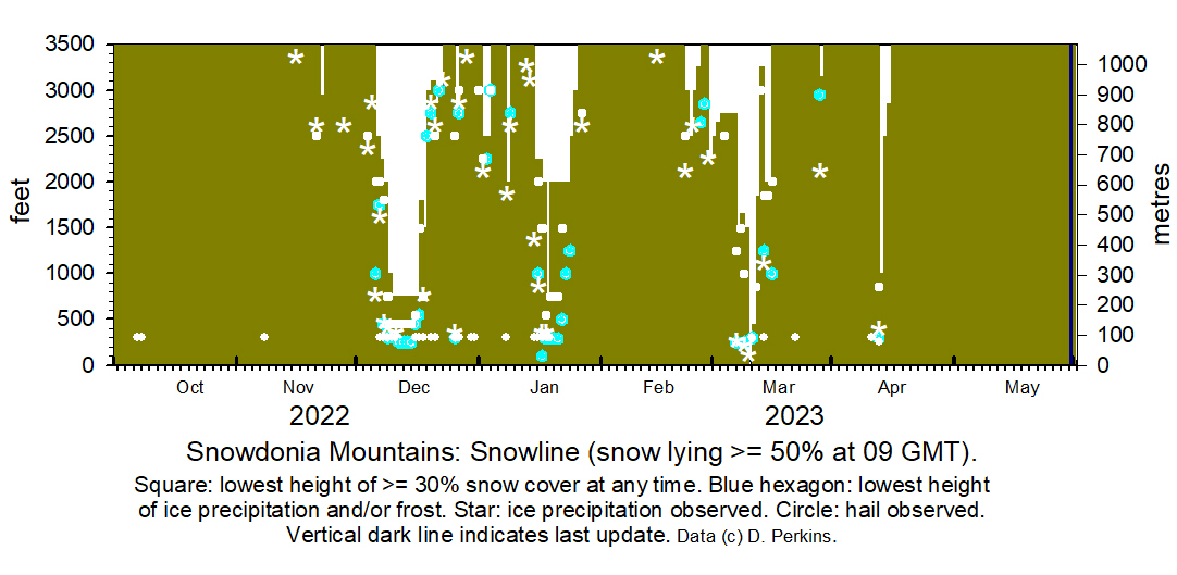
 Snowline
histogram Snowline
histogram

October 2022
There was no snow on the mountains.
November
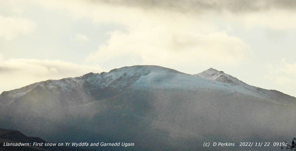
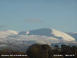
 Snow fell on the 21st and there was light lying snow on the 22nd at 0900 GMT on Yr Wyddfa and summits of the Carneddau Snow fell on the 21st and there was light lying snow on the 22nd at 0900 GMT on Yr Wyddfa and summits of the Carneddau
December
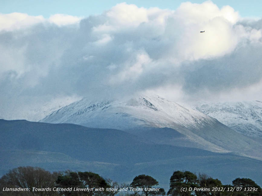
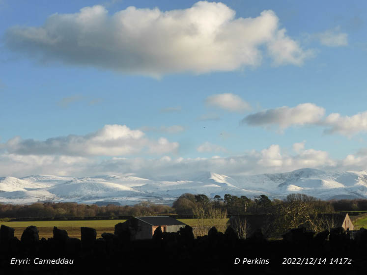
 There were snow showers on the morning of the 6th with sleet and snow as low as 650 ft with slight wet snow cover as low as 2000 ft on the north-facing slopes and summits of the Carneddau, lower in places for a while. Some more snow fell overnight 6/7th leaving a light covering above 2250 ft and sprinklings at lower levels. There were snow showers on the morning of the 6th with sleet and snow as low as 650 ft with slight wet snow cover as low as 2000 ft on the north-facing slopes and summits of the Carneddau, lower in places for a while. Some more snow fell overnight 6/7th leaving a light covering above 2250 ft and sprinklings at lower levels. Further soft hail (snow pellet) and snow showers resulted in the snowline lowering to 2000 ft on the north-facing slopes of the Carneddau by the 8th with remnants as low as 450 ft in places. On the morning of the 9th there were showers of snow pellets, sleet and snow at low levels, some freezing on cold surfaces. Further showers fell across the range in the afternoon. Snow and hail showers continued at all levels on the 10th and 11th adding to the amount of snow on the ground where there was already snow lying. With the very cold weather continuing there was little change in snow levels and ice in succeeding days until the 20th when, following warm rain, much of the snow had thawed leaving a few gully stripes and small patches. A sprinkling of snow on the 21st left some snow over 2500 ft for a while. On the 24th some snow patches and a few cornices remained over 2750 ft.. Ice precipitation snow pellets and snow early on the transiently cold 26th left deposits as low as 300 ft in places and especially on north-facing summit slopes. Following warm rain on the 27th after snow on the summits by the 29th only icy deposits, a few snow patches and cornices remained... Further soft hail (snow pellet) and snow showers resulted in the snowline lowering to 2000 ft on the north-facing slopes of the Carneddau by the 8th with remnants as low as 450 ft in places. On the morning of the 9th there were showers of snow pellets, sleet and snow at low levels, some freezing on cold surfaces. Further showers fell across the range in the afternoon. Snow and hail showers continued at all levels on the 10th and 11th adding to the amount of snow on the ground where there was already snow lying. With the very cold weather continuing there was little change in snow levels and ice in succeeding days until the 20th when, following warm rain, much of the snow had thawed leaving a few gully stripes and small patches. A sprinkling of snow on the 21st left some snow over 2500 ft for a while. On the 24th some snow patches and a few cornices remained over 2750 ft.. Ice precipitation snow pellets and snow early on the transiently cold 26th left deposits as low as 300 ft in places and especially on north-facing summit slopes. Following warm rain on the 27th after snow on the summits by the 29th only icy deposits, a few snow patches and cornices remained...
January 2023
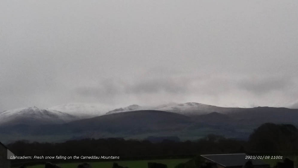
 There were a few small patches of snow and cornices on the mountains on the 1st before fresh snow fell left a cover of lying snow above 2500 ft on the 2nd with sprinklings as low as 2250 ft, Yr Wyddfa and Crib Goch were well covered. Most thawed quickly in the following mild weather leaving again some snow patches icy remnants around the summits on the 4th. On the morning of the 8th wet snow had fallen on the Carneddau Mountains above 2000 ft . There were a few small patches of snow and cornices on the mountains on the 1st before fresh snow fell left a cover of lying snow above 2500 ft on the 2nd with sprinklings as low as 2250 ft, Yr Wyddfa and Crib Goch were well covered. Most thawed quickly in the following mild weather leaving again some snow patches icy remnants around the summits on the 4th. On the morning of the 8th wet snow had fallen on the Carneddau Mountains above 2000 ft .  Fresh snow on the 15th and 16th left snow lying at 2250 ft on the sunny morning of the 16th with some as low as 1000 ft on the Carneddau, a good cover on Yr Wyddfa and white caps on the tops of Yr Eifl 1750 ft on Llyn and Cadair Idris. As the cold spell continued snow showers on the 17th left snow at 1500 ft in the morning and on the 18th snow was lying as low as 300 ft in places. On the 23rd broken snow was lying above 2000 ft with remnants at 1000 ft, rising to 2500 ft on the 24th. Some areas of broken snow remained until the 25th with snow patches at 2250 ft persisting to the end of the month. Fresh snow on the 15th and 16th left snow lying at 2250 ft on the sunny morning of the 16th with some as low as 1000 ft on the Carneddau, a good cover on Yr Wyddfa and white caps on the tops of Yr Eifl 1750 ft on Llyn and Cadair Idris. As the cold spell continued snow showers on the 17th left snow at 1500 ft in the morning and on the 18th snow was lying as low as 300 ft in places. On the 23rd broken snow was lying above 2000 ft with remnants at 1000 ft, rising to 2500 ft on the 24th. Some areas of broken snow remained until the 25th with snow patches at 2250 ft persisting to the end of the month.
.
February
 On the 4th some snow patches and a few cornices on cliffs were still persisting when at dawn on the 22nd fresh snow fell leaving a light covering at 2500 ft. More snow fell on the 28th with snow lying at 2250 ft on the central northern slopes of the Carneddau and Yr Wyddfa (Snowdon).. On the 4th some snow patches and a few cornices on cliffs were still persisting when at dawn on the 22nd fresh snow fell leaving a light covering at 2500 ft. More snow fell on the 28th with snow lying at 2250 ft on the central northern slopes of the Carneddau and Yr Wyddfa (Snowdon)..
March
¤
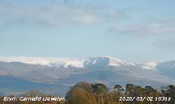
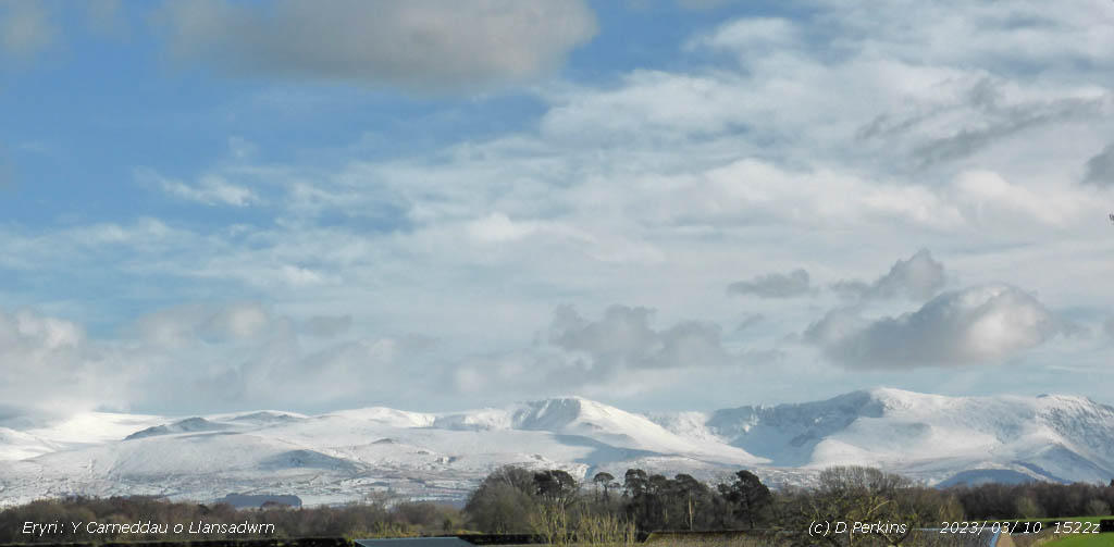
 There was snow on the mountain tops on the 1st and on the 2nd was lying at 2650 ft on the northern slopes of the Carneddau and Yr Wyddfa. Snow persisted on the summits until the 6th when further snow fell. On the 7th early showers brought snow pellets and snow as low as 250 ft with lying snow at 1250 ft across the range including the Carneddau, Yr Wyddfa and on Moel Eilio and Yr Eifl on Llyn in the west. There was snow on the mountain tops on the 1st and on the 2nd was lying at 2650 ft on the northern slopes of the Carneddau and Yr Wyddfa. Snow persisted on the summits until the 6th when further snow fell. On the 7th early showers brought snow pellets and snow as low as 250 ft with lying snow at 1250 ft across the range including the Carneddau, Yr Wyddfa and on Moel Eilio and Yr Eifl on Llyn in the west.  On the 8th snow was lying above 1650 ft and on the 9th at 1000 ft at Ogwen. Further heavy snowfalls with blizzards and whiteout on the summits continued. On the 10th after more overnight with freezing level about 2000 ft and temperatures of -5C on summits snow was drifting in the strong wind and several mountain roads were impassable, 27 cm of snow was recorded in Capel Curig and wet snow was lying at sea level in places. Snow was lying at 450 ft on the 11th and on the 12th had become mostly broken with a few large areas on the Carneddau persisting. Increasing temperatures and rain on the 13th led to considerable thawing. After midnight on the 14th fresh snow fell leaving a light covering above 1250 ft in the morning covering areas of old snow. On the 15th snow was lying above 2000 ft, 30% cover above 1850 ft, before once again warm rain led to rapid thaw leaving frequent small to medium patches of snow on the 16th . On the 8th snow was lying above 1650 ft and on the 9th at 1000 ft at Ogwen. Further heavy snowfalls with blizzards and whiteout on the summits continued. On the 10th after more overnight with freezing level about 2000 ft and temperatures of -5C on summits snow was drifting in the strong wind and several mountain roads were impassable, 27 cm of snow was recorded in Capel Curig and wet snow was lying at sea level in places. Snow was lying at 450 ft on the 11th and on the 12th had become mostly broken with a few large areas on the Carneddau persisting. Increasing temperatures and rain on the 13th led to considerable thawing. After midnight on the 14th fresh snow fell leaving a light covering above 1250 ft in the morning covering areas of old snow. On the 15th snow was lying above 2000 ft, 30% cover above 1850 ft, before once again warm rain led to rapid thaw leaving frequent small to medium patches of snow on the 16th .
April
 Snow fell on the mountains on the 12th and was lying at 1000 ft or below at 0900 GMT. There was a wintry mix of sleet and snow, with showers of snow pellets during the morning that covered the ground at 300 ft in places. Snow fell on the mountains on the 12th and was lying at 1000 ft or below at 0900 GMT. There was a wintry mix of sleet and snow, with showers of snow pellets during the morning that covered the ground at 300 ft in places.
-
You
can view the snowline histograms for previous years here:
 Winter 2021-2022 Winter 2021-2022
 Winter 2020-2021 Winter 2020-2021
 Winter 2019-2020 Winter 2019-2020
 Winter 2018-2019 Winter 2018-2019
-
You can view complete snowline reports for previous years here:
 Winter 2021-2022 Winter 2021-2022
 Winter 2020-2021 Winter 2020-2021
 Winter 2019-2020 Winter 2019-2020
 Winter 2018-2019 Winter 2018-2019
-
For earlier archived reports refer to the Site Map.
Notes
Observations
were made as near to 0900 GMT as possible. There is a good view from Llansadwrn,
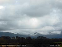
weather permitting, across the Menai Strait towards the Snowdonia Mountains. I
can see the northern slopes of the mountain range from Moel Eilio (west of Snowdon),
Snowdon summits (Yr Wyddfa and Crib Goch), the Glyderau and Carneddau to Foel-fras and
Drum to the east of the range near the Conwy Valley. With the aid of binoculars I make
daily records that include any ice precipitation observed, the lowest altitude
of snow lying at ( >= 50% cover), at ( >= 30% cover) and snow patches. I aim to update the diagram during the season at least twice weekly if there is any snow.
|


