|
Where you see these icons click for a pop-up graphic
Click once on camera and graphic icons to see the image, most in the diary are self closing on next click of mouse. You can also click on most thumbnail images to see a larger version which, depending on the browser, may then need to be clicked on again to see the largest format. Javascript must be enabled if you are using some pop-up disabling software or a firewall. Some panoramas that open in a new window, and graphics on other pages, must be closed after viewing; they may go into your toolbar if you click something else first. Click twice on any word for a definition and further information. Times are GMT (UTC, Z). Observations at this station [ ] are 24-h 09-09 GMT, some others { } occasionally refer to other 24-h periods, extremes (first indications) are given in bold and are usually 21-21 GMT. When averages are referred to (.) compares with the last decade and [.] with the 30-y climatological average [currently 1971 - 2000]. All data are subject to verification and amendment.January 2010
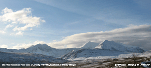
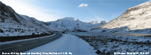
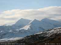
1st: Snow covered mountains set the scene for the New Year. There was clear sky earlier with overnight air minimum of -1.1C and -4.5C on the frosty ground with a sprinkling of snow pellets. Pressure was 1008 mb and there was a light N-NNE'ly breeze and visibility was very good. A little cloud had developed by 09 GMT this increasing through the morning and by 14 GMT the sky was mostly cloudy as a narrow band of showery precipitation moved across. There was a shower of rain here, but snow was falling across the mountains where snow was lying at 600 ft on northern slopes. There was a moderate shower of snow pellets at 1745 GMT that covered the ground, later there were fine snow crystals and some flakes leaving a slight crispy covering. [Pptn 1.1 mm; Max 4.3C; Min -1.0C; Grass -4.5C] The first 15 days had a mean temperature of 1.2C well below the average of the past decade (-4.5) and 30-y 1971-2000 [-3.7] monthly averages. The 10 air frosts were (+7.0) and 15 ground frosts (+2.4). Days with sleet/ snow were 10 (+8.3) and snow lying 9 (+9.0). Precipitation was 18.0 mm (16%) and [18%] of the monthly average.
16th: As an occluded frontal system moved across after midnight the temperature fell 3C and the S'ly wind reached force 7/8 with strong gusts continuing for about 3 hours. There was light rain from 0100 to 0700 GMT and the sky was still overcast at 09 GMT. Things were back to normal, a gale to note, a decent amount of rainfall to measure, the ground was no longer hard underfoot and the 8.2C felt really warm! And, I heard the bleating of new born lambs put out nearby. Soil temperatures were recovering with 5.6C seen at 5 cm depth. Lowest was 2.8C at 20 cm up from 0.4C on the 9th, at 50 cm up to 3.2C from a low of 2.7C yesterday, there was no change in the 4.9C at 100 cm. After a slight shower of rain a few breaks appeared in the cloud by 1030 GMT. We have seen no sign of wrens about the garden (good numbers in recent years) since the cold weather, they can be hit badly being so small, another small bird the goldcrest has been seen going in and out garden conifers. Robins are plentiful and so are the tits and blackbirds; thrushes are fewer, but have been seen. The sparrows have returned too, one a week ago has been joined by 4 others. The frontal cloud hung around all day and there was no bright sunshine. Towards dusk there was mist across the fields and some colour developed in the sky at sunset, but with cloud in the W the sun was not seen. Misty and overcast during the evening with little or no wind. [Rain trace; Max 8.9C; Min 7.0C; Grass 5.8C] The month ended with a mean maximum of 5.2C, lowest since before 1980, (-2.9) and [-2.2] of average. The mean minimum was 0.7C, equal lowest since 1997 ranking 4, (-2.5) and [-1.7]. The mean was 3.0C, lowest since 1985 ranking 3, (-2.7) and [-1.9] . Total precipitation was 52.6C, lowest since 2001 rank 13 since before 1928, (52%) and [60%]. Sunshine duration at RAF Valley was 67.4h (111%) and [123%], highest since 2006 and 15th highest on the Anglesey record since before 1930. Sunniest 6.6h on 8th; 6 sunless days.
February 2010
12th: Mostly cloudy overnight, but beginning to clear after dawn. Pressure was 1027 mb, visibility moderate and once again there was the light NE'ly breeze. A fine and mostly sunny day, with a few clouds at times over Anglesey. The mountains were cloudier, hiding a sprinkling of fresh snow above 2000 ft, starting the day with low cloud in the Menai Strait that was slow to lift during the morning and had not cleared the tops by late afternoon. There was a slight shower of rain before 2150 GMT. {Helens Bay 10.1C, Valley 8.0C & 8.0h, Tiree 8.3h} [Pptn trace; Max 5.7C; Min 0.0C; Grass -2.8C] 13th: Mostly cloudy at first, clouds becoming scattered with some sunny spells during the day before turning cloudier again towards dusk. Visibility was mostly very good and the wind, NE'ly force 2 at first, lessened through the day. There were some spots of rain during the evening. [Rain trace; Max 5.5C; Min 0.6C; Grass -2.3C] 14th: Again mostly cloudy with the mountaintops obscured under thin cloud that allowed glimpses of weak sunshine at first. Soon the cloud thickened and there was light rain on a warm front from just before noon not easing until after 1830 GMT. There were a showery bursts of rain around 2100 GMT and between 2300 and midnight containing a few small ice pellets. Total precipitation of 8.4 mm, was the largest of the month. {Mumbles Hd 9.2C, Manston 5.5h} [Rain 8.4 mm; Max 4.8C; Min 0.2C; Grass -3.5C] 15th: Overcast with no further precipitation until dawn when there was heavy drizzle then fog increasing until 09 GMT. Pressure 1006 mb was falling with deepening low 990 mb N Scotland and we were in warm sector air with a light SW'ly breeze. The fog soon cleared, but the morning kept overcast, occasionally brighter but no sunshine. There was showery rain from 1100, with heavier bursts around noon, through to 1900 GMT turning sleety when the air temperature fell below 3.5C during the evening. [Pptn 6.4 mm; Max 6.4C; Min 2.1C; Grass 1.9C] The first 15 days had 31.2 mm of mixed precipitation (34%) and [41%] of the February average. The mean temperature was 3.5C (-2.1) and [-1.8] of the average for the month. Soil at 30 cm averaged 3.5C (-2.2).
16th: Precipitation during the night at 02 GMT and between 0430 and 0500 GMT was of snow. There was a thin layer of snow crystals on the roof of the Stevenson screen at 09 GMT and a little on the grass. Pressure was 990 mb with low 987 mb lying close to the NW off Malin Head. The sky at first was clearing, but with cumulus clouds in the vicinity there were wintry showers of sleet, small snow pellets and slight snow from 1000 GMT. There was fresh snow on the mountains at 2000 ft at 09 GMT and with further snow during the morning was as low as 600 ft by afternoon particularly on eastern Carneddau Mountains. The afternoon was brighter with a few sunny spells and the sky had cleared by evening with frost on the grass. [Pptn 2.0 mm; Max 6.6C; Min 0.1C; Grass -2.2C]
The month ended with a mean temperature of 3.5C, lowest since 1991 ranking 4 since before 1979, (-2.2) and [-1.8] of average. The were 10 days with sleet or snow, equal highest 1996 ranking 2 since before 1979, and 3 days with snow lying at 09 GMT, most since 2006. Precipitation totalled 46.2 mm, largest since 2008 but ranking 23 lowest since before 1928, (51%) and [62%] of average. It was the sunniest February since 2008, one of the 17 sunniest on the Anglesey record, with sunshine duration at Valley 92.1h (111%) and [122%]. Sunniest day was on the 17th with 8.9h, there were 3 sunless days. |

|
10th: Scattered clouds and some early mist were burning off to give a sunny, but very hazy morning. Pressure steady on 1033 mb would begin to decline through the day. A fine and mostly sunny day, the haze thinned and cleared by afternoon so that clear views of the mountains could be seen. Two large bumblebees were seen on the heathers in full flower, a solitary pied wagtail that has been in the garden all winter has moved off. We frequently have a wagtail overwinter, and although the habitat is suitable here they are do not nest here unless it returns with a mate this year. Most birds are pairing up, 2 pairs of robins were displaying quietly until a fifth turned up when there was trouble! Tits continue to inspecting the nest boxes and I suspect thrushes and blackbirds are already nesting. There is still a lot of snow on the mountaintops, unbroken in places, with large snow beds persisting around 1000 ft. Smaller patches are still surviving at 400 ft, perhaps lower in places including Aber Valley around the headland at Penmaenbach on shady NE-facing crags. Clearer sky in the W at sundown with a brief vivid red and purple glow in the sky at 1805 GMT. A clear evening with frost and mist soon developing in low lying areas. {Milford Haven 9.8C, Valley 10.2h} [Tr melting frost; Max 9.1C; Min 0.8C; Grass -3.2C]
11th: Mostly cloudy at first, but the sky was clearing before 09 GMT melting the extensive white frost on grass. The soil surface and concrete was dry. Pressure 1028 mb was falling very slowly as occluded frontal cloud associated with a Polar low to the N of Scotland moved South. Initial cirrus and cumulus clouds cleared to give a mostly sunny morning. Small species daffodils are now beginning to flower in the garden together with the first dandelion and daisy on the lawn. Cirrus clouds remained over the snowclad mountains in the afternoon with moderately high cloud encroaching before sunset. There was a little clearance during the evening enough for a touch of ground frost before thicker cloud encroached from the North.. {Milford haven 9.8C, Valley 10.6h} [Rain 0.2 mm; Max 7.6C; Min -0.8C; Grass -4.8C]

|
13th: An overcast and dull morning with cloud covering the mountaintops . Pressure 1033 mb was rising as the Atlantic-high 1038 mb to the W of Ireland intensified. Visibility was good and there was a light NW breeze and the morning kept overcast with a few bright spells and occasional weak sunshine. The afternoon had cloud thick enough to produce spells of fine rain. The sky cleared after dark with ground frost developing. [Rain trace; Max 8.6C; Min 2.3C; Grass -1.4C]
14th: The morning was damp morning with much condensation on the copper rain gauges. After a mostly clear night the sky was becoming cloudier at 09 |GMT when the temperature was 5.5C (dewpoint 5.3C, RH 98%). Pressure was steady on 1032 mb with Atlantic-high 1037 mb off SW Ireland. With scattered clouds the morning became sunnier and with few in the afternoon pleasantly warm with the temperature 12.3C, a rise of 11.3C. I missed the honeybees, they would have been humming on the banks of heathers on the rockeries, but there were 3 large bumblebees. The absence of honeybees will make a difference to setting of fruit bushes and trees in the garden. A little cloudier at the end of the afternoon, but clearing later in the evening, ands yes there was another ground frost. {Pershore 14.1C, Valley 11.6C and 8.5h} [Rain 0.0 mm; Max 12.3C; Min 1.0C; Grass -2.5C]
15th: Cloudier from dawn with a little brightness and weak sunshine at first. Pressure 1029 mb was beginning to decline and with the jetstream persistent over Iberia and the Gibraltar Strait and the Med beginning to fragment and likely to move N, the settled spell of weather is perhaps slowly coming to an end. The morning was soon dull, the afternoon overcast with slight showers of rain between 1330 and 1430 GMT. There were some breaks in the cloud by 2000 GMT. [Rain trace; Max 11.0C; Min 2.4C; Grass -1.6C]
The first 15 days have been remarkably dry with just 0.2 mm measured rainfall. The mean temperature 4.6C was well below normal (-2.4) and [-2.1] of average and there was ground frost every night. Sunny with 109 h reported at Valley already (83%) and [103%] of the average for March .
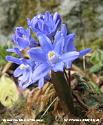
16th: A bright morning with a deep red sun starting to rise about 0640 GMT now well E of the Carneddau Mountains. Moderately high altostratus cloud at first with cirrostratus moving across by 09 GMT. There was a partial 22° solar halo, but no 'dogs'. Soon sunnier with a light to moderate S'ly breeze and very good visibility. The glory-of-the snow have appeared in the garden, photographed 2 days earlier than last year, the cold weather had not delayed their flowering. There was still plenty of snow on the tops of the Carneddau, but patches at low levels were fast disappearing. Mostly sunny, but becoming windier in the afternoon and cloudier by 1700 GMT. There was rain on a frontal system falling on western Ireland by 1800 GMT, but was not to reach here before midnight. [Rain 1.2 mm; Max 10.8C; Min 2.3C; Grass -0.7C]
On this day in 1979 we were hit by a 48-h blizzard that continued on through the 17th. There was 15 cm of level snow and 2 m drifts in the garden and 2-3 m drifts blocking the Llansadwrn to Beaumaris road.
 17th: There was light intermittent rain between 02 and 05 GMT, notable as being the most since 23rd February. The morning was overcast and dull, there had been no frost and the temperature at 09 GMT 8.5C. A slow-moving occluded front was over western Britain with pressure on 1017 mb The afternoon was windier S'ly force 5 and brighter with a little weak sunshine at 1630 GMT insufficient to record as bright sunshine, so it was a sunless day. The evening was kept overcast the wind force 5/6 and gusting at times. {Hawarden 15.3C, Capel Curig 5.2 mm, Aberporth 3.1h} [Rain 0.0 mm; Max 12.0 C; Min 5.8C; Grass 4.1C]
 18th: Another night without frost with the air temperature not falling below 8.4C, highest of the month. The temperature was continuing to rise, being in double figures 10.7C at 09 GMT. Relative humidity was down to 55% and the soil, grass and leaf litter in the wood dry. Overcast at first the sky was clearing with hazy sunshine and moderate to good visibility. Low 972 mb was W of Ireland and pressure had fallen to 1010 mb with the S'ly wind force 5/6. The morning kept fine and bright with the temperature rising to 14.4C, but from 1300 GMT there were spots of rain on the strong S'ly wind. Although I saw no sunshine a weak, but complete, rainbow was seen low in the sky over Llanddona. Later, the skies darkened and there was a moderate shower at 1500 and light rain from 1600 GMT before the cloud started to break during the evening. [Rain 0.9 mm; Max 14.4C; Min 8.4C; Grass 7.4C]
![]() Duncan Brown alerted me to reports of dustfall in central Anglesey (and N England). While there has been local dust around during the dry weather there have been duststorms in northern Africa with Saharan dust transported to S Europe in recent days. Backward trajectory analysis using HYSPLIT, courtesy of NOAA ARL Website, revealed that air arriving between 500 and 1000 m AGL at 1400 GMT today over central Anglesey could have picked up dust N of large storms in S Algeria, Mali and Mauritania on the 16th that could have been washed out in this afternoon's rain. .
Duncan Brown alerted me to reports of dustfall in central Anglesey (and N England). While there has been local dust around during the dry weather there have been duststorms in northern Africa with Saharan dust transported to S Europe in recent days. Backward trajectory analysis using HYSPLIT, courtesy of NOAA ARL Website, revealed that air arriving between 500 and 1000 m AGL at 1400 GMT today over central Anglesey could have picked up dust N of large storms in S Algeria, Mali and Mauritania on the 16th that could have been washed out in this afternoon's rain. .
20th: Light rain continuous and turning moderate just before 09 GMT then beginning to ease. The 18.6 mm, largest since the 18.7 mm on 5 December 2009, certainly wetted the dry ground. Pressure was 1000 mb within low-pressure over Wales. The rain petered out during the morning and by noon the sky was brighter with some sunny spells during the afternoon. Cloud and mist was slow to lift from the mountains. [Rain 1.2 mm; Max 8.7C; Min 5.3C; Grass 5.2C]
21st: Some clear spells overnight that allowed a ground frost to develop, but the sky was overcast at dawn. By 09 GMT the sky was starting to clear and there was some weak sunshine. Pressure 1015 mb was rising in a ridge across the UK and by 11 GMT cloud was lifting from the tops of the mountains. There is still broken snow around the summits with some large patches as low as 1000 ft. By noon cloud was encroaching from the SW with mist and rain beginning to affect the W coast. There were spots of rain here during the early afternoon, in a strengthening S'ly wind, with light rain from 1530 GMT petering out before 17 GMT. The evening and night were overcast with the strong wind continuing. [Rain 0.9 mm; Max 10.4C; Min 2.0C; Grass -1.5C]
22nd: A shower of rain at 01 GMT then fine with moderately high cloud and a little weak sunshine just before 09 GMT. With the S'ly wind strengthening to a gusty force 7/8 there were some spots of rain on a weak cold front that turned to light rain during the morning. Pressure 1009 mb was falling with low 983 mb S of Iceland. From noon the sky was brighter with a few sunny spells before darkening cumulonimbus clouds brought heavy showers across Anglesey from 1530 GMT. Hail was reported 'petit pois' size on the banks of the Afon Nodwydd near Pentraeth at 1555 GMT, but here we had rain. Later and during the evening the sky began to clear. {Rhyl 12.4C, Capel Curig 11.4 mm, Aberporth 5.9h} [Rain 3.4 mm; Max 12.0C; Min 7.3C; Grass 6.8C]
23rd: Enough of clear spells overnight to give a touch of ground frost, but the sky was overcast. Examination of the hailometer revealed no hail marks during the past 24-h. The morning was fine with a little weak, obscured, sunshine at first through altostratus cloud. Thickening cloud by 1300 GMT brought slight rain this turning heavier during the afternoon. Buds of several plants and trees are beginning to break all at once. These include horse-chestnut, sycamore, blackcurrant, and raspberry. The dwarf white rhododendron now has several flowers open while leaves of honeysuckle and clematis have been unfolding over several days. The large flowered daffodils are now open, again several varieties appearing almost at the same time. Several garden shrubs have yet to show signs of regrowth and the head gardener wonders what will be the effects of this winter's frosts. [Rain 7.0 mm; Max 11.2C; Min 3.0C; Grass -0.5C]
24th: Overcast with ragged low stratiform clouds with spots of rain turning to light rain. Visibility was moderate in mist and low cloud that was slow to lift. By afternoon the rain had petered out and though mostly cloudy there were some brighter spells. [Rain 2.4 mm; Max 11.0C; Min 6.3C; Grass 5.8C]
25th: A mostly cloudy, but bright morning with some sunny spells soon developing. The temperature at 09 GMT was into double figures at 10.3C, in a light SE'ly breeze, and there was a lot of birdsong especially blackbirds and thrushes around the garden and wood. A trace of pink coloured Saharan dust was observed, falling in rain between 04 and 07 GMT. Pressure 996 mb was falling, but the day kept sunny here the temperature rising to 15.1C, highest of the month and highest since 31 October. Heavy rain was affecting both S England and N Scotland and by the end of the afternoon the sky turned cloudier with a few spots of rain coming along. There was light to moderate rain from 1915 to 0300 GMT accumulating 13.1 mm. {Coningsby 16.4C, Rhyl 14.6, Lerwick 5.3h, Valley 3.0h} [Rain 13.1 mm; Max 15.1C; Min 7.1C; Grass 5.1C]
26th: After the overnight rain the sky began to clear soon after 07 GMT leaving cumulus clouds over the mountaintops with cirrus clouds overhead at 09 GMT. There was a fresh S'ly breeze, but the day was fine and sunny with scattered clouds and moderate visibility. [Rain 0.0 mm; Max 11.9C; Min 5.6C; Grass 5.3C]
27th: When I opened the door just before 09 GMT I heard the chiffchaff for the first time. I kept a watch yesterday, but he had not arrived before dusk. Despite severe gales, rain and duststorms on route this year the bird arrived on time again, usually it's the 27th. The sky was clearing at first and with a light W'ly wind the 7.8C felt very pleasant. Pressure 1005 mb was rising with to the N low 987 mb Faeroes and high 1027 mb to the S over Iberia. The brightness did not last long the morning became duller by 11 GMT, but began to clear again after noon to give a mostly sunny afternoon. Cloudier once again by sunset when a slight pink and purple glow was seen. The evening was partially cloudy but the near full moon appearing from time to time. (Mumbles Hd. 12.1C & 7.0 mm} [Rain 0.0 mm; Max 12.3C; Min 4.9C; Grass 1.5C]
28th: Broken sky with little change up to 09 GMT, observations are now done at 10 am Summer Time (GMT +1) having started. I don't like the change, but would support GMT +1 throughout that we had for the 3-y trial a few years ago. It would seem reasonable for Scotland to have GMT in the winter, I see no problem in a time zone at the border! During World War II GMT +2 was used successfully during the summer months. Pressure was 1008 mb with low 989 mb over the N North Sea with an occluded front over S Scotland. The jet stream still to the S is fragmented, but keeps reforming driving lows over the western Med or towards N Europe. The day was mostly cloudy, but there was some brightness with a few sunny spells later. By 1600 GMT rain on a warm front associated with Atlantic-low 998 mb had moved into SW England making slow progress northwards. {Manston 13.9C, Milford Haven 12.7C, Valley 5.6h} [Rain 1.8 mm; Max 12.5C; Min 4.3C; Grass 0.5C]
29th: It had been raining since 04 GMT and there was 1.8 mm in the rain gauge. Low 983 mb was W of Biscay with a warm front stretching from S Wales to Kent. The temperature had fallen to 4.0C and while there was rain here light snow was falling on the mountaintops. Overcast with uniform grey stratiform clouds the light rain continued through the morning, stopping around 1245 GMT when the sky was brighter with a hint of something better coming along, but no the rain soon resumed. A sunless day. {Trawsgoed 11.8C, Capel Curig 23.0 mm} [Rain 9.3 mm; Max 9.6C; Min 4.0C; Grass 0.8C]
30th: At midnight low 985 mb off Brest was steaming towards St. George's Channel. Continuous light rain the 9.3 mm was sufficient to make puddles around the weather station and pools along the local roadsides. The low 981 mb was over the Irish Sea and winds near the centre were light and variable. The rain stopped briefly from 1015 GMT and the sky was a little brighter, but soon resumed and was interspersed with intermittent slight drizzle during the afternoon. The soil on the garden plot that had been dry enough to work now looks very wet. With the temperature just 8.3C at 30 cm thoughts of sowing seeds of some early crops will have to wait. With spring on hold the low became slow-moving over Anglesey things were a lot worse in Scotland and N Ireland where winds were strong to gale and temperatures low enough for heavy snow to fall. Power lines were brought down and nearly 100,000 homes in N Ireland and 7,000 in Scotland were without electricity. Disruption was caused on the roads, flights and ferries were canceled. There was a glimpse of sunshine here before dusk and with the sky only partly covered and little or no wind at the centre of the low temperatures began to fall during the evening with a touch of ground frost before midnight. [Pptn 21.3 mm; Max 8.8C; Min 4.0C; Grass 3.8C]
31st: At midnight the low 978 mb had started to move E and was centred near Manchester. A band of moderate to heavy precipitation on an occluded front moved in off the Irish Sea that turned to sleet on low ground falling as snow above 600 ft in Snowdonia. At 09 GMT with 21.3 mm precipitation, a mixture of sleet and snow, in the rain gauge, the largest since 19 November (25.3 mm). Pressure had risen to 990 mb with the low 982 mb off the E coast of England. The mixture of precipitation continued through the morning. Snow had fallen widely in Snowdonia with at least 10 cm reported in some places. The strong to near gale-force NNW'ly wind and high spring tide at 1115 GMT resulted in emergency services attending when 30 ft waves breaking over the promenade caused flooding along the sea front in Llanfairfechan. Showers, some heavy with snow pellets, continued during the afternoon that was bright at times with some sunshine. The day's maximum temperature was 6.0C, second lowest of the month. After another shower of snow pellets at 1800 GMT showers died out during the evening. Some 30, 000 homes in N Ireland and 5,000 in Scotland were reported to be still without electricity supply. With 100 passengers aboard the 1511 GMT train from Glasgow became stuck in a huge snowdrift 20 miles short of its destination Inverness. A rescue snowplough train also became stuck, but a third eventually managed to reach the passengers and enabling them to finish their journey after 02 GMT. [Rain 3.2 mm; Max 6.0C; Min 0.6C; Grass -1.1C]
Precipitation, most falling in the second half of the month, totaled 84.5 mm, highest since 2008 ranked 27 since 1928, (133%) and [100%] of the averages. There were 17 (+2.7) dry (<0.2 mm) days. The mean temperature 6.4C, lowest since 2006 ranked 11 since before 1979, was (-0.7) and [-0.4] of the averages. The 147.0 h sunshine duration at Valley was sunniest since 2007, rank 10 on the Anglesey record since before 1930, and (112%) and [139%] of average. Sunniest day was on the 7th with 10.8h; there were 4 sunless days.
April
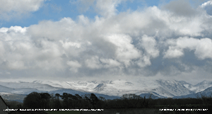 1st: With mostly clear sky around dawn there was a ground frost (-2.7C) the air temperature keeping above freezing at 0.4C was lowest of the month. The sun rose at 06 GMT as an orange ball, now well to the East of the Carneddau in the direction of Conwy. Earlier there had been some snow pellets and a little sleet. By 09 GMT the sky was mostly cloudy with the snow covered mountaintops obscured, but fresh wet snow was seen as low as 400 ft. Pressure 1006 mb was rising as a ridge of high-pressure crossed from the West. The low of yesterday was filling, 986 mb off the NE off Scotland, but another Atlantic-low 993 mb W of Ireland was deepening and heading our way. There was a slow-moving detached warm front mid to S Wales, but here it was a fine day with increasing amounts of sunshine by afternoon and a sunny early evening. [Rain 0.1 mm; Max 10.5C; Min 0.4C; Grass -2.7C]
2nd: A fine and bright morning, but there were cumulus clouds in the vicinity threatening showers. Pressure was 996 mb with low 988 mb SW Ireland. There was a light shower at 1045 GMT then some more sunshine. Well, it's April after all. During the afternoon the showers pepped up a bit and there was a shower of small hail in Benllech at 1705 GMT, but we had just rain here. By evening showers had left a covering of fresh snow on the Snowdonia Mountains above 2500 ft. Showers continued up to 2300 GMT. [Rain 3.9 mm; Max 9.5C; Min 1.5C; Grass -2.0C]
3rd: Another bright morning, again cumulus clouds were seen and we did have a few spots of rain during the morning. Low 992 mb was over Cornwall, but here pressure 998 mb was rising and the day kept mostly dry with sunny spells coming along in the afternoon. There was light fresh snow on the mountains at 2000 ft, mostly centrally between Carnedd Llewelyn and C. Dafydd with a good covering along the ridge to Penyrole-wen. Today, I got the mower out!. Usually in recent years it has been kept busy during the winter as the grass continued to grow. Not this year. Checked out the mower, but there was little to cut, the grass still not growing very much. The leaves of bluebell are quite tall, but still no flowers. We have seen a peacock butterfly that managed to overwinter; there are plenty of ladybirds about too seemingly unaffected by the winter weather. Broken cloud cover during the evening and night. {Gravesend 12.6C, Isle of Portland 29.6 mm, Valley 8.4h} [Rain trace; Max 12.2C; Min 2.5C; Grass -0.8C]
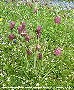
4th: Bright, fine and mostly sunny with pressure 1012 mb rising, a light W'ly breeze with good though hazy visibility. There were once again cumulus clouds in the vicinity, but these diminished through the day and there were clear views of the snow covered mountaintops later in the afternoon. Hawthorn leaves are opening in the wood, but not yet on roadside hedges, and there is a fine display of snakes head fritillaries coming on the 'meadow area' in the garden. We started with just 4 plants, but within a few years they have seeded themselves and we now have too many to count and they are spreading into the lawn. Lesser celandine, however, is spreading and becoming a problem. By evening frontal cloud was encroaching from the W and the wind was freshening. [Kinlochewe 12.7C, Milford Haven 10.0C, Capel Curig 13.8 mm] [Rain 11.1 mm; Max 11.8C; Min 1.8C; Grass -0.9C]
5th: Overcast with spots of rain on the freshening S'ly breeze. Slight rain during the morning and becoming brighter with some sunny spells in the afternoon. Low 972 mb was W of Rockall, S of Iceland, and the wind a sustained force 6/7 reached gale force 8 at times during the afternoon. At Capel Curig force 9 was recorded at 15 GMT with a peak gust of 68 mph. The wind was strong and gusty through the evening and night. [Rain 0.2 mm; Max 11.8C; Min 5.2C; Grass 3.9C]
6th: A cold front brought heavy rain into W Scotland and Ireland overnight and moved slowly into Wales during the morning. The morning was overcast with a near-gale force S'ly wind keeping strong force 6 during the day only moderating during the evening. There was continuous light rain from 1130 GMT turning moderate from 1500 GMT and stopping by 1700 GMT as the front moved to the SE. A sunless day here although the mountaintops were lit up at sunset. [Rain 3.1 mm; Max 10.6C; Min 8.6C; Grass 7.8C]
7th: The front was over the Welsh Borders at midnight and the morning was fine with cloud decreasing slowly. Pressure 1021 mb was rising in a ridge from high 1030 mb W of the Bay of Biscay. By noon with just 3 oktas of cloud cover it was fine and sunny. There was a moderate NE'ly breeze and the temperature rose no higher than 12.4C. [Rain 0.0 mm; Max 12.4C; Min 4.9C; Grass 2.4C]
8th: With clear sky overnight the temperature on the grass had fallen to 0.4C and there was moderate dew. Pressure had risen to 1031 mb with the high 1034 mb off Lands End. Under 3 oktas of thin cloud in the slightly hazy sunshine at 09 GMT the temperature was 10.3C (dewpoint 6.9C). There was a light air from the SW with stronger gusts enough to move small twigs on the trees.. Feeling warmer with the temperature rising to 15.7C during the afternoon. Some small cumulus clouds formed over the mountains that still had some quite large patches of snow on N-facing cliffs and gullies. It was a clear evening and night. [Lee-on-Solent 17.6C, Camborne 12.7h, Valley 11.5h] [Rain 0.0 mm; Max 15.7C; Min 3.5C; Grass 0.4C]
9th: Pressure had risen to 1034 mb over most of the British Isles. It was a sunny morning with 5 oktas of cloud and very good visibility. Fine and dry everywhere except the N of Scotland where there was a little overnight rain. A dry mostly sunny day here the temperature rising from 11.1C at 09 GMT to 16.0C by late afternoon under thin clouds. A fine evening with little or no wind, but no frost. [Valley 3.7h] [Rain 0.0 mm; Max 16.0C; Min 5.0C; Grass 2.2C]
10th: Again no overnight frost. High-pressure was moving NE and was over the North Sea and Scandinavia 1037 mb. Pressure here was on 1034 mb giving another fine, sunny day in most parts of Britain. Under thin high altostratus cloud, and with a light SE'ly breeze, the temperature at 09 GMT was 13.4C (dewpoint 5.6C this rising to 18.5C during the day. Bright with some sunshine for a time in the afternoon before cloud encroached again by evening with sea mist moving into the Menai Strait. Highest temperatures were in the North, 19.4 at Aviemore and 19.0C at Capel Curig. [Aviemore 19.4C, Capel Curig 19.0C, Glasgow 12.3h, Valley 9.2h] [Rain 0.0 mm; Max 18.5C; Min 5.9C; Grass 1.9C]
11th: Pressure was 1039 mb over Scandinavia and was falling here 1032 mb. With 6 oktas cover of altostratus cloud it was a bright and fine morning. There was a light SE wind. The temperature was 13.2C (dewpoint 7.7C) and the soil surface was drying out in patches. Visibility was good, but hazy. Cooler today with the temperature rising to 15.2C and to just 8.1C in Shetland. The cloud dispersed during the afternoon that was mostly sunny well into the evening. Large fires were seen on the mountains on the mountains at 2100 GMT with the smell of burning gorse reaching Llansadwrn (wind E'ly force 2). {Castlederg 20.4C, Dunstaffnage 13.6h} [Rain 0.0 mm; Max 15.2C; Min 7.1C; Grass 3.8C]
 12th: Mostly clear skies again overnight and a sunny, but hazy morning. Pressure 1032 mb was unchanged here, but the high 1037 mb had moved to be S of Iceland. There was a moderate NE'ly breeze and the temperature at 09 GMT was 8.6C (dewpoint 3.5C). By noon with dense smoke haze increasing (dust, wildfires and pollutant aerosols can be the cause) the blue of the sky was pale and the mountains were barely visible and had almost disappeared by afternoon. Despite the sunshine, the day's maximum struggled to reach 12.4C. [Tyndrum 20.3, Dunstaffnage 13.3h, Valley 11.6h] . [Rain 0.0 mm; Max 12.4C; Min 4.4C; Grass 2.4C]
13th: Bright with hazy sunshine and a cool NE'ly breeze. Overnight the temperature on the grass was down to 0.8C with some dew formed. The drying soil on the surface of the bare plot was still damp in patches. Pressure was high 1037 mb to the NW, but had fallen to 1029 mb here. Another cool day with hazy sunshine, paled blue skies ![]() and a maximum of 11.4C A weak cold front over Scotland moved S during the day and cloud encroached by late afternoon so that the sky was mostly covered by 1830 GMT giving a dull evening. [Lee-on-Solent 17.5C, Dublin AP 12.6h, Valley 11.5h] [Rain 0.0 mm; Max 11.4C; Min 3.9C; Grass 0.8C]
and a maximum of 11.4C A weak cold front over Scotland moved S during the day and cloud encroached by late afternoon so that the sky was mostly covered by 1830 GMT giving a dull evening. [Lee-on-Solent 17.5C, Dublin AP 12.6h, Valley 11.5h] [Rain 0.0 mm; Max 11.4C; Min 3.9C; Grass 0.8C]
14th: Pressure was 1025 mb in a ridge from Atlantic-high 1038 mb to the W. The morning was overcast and dull at first with remnant frontal cloud slipping South. There was a moderate NE'ly breeze and the temperature 8.7C rose to just 9.8C during the day. With the cloud breaking up sunny spells developed through the morning while the afternoon was mostly sunny as the cloud cleared. Haze thickened again during the day. Less windy during the evening under a mostly clear sky. {Tyndrum 20.2C, Dublin 12.6h, Valley 10.1h} [Rain 0.0 mm; Max 10.1C; Min 4.4C; Grass 1.8C]
15th: A fine and sunny start to the day with moderate visibility and haze, enhanced by volcanic ash, the mountains were largely obscured. Flights in and out of British airspace were cancelled amid fears of engine damage due to the ash. High-pressure continues to dominate with pressure here 1026 mb and high 1035 mb S of Iceland. There was a moderate NNE'ly wind with the temperature at 09 GMT 8.1C (dewpoint 3.7C). Airflow around the high was responsible for bringing a plume of ash from the Eyjafjallaj�kull volcano in Iceland towards Britain. Deposits of dust were observed Lerwick, Shetland, during the afternoon. Keeping sunny during the afternoon, with a maximum temperature of 10.3C, the haze thickened with views of the mountains obscured from Anglesey. The evening remained fine with hazy sunshine and the night had mostly clear sky with the temperature on the grass falling to 0.2C. [Shannon AP 12.6h, Valley 12.0h] [Rain 0.0 mm; Max 10.4C; Min 3.7C; Grass 0.2C]
The first 15 days had rainfall of 18.4 mm (25%) and [32%] of average. The mean temperature 8.2C was below and both the decadal (-0.9) and 30-y [-0.4] monthly averages.
16th: Another fine and sunny morning after an overnight touch of ground frost (-0.7C). The temperature at 09 GMT was 10.4C, this exceeding yesterday's highest so 10.4C was the maximum for the past 24-h (09-09 GMT). Pressure was 1031 mb within the high established over the Irish Sea, there was a light E'ly breeze. Visibility was good, but again hazy a combination of pollutant aerosols and volcanic dust. The Met Office reported fine ash from the Eyjafjallajokull volcano had been detected in northern England, the Midlands and the Thames Valley. Falls of dust were reported in Sheffield and as far south as Swindon, Brize Norton, Kent and Chiswick in London, Flight restrictions remained in place over Britain. Somewhat warmer here today, 12.8C by afternoon requiring the opening of greenhouse vents! The white flowers of blackthorn, that come out before the leaves open, were spotted in hedgerows along the road to Benllech. Haze increased through the day being moderately thick with the skies being mostly clear of cloud. Clear skies in the evening with visibility improving views of the mountains were much clearer. A clear night with another touch of ground frost. [Aboyne 18.3C, Dublin AP, 13.3h Valley 12.8h] [Rain 0.0 mm; Max 12.8C; Min 3.5C; Grass -0.7C]
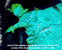
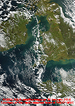
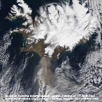 17th: A sunny morning with the temperature 12.0C at 09 GMT. Pressure was 1023 mb in a narrow ridge extending from high 1037 mb over Greenland with low-pressure 990 mb Norway and 998 mb off S Portugal. The breeze still felt cool, but in the hazy sunshine the temperature rose to 17.8C, highest since the 10th. Snow showers were reported in Shetland. The explosive eruptions of the Eyjafjallajokull volcano continued today (see MODIS AQUA satellite image). According to the Icelandic Met Office there were numerous lightning strikes associated with the plume. The cloud height was about 16,000 feet (4876 m), periodically up to 24,000 feet (7315 m) with ash being carried southward. There were reports from many parts of Britain of slight dust deposits from the volcano. {Sutton Bonnington 18.4C, Coleshill 13.9h, Valley 12.8h] [Rain 0.0 mm; Max 17.8C; Min 3.4C; Grass -0.7C]
18th: Almost clear skies again this morning with hazy sunshine and moderate visibility. A cold front over Scotland had brought a return to wintry weather with snow showers making their way southward during the day. Cloudier with moderately high cloud encroaching over Snowdonia later in the afternoon with clear skies remaining over Anglesey. Moderately thick smoke haze and volcanic ash continuing to cover much of Britain and spreading to Europe. With the frontal cloud stalled, just to the N of here, the evening sky was clear at first giving a cool evening with the temperature on the grass falling to 0.3C. Cloud began to encroach by 21 GMT. [Valley 8.9C] [Rain 0.0 mm; Max 12.9C; Min 4.0C; Grass 0.3C]
![]() 19th: Mostly cloudy overnight as the frontal cloud moved S; there was mist around dawn, but visibility improved to moderate by 09 GMT. There was a slight deposit of small grey dust particles over 24-h on a cleaned surface. Partly cloudy with a few sunny spells during the morning. Similar in the afternoon with the temperature rising to just 9.8C. Brightening from 15 GMT onwards and mostly sunny during the evening. [Rain 0.0 mm; Max 9.8C; Min 3.8C; Grass 0.8C]
19th: Mostly cloudy overnight as the frontal cloud moved S; there was mist around dawn, but visibility improved to moderate by 09 GMT. There was a slight deposit of small grey dust particles over 24-h on a cleaned surface. Partly cloudy with a few sunny spells during the morning. Similar in the afternoon with the temperature rising to just 9.8C. Brightening from 15 GMT onwards and mostly sunny during the evening. [Rain 0.0 mm; Max 9.8C; Min 3.8C; Grass 0.8C]
![]() 20th: Becoming cloudy with slight showers of rain around dawn in some places, then brightening with some hazy sunshine during the morning. I am grateful to Duncan Brown who alerted me to deposits of greyish white dust on cars in Nebo and Bethesda, Gwynedd, that may have come from the Eyjafjallajokull volcano, and trace deposits of reddish brown dust in Waunfawr may be Saharan in origin. The volcanic dust appears to have moved S in association with the weather front on the 19th. While there has been some dry deposition, larger deposits could have been washed out by showers of rain when and where they occurred.
20th: Becoming cloudy with slight showers of rain around dawn in some places, then brightening with some hazy sunshine during the morning. I am grateful to Duncan Brown who alerted me to deposits of greyish white dust on cars in Nebo and Bethesda, Gwynedd, that may have come from the Eyjafjallajokull volcano, and trace deposits of reddish brown dust in Waunfawr may be Saharan in origin. The volcanic dust appears to have moved S in association with the weather front on the 19th. While there has been some dry deposition, larger deposits could have been washed out by showers of rain when and where they occurred.
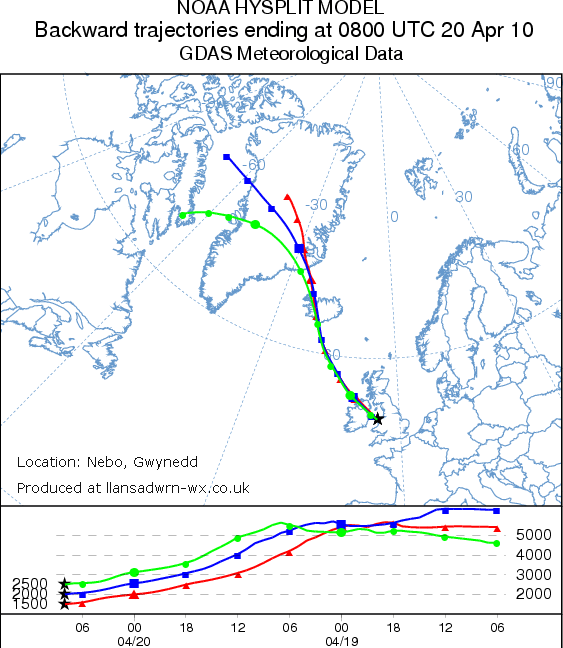 The HYSPLIT volcanic ash model at the NOAA ARL website was used to confirm the position of the ash plume following eruptions timed at 2100 GMT on the 17th (see MODIS image above) and 1200 GMT on the 18th. The plume headed S taking up to 48-hours to arrive over North Wales between the 19 - 20th before retreating North again. Backward trajectory analyses for Nebo revealed that the ash plume was overhead during the 24-h between 2100 GMT on the 19th to 2100 GMT on the 20th.
Trajectories 0600 GMT to 1000 GMT on the 20th, when light showers of rain were reported, were when deposition was most likely. The example trajectory for air arriving at 0800 GMT on the 20th between 1500m and 2500m AGL at Nebo (left) indicates parcels of air over the volcano between 3000m (10,000 ft) and 5000m (16,000 ft) about 24-h previously, earlier and later trajectories were similar.. The reddish brown dust in Waunfawr is likely to have originated from a pool of dust NW of the Canary Islands
 ![]() originating from dust storms in the Sahara. This dust was transported at higher level around the high-pressure over the Atlantic, passing close to Iceland, taking a much longer journey time than the volcanic dust.
originating from dust storms in the Sahara. This dust was transported at higher level around the high-pressure over the Atlantic, passing close to Iceland, taking a much longer journey time than the volcanic dust.
Turning cloudier early in the afternoon and becoming thick enough to produce a few spots of dusty rain at 1525 GMT; the temperature reaching just 10.9C in the persistent cool NE'ly breeze. Less hazy by evening with views of the mountains improving. [Valley 6.0h] [Rain trace; Max 10.9C; Min 1.1C; Grass -2.8C]
21st: Fine and sunny. Pressure was 1024 mb in ridge of high-pressure from high 1025 mb N Ireland. Just 3 oktas of cloud cover, and in the fresh NE'ly breeze the 6.8C air temperature felt chilly. There had been trace amounts of both grey and light reddish brown dust over 24-h on a clean surface. There was some precipitation to the N overnight with snow showers in N Scotland and over the Highlands. Despite plenty of sunshine through the day the air temperature failed to reach double figures reaching 9.9C. [Lee-on-Solent 14.8C, Prestwick 13.4h, Valley 8.3h] [Rain 0.0 mm; Max 9.9C; Min 2.4C; Grass -0.3C]
22nd: Yesterday was the 15th day without measurable rain and qualified as an absolute drought. The terminology introduced by G. J. Symons in 1887 is no longer used officially, it required a minimum of 15 days none of which was credited with 0.2 mm, or more. Overnight the air temperature fell to 0.7C and on the grass the -4.2C was lowest of the month. Pressure 1020 mb was falling and low 1002 mb S Norwegian Sea brought a cold front on to N Scotland during the morning. Wintry showers continued to affect N Scotland, but here it was much of the same with good spells of sunshine with the cool NE'ly wind. [Chivenor 15.0C, North Wyke 13.2h, Valley 11.1h] [Rain 0.0 mm; Max 11.6C; Min 0.7C; Grass -4.2C]
23rd: Overcast at 06 GMT the moderately high cloud thinning and dispersing as the sun got higher in the sky as 09 GMT approached. A warm front lay over Scotland and to the N snow showers continued in Shetland and the Highlands, but rain elsewhere. It was dry here with thin cloud and mostly weak, hazy sunshine, for a change the wind direction was S'ly and with the temperature rising to 15.4C the day was much more pleasant. Also observers spotted the first swallows of the season, their arrival perhaps boosted by the S'ly wind. {Northolt 18.1C, South Uist 16.0 mm, East Malling 13.3h, Valley 7.3h] [Rain 0.0 mm; Max 15.4C; Min 3.0C; Grass -1.5C]
24th: Broken cloud and a light ESE'ly breeze and a temperature of 12.5C (dewpoint 3.6C, 54% RH) at 09 GMT. Dull at first soon brightening with weak hazy sunshine the temperature rising to 18.8C, highest of the month. {London, St. James Park 21.3C, Stornoway 8.0 mm, Manston 12.5h} [Valley 15.6C, 6.5h] [Rain 0.7 mm; Max 18.8C; Min 5.0C; Grass 0.6C]
25th: A shower of rain (0.7 mm) at 0230 GMT broke the 16-day drought, but by 09 GMT the ground was again partly dry. Droughts are rare here, it is necessary to look back to 1997 to find a longer drought in April (17-days, 3 - 21). In May 2004 there was an 18-day drought in Llansadwrn between the 9th and 26th. [Rain trace; Max 15.2C; Min 9.9C C; Grass 7.9C]
26th: Mostly cloudy and dull at first, but brightening later. High 1030 mb was centred over the western approaches to the English Channel with pressure here 1025 mb. Another fine and dry day becoming sunny by afternoon the temperature rising to 17.1C; light winds during the morning strengthened to force 5 S'ly by 18 GMT. At 21 GMT the sky was mostly clear with good visibility. [Rain 0.0 mm; Max 17.1C; Min 8.1C; Grass 5.0C]

|
 28th: After a light shower of rain around 04 GMT, associated with a weak cold front, it was a fine morning with plenty of sunshine. At 09 GMT there were 5 oktas of altocumulus (with a few lenticular clouds in the lee of Snowdon), cirrostratus and cirrus clouds with very good visibility. There was a gusty fresh S'ly wind and the day continued breezy with the temperature rising to 18.3C during the afternoon. . [Rhyl 20.9C, Capel Curig 17.7C] [Rain 0.1 mm; Max 18.3C; Min 11.8C; Grass 10.0C]
 29th: A dull morning with skies overcast. Pressure was 1010 mb with a low heading N over the Channel into SW England and S Wales. A band of rain reached mid Wales during the day, but kept SE of the Snowdonia Mountains keeping dry here. Late afternoon was brighter with a few glimpses of sunshine during the evening before a little showery rain from 2230 GMT to about midnight. {Hawarden 14.3C, Valley 1.0h} [Rain 0.4 mm; Max 12.5C; Min 9.8C; Grass 9.8C]
30th: After a shower of rain around 02 GMT there was a clearing sky up to 09 GMT with altocumulus clouds above the weather station. Cumulus clouds were building over the mountains to the S and soon the morning turned cloudier. Showery rain spread NE across N Wales, there were a few spots here from 11 GMT, slow to wet the dry ground at first, and slight rain from noon until around 14 GMT. Later the sky began to clear allowing a little sunshine with a few more spots of rain around 18 GMT. [Rain 0.5 mm; Max 13.6C; Min 7.6C; Grass 5.2C]
The month ended with a rainfall total of 20.8 mm, lowest since 1984, (28%) and [36%] of average ranking 7 since 1928. The mean temperature was 9.1C, lowest since 2006, (-0.1) based on the decadal average and [+0.5] of the 30-y average indicating a continuing warming trend. It was sunniest since 2007, the 222.9 h duration recorded at Valley was the second highest on the Anglesey record since 1930, (137%) and [142%] of average. The sunniest day on the 16th had 12.8h, there were no sunless days.
May
1st: A mostly cloudy morning with good, but hazy visibility. There was moderate to heavy dew on the grass, but no frost with the minimum 2.1C. Pressure was 1009 mb with low 1008 mb off NW Ireland and frontal cloud to the North. There were shower troughs to the West and there were light showers over parts of Snowdonia in the morning with bands of heavier showers over mid Wales and S Snowdonia during the afternoon. Here although forecast had indicated heavy rain later the day was fine and dry with the sun occasionally breaking weakly through with no bright sunshine. [Rain 0.2 mm; Max 11.6C; Min 5.0C; Grass 2.1C]
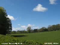 2nd: A bright morning with high cirrus cloud dominating with a few small cumulus mainly to the South and cirrostratus to the West. With no substantial rainfall bare soil was looking bone dry, but lawn grass and fields were looking very green. Hedges and trees are leafing up, the beeches with their bright light green leaves are well ahead along with horse-chestnuts. Sycamores remain slow to leaf while ash and elm are in flower with little or no leaves. Bud scales have started to fall and with gusts of wind they sometimes resemble snowflakes. The day was mostly sunny and with a cool NE breeze off the sea the temperature rose to 10.3C. During the evening showers moved in across Anglesey and NW Wales off the Irish Sea. From 2230 GMT until after midnight, as the air temperature dropped to 3.7C, there was wintry precipitation, including snow pellets. [Pptn 0.7 mm; Max 10.3C; Min 6.0C; Grass 4.5C]
3rd: Another bright and sunny morning with very good visibility in clear air, there was a sprinkling of fresh snow on the mountaintops across the range from the eastern Carneddau, low on the cliffs of the N-facing Black Ladders as low as 2250 ft, centrally on the summits of Y Garn and around Yr Wyddfa in the West. Cumulus clouds were being blown along briskly on the fresh NE'ly breeze. Pressure was 1028 mb with high 1036 mb W of Ireland and complex low-pressure over Europe to the East. This continued the flow of cool air from the arctic with showers affecting E-facing coasts of the UK. The Mediterranean was keeping uncharacteristically unsettled with low-pressure over N Africa. The day was mostly sunny on Anglesey with cumulus clouds persisting over Snowdonia. There are now plenty of bluebells flowering in the wood ![]() .The evening was sunny with a clear sky at 21 GMT. [Rain 0.0 mm; Max 11.1C; Min 3.7C; Grass 1.5C]
.The evening was sunny with a clear sky at 21 GMT. [Rain 0.0 mm; Max 11.1C; Min 3.7C; Grass 1.5C]

|
4th: With a mostly clear sky overnight the temperature on the grass dropped to 0.2C and there was moderate dew. A sunny morning on Anglesey with scattered fair weather cumulus clouds; the mountains were mostly cloud covered. Pressure was 1030 mb with the high 1036 mb W of Ireland and low 990 mb over the western Mediterranean. There was a force 3/4 N'ly breeze and visibility was good with slight haze. Soil moisture levels had fallen to 36% and soil under grass was dry and crumbly. The afternoon had fewer cumulus clouds over Anglesey at first while they persisted over Snowdonia. By 16 GMT the sky was cloudier and becoming increasingly hazy. [Rain 1.6 mm; Max 11.6C; Min 3.2C; Grass 0.2C]
5th: Overcast with moderate fog and heavy drizzle from 0430 GMT easing by 09 GMT to light drizzle. There were trace deposits of dark-grey volcanic dust. Pressure 1024 mb had fallen with high 1033 mb W of Ireland and low with frontal wave over Italy. A frontal wave was over the Isle of Man with a warm front hanging SW-ward over Anglesey and Cardigan Bay. Fog was lying to low level in the Menai Strait and slight drizzle continued through the morning into the afternoon when there was a spell of light rain with further deposits of dark-grey volcanic dust. Ash dispersion from eruptions of the Icelandic Eyjafjallajokull volcano, being a point source of emission , is very dependent on the local direction of air flow. Forward trajectory analysis, using HYSPLIT at the NOAA ARL website, indicated that parcels of air over the volcano at 06 GMT on the 4th reached western Britain and Wales on the 5th between midnight and 06 GMT today. Air over the volcano at high levels (10,000 m) arrived first, lower levels (1000 m) took longer to reach here (and then traveled further into S Europe) partly accounting for the spread of deposition observed during the day. Rain ceased and the cloud thinned by 16 GMT; there was some weak sunshine breaking through at 1730 GMT. There was little or no wind. [Rain 3.4 mm; Max 11.5C; Min 7.2C; Grass 5.2C]
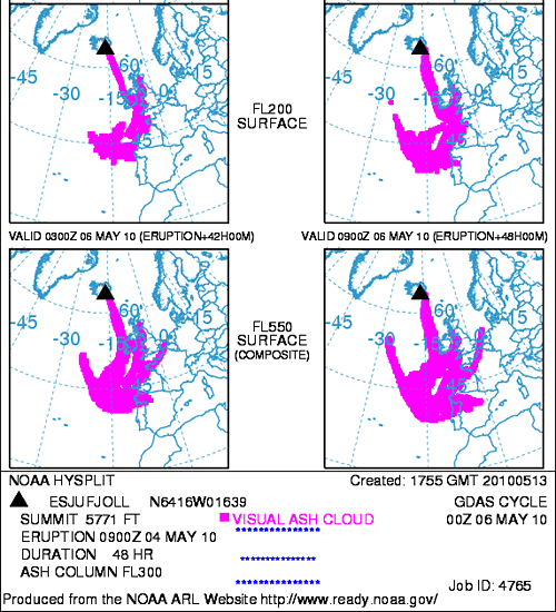
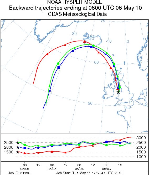 6th: As the fronts moved S there was a spell of light rain from 0200 GMT until 06 GMT with drizzle and fog up to 09 GMT. A moderate deposit of dark grey dust was collected at 09 GMT. Backward trajectories using HYSPLIT at the NOAA ARL website indicated that air during the spell of rain came from the vicinity of the volcano, the example (right) is at 06 GMT for air arriving over Llansadwrn between 1500 and 2500 m AGL. A light NE'ly breeze picked up, but the fog persisted through the morning until 1430 GMT when it began to lift. Soon the sky cleared and the rest of the afternoon was sunny with a cool NE'ly breeze. There were a few cumulus clouds mainly over the mountains of Snowdonia and it was cloudier after 21 GMT with a shower of rain at 2200 GMT. {Helens Bay 16.5C, Milford haven 14.5C, Mumbles Hd. 10.8 mm, Tiree 12.6h, Valley 5.0h} [Rain 0.8 mm; Max 13.3C; Min 8.0C; Grass 5.5C]
7th: Overcast sky after midnight, but clearing after a slight shower of rain around 08 GMT. pressure was 1016 mb with remnant occluded frontal cloud along the spine of Britain. High 1020 mb was SW Iceland and with low-pressure 1002 mb over Europe we were still in a cool NE'ly flow of air from Arctic regions. There were cumulus clouds over the mountains, but on Anglesey it was a mostly sunny day. Cloudier by evening with a pale sunset. {Hawarden 14.4C, Valley 8.9h} [Rain 0.0 mm; Max 12.2C; Min 5.9C; Grass 4.0C]
8th: Pressure had risen to 1017 mb, high 1031 was SW Iceland and low 999 mb was over the Azores with weak low-pressure centres scattered across the Mediterranean and N Africa. Slow-moving frontal cloud lay over S England and the Channel with patchy rain keeping to the S of the Snowdonia Mountains. The day was fine and dry here with sunny or weak sunshine through until the evening. The persistent moderate to strong NE'ly wind, directly from the Arctic regions, felt cold in the shade, but in a sheltered spot the 12.0C maximum was pleasant enough. The best place to be was on the West coast, less windy and a chance for the air to warm a little crossing the island reaching 13.4C at Valley. The evening and night were clear skied with the wind moderating at dusk. [Rain 0.0 mm; Max 12.0C; Min 7.3C; Grass 6.3C]
9th: With pressure steady on 1017 mb it was a fine and sunny morning with a few fair-weather cumulus clouds moving along on the gentle NE'ly breeze. Slight dew on the grass with the minimum thermometer reading 0.5C. The slowest the air temperature in the screen reached was 3.2C. Currently (090 GMT) it was 8.5C (dewpoint 3.7C) and this was to rise to a modest 11.1C during the sunny afternoon (clear blue sky at first, hazier and murky later). Butterflies were around the garden mostly orange tips, holly blues and the odd peacock. Fledged robins were seen, the first of the season. Blue tits will not be long as frantic feeding is taking place in one of the nesting boxes in use. [Rain 0.0 mm; Max 11.1C; Min 3.2C; Grass 0.5C]
10th: A cloudy morning with a mixture of cumulus and stratocumulus clouds. Pressure was 1014 mb in a weak ridge of high-pressure while the Atlantic-high was intensifying (1035 mb at noon). During the morning there were a few sunny spells (very blue sky), but towering cumulus clouds were seen to the SE with precipitation over some of the mountains to the E of the range. A band of light rain was slow-moving to the NE and more dark clouds moved across the N Wales coast early in the afternoon. A very light NE'ly breeze at first picked up during the day to force 4/5 by late afternoon. It was another dry day here with long spells of sunshine later in the afternoon. After 18 GMT there was thin cloud with hazy sunshine. {Solent 15.9C, Milford haven 13.2C, Manston 10.6h, Valley 7.7h} [Rain 0.0 mm; Max 11.4C; Min 5.9C; Grass 3.8C]
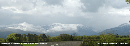 11th: Another chilly, but frost-free night mostly cloudy at dawn and starting to clear before 09 GMT. There were moderately developed cumulus clouds moving in off the Irish Sea on a moderate NNE'ly wind. These produced a sprinkling of snow as low as 1500 ft on the central Carneddau, most on the top between C. Dafydd and Penyrole-wen, and in Cwm Idwal. Pressure was 1015 mb with the Atlantic-high 1037 mb slipping S to just below 50° N at midnight. Pressure was low 1004 mb over Brittany with an occluded front lying from Cape Finisterre to S Baltic. On the southern French coast between Cannes and Nice an unseasonable storm, with reported 8-10-m high waves, caused a lot of damage and closure of part of the Promenade des Anglais in Nice. Showers kept away from here and there were some sunny spells in the morning. In the afternoon longer spells of sunshine, with a clear blue sky and a few passing clouds the temperature rose to 10.2C lowest of the month, the wind moderating at times only to return again later. Clear sky at dusk with the temperature on the grass falling to -0.5C. [Pptn 0.7 mm; Max 10.2C; Min 3.2C; Grass 1.0C]
12th: Showery precipitation from 0130 to almost 0300 GMT left a few faint marks on the hailometer indicative of snow pellets. The overnight minimum temperature was 2.5C and on the grass -0.5C, both lowest of the month. Showery precipitation off the Irish Sea from 0730 GMT was sleety with more sprinklings of snow seen on the mountaintops. The snow today had fallen mostly on C. Llewelyn and towards Foel-grach and together with remnants of yesterday's falls sufficient to record >50% cover above 2800 ft. Pressure was 1016 mb with the Atlantic-high 1035 mb at 48° N 35° W. Pressure still remains low 1006 mb over the Mediterranean. Cumulonimbus were seen with further wintry showers falling on the mountains during the morning. Here, some sunny spells in the persistent NE'ly with convective clouds in the vicinity through to the afternoon. Heavy showers were reported on the mainland near the mountains. By 1800 GMT the sky was clearer except for the mountaintops, and it was less windy before dusk. There was a fine view of the ISS, now the largest bright object in the sky apart from the moon, passing slowly at 45° NW to SE at 2200 GMT in clear sky. [Rain 0.0 mm; Max 11.3C; Min 2.5C; Grass -0.5C]
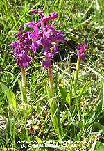 13th: More or less a clear sky at 06 GMT with a minimum temperature of 2.6C; with dew on the grass that had dried off by 09 GMT. It was also cloudier, 3 oktas and a change of wind direction being SSW'ly force 4. Completing the obs a dark cumulus cloud approaching from the W brought a gusty wind and a few spots of rain at 0915 GMT. The Atlantic high had moved a little further S to 47° N 33° W and there was a low 992 mb over SE Iceland. Pressure remained low over the Mediterranean with low 1004 mb over Italy. Volcanic ash kept to the W and N of Britain, with a tongue as far as Spain. A mostly sunny day with scattered cumulus reducing to a few by the afternoon when frontal cloud was seen encroaching from the north-west reaching here by 1800 GMT. New potatoes from Llanbedregoch were on sale on the roadside for £3 per kilogram. Jersey potatoes have been reported as being in short supply this year because of the dry weather. [Rain 1.9 mm; Max 13.4C; Min 2.6C; Grass -0.4C]
14th: There was light rain from 0100 GMT to 0500 GMT turning to drizzle and slight showers ongoing at 09 GMT. Overcast sky with lowish ragged stratus with mist and rain in sight on slopes of mountain in the West. To the east it was clear with very good visibility, this soon changing as the low cloud moved across the range. The morning kept dull and overcast, but the the sky began to clear at 15 GMT and the rest of the afternoon and evening had clear sunshine. Still cool for May the maximum reaching 12.6C, but in Liscombe in Devon the maximum was 7.4C. Scattered clouds began to encroach at 22 GMT. {Gravesend 16.7C, St. Bees Hd. 26.4 mm, Rhyl 11.8 mm, Valley 9.1h} [Rain trace; Max 12.6C; Min 6.5C; Grass 5.9C]
It was a dry first 15-days with 11.9 mm (16%) and [21%] of average, and with temperatures well below even the 1971-2000 average. The mean maximum was 12.0C (-3.6) and [-4.0] and the mean minimum 5.0C (-3.2) and [-2.0].
15th: Overcast at times during the night, occasional broken cloud, overcast and murky at 0600 GMT with poor visibility. Visibility had improved by 09 GMT with 5 oktas cover of developing cumulus clouds. Calm or variable light winds at the surface here, but generally there was a NW'ly flow bring the clouds overhead. Pressure was 1017 mb with Atlantic-high 1031 40° N and 24° W. Low 997 mb was NW of Rockall, low 987 mb was over the Baltic and low 990 mb over the Adriatic and producing much sharp wave action on the Mediterranean Sea. The morning was dry and had some sunny spells between the passing clouds. The afternoon was sunnier with the temperature rising to 15.5C. By evening with a frontal wave over Ireland moved across the Irish Sea and was here by midnight. [Rain 2.6 mm; Max 15.5C; Min 5.1C; Grass 2.0C]
16th: Light rain from midnight to just before 03 GMT bringing a welcome 2.6 mm of rain. It had wetted the soil, the grass had greened up, but was evaporating with concrete already dry. Soil moisture was down to 34% DW, it will take a little more rain to make a lot of difference. It was a mostly cloudy morning with cloud building up against the mountains was slow to clear. The afternoon was sunnier with the temperature rising to 16.3C before a cloudier, and rather murky evening with a paled blue sky the result of more volcanic ash overhead. Flight restrictions in British airspace were again in force in the north-west. {Sennybridge 14.5C, Valley 9.6h}[Rain 0.0 mm; Max 16.3C; Min 4.8C; Grass 2.0C]

|
At Tywyn Aberffraw the last traces of water in the pool slacks left from the rains in March was fast disappearing. The mature willow slack above looked very green, as did some of the other slacks, where creeping willow was beginning to flower ![]() . The fixed dunes, however, looked very dry. Usually at this time of year they are green with mosses, but with recent dry weather this is not so. There were lots of common blue butterflies around
. The fixed dunes, however, looked very dry. Usually at this time of year they are green with mosses, but with recent dry weather this is not so. There were lots of common blue butterflies around ![]() , the female is brown with a light dusting of blue near the body. Few plants were seen in flower, there were a few dune pansies
, the female is brown with a light dusting of blue near the body. Few plants were seen in flower, there were a few dune pansies ![]() . It was a different matter on rocks bordering the beach where the sea pink (thrift)
. It was a different matter on rocks bordering the beach where the sea pink (thrift) ![]() was in full flower on the rocks amongst colorful orange, grey and black lichens. Also on a rock, although it also grows on sand, was sea sandwort
was in full flower on the rocks amongst colorful orange, grey and black lichens. Also on a rock, although it also grows on sand, was sea sandwort ![]() and here is the flower in close up
and here is the flower in close up ![]() .
.
18th: Almost clear sky at 06 GMT, but remnant frontal cloud in the west started to encroach by 09 GMT. This cleared away within the hour to give a sunny morning with very good (clear) visibility. Cloudier at times during the afternoon, then further moderately high cloud encroached by evening. At 2100 GMT there was a band of rain approaching from the W, but this became very patchy over Anglesey and remained dry until after midnight. {Kinlochewe 20.7C, Hawarden 18.9C, Lerwick 15.8h} [Rain 0.1 mm; Max 17.6C; Min 3.9C; Grass 1.2C]
19th: Just a few spots of rain around 01 GMT and from 07 GMT delivered just 0.1 mm. At 09 GMT this had dried off and the soil looked just the same, very dry. Overnight the minimum was 10.0C, 2nd highest of the year, highest since 28th April (11.8C). High 1031 mb was over Biscay and low 1001 mb near Iceland with associated occluded frontal cloud over the Irish Sea. Overcast skies with low cloud fog on the mountains and drizzle around the western coast. There was a light S'ly breeze, the morning became brighter as the altostratus cloud thinned with the sun breaking through by 1100 GMT with a little sunshine around noon. The afternoon kept mostly cloudy, but bright at times. The cloud hugged the tops of the mountains all day. {Rhyl 18.2C} [Rain 0.0 mm; Max 16.7C; Min 10.0C; Grass 8.9C]
20th: A bright morning here being just high enough to be out of the sea fog and low cloud giving a little drizzle in coastal areas. Pressure was 1033 mb in a ridge from high 1034 mb over the English Channel. Remnant frontal cloud began to disperse during the morning and in the light S'ly breeze the temperature rose to 21.6C, highest since 6 August 2009 (21.8C). Mist continued to affect coastal areas, some murky looking cloud moved in here at 14 GMT then cleared away again within an hour to give a sunny and warm end to the day. {Brooms Barn 24.3C, Hawarden 22.5C, St Athan 7.9h} [Rain 0.0 mm; Max 21.6C; Min 11.5C; Grass 8.2C]
 21st: Sea fog moved in during the night with visibility < 200 m at 03 GMT. Fog at 07 GMT began to burn away before 09 GMT and the temperature had risen to 16.5C in hazy sunshine. With several contrails and much cirrostratus cloud overhead there was a partial 22° halo. To the S there were towering cumulus clouds spreading out to form stratocumulus, but these diminished through the morning. A fine and sunny day, the hazy sunshine at times was weak through thin high cloud. A weak NE'ly sea breeze off Red Wharf Bay persisted in the afternoon dying away during the evening. [Rain 0.0 mm; Max 22.0C; Min 9.0C; Grass 7.6C]
 22nd: Another fine and sunny day with a light SE'ly breeze. A pale blue sky the result of Saharan dust in the atmosphere (no volcanic dust). The sky was clear at first, a little cloud developed over SE Anglesey clearing by the afternoon, but persisted over the mountains. The temperature rose to 24.0C during the afternoon, highest since 1 July 2009 (28.1C). [Rain 0.0 mm; Max 24.0C; Min 13.8 C; Grass 10.0C]
23rd: Overnight the temperature did not fall below 15.0C, highest minimum of the month. A fine sunny morning, the clear sky was much bluer. Pressure was 1025 mb within the high 1027 mb centred over S Wales. A light to moderate S'ly breeze during the day with the temperature rising to 24.8C, highest of the month. During the afternoon the haze increased and the sky turned milky again as Saharan dust returned. The Icelandic volcano has stopped erupting. Soil moisture had fallen to 28.9% (0 - 5 cm deep under grass); during the afternoon the leaves of a mature sycamore were wilting. [Santon Downham, Suffolk 28.4C, Hawarden 26.3C, Valley 18.2C, Aberporth 15.1 h, Valley 14.7 h] [Rain 0.0 mm; Max 24.8C; Min 15.0C; Grass 10.6C]
24th: Overnight the air temperature dropped to 10.4C falling 14.4C from yesterday's maximum. There was fog at 06 GMT, but this had started to clear before 09 GMT although visibility was only moderate. Mostly cloudy at first with hazy sunshine, with a milky blue sky, by midmorning. There was a cool N'ly breeze and although the sky was clear, and bluer, in the afternoon the temperature was pegged back to 15.0C, nearly 10C less than yesterday. [Rain 0.0 mm; Max 15.0C; Min 10.4C; Grass 7.7C]
26th: Overcast at dawn so that the temperature on the grass did not fall below 7.3C and was dry. The morning was dull here with occasional brightness breaking through. An area of rain moved S over N England reaching Manchester by noon, but it remained dry here. By afternoon the sun broke through and the sky cleared over Anglesey, but remained cloudy over Snowdonia. With Saharan dust still in the air visibility remained moderate through the day. A very cool evening with temperatures falling. Lots of flowers from the sycamore and beech trees are falling to the ground and almost covering the rather yellow looking dry grass. The excessive fall of flowers is likely to be due to the very dry weather. [Rain 0.0 mm; Max 13.5C; Min 9.5C; Grass 7.3C]
27th: A clear sky with sunshine early in the morning and the temperature on the grass falling to 0.2C. At 09 GMT the sky was cloudier with some dark cumulus clouds in the vicinity. Visibility was very good and clear; with airflow from the NW the Saharan dust had moved away. Low 1005 mb was over N Scotland and around the low there were densely packed showers affected Scotland and N Ireland through the day. Temperatures were low enough for some snow to fall in the Highlands. The morning was mostly cloudy with a light NW'ly breeze, but the afternoon brightened with some sunshine. By evening the sky cloud had encroached (by 17 GMT) and there were some spots of rain, but these did not wet the ground that remains very dry. {Mumbles Hd. 15.9C} [Rain trace; Max 15.3C; Min 4.2C; Grass 0.2C]
28th: Broken cloud after midnight and clearing to a few around dawn allowed the temperature in the air to fall to 3.7C, and on the grass -0.3C, lowest in May since -0.6C on 30th in 2007. Sunshine between cumulus clouds raised the temperature by 09 GMT to 11.8C (dewpoint 4.8C). Visibility was very good and clear, there was a light W'ly breeze. Snow patches were still to be seen on the Carneddau Mountains, but no fresh snow was seen. Sunny spells in the morning and almost clear sky here in the afternoon when a line of cumulus close persisted over the Snowdonia Mountains. By evening first cirrus then moderately high cloud in advance of rain-bearing fronts associated with a train of Atlantic-depressions W of Ireland was seen approaching in the West. [Rain 6.9 mm; Max 16.3C; Min 3.7C; Grass -0.3C]
29th: There was light rain from 03 GMT that had accumulated 6.9 mm by 09 GMT. Pressure was 1006 mb with low 1002 mb closeby over SW Ireland. Visibility was moderate in low cloud, mist and intermittent rain through the morning. Rain at times in the afternoon turning to fog with drizzle with the low cloud persisting over Anglesey into the evening. At 18 GMT cloud was low enough for fog at the bridges, but it was bright as and sunny in the Nant Ffrancon Pass in a lee clearance effect. The day was sunless here. [Rain 2.2 mm; Max 14.6C; Min 8.9C; Grass 5.6C]
30th: Cloud had began to lift soon after midnight and by morning was broken with some sunshine breaking through. At 09 GMT, temperature 11.7C (dewpoint 7.1C), there were 4 oktas cover of cumulus clouds, good visibility with a blue sky. Despite the 2.2 mm rainfall the soil surface on the bare-plot had already dried (temperature at 5 cm depth 16.1C). Low 1001 mb was over the North Sea and was rising here 1014 mb in a ridge from Icelandic-high 1021 mb. A mostly sunny day with the light NW'ly breeze freshening force 3/4 by afternoon. [Rain 0.0 mm; Max 16.4C; Min 9.2C; Grass 8.4C]
31st: An earlier mostly cloud covered sky with altostratus and mackerel altocumulus was clearing away in a light E'ly breeze. At 09 GMT there a few small cumulus clouds had developed. Pressure was 1022 mb with high-pressure 1023 mb N of Scotland and 1026 mb Cape Finisterre. Low 974 mb was SE Greenland and low 1001 over the Adriatic. The jetstream had settled over the UK and N France and frontal cloud was poised to the West. Before that arrived there was some clear sunshine during the morning. Some patchy cloud passed over during the afternoon, but another spell of sunshine allowed the temperature to rise to 19,1C before thin high cloud started to encroach from the West. Late afternoon was bright, with weak sunshine; cloud began to thicken during the evening that kept dry. The 31st by a statistical curiosity was the wettest day of the month. The rain fell between 0100 and 0530 GMT on the 1st of June, but as the recording period is 09 - 09 GMT the 31st was creditied with the total. [Rain 7.5 mm; Max 19.1C; Min 7.1C; Grass 3.5C]
It was the sunniest May at Valley on the Anglesey record with 271.9 h duration [(140%)] of average, despite having 2 sunless days beating the previously highest 1977 (Kipp & Zonen adjusted data). The sunniest day was on the 23rd with 14.7h. In Llansadwrn the 28.6 mm rainfall, lowest since 1998 (25.3 mm) ranking 8 since 1928, was (39%) and [50%] of average. The mean temperature was 10.8C and despite 4 days >20C was (-1.1) and [-0.7] of average. With 133.9 mm rainfall it was the driest spring since 1990 (80.2 mm lowest on record since 1928) ranking 7.
June
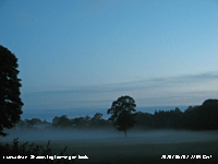 1st: Light rain from 0100 - 0530 GMT then some drizzle accumulated 7.5 mm that was credited to the 31st May (see above). At 09 GMT the sky was still overcast, but the cloud was thinning and was lifting from the lower slopes of the mountains that were still looking misty. Pressure was 1014 mb with high 1018 mb over the North Sea while low 988 was SE Greenland. An occluded front over Anglesey was slow-moving towards Merseyside arriving there about 1400 GMT. The morning kept dull and overcast, dry at first then with the cloudbase lowering again some drizzle came along before noon, reducing visibility from good to poor, before 30 minutes of light rain to 1230 GMT although nothing was evident on the rainfall radar. Soon the sky began to clear and there were some sunny spells. The grass looked a little greener after the rain and the vegetables had perked up too. The temperature rose to 13.9C, lowest of the month. By the end of the afternoon the sky was clear overhead and later shallow fog formed on the fields this persisting overnight. Brown long-eared bats were seen flying around the weather station at 21 GMT. {Kinloss 20.0C, Milford haven 17.7C} [Rain 1.0 mm; Max 13.9C; Min 10.4C; Grass 9.4C]
2nd: After shallow fog at 05 GMT cleared it was a fine and sunny morning with just a few small cumulus clouds seen over the Snowdonia Mountains. The morning was mostly sunny with the temperature rising to 21.7C before a NE'ly breeze off the sea came along. The wind was initially S'ly, but by afternoon convergent cloud had formed (sea breeze front) over the weather station as the NE'ly strengthened. There was a rapid fall in temperature to 16C that was maintained through the afternoon although the sky cleared again later. The evening was sunny. [Rain 0.0 mm; Max 21.7C; Min 8.2C; Grass 4.6C]
 Bodnant Garden dates from 1875 and is one of the finest gardens to see specimen trees in a natural setting, including over 100-y old giant American Californian Redwoods (146 ft) and Oregon Douglas Fir (158 ft) and, at this time of year, flowering rhododendrons and azaleas
 ![]() many varieties of which were grown at Bodnant all growing well in our climate and soils
many varieties of which were grown at Bodnant all growing well in our climate and soils ![]() . Established by Henry Pochin, an industrial chemist, the garden was given to the National Trust in 1949 by Henry McLaren, 2nd Baron Aberconway, and is managed by his descendants that retained the house (1792)
. Established by Henry Pochin, an industrial chemist, the garden was given to the National Trust in 1949 by Henry McLaren, 2nd Baron Aberconway, and is managed by his descendants that retained the house (1792) ![]() . The Lily Terrace has a fine view of the E-facing slopes of the Carneddau Mountains
. The Lily Terrace has a fine view of the E-facing slopes of the Carneddau Mountains ![]() . Many of the trees and Rhododendrons grow on the sides of the Hiraethlyn River valley
. Many of the trees and Rhododendrons grow on the sides of the Hiraethlyn River valley ![]() , cut by melt-water from the overflow of an ice-dammed lake during the latter stages of the last Ice Age. The Denbigh type soils, typical of a large part of Wales, are slightly acidic being low in calcium and other nutrients and suit the growing of califuge plants including Rhododendrons and woodland. It was a warm sunny day and parts of the garden were perfumed by the aromatic leaves
, cut by melt-water from the overflow of an ice-dammed lake during the latter stages of the last Ice Age. The Denbigh type soils, typical of a large part of Wales, are slightly acidic being low in calcium and other nutrients and suit the growing of califuge plants including Rhododendrons and woodland. It was a warm sunny day and parts of the garden were perfumed by the aromatic leaves ![]() and scented pure white flowers of Mexican orange blossom
and scented pure white flowers of Mexican orange blossom ![]() . The garden recently described, unfairly I thought, as 'an old man's garden', is being restored
. The garden recently described, unfairly I thought, as 'an old man's garden', is being restored ![]() and re-developed in parts
and re-developed in parts ![]() by a team of gardeners under Head Gardener Troy Smith. To have started planting Bodnant over 100-y ago required vision: To maintain the garden today needs a lot of work, make a visit soon and see for yourself.
by a team of gardeners under Head Gardener Troy Smith. To have started planting Bodnant over 100-y ago required vision: To maintain the garden today needs a lot of work, make a visit soon and see for yourself.
4th: Some high cirrus clouds early had cleared by 09 GMT. The morning was mostly sunny with moderate smoke haze developed. A few patches of moderately high clouds passed over around noon. The breeze kept S'ly all day and was strong enough to hold back the cool NE'ly off the sea so that the temperature rose to 24.0C during the afternoon. The first comma butterfly of the season was spotted in the garden. The evening was sunny too and 'big ears' was flying around the weather station when it was still quite light at 2100 GMT; there were some large moths in the garden no doubt an attraction for the bats. {Northolt 27.9C, St. Athan 24.7C} [Rain 0.0 mm; Max 24.0C; Min 12.5C; Grass 7.6C]
5th: A cloudier morning with altostratus and cirrus although cover had reduced to 5 oktas at 09 GMT. Visibility was good with persistent smoke haze. At times the day was overcast with cloud that was thin enough for weak sunshine at times. By evening the cloud was thicker, but there was no rain. [Rain 0.0 mm; Max 20.1C; Min 11.5C; Grass 7.5C]
6th: At midnight thicker frontal cloud had encroached and by morning low cloud and drizzle began to affect NW Anglesey. A cold front associated with a shallow low over London brought storms and heavy rain showers across W and N France into Belgium during the morning and Spain, Germany and S France by afternoon. Dry and bright here at first with a little light rain from noon enough to wet the ground, but not enough to restore soil moisture levels. Soil moisture measured on the 5th was 25.8% dry mass with surface soils dry and powdery. Some sferics were recorded in SW Scotland and to the S over Wales, the Midlands (with some heavy showers) and SE England during the afternoon. The evening was dull and damp. [Rain 0.9 mm; Max 17.4C; Min 10.6C; Grass 9.1C]

|
In Red Wharf Bay there is a salt marsh (open panorama above) that has typical hummock and channel formation. Plants (halophytes) that grow on salt marshes are tolerant of salt water to a greater or lesser degree. On a rising tide the sea flows into the channels, and unless it is a spring tide the tops of hummocks rarely become inundated with salt water ![]() . The tops of the hummocks have a flora including sea pink (thrift) and sea plantain, but both also grow on mountains too
. The tops of the hummocks have a flora including sea pink (thrift) and sea plantain, but both also grow on mountains too ![]() . Smaller and sometimes missed, growing on the driest parts of the marsh, is the sea milkwort that is a member of the Primulacae
. Smaller and sometimes missed, growing on the driest parts of the marsh, is the sea milkwort that is a member of the Primulacae ![]() . The plant also occurs in saline habitats in Staffordshire and Worcestershire.
. The plant also occurs in saline habitats in Staffordshire and Worcestershire.
9th: Overcast and dull at first with poor visibility in haze. There was some breaking of the cloud overhead at 09 GMT and it was for a time brighter, but there was little if any bright sunshine. Pressure was 1003 mb with low 997 mb over Cape Finisterre the low-pressure extending 1001 mb to SW England. Complex frontal systems lay over Britain and W Europe. There was showery rain in mid Wales, N Ireland and NW Scotland. The afternoon was bright at first, with the sun seen occasionally through thinner patches of cloud, then the cloud thickened bringing slight drizzle and a shower of light rain from 1515 to 1530 GMT amounting to just 0.6 mm overall. . A dull, but dry evening. [Rain 0.6 mm; Max 15.6C; Min 12.2C; Grass 11.5C]
10th: Not a lot of change in weather overnight that was mild with a minimum of 11.8C and 11.3C on the grass. There was a moderate to fresh NE'ly breeze and soil, concrete and grass were all dry. Pressure had risen 1012 mb with high 1022 mb N of Scotland and low 992 mb anchored in the Bay of Biscay. A band of frontal cloud stretched over the Irish Sea to the North Sea. Cloud hung low on the mountaintops, but thinned here with the morning becoming bright with some glimpses of sunshine. In the afternoon the cloud began to disperse giving clear sunshine into the evening here although some cloud persisted over most of the mountaintops. [Rain 0.0 mm; Max 15.7C; Min 11.8C; Grass 11.3C]
11th: Shallow mist formed on the fields at dawn and cloud moved across soon after so that at 09 GMT we were back to an overcast sky. The grass was very wet with dew and mist droplet deposition, but the soil surface and concrete were dry. The grass minimum temperature had fallen to 5.9C, and the soil temperature at 5 cm depth was 14.5C. The Biscay low was filling 1001 mb, but going nowhere, with pressure here 1011 mb continuing to rise. Brightening during the morning, but hazy moderate visibility and cloud on the mountaintops persisting. A rapid change to clearer good visibility just after noon sent me hastily with binoculars to my snow observing position. The tops had been obscured since the 8th and I was able to confirm that the snow-patches in gullies between Foel-grach and Carnedd Llewelyn had not yet melted, but the smaller one was now very small, just visible with high-power binoculars, and likely to disappear soon
12th: A bright morning, but convective clouds increased up to 09 GMT (5/8). Pressure had risen 1017 mb and we still had the cool moderate NE'ly breeze although the general airflow was NNW'ly. Sunny spells during the morning with the sky almost clear during the afternoon. While flowering plants have been outstanding this year, butterflies are low in numbers. Earlier holly blues and orange tips were frequent, but we have seen only individuals of peacock, red admiral, comma and speckled wood. By 1700 GMT frontal cloud began to encroach and had already brought rain into N Ireland and the Western Isles of Scotland. Though cloudy the evening to midnight remained dry. {Valley 12.3h, Mumbles Hd. 19.2C} [Rain 0.4 mm; Max 15.0C; Min 9.8C; Grass 8.2C]
 13th: We had a shower of rain around 0200 GMT with just 0.4 mm caught in the rain gauge. A dull start to the day with a few small spots of rain on the window at 07 GMT. The windvane indicated a change in direction of wind to SW, a ridge 1015 mb began to move into S Britain from large Atlantic-high 1032 mb N of the Azores. The Biscay low had moved towards Gibraltar, but had filled and was losing its identity over the Mediterranean. But, a thundery low 1010 mb developing over the Western Isles of Scotland, with associated frontal cloud, was over Britain and the Irish Sea. At 09 GMT the chiffchaff was still singing together with 2 blackbirds, but birdsong has fallen off. There are lots of fledglings about, families of blue and great tits visit the feeding stations. Two families of woodpeckers also visit (the second of the season), the parent (female right) shows the fluffy youngster with red cap (left) how to feed on the peanuts. Males often do this; birds of other families are not tolerated although we have more than one feeder squabbles develop. A wren is sitting on a late clutch of eggs in a nest, previously built by the male, on top of an unused swallow nest under the eaves of the house above the front door, and holding up maintenance work! Bands of showers in the N began to move SE during the day, the first was at 1130 GMT, interspersed with a little sunshine. During showers at 1625 GMT thunder was heard to the SE of the station. In Llanfairfechan at the same time there was thunder and 'ferocious' ice pellets for a few minutes; thunderstorms and heavy downpours were reported in parts of the Midlands eastwards during the evening. By evening the wind had veered to the NE, giving a fresher feel. At 2100 GMT with a clearing sky it was still light enough to read thermometers, but soon became cloudy again with a shower of rain at 23 GMT. [Rain 4.4 mm; Max 15.5C; Min 9.8C; Grass 8.1C]
 14th: No more rain after midnight; variable amounts of cloud with some sunshine breaking through before 09 GMT. There was a moderate to fresh NE'ly wind and already soil and concrete were dry. Pressure 1020 mb was rising with the Atlantic-ridge (high 1031 mb N Azores) beginning to dominate. Yesterday's low was over N France and moving S. Increasingly sunny through the day with cloud lingering over the mountaintops. A small tortoiseshell preferring full sunshine and a speckled wood preferring dappled shade on the edge of the wood were seen. A fine evening with the wind lessening. [Rain 0.0 mm; Max 15.6C; Min 10.5C; Grass 9.0C]
15th: A fine and sunny morning with very good visibility that enabled confirmation that the snow-patch, in a deep gully between Foel-grach and Carnedd Llewelyn, had survived another day. The day kept mostly sunny with few clouds and with a light to moderate NE'ly breeze the temperature was pegged to 16.8C. [Rain 0.0 mm; Max 16.8C; Min 8.5C; Grass 4.8C]
With 11 of the first 15-days dry rainfall of 21.6 mm was running 34% of the average for the month. The mean temperature was 14.2C (-0.1) and [+0.6] of average..
16th: Overnight a clear sky allowed the temperature on the grass to fall to 5.5C so there was some dew. Another fine and sunny morning with 6 oktas cover of high cirrus cloud and, unusually for here many contrails some expanding forming cirrocumulus. Visibility was very good with slight haze and with persistent, but lighter NE'ly winds off the sea the temperature rose to 18.3C during the afternoon. [Glasgow 23.5C, Pembrey Sands 22.1C, Hawarden 20.9C, Capel Curig 19.8C, Valley 19.6C, 14.3h, Aberporth 15.7h] [Rain 0.0 mm; Max 18.3C; Min 8.6C; Grass 5.5C]
17th: A cloudy morning at first, but after 09 GMT began to burn away to give a sunny day on Anglesey although cumulus clouds persisted over the Snowdonia Mountains. The temperature rose to 18.8C in the force 3/4 NE'ly breeze. If you found a sheltered spot it felt a lot warmer. The growth of grass at the weather station this year to this date (2. 8 tonnes per hectare) has been the lowest since before 2004 (7.2 tonnes per hectare) due to a combination of low temperatures in the spring and low rainfall. Soil moisture today was 26% dry mass, well below the 72% saturated water percentage and low enough to limit grass growth, but above the permanent wilting percentage of 15%. In parts of the island grass on shallow soils around rocky outcrops and roadside verges has looked yellowish brown for a week or two. During the evening visibility reduced to moderate to poor and the sky looked very murky. [Rain 0.0 mm; Max 18.8C; Min 12.0C; Grass 8.5C]
18th: At midnight with low 1003 mb over the Baltic associated frontal cloud over Scotland was moving S and began to encroach here by 03 GMT when low mist formed on the fields turning to a 'dry fog' by 06 GMT. At 09 GMT fog was lingering in mountain valleys with mountain tops in the clear, while visibility had improved to moderate here. Grass, concrete and soil were all dry, a dry or non-wetting fog has a very small droplet size and does not wet anything. Pressure was 1023 mb influenced by the Atlantic-high 1030 mb, a weak cold front was just to the North, but a detached warm front lay to the West. The sky was overcast with the air temperature 14.2C (dewpoint 12.0C, RH 87%) and soil temperature at 5 cm depth 18.0C. By 1045 GMT the cloud had thickened and there were spots of rain for about 15 minutes, these evaporating and not wetting the ground. The afternoon was overcast at first, brighter later and as the cloud moved further S began to clear around 17 GMT. [Rain trace; Max C; Min 9.0C; Grass 6.5C]
19th: Mostly cloudy around 06 GMT and beginning to clear by 09 GMT with fair weather cumulus clouds moving from the N across the sky. Winds were strong on the North Sea around low 993 S Sweden. Showers affected the East coast through the day, but here cloud cover reduced and visibility improved to very good by the afternoon although the NE'ly breeze was cool with the highest temperature rising to 13.3C. In slight haze I could no longer see the diminishing snow-patch on the Carneddau without the aid of binoculars, but it was still there during the afternoon. A fine sunny, but cool evening. [Rain 0.0 mm; Max 15.2C; Min 8.7C; Grass 5.5C]
20th: With the sky clearing after 06 GMT it was a fine and sunny morning. The temperature at 09 GMT had reached 15.2C, exceeding yesterday's highest temperature. With high 1026 mb to the W over the Atlantic, pressure here was 1023 mb There were a few cumulus clouds during the morning, less of them in the afternoon before some patchy moderately high cloud moved across later in the afternoon. Today's temperature reached 17.0C. Visibility was good with slight earlier haze clearing. After 1800 GMT the sky was mostly cloud covered. [Rain 0.0 mm; Max 17.5C; Min 7.2C; Grass 3.8C]
21st: With just 2 oktas cloud cover at 09 GMT and a light SE'ly breeze the temperature had risen to 17.5C, the maximum of the past 24-h. Scattered mostly moderately high clouds during the day and in the sunshine the temperature reached 23.6C. The evening was bright with weak sunshine as some cloud encroached from the West, this clearing later. {Castlederg 26.5C, Hawarden 23.1C} [Rain 0.0 mm; Max 23.6C; Min 9.2C; Grass 6.4C]
22nd: Overcast with good, but very hazy visibility. Pressure was 1024 mb with high 1026 mb to the S over the Channel. The cloud cleared away slowly during the morning becoming brighter with sunny spells developing. The SW'ly wind force 3 at first strengthened to force 5/6 during the afternoon raising some local dust. Visibility improved to very good and the Carneddau snow-patch could no longer be seen having completely melted on the 21st, a remarkably late date in the current climate. [Rain 0.0 mm; Max 21.4C; Min 11.2C; Grass 9.0C]
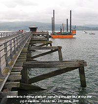 23rd: A mostly cloudy morning with some weak sunshine at times and a moderate to fresh S'ly breeze. The afternoon had a little sunshine before turning duller with the wind not moderating. Later turning brighter again with some more weak sunshine during the evening. [Rain 0.0 mm; Max 20.6C; Min 12.5C; Grass 11.3C]
24th: A cloudy start, but hints of something better to come with some breaks appearing by 09 GMT. With less wind today, there was not so much dust and tree debris flying about, the latter more noticeable because of the very dry weather. By afternoon there were sunny spells. At Beaumaris a drilling platform was stationed, work taking up to 3 weeks, to sample the sea bed around the pier. It is intended to return the pier to its former width and strengthen the timber supports. A new landing pontoon will be built and other work to enhance the kiosk and shelter. [Rain 0.0 mm; Max 20.7C; Min 14.0C; Grass 12.7C]
25th: Cloud was increasing before from 3/8 to 5/8 cover by 09 GMT. Soon mostly cloudy here although there were some blue patches to the N. In the West the sky was mostly clear and the day sunny. [Rain 0.0 mm; Max 20.5C; Min 13.2C; Grass 10.8C]
26th: A sunny morning with the temperature at 09 GMT risen to 19.8C (dewpoint 14.0C). There were a few small cumulus clouds to the S together with remnants of expanded contrails. Visibility was very good with a slight haze. The temperature went on to rise to 24.5C, the highest of the month. {Charlwood 28.6C, Hawarden 26.2C} [Rain 0.0 mm; Max 24.5C; Min 11.8 C; Grass 8.2C]
27th: The sky was almost clear at 0530 GMT then clouds developed so that at 09 GMT there were 6 oktas of cumulus and cirrus. Overnight the air temperature had not fallen below 14.6C, highest of the month. The breezy morning (S'ly force 5) soon turning dull with spots of rain at 1145 GMT on and off for about an hour. Afterwards the sky began to clear and it was a mostly sunny and dry afternoon. A clear sunny evening with less wind by 2100 GMT. [Rain trace; Max 22.0C; Min 14.6C; Grass 12.2C]
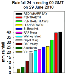 28th: A bright morning with fair-weather cumulus clouds moving along on the fresh S'ly breeze, some higher altocumulus and cirrus hinting encroachment of a frontal system. The temperature was 18.5C (dewpoint 13.2C). Pressure was 1020 mb with low 1005 N of Scotland with an associated occluded front running down the North Sea. A developing frontal-wave was W of Ireland and looked to be heading our way. It was a mostly sunny morning, but turned cloudier with a freshening f5/6 S'ly wind by noon accompanied by some spots of rain from 1230 GMT, but keeping bright with glimpses of sunshine. By 1500 GMT the low 1025 mb was over Ireland with a warm front over the Irish Sea. The cloud thickened by midafternoon with light rain setting in by 1545 GMT then heavier showery bursts during the evening as, with the low over the Isle of Man, pressure was falling. [Red Wharf Bay 40.4 mm, Pentraeth 39.7 mm, Pentraeth AWS 32.5 mm] [Rain 26.1 mm; Max 20.7C; Min 13.6C; Grass 11.8C]
29th: At midnight pressure had fallen to 1015 mb and at 0045 GMT, associated with an active cold front, there was sudden onset of heavy thunder, 'magnesium flare' white lightning and heavy rain. Thunder and lightning continued locally with very close lightning strikes and with the brilliant white light seemingly inside the house there was a series of loud fizzling discharges about 0120 GMT and the electricity supply failed. Thunder and lightning continued further away to the E until 0150 GMT. We, and a large part of SE Anglesey including Beaumaris where at the Doctor's Surgery the computer system was down and with failure of refrigeration thermally sensitive supplies could have been affected. We were without an electricity supply until 1130 GMT with a further short interruption in the afternoon. I found that electrical surges had rendered 3 electronic telephones and broadband microfilter splitters unusable, so it was out with the antique phones kept for such emergencies. TV, WiFi and equipment on Belkin surge protectors were unscathed except the line connection had failed; I had unplugged my computer system in time. I will put replacement telephones on similar protectors in future! There were reports of similar damage to electronic equipment in the area.
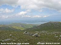 We made coffee for breakfast by boiling water on a gas barbecue, the generator was got ready to run had the electricity supply not been restored (we were once without electricity for 48-h over Christmas during severe gales). The sky was still overcast at 09 GMT, pressure 1019 mb had risen and 26.1 mm of rain had collected in the rain gauge, the most in 24-h this very dry first 6 months of the year! Observer Charles Aron in nearby Pentraeth reported that rain during the storm was torrential and recorded 39.7 mm while Keith Ledson at Red Wharf Bay had 40.4 mm.. Slowly the morning brightened with sunny spells coming along, the afternoon was cloudier, but it was dry. [Rain 0.0 mm; Max 18.8C; Min 13.5C; Grass 13.2C]
30th: A bright morning with 6 oktas cover of mostly cirrus clouds. Pressure was 1019 mb in a transient ridge of high-pressure and the day kept fine and mostly sunny. Lines of orographic convective clouds were present through the day and cumulus persisted in the W over the Snowdonia Mountains; the mountaintops kept clear of cloud until 1900 GMT when cloud descended to 3000 ft. Later as a warm front over the Irish Sea encroached, associated with low 984 mb W of Ireland that was pushing the high-pressure over the North Sea, cloud thickened with slight rain keeping just off the W coasts of Anglesey and Llyn until after midnight. [Rain trace; Max 23.5C; Min 11.2C; Grass 7.6C]
It was the sunniest June since 1975. The 251.7 h of sunshine (142%) and [149%] recorded at RAF Valley was the 3rd highest on the Anglesey record (K&Z adjusted values). Rainfall here was 47.7 mm (75%) and [72%], lowest since 2006, brought rainfall for the first 6 months to 286.4 mm, lowest in Llansadwrn since 1929 (283.7 mm). Temperatures were above average with the mean 15.0C (+0.7) and [+1.4] of average, highest since 2006.
July
1st: There were spots of rain from 0745 GMT it having been previously dry. The sky was overcast at 09 GMT and there were still the spots of light rain. The rainfall radar showed a band of rain in N-S western parts and over Anglesey where amounts were patchy. Visibility was good, but cloud and mist hung around the mountaintops. Another windy morning the S'ly force 5/6 soon becoming force 6/7. The rain petered out and with the cloud thinning it was bright with occasional glimpses of weak sunshine. At 13 GMT the sky was still overcast, visibility was moderate and thickening cloud during the afternoon brought slight rain from 1500 GMT that continued into the evening with rain from 2000 GMT through to midnight.. The day was sunless. [Rain 7.4 mm; Max 20.5C; Min 14.5C; Grass 14.5C]
2nd: Rain continued until 0115 GMT and there was a further light shower at 0515 GMT. Before 09 GMT the sky began to clear with 4 oktas of cumulus some well developed. There was a fresh S'ly breeze pushing the clouds giving some sunny spells in-between. Although convection reduced through the morning orographic cloud lines developed, some were seen over the Menai Strait at Beaumaris (below). The afternoon was mostly sunny, less convective cloud although some thinner patchy cloud encroached later. Another windy day. [Rain 0.0 mm; Max 20.3C; Min 12.0C; Grass 10.9C]

|
 4th: Pressure had fallen to 1014 mb with low 990 mb off NW Scotland. The sky was overcast and the near gale force SSW'ly wind was soon touching force 8 bending the trees and tearing off green leaves leaving a scattering on the ground. Capel Curing had reported a mws of 47 mph at 07 GMT and Valley 40 mph at 10 GMT. FirstHydro Clogwyn AWS reported mws of 60 mph and a gust of 85 mph at 09 GMT. Not a pleasant morning, not one to linger over the obs although opportunity was taken to tie back one of two plants and secure various garden furniture. There were spots of rain on the wind, but rain was heavy in Scotland. There was driving rain across the fields on a strong SW'ly wind during the early part of the afternoon, then there was a sudden clearance with sunny spells by 15 GMT. The wind moderated and the rest of the day was pleasant and mostly sunny. [Rain 3.0 mm; Max 19.4C; Min 13.0C; Grass 10.4C]
 5th: A bright and sunny early morning, but cumulus clouds were increasing and cover was 6 oktas at 09 GMT. Pressure 1022 mb was rising under the influence of Azores high 1032 mb. Complex low-pressure (992 mb) was now to the N between Iceland and Norway and the associated cold front of yesterday was making its way through northern France. Pressure was also high 1018 mb over northern Africa. The wind was a light SW'ly and visibility good. Sometimes looking darker the cumulus clouds continued to pass over through the morning with brief sunny spells in between. The afternoon was a little sunnier for a while, cloudier again by 17 GMT. [Gravesend 24.7C, Hawarden 19.7C, Valley 11.0h] [Rain 0.0 mm; Max 19.1C; Min 10.5C; Grass 6.2C]
6th: An overcast and dull morning with a temperature of 15.9C (dewpoint 11.5C) at 09 GMT. Pressure was 1025 mb in a ridge 1029 mb over S Britain and Brittany, but low 975 mb was S of Iceland with associated frontal cloud affecting the north-west. There was little in the way of brightness in the afternoon in warm sector air with showery rain from 1830 GMT and the SSE'ly breeze freshening to force 6 by 2100 GMT as the cold front approached. [Coningsby/ Heathrow 23.8C, Capel Curig 12.2 mm, Valley 0.8h] [Rain 4.0 mm; Max 17.9C; Min 10.8C; Grass 7.2C]
7th: At midnight the low was 971 mb S of Iceland and pressure had fallen to 1015 mb. At 0430 GMT there was a heavy showery of rain (3.4 mm) on the weak cold front. The morning was again overcast and dull with a fresh to strong S'ly wind. Mostly dry with low cloud and poor visibility at first; after a little slight rain at 1130 GMT the sky began to clear and visibility improve around 1400 GMT giving some sunshine. Cloud increased again during the evening. [Paris 36C, Coningsby 25.4C, Valley 3.1h] [Rain trace; Max 19.6C; Min 14.0C; Grass 13.4C]
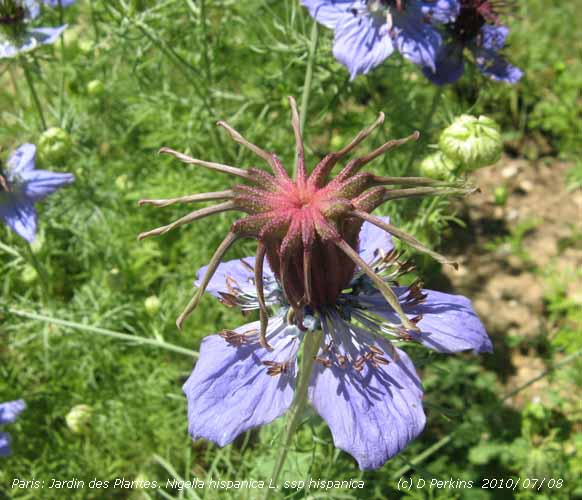 8th: A fine and bright morning and as cloud decreased becoming mostly sunny with 3 oktas cover at 09 GMT. With low 985 mb SE Iceland pressure here was 1017 mb. The temperature had risen to 16.7C and this was to rise to 19.8C during the afternoon before cloud encroached bring some light rain by 2030 GMT turning to drizzle later. [Paris 37C, Gravesend 28.5C, Hawarden 22.6C, Valley 3.5h] [Rain 3.3 mm; Max 19.8C; Min 12.9C; Grass 11.5C]
 9th: A spell of light rain from 01 GMT and intermittent slight rain or drizzle turning heavier again before 09 GMT. With a frontal-wave moving in from the West light rain or drizzle continued through the morning with poor visibility. From 1440 GMT there was moderate to heavy rain this continuous through until 2100 GMT. A sunless day. [Paris 36C, Gravesend 31.7C, Manston 28.9C, Hawarden 23.3C, Capel Curig 30.6 mm] [Rain 18.8 mm; Max 17.9C; Min 12.7C; Grass 12.4C]
 10th: Further light to moderate rain from 02 GMT until just before 09 GMT when 18.8 mm of rain was measured over 11.3 h during the 24-h period 09-09 GMT. Overnight the air temperature had not fallen below 15.8C and on the grass 15.7C, both highest of the month The morning was overcast under slow-moving frontal cloud with slight rain at times on a moderate S'ly breeze. A trace of reddish-brown Saharan dust was deposited in the showery of rain. Trajectory analyses using the HYSPLIT model (left), courtesy of the NOAA ARL Website,
 11th: Still cloudy at 06 GMT, but soon with a clearing sky there were spells of sunshine at 09 GMT continuing through into early afternoon. Pressure here was 1014 mb and with low 996 mb was off N Scotland we were in a weak ridge of high-pressure. A mass of frontal cloud associated with low 1001 mb off Lands End began to encroach by 1500 GMT leading to an overcast evening. [Paris 36C, Gravesend 28.7C, Hawarden 20.1C, Valley 6.7h] [Rain trace; Max 19.0C; Min 11.6C; Grass 6.6C]
12th: A cloudy and dull morning with slight rain at 0730 GMT odd spots continuing up to 09 GMT. Pressure was 1015 mb and cloud was well above the mountaintops and the morning slowly brightened. The afternoon kept mostly cloudy, but there were some bright spells as the cloud thinned. Winds, generally E'ly, were light and visibility very good. [Paris 34C, Charlwood 24.0C, Valley 19.5C & 4.1h] [Rain 0.0 mm; Max 17.6C; Min 11.1C; Grass 7.9C]
13th: Cloud cover was decreasing with some mountain summits in the clear and at first the morning was bright with sunny spells. Overnight the minimum was air was 10.9C and on the grass the temperature had dropped to 6.8C. The temperature at 09 GMT was 17.3C (dewpoint 11.9C), visibility good. Pressure had fallen to 1009 mb and cloud as lows to the SW 995 mb off SW Ireland and 1005 mb Bristol Channel approached thickening cloud encroached. The afternoon and evening were overcast and dull. [Manston 23.0C, Capel Curig 13.2 mm] [Rain 8.9 mm; Max 20.6C; Min 10.9C; Grass 6.8C]
14th: The sky was overcast at 06 GMT and soon there were heavy showers of rain with 8.9 mm collected in the raingauge. The sky was clearing with cumulus and cirrus overhead at 08 GMT although cloud still hugging the mountaintops. Pressure had fallen to 999 mb with low 991 mb off SW Ireland and a cold front stretching across Anglesey to Brittany. Another shower at 09 GMT then a few sunny spells. It was to be a day of sunshine and showers, heavy at 1100 GMT and 1315 GMT. At 1545 GMT thunder was heard and with cumulonimbus clouds seen to the S heavy thunder again at 1605 GMT. At 1735 GMT with dark cumulonimbus to the SE of the station thunder was heard and a bolt of lightning reported striking the mountains above Llanfairfechan near the Roman Road. A few more sunny spells came along during the evening. [Holbeach/ Marham 23.5C, Redesdale camp 35.8 mm, Capel Curig 28.4 mm, RAF Mona 23.0 mm, Valley 2.6h] [Rain 14.0 mm; Max 19.0C; Min 13.0C; Grass 8.9C]
15th: St Swithin's Day: Light showers of rain dying out with just a few spots on the window just before 09 GMT. The sky was still overcast and the morning dull. Pressure was 996 mb with low 991 mb near Aberdeen, Scotland. The was a mass of cloud, associated with a rapidly developing low SW Ireland, was heading our way. Soon brighter with sunny spells by 1115 GMT the remaining cumulus clouds scudding along rapidly on the fresh SSW'ly. By afternoon the sky was cloudier and the wind had freshened to force 6/7 and branches of trees heavy with leaves were bending in strong gusts. Bright again with the odd sunny spells, still windy but dry, at 1500 GMT. There were a few spots of rain at 1730 GMT the sky soon overcast. At 1800 GMT the wind had moderated a little, but with pressure soon starting to fall the wind picked up again backing SE'ly, freshening to near gale to gale force 8 before midnight with rain turning moderate to heavy. [Rain 11.6 mm; Max 18.4C; Min 13.2C; Grass 11.2C]
Making up for the dry start to 2010 the first 15 days of July had 74.2 mm of rain (99%) and [117%] of average. The mean temperature was 15.9C (+0.1) and [+0.3] of the average for the month.
 16th: At midnight pressure had fallen to 987 mb and the wind strengthened to force 7/8. At 01 GMT the wind backed SW'ly and increased to unseasonably force 8/9 with very strong gusts. Storm force 10 winds hit many coastal areas of Lleyn and Anglesey; at Aberdaron a gust of 84 mph was recorded, 74 mph at Capel Curig and 71 mph at Valley where a mean wind speed of 55 mph (force 10) was recorded at 01 GMT On the summit of Snowdon some record extreme force 12+ mean wind speeds were recorded between 00 and 06 GMT, with gusts of 194 mph at 0255 and 0315 GMT. Equaling the unverified report of 194 mph on Cairngorm on 19 December 2009 (Daily Telegraph, 6 January 2009) 37 mph less than the world's highest gust on Mount Washington in 1934. The night was wild here with twigs and leaves being stripped from the trees and garden furniture overturned. In Llanfairfechan a trampoline was blown 30 m over a garden wall. Irish Sea ferries were unable to dock at Holyhead and damage was reported to boats in the Menai Strait and around the coast with several breaking free of their moorings, including a fishing vessel at Brynsiencyn and a catamaran off the Gazelle that was holed in 5 places and it's prop-shaft damaged. At Four Mile Bridge a yacht broke it's mast under the bridge that was closed to traffic for a while. At Barmouth there was an 0.7 m storm-surge on top of the high tide just before midnight (Courtesy of POL & National Oceanography Centre). There were several reports of fallen trees, a parked car in Llanfairpwllgwyngyll was badly damaged by a branch torn from a large ash tree, and broken power lines in Anglesey and Gwynedd. Roads over a wide area of SE Anglesey were littered with leaves and branches, mainly broken from ash trees that are particularly vulnerable to high-winds when fully leafed. At another large ash tree a broken off branch exposed a colony of feral bees that were collected by Anglesey beekeeper Wally Shaw. At 09 GMT, still overcast, the wind had moderated and pressure 1001 mb was rising. By 0930 cloud was thinning and broken sky with sunny spells came along within the hour. The sky cleared some more in the afternoon, blue sky overhead, with a line of cumulus over the Snowdonia mountaintops. By 1630 GMT cloud had encroached; there was a shower of rain at 1715 GMT before the evening that was dry and less windy. [Rain 0.5 mm; Max 18.7C; Min 11.6C; Grass 11.8C]

|
It was the last, and open day, of a 3-week dig undertaken by volunteers and experts of the Gwynedd Archaeology Trust at Tai Cochion, Brynsiencyn ![]() . This important site with a preliminary date of 160 AD must rewrite the Roman history of Anglesey. The panorama photograph above (click to reveal, again to enlarge) shows the blackened remains of a one of at least 12 rectangular buildings 6.5 m wide (centre) on the large site, recently surveyed geophysically, close to the Menai Strait. The dig also revealed on the right of the photograph a 7.5 m wide 'Roman' road pointing in the direction of the Strait
. This important site with a preliminary date of 160 AD must rewrite the Roman history of Anglesey. The panorama photograph above (click to reveal, again to enlarge) shows the blackened remains of a one of at least 12 rectangular buildings 6.5 m wide (centre) on the large site, recently surveyed geophysically, close to the Menai Strait. The dig also revealed on the right of the photograph a 7.5 m wide 'Roman' road pointing in the direction of the Strait ![]() . On the left of the photo were found pits filled with broken pottery and 6 post-holes indicative of a raised granary store. Broken querns could be seen in the foundations
. On the left of the photo were found pits filled with broken pottery and 6 post-holes indicative of a raised granary store. Broken querns could be seen in the foundations ![]() . Pottery finds, still being excavated on the day
. Pottery finds, still being excavated on the day ![]() , included pieces of reddish-brown Samian ware, black glazed from Poole Harbour in Dorset, and white, a flanged mortarium with the potter's stamp (a likely kitchen utensil used for grinding)
, included pieces of reddish-brown Samian ware, black glazed from Poole Harbour in Dorset, and white, a flanged mortarium with the potter's stamp (a likely kitchen utensil used for grinding) ![]() . There was much discussion among visitors and experts as to how the 'township' developed, the construction of the buildings, its association with Segontium (AD 77 to 394) on the opposite bank of the Strait near Caernarfon, and what happened to it (charcoal deposits, possible fire) leaving it hidden under green fields and undiscovered until recently. The association may have included export of grain and other produce from one of the sunniest and warmest parts of the island with productive brown-earth soils, by boat the short distance across the Strait.
. There was much discussion among visitors and experts as to how the 'township' developed, the construction of the buildings, its association with Segontium (AD 77 to 394) on the opposite bank of the Strait near Caernarfon, and what happened to it (charcoal deposits, possible fire) leaving it hidden under green fields and undiscovered until recently. The association may have included export of grain and other produce from one of the sunniest and warmest parts of the island with productive brown-earth soils, by boat the short distance across the Strait.
18th: A frontal-wave moved across the Irish Sea at midnight bringing moderate to heavy rain from 03 GMT with 15.3 mm collected in the rain gauge at 09 GMT. Overcast with low uniform grey stratus, poor visibility and heavy rain on a moderate SSW'ly wind. Rain, sometimes heavy, continued through the unpleasant sunless day. {Norwich 26.0C, Hawarden 22.8C, Capel Curig 59.8 mm, Manston 14.1h} [Rain 19.6 mm; Max 17.0C; Min 13.0C; Grass 11.9C]
19th: Intermittent light rain turned heavy after midnight until after 03 GMT when slight easing to drizzle or slight rain up to 09 GMT. With another 19.6 mm in the raingauge the total for the month had risen to 109.6 mm not yet reaching the 135.8 mm of last year, or the 120.4 mm of 2008. Already the 15th wettest July since 1928 and, given a few more days of this weather, who knows? Pressure was 1019 mb with high-pressure to the S over SE England and France, while low 998 mb was W of Ireland with associated slow-moving fronts with embedded pockets of heavy rain persisted in the north-west. For about 20 minutes at 09 GMT the cloud thinned and it was brighter, the cloud soon thickening again ensured another sunless day with light rain or drizzle becoming heavier after noon and continuing through the evening. Rainfall for the 24-h 09-09 GMT of 20.2 mm was the largest of the month. [Heathrow 29.5C, Hawarden 24.6C, Shap fell 40.4 mm, Capel Curig 31.6 mm, Manston 12.4h] [Rain 20.2 mm; Max 17.0C; Min 15.2C; Grass 15.0C]
20th: It stopped raining at 0500 GMT, after a cold front had passed, but there had been a few spots in showers up to and including 09 GMT. The rainfall total had reached 129 mm 204% of the 30-y average. Cloud had been moderately high, over the mountaintops, but lowered as some more rain-bearing stratiform cloud moved across. Later lifting again and I spotted a patch of blue sky to the NW at 1040 GMT, but it soon disappeared. More spots of rain and a light shower just before noon. There was moderate to heavy rain from 1800 GMT to 2130 GMT. [Hawarden 20.7C & 68.2 mm, Lake Vyrnwy 43.6 mm, Rhyl 30.4 mm, Blackpool AP 26.8 mm, Capel Curig 14.2 mm, Dyce 10.8h] [Rain 5.9 mm; Max 16.4C; Min 12.9C; Grass 12.6C]
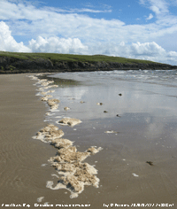
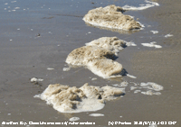 On the beach in Aberffraw Bay there was evidence of some oil pollution. A line of patches of 'chocolate mousse' an oil/ water emulsion stretched all across the beach on the incoming tide at 1400 GMT. Further up the beach were several black bands and the occasional blob of tar washed in on previous higher tides
 ![]() . Examination of the black deposits showed they were oil covered sand grains: A sample vigorously shaken in a test tube with water cleaned the sand grains, that sank to the bottom, leaving coloured water above with a foamy chocolate coloured emulsion on the sides of the tube. Possibly a new pollution incident or, as a result of the storm on the 16/17th, disturbance of the wreck of the M.V. Kimya that sank in January 1991. The Kimya was carrying a cargo of sunflower oil and there would have been some fuel oil aboard. The beach was strewn with seaweed and mussel shells while there were a number of detached large fronds of Laminaria in shallow water effects of the storm. Most of the seaweed was high on the beach, from high spring tides on 12/14th, but no oil deposits were seen at the high tide mark
. Examination of the black deposits showed they were oil covered sand grains: A sample vigorously shaken in a test tube with water cleaned the sand grains, that sank to the bottom, leaving coloured water above with a foamy chocolate coloured emulsion on the sides of the tube. Possibly a new pollution incident or, as a result of the storm on the 16/17th, disturbance of the wreck of the M.V. Kimya that sank in January 1991. The Kimya was carrying a cargo of sunflower oil and there would have been some fuel oil aboard. The beach was strewn with seaweed and mussel shells while there were a number of detached large fronds of Laminaria in shallow water effects of the storm. Most of the seaweed was high on the beach, from high spring tides on 12/14th, but no oil deposits were seen at the high tide mark
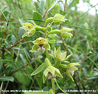 On an area of drier dune slack at Tywyn Aberffraw, typically amongst creeping willow, there were growing plants of the very rare native dune helleborine (Epipactis dunensis)
 ![]() (close up left). Several plants were recorded here on 17th July 2006 (see diary); this time 11 plants were found, but in a different location there being none at the original site. The plant also occurs, untypically under pine trees in Newborough Forest (see Diary 10 July 2009).
(close up left). Several plants were recorded here on 17th July 2006 (see diary); this time 11 plants were found, but in a different location there being none at the original site. The plant also occurs, untypically under pine trees in Newborough Forest (see Diary 10 July 2009).
22nd: As the low headed S thundery rain showers moved into North Wales. There were heavy showers from 0100 GMT and by 09 GMT 16.5 mm was collected in the rain gauge. Spots of rain led on to a prolonged thundery shower; 3 rumbles of thunder were heard from 0936 GMT and there were 4 mm of rain by noon just before the sky began to clear from the North. This brought the rainfall total for the month up to 156.2 mm, the third highest in the Llansadwrn record book since 1928. The afternoon had scattered clouds and some sunshine lasting into the early evening. At 2100 GMT remnant frontal cloud was encroaching, but the almost full moon could be seen. [Valley 7.0h] [Rain 4.0 mm; Max 17.6C; Min 12.4C; Grass 9.5C]
23rd: A bright morning with the sky clearing up to 09 GMT. With the remnants of an occluded front slipping S the 5 oktas of cloud cover was mainly cumulus with a few weakly towering to the S of the station. The morning was mostly sunny, but convective cloud persisted over Snowdonia and overhead during the afternoon. The N of the island was mostly sunny with Valley reporting 10.3h duration. By 1700 GMT frontal cloud was approaching from the W, at 2115 GMT visibility was very good and clear with broken cloud with glimpses of the moon. [Valley 10.3h] [Rain 0.4 mm; Max 18.9C; Min 12.1C; Grass 9.5C]
24th: With a band of frontal cloud over western Britain moving E it was back to overcast skies and drizzle that was heavy at times. The day continued dull and sunless with more of the same drizzle and spells of light rain through the afternoon. Some sunshine at first to the E along the North Wales coast. The cloud reached Manchester by noon where there were a few spots of rain during the afternoon and evening. The temperature reaching 16.0C, was the lowest of the month, but (+1.3) on the decadal average. There was dense sea fog around coastal areas of the island during the late evening. The rain had stopped at 2115 GMT, but the sky was still overcast. [Rain 1.6 mm; Max 16.0C; Min 11.2C; Grass 7.4C]
25th: Overcast, dull and very damp. Pressure was 1018 mb within the confines of the Azores-high 1030 mb, but not high enough to keep away the effects of fronts associated with complex low-pressure to the N. The day was again sunless here and, although no rain fell until drizzle started at 1700 GMT, the grass remained wet through the day although concrete dried. With an overnight 0.7 mm collected at 09 GMT on the 26th total rainfall had crept up to 158.9 mm, still 3rd highest in July just short of the 161.3 mm recorded in 1956. [Valley 0.5h] [Rain 0.7 mm; Max 18.2C; Min 14.0C; Grass 14.1C]
26th: Overcast and dull with little or no wind. Pressure was 1018 mb with the warm front just to the E, but going nowhere very fast. There was light drizzle at 1030 GMT this turning into a spell of light rain through the morning as low cloud moved on to the North Wales coast from the Irish Sea. The sky was brighter and the rain had stopped by 1300 GMT, but there was little in the way of sunshine in the humid afternoon as the temperature reached 22.1C, highest of the month. It was still dry at 2100 GMT and still mild in warm sector air. [Rain 2.0 mm; Max 22.1C; Min 15.1C; Grass 14.8C]
![]() 27th: Warm humid air overnight with a minimum air temperature of 15.6C. Slight rain from 0115 to 0245 GMT, drizzle and slight rain from 07 GMT. There was a trace deposit of reddish-brown Saharan dust in the rain that had been transported from an Atlantic-pool of dust within high-pressure over the Azores a similar event as the deposition observed here on the 10th. Trajectories analyses (example left) were done using HYSPLIT courtesy of NOAA ARL. No change in the overcast sky during the morning, but the rain petered out by 1030 GMT. Bright in the afternoon, with glimpses of sunshine. Broken cloud at 2100 GMT allowed bright moonlight through from time to time. [Rain 0.3 mm; Max 20.1C; Min 15.6C; Grass 15.2C]
27th: Warm humid air overnight with a minimum air temperature of 15.6C. Slight rain from 0115 to 0245 GMT, drizzle and slight rain from 07 GMT. There was a trace deposit of reddish-brown Saharan dust in the rain that had been transported from an Atlantic-pool of dust within high-pressure over the Azores a similar event as the deposition observed here on the 10th. Trajectories analyses (example left) were done using HYSPLIT courtesy of NOAA ARL. No change in the overcast sky during the morning, but the rain petered out by 1030 GMT. Bright in the afternoon, with glimpses of sunshine. Broken cloud at 2100 GMT allowed bright moonlight through from time to time. [Rain 0.3 mm; Max 20.1C; Min 15.6C; Grass 15.2C]
28th: Some broken cloud appearing just before 09 GMT following some rain at 07 GMT. Visibility was poor with more showers of rain coming along in what was a mostly cloudy morning with few glimpses of sunshine. The afternoon was dry and continued mostly cloudy with visibility improving to very good. The evening kept dry with an mostly overcast sky with light winds. [Rain 0.6 mm; Max 18.5C; Min 12.8C; Grass 9.2C]
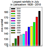 29th: Overcast with slight drizzle at 07 GMT. The 0.6 mm collected in the raingauge brought the July total up to 161.8 mm making it the 2nd wettest since before 1928, another 9.4 mm to equal the 1938 record.. Overcast and dull with a light NW'ly breeze and a further spell of drizzle at 0920 GMT. Pressure was little changed on 1018 mb in a slack between declining Azores-high 1027 mb and deepening low 997 mb over the Baltic. Low stratiform cloud was affecting the NW and the sky kept overcast and mostly dull into the dry afternoon. At 1645 GMT a patch of blue sky appeared and there was about 10 minutes of sunshine before passing by leaving an overcast evening and night. [Rain 0.2 mm; Max 16.5C; Min 13.0C; Grass 10.5C]
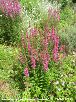 30th: Overcast with drizzle and light rain turning moderately heavy just after 09 GMT. There was low stratiform cloud moving into the Menai Strait on a SW'ly wind and visibility was deteriorating by the minute. Pressure 1013 mb was falling as low 1001 mb SW Iceland was pushing frontal cloud (triple point over N Ireland) on to western Britain. It was another wet July day with leaden skies and continuous light to moderate rain set in by the afternoon that might break the 1938 record before the end of the day - watch this space. I read the raingauge at 1600 GMT, following a burst of heavy rain, and with more that 10 mm this brought the total to over 172 mm breaking the July record. Further rain brought the day's total to 18.7 mm and to 180.7 mm for the month. [Mona 20.4 mm, Valley 14.2 mm, Capel Curig 12.2 mm] [Rain 18.7 mm; Max 16.3C; Min 13.0C; Grass 11.2C]
Not minding the wet weather the Lythrum's (Purple loosestrife) in the garden (right) have been flowering well and attracting insects to the flowers ![]() . In the last days we have seen a few pristine red admiral and peacock butterflies on the Buddleia, rather fewer than usual. It has been a difficult year for the vegetable plot, very dry initially plants suffering from lack of water, crops of early potatoes were very light, and cabbages were attacked by root fly. This month too wet and dull! .
. In the last days we have seen a few pristine red admiral and peacock butterflies on the Buddleia, rather fewer than usual. It has been a difficult year for the vegetable plot, very dry initially plants suffering from lack of water, crops of early potatoes were very light, and cabbages were attacked by root fly. This month too wet and dull! .
Total rainfall for July was 182.1 mm, the largest recorded in Llansadwrn since records began in 1928. The mean temperature 15.7C was close to the averages (-0.1) and [+0.1] hiding the lower than average mean maximum 18.7C (-0.6) and [-0.8] and the higher than average mean minimum 12.7C (+0.4) and [+1.0] values. The highest maximum was 22.1C (-4.1). Sunshine recorded at Valley was 121.4 h (73%) and [72%], lowest since 2004 and the 9th dullest on the Anglesey record since 1930. The sunniest day was on the 3rd with 12.2h, there were 6 sunless days.
August
1st: After such a dull and wet July I have been asked if August be any better? Well it did rain on St. Swithin's Day so we can expect a wet month!. The statistics, however, show that it's about 50:50 based on an analysis of - is a July with greater than average rainfall {15 with >77 mm} followed by a greater than average {17 >101 mm}August? August on average is a wetter month and 7 of the last 10 have had over 100 mm! On the 1st day the sky was typically overcast, but was a little brighter at 09 GMT with the low stratiform cloud thinning a little. Some slight showers came along later in the morning and into the afternoon that was briefly bright, but no sunshine was seen. The evening was similarly dull with a little drizzle or rain at times. [Rain 0.5 mm; Max 16.3C; Min 12.2C; Grass 11.1C]
2nd: Overcast with a N'ly wind. Pressure was 1020 mb in a ridge of high-pressure extending from high 1035 mb over the Azores. Although keeping overcast the high pressure kept at bay an area of moderate to heavy rain over Ireland that slid S on a warm front associated with low 1000 mb S of Iceland. A patch of blue sky moved across during the afternoon, but there was no sunshine until 1715 GMT when there were some glimpses and a little more later in the evening. The sky was cloudy at 21 GMT. [Rain 0.2 mm; Max 16.1C; Min 11.6C; Grass 9.9C]
3rd: Little change, overcast with low stratiform cloud associated with an occluded front over Scotland, Anglesey and Pembrokeshire. The morning had some slight showers with glimpses of sunshine. With another frontal system approaching cloud thickened during the afternoon and evening and there was light to moderate rain from 2330 GMT. [Rain 10.7 mm; Max 17.5C; Min 12.0C; Grass 10.0C]
4th: Rain until 06 GMT then drizzle with rain showers up to 09 GMT when 10.7 mm was measured. Cloud was low on the mountains and visibility moderate. Drizzle or light rain continued eventually dying out during the morning that remained dull. The afternoon was brighter with a few sunny interludes developing later. Cloud continued to hug the mountaintops into the evening. At 2030 GMT the sky was becoming clearer. [Rain 0.1 mm; Max 16.6C; Min 11.4C; Grass 11.2C]
5th: A bright start, butt already cloudier by 09 GMT. There had been some clearer sky overnight and the grass minimum had fallen to 7.4C. We were in a showery WNW'ly airflow and clouds were piling up against the mountains and with the tops covered there were showers across the summits. There were frequent showers of rain in Bangor and SE Anglesey in the morning these lessened by noon. After a few spots the afternoon was brighter as cloud lifted and there was a little sunshine. Three red admiral butterflies together with a peacock and a comma were seen on Buddleia in the garden. The sky was mostly cloudy later and into the evening that kept dry. [Rain 0.3 mm; Max 18.3C; Min 11.2C; Grass 7.4C]
6th: With Atlantic-low 1000 mb approaching the Western Isles of Scotland, and a frontal wave with triple point over the Irish Sea and Anglesey, the day began dull and wet. There was drizzle from just before 07 GMT, moderate to heavy at times. Still overcast at 1030 GMT the drizzle had stopped and the cloud was thinner. The afternoon was breezy and dry so that washing dried, but there was no sunshine. The cloud thickened later and there was some drizzle during the evening. [Rain 4.6 mm; Max 17.5C; Min C; Grass C]
7th: Drizzle and light rain showers overnight tending to lessen, but still continuing up to 09 GMT. Pressure was 1013 mb with low 1007 mb over Scotland and the 'comma' frontal cloud over North Wales. Overcast with brighter spells and occasional glimpses of sunshine and slight rain showers dying out by afternoon. Brighter during the evening with the sky clearing a little by dusk at 2030 GMT. [Rain trace; Max 16.4C; Min 13.5C; Grass 13.1C]
8th: With a more or less cloud-free sky overnight the air temperature dipped down to 9.7C and on the grass to 5.0C. There was moderate dew and condensation on windows not seen for a while. Bright at first with variable amounts of cloud, some convective cumulus were dark, the brighter again. There was a very light SW'ly breeze so progress of cloud was slow. Pressure was 1022 mb in a ridge from Azores-high 1027 mb, but this was likely to be transitory. Complex shallow lows to the North, low 1009 mb S of Iceland had associated fronts poised W of Ireland threatening more rain. Chiffchaffs around the garden still give the odd burst of song from time to time. We have many tits visiting the feeders that have to be frequently resupplied. The afternoon was brighter and increasingly sunny with the temperature rising to 19.0C. Several more red admiral butterflies were spotted and were joined by the peacock, comma and small tortoiseshell. A sunny evening and mostly clear sky at 21 GMT. [Rain 3.6 mm; Max 19.0C; Min 9.7C; Grass 5.0C]
9th: Cloud had encroached by midnight, but rain kept off until 06 GMT when drizzle then moderate rain arrived. The rain was light at 09 GMT, but driving across the fields on the moderate SW'ly wind; visibility was very poor. Rain had stopped and the sky was looking brighter at 1030 GMT and soon some glimpses of sunshine. With the day then keeping dry, but mostly cloudy, the temperature rose to 20.2C. Scattered clouds continued through the evening. [Rain 1.4 mm; Max 20.2C; Min 12.2C; Grass 10.7C]
 10th: The sky was overcast at 06 GMT then began to clear quickly with just 2 oktas cover at 09 GMT. There was a line of cumulus clouds that persisted over the Snowdonia Mountains through the day, with some lenticular altocumulus. Some patchy cloud moved across during the morning then cleared again by afternoon. It was a breezy, and after a few spots of rain in the morning a mostly sunny day, for the Anglesey Show with flags held tautly in the moderate to fresh SW'ly breeze. The show ground is adjacent to RAF Mona, where the temperature rose to 18.0C, used by Hawk trainers from nearby RAF Valley for landing and takeoff practice. There are traffic lights on the passing A5 that go to red when planes are coming in to land. It was a sunny evening with clear skies, but still breezy. [Coningsby 22.5C, High Wycombe 20.6 mm, Shawbury 9.5h, Valley 7.8h] [Rain trace dew; Max 19.0C; Min 11.7C; Grass 10.0C]
11th: Clear sky overhead early with the air minimum 9.5C and down to 6.1C on the grass. There was heavy dew and condensation on windows giving an autumnal feel to the morning. Cloudier (7/8) by 09 GMT, but bright with cumulus clouds over the mountains and slight rain on the radar over high high to the East. A family of swallows were chattering on the overhead electricity cable near the weather station. The afternoon was increasingly sunny and breezy in the moderate W'ly. The evening was mostly clear before cloud encroached again by midnight. [Rain 0.3 mm; Max 20.6C; Min 9.5C; Grass 6.1C]
12th: The sky was grey and overcast at 06 GMT and with low cloud edging in to the Menai Strait from the W drizzle, heavy at times, up to 09 GMT. Low 1007 mb was over the North Sea with high 1029 mb N Azores. An occluded front over the Irish Sea moved E triggering storms from Northumberland to Lincolnshire during the day. Heavy showers affected Northern England and a downpour during a thunderstorm in Greater Manchester during the afternoon caused flash flooding in Bramhall and part of the M60 near Prestwich. The drizzle petered out here leaving a mostly cloudy, but dry morning. The afternoon brightened and became sunny turning cloudier again during the evening. [Rain 0.1 mm; Max 16.4C; Min 11.6C; Grass 9.0C]
13th: The low 1009 mb over the North Sea was slow-moving off the Wash while pressure here 1022 mb influenced by the Azores-high 1031 mb stretching up to the W of Ireland. A not very promising mostly cloudy start gave some bright spells with glimpses of sunshine through to the afternoon and into the evening. By 21 GMT patchy cloud had moved over spoiling the chance of seeing Perseid meteors, debris from Comet Swift-Tuttle. Meteors were seen from Anglesey and Llanfairfechan when the sky cleared from the East about 11 pm. [Rain 0.2 mm; Max 17.0C; Min 11.4C; Grass 8.5C]
14th: The night was mostly cloudy with a light shower of rain at 0300 GMT, brighter after dawn, but cloudier once again up to 09 GMT. Pressure was 1021 mb with Atlantic-high 1028 mb W of Ireland and low 1015 mb over east Anglia. The morning continued mostly cloudy, but by afternoon with the sky clearing there was sunshine. The moderate to fresh NE'ly breeze off the sea gave a cool afternoon with the temperature rising to 16.8C. In the sunnier West the temperature rose to 19.1C at Valley. {Blackpool 22.2C, Hawarden 21.0C, Manston 37.8 mm, Leuchars 11.1h, Valley 10.4h} [Rain 0.0 mm; Max 16.8C; Min 12.7C; Grass 11.6C]
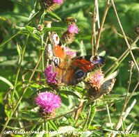 There were plenty of butterflies around on the banks of the Cefni Estuary. Peacocks (left), gatekeepers and meadow browns were frequent particularly seen on knapweed that is prolific this year. Along the edges of Newborough forest under some of the trees round-leaved wintergreen was abundant in places
 ![]() and here in close-up
and here in close-up ![]() . .
. .
The first 15-days had 22.0 mm of rainfall (22%) and [27%] of the August average. Drier than July, but with a potential water balance of 6.3 mm. The mean temperature was 14.8C (-1.0) and [-0.6] of the average for the month. Most noticeable were low maximum temperatures, the highest 20.6C on the 11th was (-4.3) of the average of the past 10-years.
16th: Pressure 1021 mb was falling and the sky was filled with cirrus clouds with a few small cumulus clouds pushed along on the light W'ly breeze. The morning was mostly sunny and with the W'ly instead of the cool NE'ly the temperature rising to 20.5C. By afternoon moderately high altostratus had encroached and there was weak sunshine at first. By 17 GMT the cloud had thickened and there were just glimpses of weakened sunshine. Rain fell over Ireland and W Scotland most of the day and eventfully reached her by dusk with light to moderate rain from 2030 to 2300 GMT. {Malin Hd. 19.1 mm} [Rain 4.7 mm; Max 20.5C; Min 11.0C; Grass 6.6C]
17th: Further drizzle and light rain, with moderate fog, from 0200 to 0900 GMT brought the rainfall to 4.7 mm. Stratiform cloud, on an occluded front, was low and visibility very poor with drizzle continuing for a while, with intermittent light rain, petering out by the afternoon. The temperature at 09 GMT was 16.0C (dewpoint 15.7C) and there was a light NW'ly breeze. The sky was slow to clear and we had to wait until 1625 GMT before the front had moved far enough eastward and for patches of blue to move across Anglesey. A line of cumulus, some towering, remained over the Snowdonia Mountains. Another cool day for August with the maximum temperature rising to 16.3C. The evening briefly sunny was cloudier by 21 GMT and overcast by midnight. {Hereford 24.4C, Mumbles Hd. 20.3C, Aultbea 20.8 mm, Hawarden 7.8 mm, Glasgow 8.6h, Valley 3.4h} [Rain 0.6 mm; Max 16.3C; Min 11.6C; Grass 11.4C]
18th: Overcast at first giving way to showery mostly cloudy skies at 09 GMT. The jetstream, positioned over southern Britain, and depressions continue to be generated to the West. Pressure here 1007 mb was declining in an unstable SW'ly airstream with a showery trough in the vicinity. There was a light shower just after 08 GMT and a heavy shower near the Menai Suspension Bridge and Four Crosses at 0950 GMT. By noon there was some sunshine breaking through and the afternoon was mostly sunny on Anglesey with, once again, showery cumulus clouds persisting over Snowdonia. The evening was mostly clear with bright stars visible. {Wisley 21.9C, Hawarden 19.4C, Lerwick 31.4 mm, At. Athan 4.2 mm, Aberporth 8.9h} [Rain 0.0 mm; Max 18.9C; Min 10.6C; Grass 8.3C]
19th: Clear sky after midnight with bright stars, turning cloudier before dawn when almost overcast. A weak ridge of high-pressure was declining and pressure was 1008 mb. Low 996 mb off S Ireland, tracking N, was winding up and pushing a warm fronton to the western seaboard. There was rain in SW England and this spread into Wales during the day reaching the N in the afternoon. The mountains gave Anglesey some protection at first, the first spots of rain here were at 1520 GMT. Light rain at first with some moderate bursts coming along during the evening. The Met Office issued a severe weather warning of heavy rain for most of Wales except Anglesey and parts of SE Wales. Rainfall here for the 24-h to 09 GMT on the 20th was 12.8 mm and at Valley 7.8 mm, both largest of the month. {Lake Vyrnwy 21.6 mm} [Rain 12.8 mm; Max 19.1C; Min 12.2C; Grass 9.8C]
20th: At midnight low 993 mb was off the Shannon Estuary, and an associated frontal system with triple point was over the N Irish Sea. Spells of rain, some moderate to heavy, through the night with a moderate to fresh S'ly wind. At 09 GMT under leaden skies there was a spell of heavy rain. Pressure was 1006 mb with the low 987 mb off the Western Isles of Scotland. Rain eased to drizzle then after a shower of rain about 1230 GMT ceased, but it took a while for the cloud to break doing so late in the afternoon the sunny spells going into the fine evening. {Weybourne 26.4C, Hawarden 24.2C, Capel Curig 39.2 mm, Manston 11.8h, Valley 2.0h} [Rain 1.5 mm; Max 18.4C; Min 14.2C; Grass 13.8C]
21st: A clearing sky at first with just 3 oktas cover at 09 GMT. Pressure 1015 mb had risen; we were on the edge of frontal cloud to the S where it was wet. Here keeping dry, with a mostly cloudy sky, occasionally bright. Towards evening as the front moved further S we had some sunshine lasting into the evening. {Weybourne 26.7C, Liscombe 21.6 mm, Mumbles Hd. 19.2 mm, Aviemore 10.1h, Valley 5.3h} [Rain 0.0 mm; Max 19.5C; Min 13.4C; Grass 12.3C]
22nd: Overcast with moderately high cloud at 06 GMT with most mountaintops in the clear. At 09 GMT the temperature was 16.6C (dewpoint 13.2C) and there were a few small cumulus clouds in the vicinity, but over the mountains to the S they were towering. Low 992 mb had mover over the North sea and was lying off the coast of Norway. The day was mostly sunny with few clouds and the temperature rose to 21.0C, highest of the month. The evening was cloudier. {Cambridge 24.8C, Hawarden 21.8C, Plymouth 17.6 mm, Valley 11.8h} [Rain 1.9 mm; Max 21.0C; Min 12.4C; Grass 10.3C]
23rd: Back to overcast skies by the morning with light rain from 06 GMT turning showery then to drizzle. A glimpse of brightness at 1925 GMT did not last or develop into sunshine. Slight showers continued in to the afternoon, then a narrow slot of mostly blue sky passed over, but there were a few more spots of rain about 1545 GMT. Ripened grain is still standing on most of the fields hereabouts, being not dry enough to harvest. {Manston 23.1C, Milford Haven 18.4C, Monks Wood 42.6 mm, Pembrey Sands 14.8 mm, Camborne 9.2h} [Rain 3.9 mm; Max 15.8C; Min 12.2C; Grass 9.8C]
 24th: Hints of broken cloud early suggested a fine morning, but a detached shower front, associated with an occluded comma front on low 982 mb S Norway, developed over Anglesey, the North Wales Coast and through Manchester across N England. A few spots of rain at 0900 GMT turned into moderate rain with heavy showery bursts up to 1100 GMT. By 1300 GMT the sky brightened and cleared soon after 1500 GMT with bright sunshine ahead of a frontal system heading SE giving rain over Scotland. A breezy day with the W'ly force 5/6 early decreasing force 3/4 in the afternoon when lines of cumulus clouds (cloud streets) were seen to the S over Snowdonia. There was a light shower of rain at 2030 GMT. [Rain 3.1 mm; Max 16.6C; Min 10.3C; Grass 8.0C]
25th: A promising start with thin moderately high cloud N of the Snowdonia Mountains with mostly weak sunshine and a light SE'ly breeze. Forecasts were for heavy rain in the S and the Met office were updating their warnings. Pressure here was 1013 mb with frontal wave low developing rapidly off Lands End bringing moist tropical air into the south-west. Rain was indeed heavy in Brittany (Tréboul 29.4 mm), Scilly Isles {43.8 mm}, parts of southern Britain and South Wales {Mumbles Head 34.2 mm}; Flash flooding was reported in areas around Swansea and Gower. The storm tracked NE and, with the added protection of the mountains, rain kept away. At Penmon it was mostly sunny with patches of blue sky persisting over Red Wharf Bay until evening. Thicker cloud overnight, but no rain. {Gravesend 20.6C, Rhyl 17.7C, Scilly 43.8 mm, Mumbles Hd. 34.2 mm, Glasgow 10.5h, Valley 3.7h} [Rain 0.0 mm; Max 16.5C; Min 10.0C; Grass 7.4C]
26th: Overcast with the occasional brighter spell as thinner cloud passed over, but no sunshine. Pressure was 1008 mb and there was a moderate NE'ly breeze. Keeping dull until noon when, with the cloud starting to break, some glimpses of sunshine developed. The afternoon saw a slowly clearing sky and the temperature rose to 17.6C. The evening was a bit cloudier, but clear spells continued overnight with sight of the bright Moon. [Rain 0.0 mm; Max 17.6C; Min 12.1C; Grass 11.6C]
27th: Pressure 1013 mb had risen with Atlantic-high 1025 mb W of Ireland. There was a light N'ly breeze and visibility was very good and clear giving excellent views of the mountains and Lleyn Peninsula. There were scattered altostratus, altocumulus and a few cumulus clouds and the morning was bright and sunny at first. By 1115 GMT a showery trough encroached giving a little rain. The afternoon brightened again with the odd sunny spell. The evening and night were partly cloud covered, but there was no more rain. [Rain 0.6 mm; Max 16.6C; Min 9.9C; Grass 7.2C]
28th: Overcast and rather dull after being bright with glimpses of sunshine around 06 GMT. Mostly clear with bright moonlight overnight and moderate to heavy dew on the grass with the grass minimum down to 5.1C. Pressure was high 1027 mb to the SW of Ireland and we were in a NW'ly airflow. The cloudiness was due to a slow-moving showery trough, blown in off the Irish Sea, moving SE across N Wales. The morning kept dull, but brightened by afternoon with a few sunny spells extending into the evening with a maximum temperature of 18.6C. {Mumbles Hd. 18.7C, Capel Curig 6.6 mm, St. Athan 8.7h} [Rain trace; Max 18.6C; Min 8.8C; Grass 5.1C]
29th: Mostly cloudy overnight with a slight shower of rain around 0845 GMT, but by 09 GMT there were signs of the cloud breaking. With a NW'ly breeze and, with moist air off the Irish Sea piling up against the Snowdonia Mountains, conditions were not favorable for a quick clearance. Pressure was not doing very much with low 1002 mb over the North Sea and Atlantic- high 1028 mb W of Ireland squashed into a dumbbell shape on the charts by ex-tropical storm 993 mb tracking North. There were a few more spots of rain at 0915 GMT then the rest of the day was dry, but turning very windy in the afternoon force 6/7 NE'ly giving the tall trees a rough time. Horse chestnut, beech and sycamore leaves already with autumn tints and beginning to fall this last week or so, along with a few twigs, were being torn from the waving branches. In compensation the sky had cleared over Anglesey, and it was sunny, leaving a line of cumulus clouds over the mountains into the evening. The temperature rose to 15.3C, the 2nd lowest of the month. By evening with pressure rising the wind had moderated and continued doing so during the mostly clear night. [Rain 0.0 mm; Max 15.3C; Min 12.0C; Grass 10.1C]
30th: Mostly clear skies overnight and a fine bright morning with a few cumulus clouds to the S and overhead. There was heavy dew, but the soil surface was dry. Pressure was steady on 1027 mb within the high 1029 mb centred over NW Ireland. Ex-hurricane Danielle 996 mb was SW of Nova Scotia. A sunny day, but the temperature rose to just 14.7C, lowest of the month. The evening continued fine and bright. [Rain 0.0 mm; Max 14.7C; Min 9.0C; Grass 5.6C]

|
Rainfall of 51.3 mm (51%) and [64%] of average was lowest since 2003 and ranked 14th driest since 1928. The mean temperature 14.6C, lowest since 1993, ranked 8 since 1979. Warm days were few and far between (just 5 days 20C, or more); the highest maximum 21.0C was (-3.9) of average. Sunshine at RAF Valley was 175.0h (115%) & [107%] highest since 2005 (K&Z adjusted values) ranking 20th sunniest on the Anglesey record since 1930.
September
1st: With high cirrus clouds overhead it was a weakly sunny September morning turning to clear sunshine later with a light NE'ly breeze. Visibility was good, but hazy. A halo was not seen at 09 GMT, but as more cirrostratus moved across in the afternoon a 22° halo with sun dogs (parhelia) and a bright upper arc of contact was seen for about an hour from 14 GMT. The evening was sunny with light breezes. At 2210 GMT an earth tremor occurred 5 km SW of Bangor magnitude 1.1 ML. Lasting between 3 - 5 seconds, there were reports (BGS) of it being felt and rumbles heard in the Bangor & Caernarfon area. [Rain 0.0 mm; Max 20.2C; Min 10.8C; Grass 6.3C]
2nd: Another fine and weakly sunny morning with cirrus and cirrostratus clouds. There was a light SE'ly breeze and visibility was good although hazy under milky blue sky. The day continued sunny and the temperature rose to 21.5C, higher than any day in August. A light sea breeze set in during the afternoon for a while before dying away. By 1800 GMT visibility was poor and likely to have been reduced by Saharan dust in the air. During the evening the haze and sky turned to pink then pinkish-grey as the sun set. Later slight mist was seen across the fields. [Rain 0.0 mm; Max 21.5C; Min 11.2C; Grass 6.3C]

|
3rd: The sky was mostly covered with high cirrus clouds through which the sun shone weakly. A light SSE'ly breeze with good, but moderately hazy visibility. The blue of the sky was still milky, an indication that dust was still in the air. A sea breeze that picked up for a while in the afternoon soon abated. The temperature rose to 22.1C, highest of the month and highest since 26th July. A pinkish-red sky was seen around sunset, brighter than yesterday. [Valley 22.4C, 12.4h] [Rain 0.0 mm; Max 22.1C; Min 11.7C; Grass 8.8C] The first 15-days have seen temperatures well above average with the mean 15.7C (+1.5) and [+2.3]. Rainfall was 45.0 mm (43%) and [49%] of the average for September..
16th: Another overcast morning with spots of rain at times. Deep low 974 mb was over the Norwegian Sea and in it's circulation cooler air was being brought on a showery NW'ly airstream. Visibility was good, but cloud was low on upwind mountain slopes giving a misty view. After a few more spots of rain the sky began to clear bringing along sunny spells particularly in the afternoon. A funnel cloud was reported, seen off Benllech. With the rain and still-warm soil fields that were ploughed and resown immediately after harvest are already looking green. The evening continued mostly sunny and dry although some well developed cumulus clouds were seen to the S. At 21 GMT with partly cloudy skies Jupiter, being closest to Earth for some years, looked very bright low to the SE. [Rain 0.3 mm; Max 15.3C; Min 10.2C; Grass 8.1C] The month ended with a rainfall total of 123.3 mm, largest since 2004, (119%) and [134%] of the averages ranking the 25th wettest September since before 1928. The mean temperature 14.2C was highest since 2006 ranking 10th highest since 1979 equal to the decadal average but [+0.8] based on the 30-y average. At Valley it was sunniest since 2006 with 130.3 h of sunshine [(103%)} of average (K&Z adjusted). The sunniest day was on the 3rd with 12.4h while there were 3 sunless days recorded.
1st: Overcast with intermittent light rain, moderate visibility and a fresh to strong S'ly wind. Pressure had fallen to 993 mb with deep low 996 mb S of Iceland with associated frontal triple-point over the Irish Sea. There was a heavier burst of rain around 0930 GMT and slight rain continued on through the morning petering out as the band of rain moved eastward. By afternoon the sky was clearing giving some late afternoon sunshine. At 21 GMT the wind had moderated and with 2 oktas cloud cover stars could be seen and visibility was good looking towards the mountains. [Capel Curig 21.8 mm] [Rain 1.0 mm; Max 15.4C; Min 12.0C; Grass 10.8C] The first 15-days had 38.6 mm of rain (25%) and [34%] of the October averages. The mean temperature was 12.6C (+1.2) and [+20.0} of the monthly averages..
16th: With well broken cloud it was a much brighter morning with clear sunshine and very good visibility. Pressure was 1024 mb in a ridge from Atlantic-high 1028 mb. The afternoon with well-broken cloud had further sunny spells that continued into the evening. [Rain 0.0 mm; Max 12.3C; Min 8.0C; Grass 5.4C] For October it was a relative dry month with 87.7 mm rainfall (56%) and [78%] of average. The mean temperature was 10.9C just below the decadal average (-0.4), but just above the 30-y average [+0.4]. The highest maximum 22.8C, highest in October since 2005, was (+3.1) of average. It was also a very sunny month the 131.8h duration at Valley was the 2nd sunniest on the Anglesey record since 1930 (K&Z adjusted values) beating 1965.
1st: A bright morning for the first day of November. There was a lot of cirrus in the sky above the weather station together with a wide expanding contrail. Autumn colours have developed strongly in the last week, enhanced by the larger temperature ranges we have had towards the end of October. The beech trees are particularly impressive this year and, apart from some top branches, there has been good leaf retention. Just a light SE'ly breeze, sometimes calm, low mist (shallow fog) formed on adjacent fields at 07 GMT and lingered a while, but in the Menai Strait there was a fog from Beaumaris through to nearly Caernarfon and in some in the mountain valleys too. Along the A5, near Ogwen, cloud was,forming and reforming at the head of the Nant Ffrancon Pass and there was some cumulus around the summits of Yr Wyddfa and Carnedd Llewelyn. Here the temperature was 7.5C with a dewpoint of 7.1C (97% relative humidity). Pressure was 1014 mb with low 971 mb S of Greenland and we were in a ridge high 1014 mb S Scotland to Azores 1030 mb. It was not to last, and with pressure falling by the afternoon it was cloudy with rain coming along later on weak fronts passing over in the night. [Rain 4.4 mm; Max 12.9C; Min 6.7C; Grass 2.0C] The first 15-days had rainfall of 86.8 mm (57%) and [69%) of the monthly averages. The mean temperature 8.5C was (+0.2) and [+1.2] of averages.
16th: There was a deep red sky over the Carneddau in the morning and many would say that it was a shepherd's or sailor's warning of bad weather on its way. Pressure was 1019 mb and a deepening Atlantic-low 984 mb was approaching SW Ireland. Here the morning was bright with weak sunshine shining through the cirrus with altocumulus and a few cumulus clouds. The crew of an RAF on helicopter saw 2 waterspouts off Anglesey. The first near the Skerries at 1100 GMT and another, that they filmed, at 1140 GMT off South Stack. By noon cirrostratus began to encroach from the W and a solar halo developed both 22° and 46° circles persisting until thicker cloud encroached by 14 GMT. By evening the SSE'ly wind was strengthening, but it kept dry. [Rain 0.2 mm; Max 10.3C; Min 2.2C; Grass -1.2C] The month ended having seen some of the lowest temperatures since 1993. The mean 6.3C was (-2.0)and [-0.9] of average. Highest 9.8C ranked 8 since 1979, but the lowest minimum -4.1C was lowest on record. Air frosts were on 4 days having 47.4h duration, and there were 11 ground frosts. Rainfall, 108.9 mm and duration 81.5h, lowest since 2008 ranking 35 since 1928, was (72%) and [87%] of the average. Sunshine duration at Valley was 84.5h (161%), the highest on the Anglesey record since 1930 (K&Z adjusted data). The sunniest day was on the 20th having 7.3h and there were 4 sunless days.
The first 15 days had a mean temperature of 2.3C (-3.5) and [-3.3} of average with 29.5 mm of various precipitation (24%) and [26%] of the month's average total.
A remarkably cold month to end 2010 with several records smashed going back over 30-years. The month ended with a mean temperature of 1.8C, lowest in December since before 1979, (-3.9) and [-3.7] of average. The mean maximum 4.3C, also lowest recorded, was (-3.8) and [-3.6] of average. The mean minimum -0.7C, equal lowest with 1981 ranking 2, was (-4.0) and [-3.8] of average. There were 20 air frosts equaling 1981 (rank 2), the lowest minimum -9.0C was lowest on record, and the 23 ground frosts were most since before 1985. Precipitation, mostly snow and snow pellets, totalled 69.8 mm (57%) and [61%] was lowest since 2001, ranking 13 in Llansadwrn records since 1929. Days with sleet or snow falling 14 (+11.1) and lying snow 14 (+13.1) were most in any month; and days with hail (mostly snow pellets) 13 (+6.4) were second only to November this year.
4th: With much sheet cirrus in the sky it was a bright morning with some weak sunshine at first. Later moderately high cloud thickened and we had a few spots of rain from time to time, but hardly enough to wet the ground, until about 1630 GMT when there was a prolonged shower sufficient to wet the ground. A little brighter early evening, but I did not see any sunshine. [Rain 0.6 mm; Max 20.3C; Min 11.3C; Grass 8.41C]
5th: A mostly cloudy day with a few spots of rain from time to time. Pressure here was 1017 mb between high 1030 mb Norway and complex Atlantic low-pressure 992 mb W of Ireland. There was a cloud-filled SE'ly airflow and in the shadow of the Snowdonia Mountains there was little rain here. A clear slot developed in the lee of the mountains in the afternoon, blue sky was seen for a while, but little if any no sunshine reached here. An overcast evening and night. [Rain trace; Max 19.1C; Min 14.2C; Grass 12.1C]
6th: Overcast with a few spots of rain before 09 GMT. The overnight air minimum did not go below 14.7C, highest of the month, equal to the lowest maximum in August. Pressure 1005 mb had fallen and the sky remained overcast, with the few spots of rain from time to time through the day. Rainfall was much heavier over Ireland and South Wales, there was persistent slight rain here from 1645 to 2000 GMT. The E'ly wind soon veered S'ly after the rain. Overnight the sky partly cleared. {Topcliffe 21.9C, Hawarden 19.8C, Knock AP 86.5 mm, Killowen NI. 83.6 mm, Mumbles Hd. 28.6 mm, Lerwick 12.7h, Valley 0.0h} [Rain 3.8 mm; Max 17.4C; Min 14.7C; Grass 13.5C]
7th: Bright at first with a little sunshine, but approaching 09 GMT cloudier with cumulus clouds in the vicinity. A light shower of rain, then with the showers moving off a little sunshine. Pressure 996 mb was falling with low 990 mb off NW Ireland. Visibility was moderate to good with showers in sight over Snowdonia. The wind was light S'ly. The afternoon was mostly sunny, but there was a slight shower of rain at 1430 GMT, and the sky was clearer late afternoon and early evening. The wind picked up being S'ly force 4 later. {Gravesend 21.6, Hawarden 19.1C, Manston 9.7h, Valley 8.0h} [Rain 0.1 mm; Max 19.0C; Min 11.5C; Grass 8.7C]
8th: Hardly a cloud in the sky in the morning with light SSE'ly breezes. Pressure was 1002 mb in the middle of complex low pressure. Pressure was high 1029 mb over Finland and the Azores. By 09 GMT the temperature had risen from a minimum of 10.6C overnight to 16.0C (dewpoint 11.6C) and went on to rise to 21.8C. Some passing clouds gave a few spots of rain in the middle of the afternoon, otherwise sunny. {Llansadwrn 21.8C, Hawarden 20.7C, Exeter AP 26.0 mm, Valley 10.0h} [Rain trace; Max 21.8C; Min 10.6C; Grass 7.4C]
9th: The morning was mostly cloudy, but clearing over Anglesey, in the afternoon in a ridge if high-pressure, leaving cumulus clouds over Snowdonia. A low SW of Ireland was moving E and frontal cloud began to encroach from the West (see photo above right). There were several little egrets as well as herons and swans on the pool, river Cefni and tidal estuary on the right of the photograph. There was light rain from 2230 GMT.{Killowen 22.5, Hawarden 19.5C} [Rain 5.0 mm; Max 20.4C; Min 12.5C; Grass 9.3C]

10th: Dull and overcast with low stratus cloud with mist giving poor visibility. Temperatures this beginning of September have been well above average. The mean maximum was running at 20.2C (+2.8) and [+3.2]. Overnight rain was 5.0 mm, but had stopped before 09 GMT and, although remaining overcast into the afternoon, was dry until rain arrived about 1700 GMT. A windier day with a force 5 SW'ly; and sunless. Despite the rain there was a chiffchaff singing strongly at 1850 GMT, possibly out summer resident, or another making its way South for the winter. Rain was heavy during the afternoon in South Wales with 50.6 mm recorded in Sennybridge. {Church Fenton 22.7, Sennybridge 50.6 mm}[Rain 7.6 mm; Max 17.8C; Min 13.2C; Grass 12.8C]
11th: Showery rain continued overnight. Overcast at first with low cloud and misty moderate visibility. Just after 09 GMT a few breaks started to appear in the cloud slowly lifting cloud. Continuing mild, overnight the minimum was 14.5C and was then 15.4C. By afternoon there were some sunny spells between 'beefy' cumulus clouds. We missed any heavy showers and just had a few spots about 1700 GMT before the sky more or less cleared overhead with stars visible at 21 GMT. {Hawarden 20.9C, Sennybridge 26.0 mm} [Rain trace; Max 18.1C; Min 14.5C; Grass 14.6C]
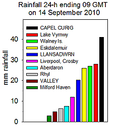 12th: Overnight under mostly clear sky the temperature on the grass fell to 6.2C and there was heavy dew. Soon after dawn the sky became cloudier and by 09 GMT there were 6 oktas of cumulus clouds; there were showers over the Snowdonia Mountains. Visibility was moderate with haze and there was a light NW'ly breeze.. Pressure was 1024 mb with a ridge of high-pressure, from high 1032 mb to the SW, moving East. A fine and mostly sunny day, lighter winds in the afternoon and the temperature rose to 19.8C. There were several butterflies around the garden including red admirals, small tortoiseshell and speckled wood all favoring the tall blue Verbena bonariensis. Later cloud associated with fronts approaching from the West arrived around 1700 GMT. There was drizzle and light rain from 2300 GMT. {Solent 22.2C, Mumbles Hd. 18.6C, Rhyl l5.2 mm}[Rain 2.9 mm; Max 19.8C; Min 9.8C; Grass 6.2C]
13th: Overcast, dull and a bit wet. Drizzle and spells of light rain had amounted to just 2.9 mm at 09 GMT, but enough to make it a rather unpleasant morning. Pressure 1021 mb was falling slowly with a slow-moving warm front over Anglesey associated with low 998 mb over Iceland. There was a moderate to fresh SW'ly wind, so when there was rain it was driving across the open fields. A dull sunless day with drizzle and rain; most rain fell on the Snowdonia Mountains (Capel Curig 41 mm and in Llansadwrn 20.3 mm in the 24-h to 06 GMT on the 14th). {Murlough 22.1C, Hawarden 18.3C, Manston 4.3h} [Rain 18.0 mm; Max 16.5C; Min 12.9C; Grass 12.0C]
14th: Drizzle and rain at first with a fresh to strong SW'ly breeze. At 09 GMT pressure 1012 mb was falling slowly as the warm front warm wave over Anglesey was beginning to move. There were some heavier showers of rain then the sky began to clear by 1030 GMT. A clear slot with bright sunshine until 1300 GMT when it was cloudier. A short heavy shower of rain at 1410 GMT then brightening again with a clearing sky at 1800 GMT and yet more showers coming along between 1900 and 2200 GMT. {Donna Nook 21.5C, Hawarden 18.9C, Capel Curig 45.2 mm, Valley 5.5h} [Rain 4.2 mm; Max 18.3C; Min 14.2C; Grass 14.0C]
15th: Persistent low cloud was shrouding the mountains although visibility at low levels was good. Breezy, the fresh SW'ly drying the ground there having been no noticeable rain since midnight. Pressure was 1013 mb with low 984 mb near Aberdeen off NE Scotland; associated frontal 'comma' cloud lay to the N of here. The morning continued overcast and breezy while as the wind veered W'ly in the afternoon there were more light showers. Between 1645 and 1800 GMT the showers were heavier, but the evening was brighter with the wind NW'ly. The day's temperature 15.2C was the lowest since 30 August (14.7C) and before that the 29th May (14.6C). {Hurn 19.3C, Milford Haven 16.9C, Aberporth 6.0h} [Rain 2.8 mm; Max 15.2C; Min 9.0C; Grass 7.3C]
17th: Somewhat brighter just after dawn, but then cloudier and overcast at 09 GMT. There was a moderate NNW'ly wind and visibility was good although the mountaintops and lower slopes were cloud covered and misty. Low 987 mb was filling over Norway and there was a narrow band of high-pressure 1024 mb W of Ireland with pressure here 1018 mb. The morning kept cloudy with slight showers of rain, brighter with glimpses of sunshine early afternoon then thicker cloud encroached with a dark sky at 17 GMT. Later there was broken cloud with a few stars seen at 21 GMT. [Rain 0.9 mm; Max 12.7C; Min 7.0C; Grass 4.6C]
18th: Scattered clouds from dawn mainly over the mountains and bright and sunny on Anglesey. Pressure was 1020 mb with the high 1022 mb over the Scilly Isles. A chiffchaff was singing and there was a speckled wood butterfly resting on the Stevenson screen roof at 09 GMT. In the garden sweet peas are still flowering and there are plenty of runner beans and there is a late crop of peas and lettuce coming along. Later crops of potatoes did better than early that were affected by dry spring weather. There was a light SW'ly breeze and a temperature of 12.7C (dewpoint 8.6C). Soon cloudier and increasingly dull with rain commencing at 1145 GMT. A wet afternoon with the rain continuing on into the night. [Rain 33.0 mm; Max 14.3C; Min 6.3C; Grass 4.3C]
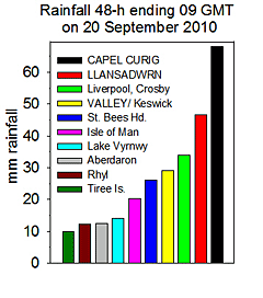 19th: Moderate to heavy rain overnight and still raining at 09 GMT. In the raingauge was 33.0 mm, largest of the month and the largest daily fall this year to date. There was a moderate, but blustery, SW'ly wind and visibility was poor. Low 997 mb S of Iceland had associated fronts moving eastward across the UK. We were in warm sector air with a triple point just to the N of here, the temperature rose to 14.9C by 16 GMT and varied little through to the next morning. More rain through the morning soon accumulating another 11.5 mm by 1300 GMT when rain stopped after 24.5h of continuous rain that accumulated 45.0 mm in the spell. The afternoon was a little drier keeping very dull and windy, with occasional drizzle. Rainfall over 48h ending 06 GMT on the 20th (graphic on the right) most rain fell on the Snowdonia Mountains in Capel Curig 68 mm and SE Anglesey in Llansadwrn 47 mm. [Rain 13.5 mm; Max 15.1C; Min 10.3C; Grass 10.0C]
20th: Overcast at first, but a few breaks appearing in the sky by 09 GMT. The temperature had reached 15.1C, the maximum of the past 24.h and went on to reach 18.2C by afternoon becoming fine and mostly sunny. [Hawarden 20.0C, Valley 7.6h] [Rain 0.0 mm; Max 18.2C; Min 13.5C; Grass 12.8C]
21st: Mostly clear skies at first, but turning cloudier by 09 GMT with 4 oktas cover. In a ridge from France pressure was 1017 mb and there was a light to moderate S'ly breeze. Low 998 mb at midnight W of Ireland was moving E and although filling 1002 mb at noon had an associated rain-bearing warm frontal system over Ireland. Fog was widespread at first in the Midlands and South. The day became mostly cloudy although it was bright, sunny and warm in Benllech around noon, the temperature in Pentraeth rising to 19.2C and in Llansadwrn to 19.8C. There was little in the way of sunshine, the evening mostly cloudy; later partially cloudy moon and stars were visible soon after dusk at 2030 GMT. [Hawarden 20.8C, Valley 1.0h] [Rain 0.0 mm; Max 19.8C; Min 13.2C; Grass 11.9C]
22nd: A fine and bright morning with cloud decreasing. Pressure was 1013 mb with low 1006 mb off the Western Isles of Scotland with a cold front moving across the Irish Sea. There was a fresh S'ly wind and visibility good. Soon cloud encroached from the W bringing rain from 1215 GMT to 1500 GMT and the start of a spell of frequent showers (8 recorded by the autographic raingauge) by 09 GMT on the 23rd. [Rain 6.1 mm; Max 16.8C; Min 12.6C; Grass 10.2C]
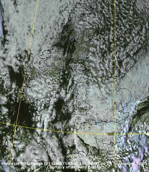 23rd: A dull morning with frequent showers of rain (7 recorded by the autographic raingauge) through the day from 0630 GMT, heavier at 0805 GMT and a light shower at 09 GMT during observations. Pressure was 1004 mb within slow-moving low-pressure centred over the North Channel and Irish Sea 1003 mb. There were more showers during the day, heavy over the mountains, that was occasionally brighter. The SW'ly wind force 4 veered WNW'ly by 18 GMT. Showers ceased after a moderately heavy showers at 2000 GMT. In Newcastle there was flash flooding in a thunderstorm during the evening rush hour that caused gridlock on the roads. [Capel Curig 29.8 mm, Valley 1.2h] [Rain 5.0 mm; Max 17.2C; Min 13.4C; Grass 12.8C]
24th: A slight shower around 03 GMT then a bright morning with cloud cover decreasing. Pressure had risen 1011 mb as the low 998 mb moved over the southern North Sea. Pressure was high 1025 mb SE Iceland and between cool drier air was being drawn over W Britain from Arctic regions. The NNE'ly was force 6 and the temperature at 09 GMT 10.9C (dewpoint 6.7C) with relative humidity 75% drying concrete surfaces and almost drying the grass. Closed cell convective clouds were frequent to the N, NW and over the Irish Sea; clouds sometimes forming 'streets' remained in the vicinity through the day diminishing for a while during late afternoon and evening, as the wind moderated to force 3, only to increase again by 21 GMT. A dry day with the temperature rising to just 11.7C, lowest of the month. [ ] [Rain 0.0 mm; Max 11.7C; Min 9.7C; Grass 9.7C]
25th: A fine and mostly bright morning with a strong cold-feeling N-NE'ly wind. Atlantic-high 1025 mb was persisting to the W and pressure here was 1020 mb. With low 997 mb S Norway isobars were tight over Britain maintaining a cool N'ly airflow. Marine stratocumulus over the Irish Sea retreated westward by the afternoon and, apart from lines of cumulus over Snowdonia, there was sunshine. Another dry and cool day with the temperature rising to 11.8C. During the evening patchy cloud moved across once again. [Valley 7.7h] [Rain 0.0 mm; Max 11.8C; Min 7.3C; Grass 5.1C]
26th: A fine morning and with cloud decreasing for a time blue sunny skies. Overnight the air minimum temperature had fallen to 5.8C, lowest of the month and on the grass to 3.0C, but at Valley a ground frost -0.9C was recorded. With the cool moderate NE'ly wind persisting it felt cold out of shelter in the shade. Turning cloudier again by afternoon as orographic cloud formed. A cool day with the temperature rising to 12.3C. By evening the cloud dispersed and under clear sky temperatures fell, with dew forming on grass, before cloud encroached by midnight. [Valley 7.7h] [Rain 0.0 mm; Max 12.3C; Min 5.8C; Grass 3.0C]
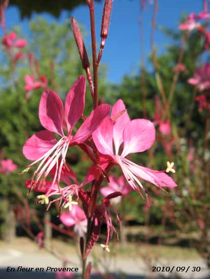 27th: The grass minimum had fallen to 2.9C, lowest of the month, and lowest since 31 August. At Valley another ground frost -0.5C was recorded. The morning was dull with overcast sky and there was a very light NNE'ly breeze. There was a little brightness early in the afternoon as cloud broke, with odd glimpses of sunshine, then cloud closed and thickened again later. [Rain trace; Max 14.8C; Min 6.4C; Grass 2.9C]
28th: By dawn the sky had almost cleared and it was a fine sunny start to the day. The temperature at 09 GMT had risen to 14.8C (dewpoint 9.6C) in a strong and warm S'ly wind, the highest of the past 24-h. Pressure was 1014 mb with complex low-pressure 970 mb near Iceland and high-pressure 1026 mb Scandinavia. Frontal cloud over the Irish Sea encroached by afternoon and as cloud thickened there was a spell of rain from 1430 to 1730 GMT. Overcast and dry at 20 GMT then further showery rain from 2100 GMT. [Valley 16.2 mm, Capel Curig 7.2 mm] [Rain 18.5 mm; Max 18.8C; Min 10.6C; Grass 10.7C]
29th: There was rain from 03 GMT turning moderate to heavy before 09 GMT with a total of 18.5 mm in the raingauge, the second largest 24-h fall of the month. There was a moderate S'ly breeze and moderate visibility in the rain. Keeping overcast the rain did start to ease by 10 GMT and as the cold front moved eastward the sky starting to clear by noon giving a sunny afternoon. The sky kept mostly clear during the evening with stars and moon visible at 2130 GMT. [Pembrey Sands 17.2C, Valley 6.7h] [Rain 0.4 mm; Max 16.3C; Min 12.6C; Grass 11.6C]
30th: After a mostly clear night, with mist in some low lying places, it was a fine bright morning with the sun rising over a few clouds over the Carneddau just before 07 GMT. Pressure was 1013 mb; low 979 mb SW Iceland had an associated front moving across Ireland where rain was already falling and soon moving into Cornwall. By 09 GMT remnant frontal cloud over the Irish Sea passed over and there was a light shower of rain in Pentraeth. By noon there was some more sunshine until 15 GMT when the sky turned cloudier with some showery rain in the vicinity. The sky was overcast at 2100 GMT. [Milford Haven 17.3C, Valley 4.2h] [Rain 0.6 mm; Max 16.4C; Min 9.6C; Grass 6.4C]
October
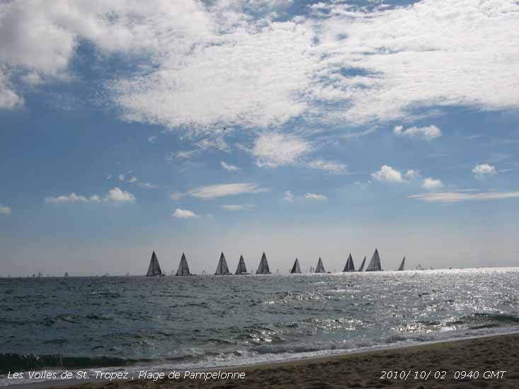 2nd: A bright morning with weak sunshine and moderate hazy visibility. With low 962 mb W of Scotland and high 1032 E Finland pressure here was 1000 mb There was a strong S'ly airflow over Britain. There was a trough over the Irish Sea and before noon cloud had thickened with a few spots of rain in some parts of Anglesey. The afternoon remained cloudy with showery rain during the evening from 19 GMT and broken cloud later. [Rain 13.5 mm; Max 14.7C; Min 7.6C; Grass 3.7C]
3rd: There was light to moderate rain from 02 GMT through to morning. A wet morning and raining at 09 GMT. Pressure had fallen to 990 mb with low 968 W of Scotland and frontal wave low 986 mb over the Bristol Channel. Showery rain continued before petering out around noon. The SE'ly breeze veered W'ly and the afternoon was brighter with broken cloud during the evening with no more rain. [Rain 0.8 mm; Max 14.9C; Min 10.8C; Grass 8.8C]
4th: Some mist and fog patches around the coast early clearing to give a fine morning with hazy sunshine and a moderate Sly breeze. Low 957 mb was S of Iceland with low 990 mb Bay of Biscay, pressure here was 999 mb. Frontal cloud lay to the W of Ireland and over SE England, there was a clear slot over the Irish Sea. Clouds persisted over the mountaintops and, although fronts in the West edged closer during the day, it was mostly sunny on Anglesey. By evening cloud encroached bringing showery rain then moderate to heavy rain before midnight. [Hawarden 18.3C, Capel Curig 15.6 mm, Valley 16.3C, 7.4h] [Rain 4.1 mm; Max 16.1C; Min 9.8C; Grass 6.6C]
5th: Rain died out soon after midnight with more showery rain before 06 GMT. Frontal cloud, associated with low 953 mb S of Iceland, began to clear soon after 09 GMT giving a mostly sunny day. Cloud had encroached by 18 GMT. [Hawarden 18.8C, Capel Curig 15.6 mm, Valley 13.8 mm, Valley 5.4h] [Rain 16.5 mm; Max 15.9C; Min 11.2C; Grass 9.8C]
6th: Overcast skies at midnight slowly clearing eastward by morning. A sunny morning with a little cloud at times, persistent lines of cumulus over the mountains in the afternoon. [St Athan 16.9C, Valley 9.3h] [Rain 0.4 mm; Max 15.1C; Min 9.0C; Grass 7.2C]
7th: A fine and sunny morning with some high cirrus overhead and cumulus clouds hugging the Snowdonia mountaintops as the sun rose. Atlantic-low 952 tracking slowly S was W of Brest and pressure here 1015 mb. Cloud persisted over Snowdonia during the day otherwise the day was fine and mostly sunny. [Valley 18.3C, 8.4h] [Rain 0.0 mm; Max 19.9C; Min 10.8C; Grass 8.4C]
8th:
The sun was rising over the Carneddau with partly cloudy sky at 0650 GMT. Pressure was 1014 mb with slow-moving low 967 mb now W of Biscay and blocking-high 1039 mb near St Petersburg. ![]() The METOP-A satellite image shows the Atlantic-low with Wales and Anglesey in a clear slow between a warm front Scotland- N England and a cold front SW Ireland . The result was an S'ly upper airflow over Spain and Brittany originating from Morocco and Western Sahara carrying dust
The METOP-A satellite image shows the Atlantic-low with Wales and Anglesey in a clear slow between a warm front Scotland- N England and a cold front SW Ireland . The result was an S'ly upper airflow over Spain and Brittany originating from Morocco and Western Sahara carrying dust ![]() . A fine day after early coastal mist patches had cleared with hazy sunshine, the haze due to Saharan dust moderately high in the atmosphere, the temperature rising on north-west coast at Valley, with a surface E'ly breeze, to 23.0C. Low cloud and fog (haar) persisted most of the day in some NE English counties and North Sea facing coasts. [Chivenor 23.1C, Valley 23.0C, 6.4h] [Rain trace; Max 22.8C; Min 11.4C; Grass 6.6C]
. A fine day after early coastal mist patches had cleared with hazy sunshine, the haze due to Saharan dust moderately high in the atmosphere, the temperature rising on north-west coast at Valley, with a surface E'ly breeze, to 23.0C. Low cloud and fog (haar) persisted most of the day in some NE English counties and North Sea facing coasts. [Chivenor 23.1C, Valley 23.0C, 6.4h] [Rain trace; Max 22.8C; Min 11.4C; Grass 6.6C]
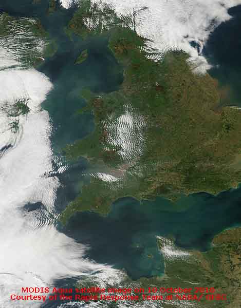 9th: A sunny morning with partly cloudy skies at first reducing through the morning. Much of Britain was covered with low cloud and fog that once again persisted through the day along coastal areas bordering the North Sea. Coasts around the Irish Sea and W Scotland, all with >9 h sunshine, did the best for sunshine. Frontal cloud, associated with complex Atlantic-lows, affected Ireland and SW England. Another dry day with hazy sunshine and a light E'ly breeze; the haze a combination of persistent Saharan dust and pollutant aerosols (smoke). [Aberporth 18.1C, Dunstaffnage 9.9h, Valley 9.3h] [Rain 0.0 mm; Max 16.8C; Min 13.4C; Grass 9.2C]
10th: Clear with hazy sunshine through the day with a light ENE'ly breeze. Haze, due to the plume of Saharan dust and pollutant aerosols (smoke), can be seen on the MODIS AQUA satellite image (courtesy of the Rapid Response Team at NASA/ GFSC) showing up against the dark colour of the Irish Sea and English Channel. [Solent 22.5C, Milford Haven 19.6, Norwich AP 10.4h, Valley 9.3h] [Rain 0.0 mm; Max 16.0C; Min 11.0C; Grass 8.8C]
11th: With pressure remaining high 1028 mb N Scotland with ridge southwards clear skies with hazy sunshine was the order of the day for western Britain. Haar, off the North Sea, again affected the East coast between the Tay estuary and the Wash for most of the day. [Milford Haven 19.2C, no significant rain, Aberporth 10.9h, Valley 10.4h] [Rain 0.0 mm; Max 14.3C; Min 9.4C; Grass 6.1C]
12th: Much of the same, early mist and fog in low lying areas and around the coast at Rhosneiger soon gave way to a day of hazy sunshine. In Braemar the air temperature fell to -2.8C. Here the sun rose over the Carneddau Mountains at 0654 GMT in a cloudless sky. Visibility was good with pollutant haze through the day. A large mountain fire of gorse at Brynrefail near Caernarfon created a lot of smoke and required attendance of firefighters. Fog lingered much of the morning in the Midlands and parts of western Scotland, and East coast bordering the North Sea for much of the day. It was sunny with the sun setting around 1836 GMT viewed from Rhosneiger. [Solent 18.1C, Trawsgoed 16.7C, Braemar -2.8C, no significant rain, Aberporth 10.4h] [Rain 0.0 mm; Max 13.0C; Min 7.2C; Grass 2.0C]
13th: Mostly clear overhead overnight and in the morning hazy sunshine in moderate visibility looking towards the mountains. Mist and fog had formed in low-lying areas and sea fog lingered during the day at Rhosneiger. A patch of Saharan dust had returned from a pool over the Atlantic to the NW remaining from the previous event. There was moderate to heavy dew on the grass with the temperature down to 0.8C, but concrete was dry. Atlantic-high 1026 mb covered Britain and pressure here was 1023 mb; there was a light SE'ly breeze. The day was sunny here; marine stratiform cloud moved on to he W coast (Valley, with coastal fog at times, reported just 5.3h of sunshine). Low cloud affected large parts of Britain except the far SW England, most of Wales and NW England. Cloud eventually encroached here from the W during the evening when the wind had backed N'ly. [Valley 5.3h] [Rain 0.0 mm; Max 12.8C; Min 6.1C; Grass 0.8C]
14th: Overcast and dull and with moderate visibility mountains were obscured. A dry and sunless day. Some breaks appeared in the cloud from time to time during the evening. {Trawsgoed 11.8, Valley 0.0h} [Rain 0.0 mm; Max 9.9C; Min 8.8C; Grass 7.3C]
15th: A little brighter today with thinner occasionally broken cloud and a few glimpses of sunshine in the morning. Visibility was good with a little haze. In the afternoon the cloud thickened with a few spots of rain around 1500 GMT and 1830 GMT. There was a spell of light rain from 2200 to 2300 GMT. [Rain 2.3 mm; Max 12.4C; Min 8.7C; Grass 6.1C]
17th: Bright at first with moderately high cloud increasing through the morning. Although pressure had increased 1027 mb a weakening warm front associated with Icelandic-low 985 mb moving SE brought thickening cloud by afternoon and a little rain and drizzle from 2100 GMT. [Valley 2.1h] [Rain 0.5 mm; Max 13.2C; Min 5.9C; Grass 0.7C]
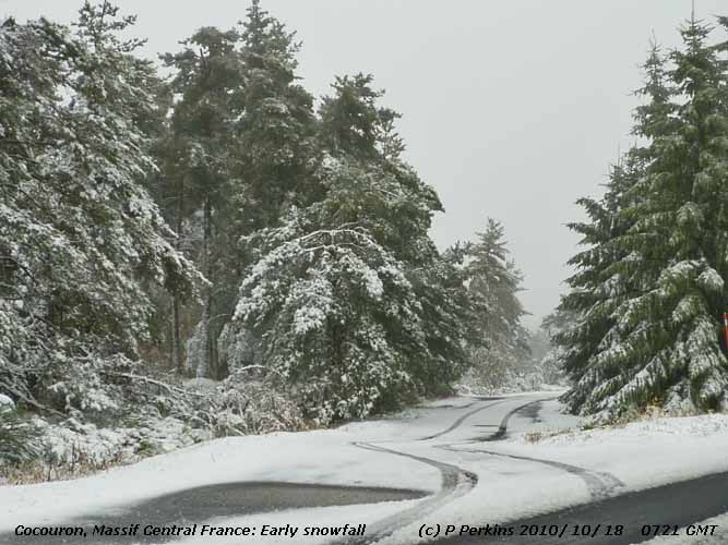 18th: An overcast and sunless day. Showery rain from 1900 GMT until 2200 GMT. [Valley 0.0h] [Rain 3.2 mm; Max 12.4C; Min 8.7C; Grass 7.3C]
19th: A bright start to the day, but cloud increasing with spots of rain by 0930 GMT as weak frontal cloud moved across from the N. There was a spell of slight rain lasting about an hour from noon. The afternoon was mostly cloudy with a slight shower of rain at 17 GMT. The wind a moderate WNW'ly in the morning veered N'ly freshening force 5/6 by evening. In Llanfairfechan there was a moderate shower of ice pellets at 2110 GMT. [Rain 0.3 mm; Max 12.0C; Min 6.0C; Grass 1.7C]
20th: A fine and sunny morning with very good visibility. Pressure was 1022 mb between Atlantic-high 1028 mb to the W and Baltic-low 995 to the E airflow was from Arctic regions. The temperature at 09 GMT was 6.9C (dewpoint -0.4C) and the grass almost dry in the fresh to strong N'ly wind. A little cloud at times through the day clearing towards evening. [Pembrey sands 11.1C, Valley 3.8h] [Rain trace; Max 8.9C; Min 5.1C; Grass 1.9C]
21st: A bright morning with cloud decreasing quickly with good, but hazy visibility. The first ground frost of the season -2.4C was recorded by the grass minimum thermometer, the last (-0.4) was on 13th April. With clear skies there was extensive white frost on fields in southern England. With sunny spells coming along here the temperature rose to 14.2C by early afternoon, then cloud encroached bring an increasing dull afternoon and evening. A dry day. [Rain 0.0 mm; Max 14.2C; Min 2.8C; Grass -2.4C]
22nd: Mostly cloudy at first with a light to moderate SW'ly breeze. Soon with a clearing sunny spells developed through the morning. In swirling gusts of wind leaves were falling from the trees. Leaf fall has so far not been great although beech, that have moderately developed autumn tints, are are looking thin on the topmost branches. Cloudier at times and with dark clouds approaching a few spots of rain about 1300 GMT. There was blustery rain from 1430 GMT, continuous light to moderate until 2100 GMT, accumulating 13.6 mm. [Rain 13.6 mm; Max 13.0C; Min 8.0C; Grass 7.3C]
23rd: A slight shower of rain about 04 GMT the with a clearing sky there was low-lying lingering mist on the fields at dawn. As the sun rose over the Carneddau Mountains the mist began to clear. Visibility was moderate at first and there were a few cumulus clouds over the mountains and cirrus tending to increase as an occluded front moved over from the North. Sunny spells gave way to a light shower of rain around 11 GMT then clearing to give sunny spells and good visibility in the afternoon. There was a further spell of showery rain from 1800 GMT through till 2230 GMT with a final slight shower at just before midnight. [Rain 3.7 mm; Max 10.5C; Min 5.0C; Grass 2.1C]
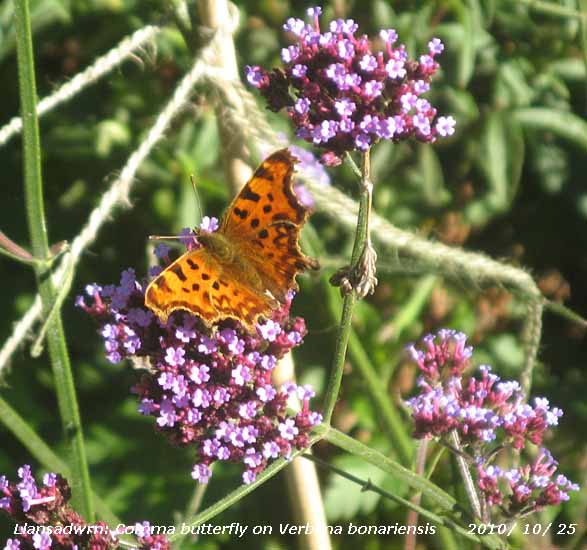 24th: A bright morning with small cumulus, altocumulus and cirrus clouds tending to increase around 09 GMT, then decreasing again. Pressure was 1018 mb with low 989 mb Denmark drawing down cool air from the North as a result although mostly sunny the temperature did not rise above 9.5C. A mostly clear evening with dew forming on the grass. [Rain 0.0 mm; Max 9.5C; Min 4.7C; Grass 2.3C]
25th: Almost clear skies at dawn with a white frost on the grass and the grass minimum down to -1.5C. The minimum air temperature was 1.7C, lowest in October since 2008 and 7th lowest here in 33-years. Pressure had risen to 1029 mb with high 1030 mb centred over Wales. There was a light, but variable, generally SE'ly breeze and very good visibility. Some altostratus was seen in the far W and overhead there were several contrails, moving S, and patches of cirrus with a bright parhelia (right hand sun dog) clearly visible in one. The sky cleared to a deep blue and the day was sunny with the temperature rising to 11.5C; red admiral, comma and speckled wood butterflies were spotted in the garden attracted by the long-flowering Verbena bonariensis. Late in the afternoon patchy cloud began to encroach from the W with a strengthening SW'ly wind [Rain 3.5 mm; Max 11.5C; Min 1.7C; Grass -1.5C]
26th: Light rain and/ or drizzle from 0230 GMT and it was raining at 09 GMT with a fresh SW'ly wind. A warm front was over Anglesey and western parts of Britain. The rain turned to drizzle during then visibility reduced, as fog developed, and at 1140 GMT it was < 100m. By afternoon visibility had improved while the temperature rose through the day reaching 14.0C and hovering around this temperature until after midnight. There was showery rain during the evening. [Hawarden 16.6C, Valley 14.6C, Lake Vyrnwy 20.0 mm, RAF Mona 11.4 mm, Valley 0.0h] [Rain 5.1 mm; Max 14.0C; Min 4.3C; Grass 2.2C]
27th: At 02 GMT the temperature began to fall on a cold front reaching a minimum of 9.6C as the sky cleared. At 09 GMT there was a little cloud hugging the Snowdonia Mountains otherwise it was clear and sunny with moderate to good visibility and light to moderate SW'ly breeze. Deepening low 980 mb was N Scotland tracking E; pressure here 1013 mb. Winds were strong to gale in St George's and English Channel and freshened here during the day. During the afternoon cirrus clouds increased and thicker cloud, on a cold air development, encroached by 1700 GMT bringing rain. Thunder was heard at 1754 GMT. [Rain 2.8 mm; Max 14.7C; Min 9.6C; Grass 7.5C]
28th: At midnight we were in a mild moderately strong SW'ly air flow, but developments were taking place in mid-Atlantic W of Ireland. Low 988 mb was heading our way and deepening rapidly. A mostly cloudy morning with pressure 1010 mb falling. Spots of rain at 0950 and slight rain around noon, then a somewhat drier afternoon with strengthening wind. A sunless day. At 1800 GMT the low was 972 mb off Shannon, Ireland. Isobars were tightly packed on the Irish Sea chart and the S'ly wind was strong to gale force 8/9 wind during the evening. On Snowdon mean wind speed at 1855 and 1915 GMT reached 108 mph with gusts of 149 mph. The wind had moderated a little by midnight. [Rain 1.6 mm; Max 14.4C; Min 8.5C; Grass 5.5C]
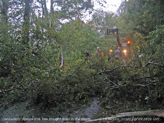 29th: The wind was strengthening again in the morning. Pressure 991 mb was falling as the low NW Scotland continued to deepen 968 mb as it tracked North. A slow-moving frontal system over Ireland (delivering heavy rainfall in Ireland) had wave depressions to the S and these moved N during the morning and were to the W of here at noon 980 mb. The cold front moved across the Irish Sea during the afternoon and the temperature started to fall rapidly from the maximum of 14.7C at 1500 GMT. At the same time the SW'ly wind strengthened to gale force with severe gusts bringing down a large mature lime tree near the weather station. The tree was dangerous and the driveway to Gadlys was closed for an hour before heavy farm equipment was brought in to clear it. The wind moderated later, but showery rain continued the sky beginning to clear before midnight when a bright half-moon could be seen. The 2 masted square rigger, the 180 ft Fryderyk Chopin, lost both masts in heavy seas and force 9 S'ly wind 100 miles off the Scilly Isles. The Polish ship had a crew of 47, mostly 14-y old trainees. Several ships in the area gave assistance and no one was hurt. [Rain 4.1 mm; Max 15.7C; Min 10.6C; Grass 10.0C]
30th: A bright start with showers, some bright spells and much lighter winds. Pressure 992 mb was rising as low 958 mb over the Norwegian Sea N of Scotland was slowly filling. We were in a brisk showery SW'ly airstream with convective clouds in the vicinity. Soon there was a moderately heavy shower of rain and ice pellets. The day was mostly cloudy with frequent showers some with ice pellets. The wind backed S then SE'ly in the afternoon and there was a spell of rain, heavy at 1930 GMT, but the sky had cleared at 2130 GMT with the grass minimum dipping to 2.4C. [Rain 10.2 mm; Max 11.1C; Min 6.6C; Grass 2.5C]
31st: Mostly cloudy in the morning with altocumulus overhead and moderately high and thin altostratus with the sun looming through at times. The mountaintops had some cumulus around the peaks and some valleys were filled at times with clouds. Visibility was good, but misty at lower levels. There was a light to moderate NE'ly breeze and a temperature of 10.2C (dewpoint 9.2C). The morning kept mostly cloudy, but the afternoon brightened with some weak sunshine and a few clear sunny spells before more cloud encroached before dusk. There was a shower of rain around 1930 GMT then the sky started to clear. [Rain 0.5 mm; Max 11.7C; Min 6.4C; Grass 2.4C]
![]()
![]()
![]()
![]()
November
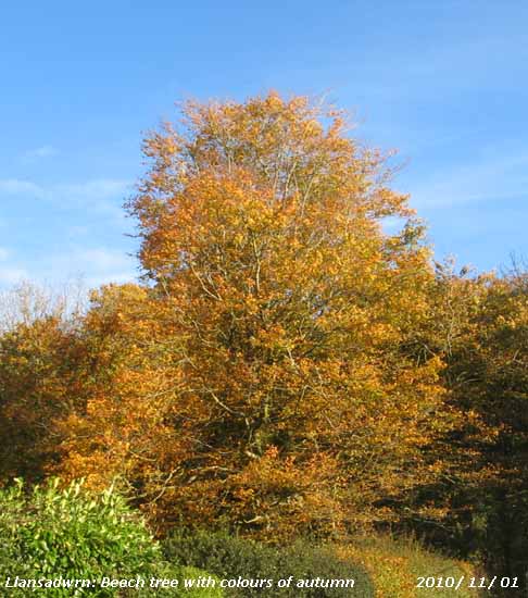
2nd: In contrast to yesterday it was overcast and dull, poor visibility with a light to moderate SW'ly wind and slight rain. Complex lows 969 mb over Iceland and an occluded front just to the NW resulted in a sunless day. There was moderate to heavy rain from noon to 1700 GMT and after respite until 2000 GMT more rain through to 2100 GMT ending in a downpour. Soon after the sky began to clear. [Rain 16.2 mm; Max 12.6C; Min 7.5C; Grass 7.5C]
 3rd: Some clear sky with stars shining brightly just after midnight, but keeping mild with an overnight minimum not falling below 8.6C. Overcast again and under a uniformly grey stratus there was a misty view of the mountains with cloud on the lower slopes. There was intermittent light to moderate rain through the morning turning to drizzle, heavy at times, in the afternoon, petering out by 16 GMT. Remaining overcast and sunless the temperature began to rise at 1500 GMT by 3.5C, as warm moist air arrived on a warm front, reaching over 13C. With soil moisture approaching saturation in some places several local fields had standing water in gateways and a few had pools of water appearing. Cattle are still on well drained fields adjacent to the weather station, but now the weather has turned wetter I expect they will be soon housed for the winter. Another sunless day. The temperature kept over 13C during the night with further spells of light rain from 2000 GMT. {Rhyl 15.1C Capel Curig 17.6 mm, Valley 0.0h} [Rain 7.9 mm; Max 13.6C; Min 8.6C; Grass 6.4C]
4th: A spell of rain from 0600 to 0700 GMT then a very dull morning with mist and occasional slight drizzle. Pressure was 1012 mb with complex lows 993 mb lying to the NW while pressure was high 1033 mb from Iberia to Italy. We were still in the strong warm W'ly airflow with the jetstream well established over Britain. Winds had reached gale force 8 in exposed places on the Lleyn Peninsula, at Aberdaron mws was 43 mph at 06 GMT. The temperature at 09 GMT was 13.6C, the highest of the past 24-h, rising to 14.0C that was to be the highest of the month. The SW'ly kept at about force 5 and keeping dull with poor visibility into the afternoon. Rain was moderate to heavy at times between 1400 and 1600 GMT. Colourful beech leaves continue to pile up around the garden and roadsides, they were not blowing away as they were wet. {Hawarden 18.3C, Keswick 53.2 mm, Lake Vyrnwy 35.8 mm, Manston 5.1h, Valley 0.0h} [Rain 8.3 mm; Max 14.0C; Min 9.4C; Grass 9.1C]
5th: A little broken cloud in the night, but the sky was overcast in the morning, . some altostratus was thin enough for the sun to be seen looming through at 09 GMT. The temperature had kept close to the maximum 14C through the night until 0500 GMT then under a weak cold front had began to fall to the minimum 9.8C highest of the month. Remaining overcast the temperature rose from 11.1C at 09 GMT to 12.3C around noon. With the temperature slowly falling again in the afternoon there were spells drizzle and light rain from 15 to 17 GMT turning to slight showers later. A sunless day. {St Athan 14.5C, Liscombe 26.4 mm, Sennybridge 17.8 mm, Valley 0.0h} Rain 2.3 mm; Max 12.3C; Min 9.8C; Grass 8.3C]
6th: A fine and sunny morning with the temperature down to 4.6C at 09 GMT (dewpoint 3.8C). Smoke was drifting from the NW and the sky was very blue; although slightly hazy looking towards the sun visibility was very good. There were some small cumulus clouds over the Snowdonia Mountains and a few altocumulus elsewhere soon disappeared. Pressure was 1019 mb with frontal cloud over Scotland and S England. A sunny morning turning cloudier by afternoon and with thicker cloud arriving by 1615 GMT some spots of rain. Continuous rain from 1645 GMT becoming moderate then heavy from 2030 to 2115 GMT. Precipitation for the 24-h ending 09 GMT on the 7th was 20.2 mm, largest of the month. [Rain 20.2 mm; Max 11.4C; Min 4.6C; Grass 2.1C]
7th: Rain eased by 02 GMT then turning colder moderate to heavy shower of snow pellets at 0345 GMT. Snow had fallen on the Snowdonia Mountains and was lying at 1500 ft on the Carneddau, from Drum to Carnedd Llewelyn and lying moderately thickly on slopes of Carnedd Dafydd with sprinkling further W on the tops around the Llanberis Pass. With cloud clearing it was a sunny morning. Pressure was 1013 mb in a ridge of high-pressure from mid-Atlantic high 1041 mb. Deepening low 968 mb between Greenland and SW Iceland was heading for NW Scotland, fronts and strengthening winds were likely to reach us by midnight. A bright afternoon with some sunshine, but the wind was strengthening. During the evening pressure was falling rapidly setting off the Oregon storm alarm about 2200 GMT when pressure was 986 mb. Pressure continued to fall with the S'ly wind (force 8/9) making a racket in the trees. The hours up to midnight saw Valley reporting mean wind speed of 48 mph (force 10) with a peak gust of 65 mph. [Rain 1.7 mm; Max 10.3C; Min 3.2C; Grass 2.5C]
8th: At midnight pressure had fallen to 978 mb and storm force winds continued to batter. At Valley a mws 52 mph was reported and on Snowdon 77 mph (hurricane force 12) with gusts of 106 mph were reported at 0155 and 0215 GMT. At Gorwell Heights in Llanfairfechan violent gusts off the mountains destroyed a greenhouse, bending the aluminium frame hurling and breaking several sheets of toughened glass over 10 m, and also removed a ridge tile from a house. Pressure was still falling at 09 GMT reaching a low 965 mb, but the wind had dropped and was almost calm with the low moving more slowly over the Irish Sea. A near record low pressure for |November of 963 mb was around 1500 GMT. The morning was fine with sunny spells before showers moved in bringing some rain by noon. Spots of rain continued intermittently during the afternoon with the wind picking up again by evening. [Rain 1.1 mm; Max 11.6C; Min 4.3C; Grass 3.3C]
9th: A windy morning the N/NE'ly blowing force 6/7 across the fields bending tall trees and removing leaves. A few breaks were evident in the cloud and visibility was good, but hazy with cloud on the mountaintops. Pressure was 982 mb and the morning brightened with a little sunshine. Dark convective clouds moved across the sky in the afternoon, it kept dry here but there was a prolonged shower in Caernarfon around 15 GMT this falling as snow above 2000 ft on Snowdon. Later the cloud lifted from the summits revealing fresh snow mostly on the West of the range. [Rain 0.0 mm; Max 8.6C; Min 3.3C; Grass 0.9C]
10th: A brief respite from the winds today as we were in a ridge between low-pressure of 999 mb. There were a few breaks in the cloud and with slight variable breezes or calm it was a pleasant morning as sunny spells developed. The temperature was 4.6C (dewpoint 0.4C) and this rose to 7.5C just after noon. The afternoon was sunny with clear sky overhead at times. The variable breeze started to pick up later and by 21 GMT had settled to a S'ly force 5/6. The reason was another deep low 957 mb S of Iceland at 18 GMT following a similar track to the last, heading four way. A clear evening with the temperature at 1830 GMT falling to 4.3C. This was a low as it would go as an associated warm front over Ireland brought cloud and rising temperatures in the hours before midnight. [Rain 6.8 mm; Max 11.8C; Min 4.3C; Grass 3.0C]
11th: At midnight the deepening low was 951 mb, the Oregon storm alarm sounded at 03 GMT as pressure began to fall very rapidly. The was rain from 0130 GMT, moderate to heavy at times, to 0730 GMT. At 06 GMT the low was lying to the NW off Malin Head 947 mb and at 09 GMT pressure here was 978 mb. The wind, strong at times through the night was SW force 5. In Kent the Port of Dover was closed for a time delaying ferries to France. The Dartford bridge was closed as winds gusted to more than 60 mph
The Met Office issued a severe gale warning for Anglesey at 1025 GMT for the hours 1600 to 0400 GMT. The morning was blustery, but fine with good visibility and sunny spells coming along, pressure fell more slowly to 977 mb and noon and bottomed at 975 mb in the afternoon. The wind strengthened to force 7/8 and a 20 mph speed limit put on the Britannia Bridge, with strong gusts, but it was sunny at times. The Storm force winds during the evening with violent gusts: Snowdon summit gust of 190 mph, Capel Curig 91 mph, Clogwyn Station 89 mph, Aberdaron 81 mph, Holyhead 78 mph, Amlwch and Valley 71 mph. It was a wild night. With the wind roaring in the treetops a slate was blown from the observer's house smashing on the ground just missing his parked car; and twigs and dead branches were being broken from trees while beech nuts were battering the roof and windows. The Cleddau Bridge in Pembrokeshire, and the Britannia Bridge was closed and light traffic diverted via the Menai Suspension Bridge. Nearly 300 high-vehicles were stopped from crossing. Ferry services to Ireland from Holyhead were also cancelled. {Wisley 15.6C, Tyndrum 56.2 mm, Capel Curig 29.0 mm, Pentraeth 0.2 mm, Valley 3.2h} [Rain trace; Max 10.5C; Min 4.3C; Grass 3.0C]
12th: With pressure on 981 mb the gale force wind began to moderate a little after midnight. There was broken cloud cover during the night, but it was mild with the temperature fairly steady and not falling below 8.6C and 7.0C on the grass. The air too was relatively dry with humidity down to 71% at 0230 GMT. After dawn cloud was increasing with 6 oktas at 09 GMT. There was a lot of debris, leaves, twigs,and small branches together with masses of beech nuts on the ground. In the wood a large number of dead branches from the treetops were down. These had fallen because they had been ring-barked by grey squirrels several years ago. There are no greys at the moment having been culled in an attempt to protect the reds. We did have reds here 30-years ago, we are hoping they will return, perhaps along the hedgerows, from those surviving near Pentraeth. There was a moderating strong breeze and being dry I was able to get the ladder out, go on the roof and replace the slate. It was on part of the roof that has shaped (fishtailed) slates and it was necessary to shape up a new one from the usual rectangular ones I have in stock. The day kept dry, but dull the wind lessening all the time. During the evening, about 20 GMT, there was a heavy shower in Benllech, with a little reaching Pentraeth, but it kept dry here. {Exeter AP 14.6C, Eskdalemuir 29.0 mm, Aldergrove 6.7h, Valley 0.7 h} [Rain trace; Max 10.0C; Min 8.6C; Grass 7.0C]
13th: Some clear spells overnight had allowed the temperature on the grass to drop to 1.8C. At 09 GMT pressure 990 mb was rising and there were a few spots of precipitation on the funnel of the rain gauge. A little cloudier than at dawn with cumulus clouds and frequent crepuscular rays looking towards the Snowdonia Mountains. By noon the cloud was lifting from the Carneddau, but Snowdon seemed always to have a cap of cumulus whenever I looked that way. Sunny until about 16 GMT when cloud encroached from the W bringing rain from 1700 to 1900 GMT with showers until 2200 GMT. {Mumbles Hd. 13.3C, Tulloch bridge 29.8 mm, Capel Curig 12.2C, Aberporth 5.3h} [Rain 4.4 mm; Max 11.2C; Min 5.3C; Grass 1.8C]
14th: Almost calm with smoke drift indicating a light air from the north-west. With pressure on 992 mb we were in a slack area of low-pressure, centred on Newcastle on 989 mb, with surrounding frontal systems. The day was bright with sunny spells between showers, generated from slow-moving cumulus clouds, and the occasional rainbow. The convective clouds diminished by the evening that was mostly clear here. [Rain 0.0 mm; Max 9.8C; Min 2.7C; Grass -0.5C]
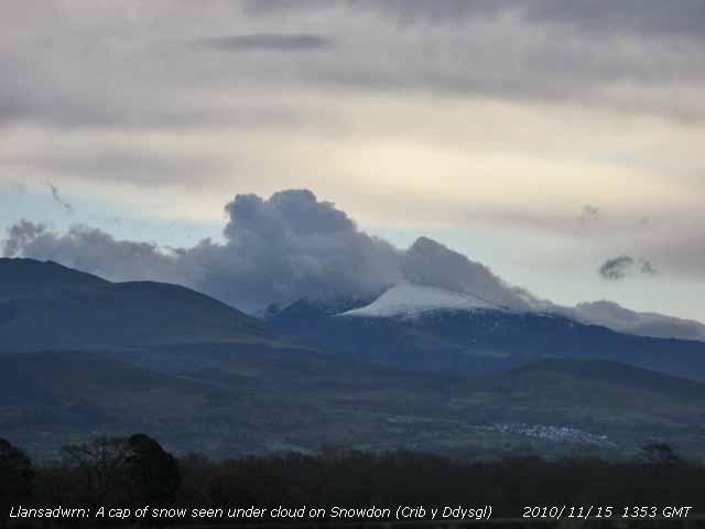 15th: With the clear still weather overnight there was a white frost on the grass (minimum -2.2C) the result of heavy dew freezing. Ice had formed on water and the temperature of soil at 5.0 cm was down to 3.0C. The Met Office had issued a warning of icy surfaces in Wales. No air frost though with the temperature not falling below 2.0C, but it had fallen to -4.4 in Sennybridge in S Wales. A few clouds around, but the mountains were clear although the view was hazy looking into the sun. Pressure had risen to 1011 mb in a minor ridge. The morning was fine and mostly sunny here although cloudier to the NW where a line of precipitation had developed. Duncan Brown reported seeing a waterspout off Llangwnadl on the Lleyn at 1145 GMT lasting 15 minutes. In the afternoon there was snow on the summits of Snowdon (Crib y Ddysgl) and the Carneddau and a very large dark cumulonimbus, with precipitation, was seen slow-moving over NW Anglesey. Thunder was heard at 1330 GMT. The mountains and SE Anglesey kept sunny until showers of rain and ice pellets moving eastward reached here by dusk. Showers ceased by 2100 GMT and the sky cleared. [Rain 6.3 mm; Max 10.2C; Min 2.0C; Grass -2.2C]
17th: A strengthening force 4/5 SSE'ly wind with a nearly overcast sky in the morning, there was a small lee-break in the shelter of the mountains. There was very slight rain falling, but this stopped after a while and the morning brightened with sunny spells developing by afternoon. It kept dry here as we were sheltered from stronger wind and heavy rain affecting SW England {Cardinham 50.2 mm} and S Wales {Mumbles Head 43.2 mm} . In Cornwall St Austell and Lostwithiel were worst affected with deep water flooding houses and causing landslides disrupting train services in and out of the county. Heavy rain in Pembrokeshire caused some flash flooding trapping vehicles and inundating several properties with emergency services kept busy pumping out. Here the sky turned cloudier by 16 GMT, but no rain reached here. {Chivenor 13.0C, Mumbles Hd. 12.5C, Cardinham 50.2 mm, Mumbles Hd. 43.2 mm, Camborne 6.6h, Aberporth 3.5h} [Rain 0.1 mm; Max 10.0C; Min 5.2C; Grass 2.4C]
18th: A bright start to the day with some clouds over the mountaintops and jetstream cirrus from the North overhead. The main jetstream from the W was well to the South. There was a force 3 SE'ly breeze and we were in a lee-clearance, but Valley had been reporting showers since 05 GMT and these arrived spoiling the sunshine just before noon although a small patch of blue persisted on the mainland near Llanfairfechan. The afternoon was bright and mostly dry with just a few spots of rain before a spell of rain arrived towards dusk continuing up to 2015 GMT. {Yeovilton 12.9C, Valley 11.4C, Ballypatrick For. 27.6 mm, Pembrey sands 19.2 mm, Camborne 3.1h, Valley 1.4h} [Rain 6.9 mm; Max 11.0C; Min 5.9C; Grass 3.5C]
19th: Some broken cloud at night with a slight shower of rain at 05 GMT then the sky cleared. At 0730 GMT a small cumulus cloud to the E of C. Llewelyn turned red in the rising sun, but the day was to be brilliantly sunny. Showers were forecast, and although a cumulonimbus was spotted far to the W, and cumulus clouds to the NE over Cumbria, the convective clouds kept well away from here. Pressure 1009.5 mb was rising and the high cirrus overhead at 09 GMT soon cleared. A little misty at first with a few persistent clouds lifting from the mountains except Snowdon by noon. Some very broken snow was hanging on around the summits. Little or no wind all day. {St Catherine's Pt. 13.5C, Trawsgoed 12.1C, Mumbles Hd. 3.6 mm, Aberporth 6.8h} [Rain 0.1 mm; Max 12.3C; Min 4.8C; Grass 0.8C]
20th: An almost clear sky in the morning with a light E'ly breeze. There were some clouds to be seen over Liverpool Bay and a cumulus bubbling over the Lleyn Mountains, but this was probably over Cardigan Bay. There had been a touch of frost on the grass, heavy dew and condensation in the raingauge measured 0.1 mm. Some mist at low levels giving moderate to good visibility, but the mountaintops were clearer in outline. A sunny day with RAF Valley reporting 7.3h sunshine the most in Britain. An occlusion over Scotland and N England moved S during the day and arrived here about 18 GMT bringing some spots of rain then light rain just before midnight. {Milford Haven 10.5C Capel Curig -0.5C, St Athan 3.6 mm, Valley 7.3h} [Rain 3.2 mm; Max 8.5C; Min 3.6C; Grass -0.2C]
![]() 21st: The light rain continued until 0615 GMT then turned to drizzle, but ceased before 09 GMT. Some breaks were appearing in the cloud and with pressure 1017 mb rising some sunshine later in the morning. The afternoon was cloudier with light showers of ice precipitation from 1340 GMT. These were initially of snow grains then turned to small ice pellets and rain. Snow showers were frequent over the Snowdonia Mountains. There was light rain (no ice precipitation) from 1900 GMT until midnight. {Manston 10.2C Valley 7.6C, Durham 10.8 mm, Valley 2.1h} [Rain 2.6 mm; Max 6.4C; Min 3.8C; Grass 0.6C]
21st: The light rain continued until 0615 GMT then turned to drizzle, but ceased before 09 GMT. Some breaks were appearing in the cloud and with pressure 1017 mb rising some sunshine later in the morning. The afternoon was cloudier with light showers of ice precipitation from 1340 GMT. These were initially of snow grains then turned to small ice pellets and rain. Snow showers were frequent over the Snowdonia Mountains. There was light rain (no ice precipitation) from 1900 GMT until midnight. {Manston 10.2C Valley 7.6C, Durham 10.8 mm, Valley 2.1h} [Rain 2.6 mm; Max 6.4C; Min 3.8C; Grass 0.6C]
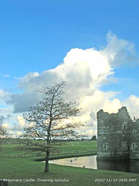 22nd: The sky was starting to clear from dawn with some sunshine during the morning. By noon cumulus clouds were in the vicinity and we had a moderate shower of 3-4 mm ice pellets at 1435 GMT sufficient falling that seeking shelter from gardening duties was necessary. Again there was a pre-shower fall of small ice particles, similar to yesterday. The rest of the day was partly cloudy with a few spots of rain at times. {Murlough 9.9C Valley 8.5C, Rhyl 2.4 mm, Camborne 6.3h Valley 1.9h} [Rain 4.5 mm; Max 8.0C; Min 3.0C; Grass 1.3C]
23rd: Showers of rain from midnight, moderate to heavy at 0630 GMT and with ice pellets at 0850 GMT. Soon the sky began to clear and visibility to improve from poor to moderate to good. Shower clouds remained in the vicinity,like the one seen from Beaumaris Castle, and another shower of rain came over about 10 GMT. Fields near Cremlyn are very wet with pools of standing water and the road to Beaumaris once again partially flooded. Several attempts have been made in recent years to stop surface water accumulating on this road. They have been unsuccessful, the ditches are just not big enough. It was mostly sunny around noon, but the afternoon was cloudier with more showers later. At 1600 GMT there was a moderate shower of rain and ice pellets between 4 and 5 mm. [Rain 4.5 mm; Max 8.1C; Min 4.5C; Grass 2.4C]
![]()
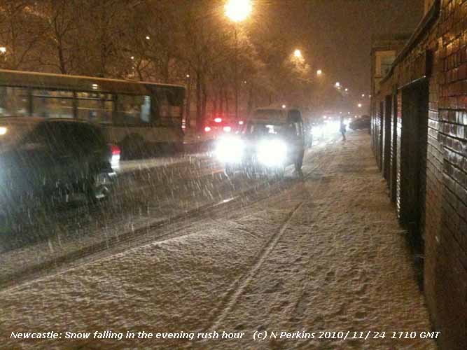 24th: Mostly cloudy at first the sky starting to clear before 09 GMT. There was a light air from the N indicated by smoke drift and the temperature was 2.5C with a dewpoint of 1.5C and a 65% chance of ice precipitation. There were fresh deposits of snow on the Snowdonia Mountains, there has been this month little or no mention of weather and snow in weather forecasts for North Wales, if the weather here was mentioned at all on national radio or television! This is not unusual, but was to change later in the day when snow was forecast for Conwy and Gwynedd. The day kept dry here with sunny spells, turning cloudier as the NE'ly wind strengthened to force 5 later in the afternoon. Snow fell in Scotland and showers along the E coast of England including Newcastle at 1710 GMT where the early snowfall caught out people on their way home. During the evening here there were showers of sleet and later snow pellets and a few small flakes of snow. [Pptn 0.6 mm; Max 6.4C; Min 1.8C; Grass -0.9C]
25th: More wintry showers overnight, with falls of snow pellets at 0120 GMT and a moderate fall between 0128 and 0132 GMT (thanks Evan), with snow pellets still lying on the ground at 09 GMT with the hailometer lightly marked. The temperature was 2.5C, the same as yesterday, but the dewpoint was -0.2C indicating >80% chance of ice precipitation. Snow was lying on the mountains as low as 1000 ft in places with reports of 5 cm in central Snowdonia. We were in a strong showery N'ly air flow, although the wind here and along the Menai Strait was NE'ly being deflected by the mountains. Frequent light showers of snow pellets and small flakes of snow continued during the morning and petered out by the afternoon. Moderate to heavy snowfalls in Scotland and NE England. At Newcastle Airport after waiting to land to allow snowploughing a flight with 189 passengers slightly overshot the runway. Here a partially cloudy sky during the evening allowed a ground frost to occur with the temperature on the grass falling to -3.1C. {Valley 5.3C} [Pptn 4.7 mm; Max 4.2C; Min 1.6C; Grass 0.3C]
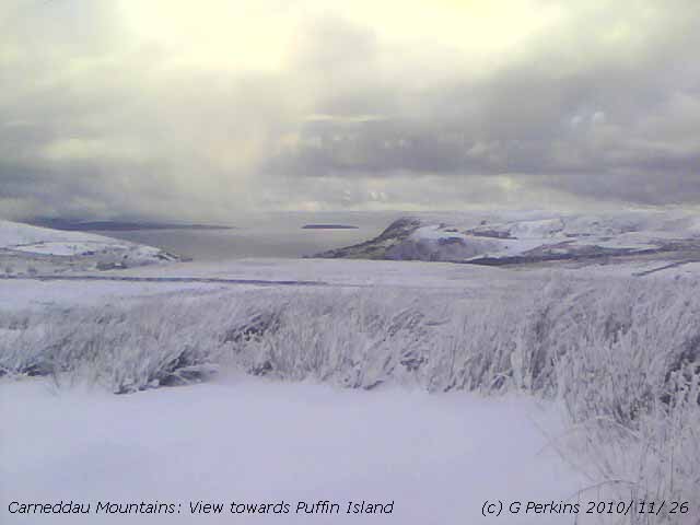
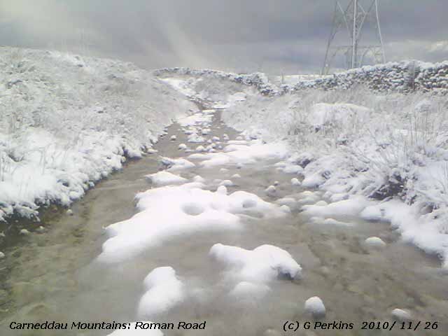 26th: Cloudier from midnight with precipitation, on an occluded front making slow progress eastward, beginning at 0500 GMT. Rain at first turning to sleet then snow from 0825 GMT starting to settle, but soon melting here. Flights between N & S Wales were delayed as, unusually due to ice deposits, the runway at RAF Valley was closed this morning for about 3h. On the mountains, partially obscured because of developing low-level fog, snow was lying at 1000 ft, or below, in places. At 09 GMT the air temperature was 1.0C, dewpoint 0.2C). Showery precipitation, variously sleet, wet snow pellets, dry snow pellets and snow, through the day with the odd sunny spell coming along. There was snow on the A55, particularly Rhuallt Hill, and 3-vehicle crash closed the the A5025 on Anglesey between Amlwch and Cemaes Bay. Significant accumulations of snow on the mountains above 2000 ft, between 5 - 15 cm by the afternoon, when snow was lying as low as 500 ft in places. The day's maximum temperature of 2.8C was the lowest on record in November at this station. {Milford Haven 5.9C, Trawsgoed min -6.7C} [Pptn 3.6 mm; Max 2.8C; Min 0.4C; Grass -3.1C]
27th: After a cold night with the air minimum down to -0.5C, the first air frost of the winter since 11 March. Showers of snow pellets and snow around 0630 GMT left a covering >50% of snow pellets on the ground. Some patches of blue with clouds moving along on the fresh to strong cold NE'ly breeze. The mountains looked very white with snow down to 350 ft, with some drifting at higher levels, and there was a covering of icy deposits on Rhosneiger beach. The temperature at 09 GMT was 1.6C, dewpoint -2.5C, rising to only 2.4C around noon, now the lowest maximum in November on record here, as sunny spells developed with a few fair-weather cumulus clouds to the South. The afternoon was cloudier with orographic 'cloud streets' forming over S Anglesey clearly seen on the MODIS AQUA satellite image below left. The image uses channels 7-2.1 and shows snow cover (and some colder cloud tops) coloured blue. The image of snow cover in northern Britain

![]() shows the wide extent of snow in SW Ireland, E England, the Midlands and S Scotland. Keeping fine here the sky was partially cloudy by evening as the temperature plunged. [Pptn 0.4 mm; Max 2.5C; Min -0.5C; Grass C]
shows the wide extent of snow in SW Ireland, E England, the Midlands and S Scotland. Keeping fine here the sky was partially cloudy by evening as the temperature plunged. [Pptn 0.4 mm; Max 2.5C; Min -0.5C; Grass C]
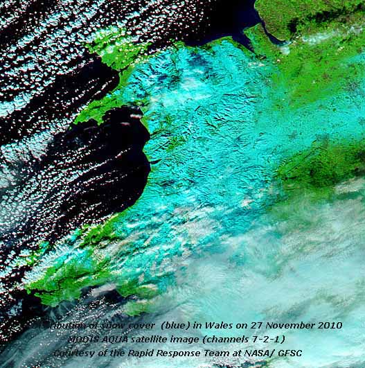 28th: Very cold overnight the air minimum fell to -4.1C lowest of the month, and on the grass to -7.9C, both temperatures lowest on record in November at this station. A moderate shower of snow pellets at 0525 GMT and were still lying covering the cold ground in the morning. The sky was clearing and at 0800 GMT there was a fall of ice crystals, from clear sky overhead; there were cumulus in the vicinity and towering cumulus to the NE over Liverpool Bay/ Cumbria and over the Irish Sea West of Anglesey. The morning was sunny, visibility was very good and the snow on the mountains was showing up brilliantly white against the blue, almost cloudless sky by noon with the temperature rising to 3.9C. Mostly sunny with convective clouds persisting well away over the Irish Sea and Liverpool Bay. A clear sky after dark and once again temperatures were falling. [Pptn 0.0 mm; Max 3.9C; Min -4.1C; Grass -7.9C]
29th: Very cold again overnight the air temperature -4.0C and on the grass -8.4C this taking the record for the lowest in November. No precipitation in the past 24-h, but there was 0.15 mm of frost deposition measured. A sunny morning with yesterday's snow pellets unchanged on the ground, even on the Stevenson screen roof, though slightly melted yesterday, they were still there. Soil temperatures are falling quickly, at 5 cm soil was frozen at -0.2C and at 10 cm it was 0.7C. Lower depths are also falling it being 5.5C at 50 cm and 8.2C at 100 cm. Some moderately high cloud in the vicinity at first, a few small cumulus seen over the mountains and well-developed out over Liverpool Bay. Visibility was good, but in the bright sunshine of recent days smoke haze had increased ![]() , but lessened in the afternoon
, but lessened in the afternoon ![]() . Good views of the Snowdonia Mountains were seen later, the rocky outcrops being dramatically outlined in the snow
. Good views of the Snowdonia Mountains were seen later, the rocky outcrops being dramatically outlined in the snow
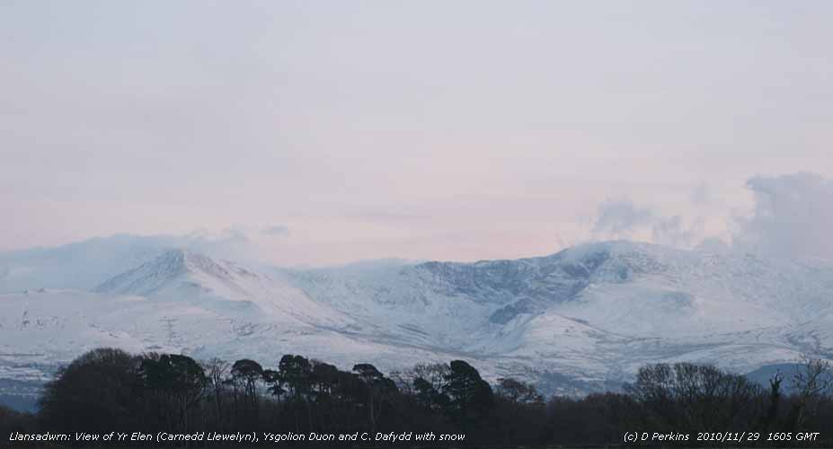 Before dusk some cloud began to form around the summits and in the Nant Ffrancon Pass. The day's maximum temperature was 2.3C, the lowest in November on record here. The evening was clear at first with air and grass temperatures below zero. Later temperatures rose as cloud encroached. [Pptn 0.7; Max 2.3C; Min -4.0C; Grass -8.4C]
30th: There was a spell of wet snow from 0500 to 0630 GMT leaving a slight covering on concrete and tarmac surfaces. A mostly cloudy morning with a few flakes of snow seen at 09 GMT; snow was falling on the mountains with fresh snow as low as 250 ft near Aber ![]() (the highest foreground in the photo is 300 ft). The temperature was 1.5C (dewpoint -0.4C), pressure was 1019 mb and rising and there was a freshening moderate ENE'ly wind. Visibility was good, but there was low cloud obscuring the mountaintops. Fresh snow was lying as low as 350 ft on the lower slopes of the Carneddau. Some sunny spells came along before noon. Cloudier in the afternoon with less sunshine, but kept fine. The maximum temperature for the second day reached 2.3C, the lowest on record in November. Partially cloudy early in the evening clouds increasing by midnight. [Pptn 0.5 mm; Max 2.3C; Min -1.6C; Grass -5.5C]
(the highest foreground in the photo is 300 ft). The temperature was 1.5C (dewpoint -0.4C), pressure was 1019 mb and rising and there was a freshening moderate ENE'ly wind. Visibility was good, but there was low cloud obscuring the mountaintops. Fresh snow was lying as low as 350 ft on the lower slopes of the Carneddau. Some sunny spells came along before noon. Cloudier in the afternoon with less sunshine, but kept fine. The maximum temperature for the second day reached 2.3C, the lowest on record in November. Partially cloudy early in the evening clouds increasing by midnight. [Pptn 0.5 mm; Max 2.3C; Min -1.6C; Grass -5.5C]
December
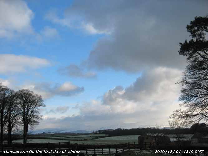 1st: A prolonged snow shower just after midnight deposited 2.5 cm (cold surface) of dry loose snow with snow lying about 1.5 cm on the grass at 09 GMT. Snow was lying at sea level and along the sides of A55 on Anglesey, the treated surface was clear. In a light to moderate NE'ly breeze the temperature was -0.5C (dewpoint -2.9C); there were recent and current flurries of snow and snow pellets. Snow had deposited on the still-flowering Salvia gregii
 ![]() , usually this will go on to flower until Christmas, and had formed comical white hats on the dead heads of Teasel
, usually this will go on to flower until Christmas, and had formed comical white hats on the dead heads of Teasel ![]() . It was cold enough for icicles too, this one 20 cm long had formed from water leaking from a rainwater gutter
. It was cold enough for icicles too, this one 20 cm long had formed from water leaking from a rainwater gutter ![]() . Soon brightening with a little weak sunshine the showers dying out. Some sunny spells around noon with a maximum temperature of just 1.2C, then cloudier by 1430 GMT and a shower of wet snow pellets at 1745 GMT whitened the ground where the snow had melted through the day. [Pptn 0.1 mm; Max 1.3C; Min -1.2C; Grass -2.8C]
. Soon brightening with a little weak sunshine the showers dying out. Some sunny spells around noon with a maximum temperature of just 1.2C, then cloudier by 1430 GMT and a shower of wet snow pellets at 1745 GMT whitened the ground where the snow had melted through the day. [Pptn 0.1 mm; Max 1.3C; Min -1.2C; Grass -2.8C]
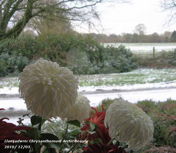 2nd: Snow was lying at low levels on the mainland and there were recent showers of snow pellets. At the weather station and adjacent field there was 1.0 cm of lying snow (60%) cover. At 09 GMT, during observations, there was a moderate squall (from the NE) with snow pellets and snow thrown in, the precipitation covering the ground. Good visibility reduced to poor for a while. The temperature was 1.3C, highest of the past 24-h, with a dewpoint of -2.2C. The day had frequent showers of snow pellets and snow with bright and sometimes sunny spells. The evening was mostly clear with temperatures falling soon crisping up the deposits of ice on the ground. [Pptn 0.1 mm; Max 1.3C; Min -0.5C; Grass -1.9C]
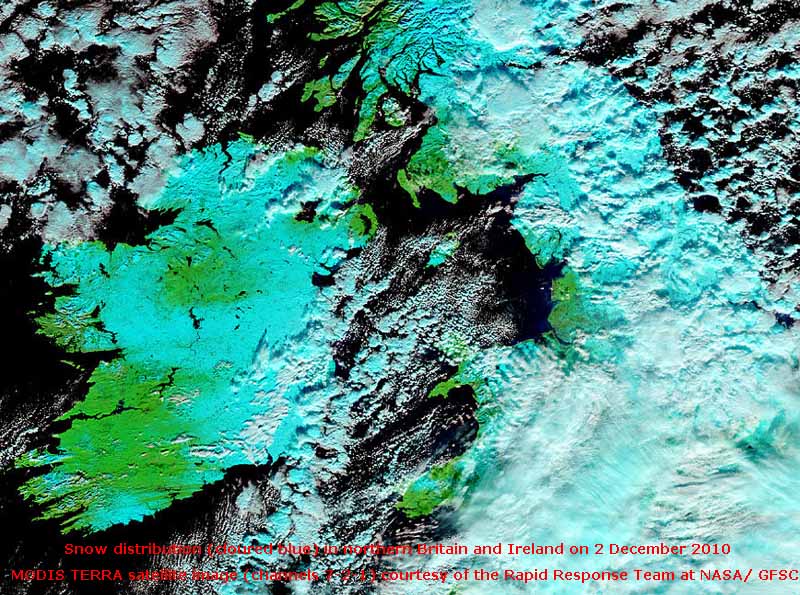 3rd: A spell of snow around midnight left a light covering 0.5 cm on the ground in the morning. Concrete, bare soil and colder surfaces were completely covered with 1.0 cm snow. The grass in the fields looked variably white (70%) with green showing through in places. With the wind a light S'ly a band of snow showers moved in off the Irish Sea reaching here about 0830 GMT bringing continuous slight snow for over an hour. The temperature was -0.8C, dewpoint -2.3C) currently snowing. A frontal system on the W coast of Ireland was tracking E. After the snow the morning was occasionally bright with a little sunshine before turning cloudier again by 1500 GMT when it began to rain. The sleety rain was moderate to heavy from 1800 to 2000 GMT under a wavy slow-moving occluded front off the Irish Sea. [Pptn 5.5 mm; Max 2.9C; Min -4.2C; Grass -7.7C]
4th: Light rain under a leaden overcast sky. At 09 GMT the temperature had crept up to 2.9C, the highest of the past 24-h. It was calm and relative humidity was 100%. There was to be zero evaporation measured by the Piche evaporimeter in the next 24h. The ground was frozen hard and there were remnants of ice precipitation; concrete was icy. Visibility was good, but the view of the mountains under the moderately high cloud was misty over the lying snow. The day was sunless, but the sky started to clear during the evening. [Pptn 6.3 mm; Max 3.7C; Min -0.8C; Grass -1.2C]
5th: Frequent showers of rain and small clear ice pellets (< 2 mm ) from 01 GMT had frozen on the ground by the morning. There was a glaze of ice and it was very slippery on untreated surfaces. The sky continued to clear over Anglesey leaving a line of cumulus clouds over the Snowdonia Mountains where more snow had accumulated overnight It was a fine day with light generally N'ly breezes and a little sunshine. The sky was clear by evening and temperatures were again dropping. [Pptn 0.0 mm; Max 5.1C; Min -0.5C; Grass -3.6C]
6th: Clear sky, little wind and a hard frost overnight with ice crystals (hoar frost) on tall vegetation. The fields looked very white with frozen dew and hoar and the mountains stunning with large accumulations of snow on the summits. The temperature at 09 GMT was -2.3C, in the Pentraeth frost-hollow it had fallen to -4.9C. A sunny morning with hardly a cloud in the sky and calm or variable light airs and good or very good visibility with slight smoke haze. In the afternoon a line on convergent cloud to the West encroached. [Pptn 0.0 mm; Max 5.1C; Min -2.9C; Grass -6.6C]
7th: There was little or no wind with a hole in the moderately cloud overhead at 09 GMT with the temperature on 0.3C. There was light rain on the W coast, here sleety precipitation from 0515 to 0530 GMT had left a frozen deposit on the ground and vegetation. Snow on the mountains was lying at 1500 ft with heavier deposits over 2500 ft, patches as low as 350 ft with slight fresh snow. The mountaintops were clear at first and in places mist could be seen forming over the snow. A cloudy day, as a detached slow-moving occluded front moved S over Anglesey, with occasional weak sunshine seen briefly early and late. The evening partly cloudy at first, with light airs, clearing before midnight. [Pptn trace; Max 1.8C; Min -2.4C; Grass -5.5C]
8th: Mostly clear sky overnight with air (-0.7C) and ground frosts (-4.2C). There was a recent fall of small snow pellets lying on the hard frozen ground and cold surfaces. Remnants of icy precipitation remained, but there was little frozen dew. A few fair weather cumulus clouds appeared moving across on the light NE'ly breeze, then disappeared to give a sunny somewhat hazy morning. A few clouds formed over the mountaintops in the afternoon when there was a hazy view. [Pptn 0.0 mm; Max 3.5C; Min -0.7C; Grass -4.2C]
9th: A frosty night and turning cloudier from dawn. Slight remnants of ice precipitation remained, the ground still frozen hard. Soon some sunny spells and with the temperature from 2.0C at 09 GMT to 7.6C gnats were seen around the garden. A mostly fine afternoon although there were a few spots of drizzle. Snow on the mountains had thinned and was disappearing at lower levels although patches remained. Overcast with a few more spots of rain during the evening with the temperature 5.5C at 22 GMT. [Pptn 0.1 mm; Max 7.6C; Min -1.1C; Grass -5.2C]
10th: A mild night under a blanket of cloud with the air temperature keeping over 5.5C. The sky was a uniform grey colour there was good visibility. The ground had softened, but felt hard underfoot on grass. It was a dull and damp morning and the afternoon remaining overcast had a few spots of drizzle at times. The day was sunless, but there was some colour in the sky when the setting sun illuminated the still cloudy sky. The evening was overcast and damp with little or no wind. [Pptn 0.5 mm; Max 7.2C; Min 2.0C; Grass 0.10C]
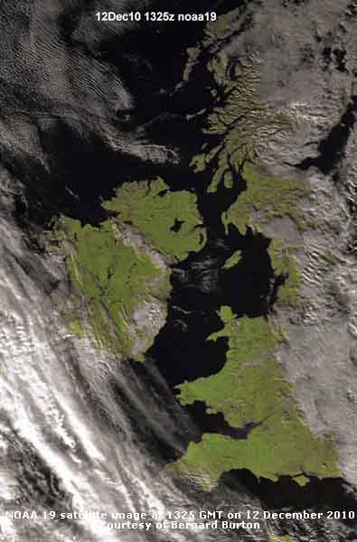 11th: Overcast with low uniform grey stratus the mountaintops obscured. Overnight little variation in temperature, the minimum 5.9C. Remnants of a slow-moving weather lay from N Ireland across Anglesey to E Anglia. The day remained dull and sunless, but dry. During the evening breaks appeared in the cloud and there was clear sky overhead by midnight. [Pptn 0.0 mm; Max 7.7C; Min 5.9C; Grass 5.0C]
12th: With clear sky the air temperature had fallen to 1.9C and there was a touch of ground frost (-0.8C) the grass looking white at dawn, but had mostly disappeared by 09 GMT. Visibility was good, with haze smoke haze at low levels and clear enough to see broken snow on the mountaintops. High pressure, 1030 mb over the Western Isle, stretched from Iceland to Wales and here was 1027 mb. The jetstream and frontal cloud lay over the North Sea while more fronts, associated with Atlantic-lows, were kept well away resulting in a clear sunny day for much of western Britain (see NOAA satellite image left). A similar image from MODIS AQUA satellite using channels 7-2-1 ![]() shows the distribution of snow, coloured blue contrasting with the mostly white clouds. During the evening cloud encroached from the East, but not before there was a ground frost. [Pptn trace dew; Max 6.2C; Min 1.9C; Grass -0.8C]
shows the distribution of snow, coloured blue contrasting with the mostly white clouds. During the evening cloud encroached from the East, but not before there was a ground frost. [Pptn trace dew; Max 6.2C; Min 1.9C; Grass -0.8C]
13th: Mostly cloudy and damp with dew on the funnel of the raingauge. Overnight the air temperature had fallen to 0.1C and at 09 GMT was 2.2C (dewpoint 0.3C). There were still some remnants of ice precipitation on the ground, and bare soil and grass underfoot frozen hard. The day was mostly cloudy and dull, the moderately high altostratus leaving the mainland mountaintops in the clear, persisting into the afternoon. After dark there were some clear patches and I was lucky to see the flare of a GEMINID meteor at 2200 GMT. [Pptn 0.0 mm; Max 4.4C; Min 0.1C; Grass -4.2C]
14th: Clear sky over the station at 09 GMT with a little over the mountaintops and to the north-east. With a touch of air frost and on the grass the temperature down to -3.3C, there was moderate frozen dew that looked slightly white across the fields. All remnants of previous ice precipitation, even in shady areas, had disappeared. Visibility was good with moderate smoke haze. Within an hour the sky was cloudier, as a decaying cold front encroached, remained overcast and dry for the rest of the day Little or no wind through the day and into the evening and night. [Pptn 0.0 mm; Max 5.8C; Min -0.1C; Grass -3.3C]
15th: Mostly cloudy overnight with the air temperature keeping up to a low of 1.2C and no ground frost since the morning of the 14th. There was a light N breeze and with relative humidity 81% the grass was unusually free of dew and dry. The cloud was moderately high just touching some of the mountain summits. Becoming dull, but dry through the day until 1700 GMT when there was drizzle, sometimes heavy, until 2030 GMT. [Pptn 0.9 mm; Max 6.8C; Min 1.2C; Grass -2.5C]
![]() 16th: Overcast at first after a mild night, the temperature at 09 GMT was 6.8C (dewpoint 6.1C). Pressure 1014 mb was falling and the wind was a moderate NNW'ly. At 1000 GMT there was a heavy burst of rain and the morning continued with brief sunny spells with bright rainbows with showers in the vicinity. On the mountains large snow patches were persisting at 750 ft near Aber, but the tops were obscured initially with the cloudbase at 1200 ft. Temperature fell during the day and at 1620 GMT there was a moderate shower of snow pellets here that covered the ground, and on the mountains ice precipitation and snow showers were frequent during the afternoon. Some broken sky after dusk with another moderate shower of snow pellets and snow at 2345 GMT. [Pptn 15.9 mm; Max 7.1C; Min 4.1C; Grass 3.8C]
16th: Overcast at first after a mild night, the temperature at 09 GMT was 6.8C (dewpoint 6.1C). Pressure 1014 mb was falling and the wind was a moderate NNW'ly. At 1000 GMT there was a heavy burst of rain and the morning continued with brief sunny spells with bright rainbows with showers in the vicinity. On the mountains large snow patches were persisting at 750 ft near Aber, but the tops were obscured initially with the cloudbase at 1200 ft. Temperature fell during the day and at 1620 GMT there was a moderate shower of snow pellets here that covered the ground, and on the mountains ice precipitation and snow showers were frequent during the afternoon. Some broken sky after dusk with another moderate shower of snow pellets and snow at 2345 GMT. [Pptn 15.9 mm; Max 7.1C; Min 4.1C; Grass 3.8C]

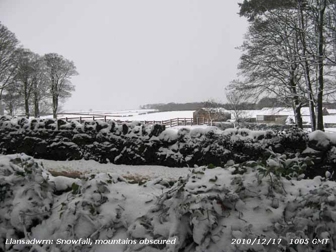 17th: Snow pellets at 1243 GMT (reported by Evan) and almost continuous snow overnight left an average of 12 cm of dry and crisp lying snow and 15.9 mm of melted snow was measured in the gauge at 09 GMT. The temperature was -1.5C (dewpoint -2.1C) and showery precipitation, variously snow grains, small snow pellets and snow continued through the morning. The density of snow, sampled from a cold surface, was 118 kg m-3 . Snow continued to accumulate in SE Anglesey and the Bangor area of Gwynedd, there was another 5 cm on the snow board and a level 17 cm on the grass at 1300 GMT.
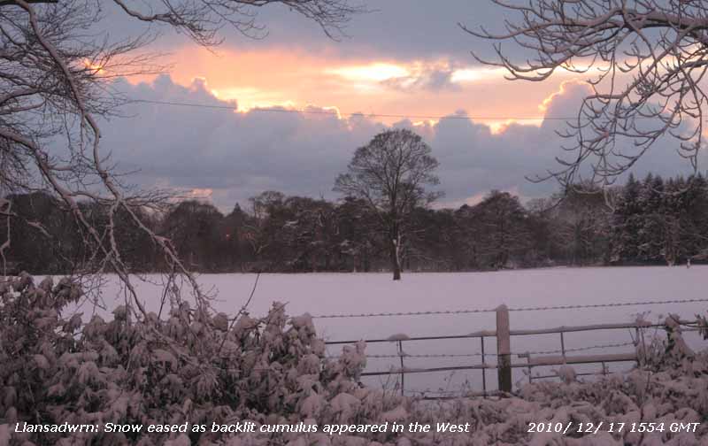 The observer's car was going nowhere today
 ![]() , the road at the weather station was only passable to 4-wheel drive vehicles
, the road at the weather station was only passable to 4-wheel drive vehicles ![]() and, a reporter on the R4 BBC News said the Britannia Bridge was closed because of snow and ice. In Upper Bangor traffic was at a standstill on Holyhead Road. The A55 between Llandegai and Anglesey was hazardous, with stationary traffic and a 2-hour holdup reported. The road past the Antelope Inn at the Suspension Bridge looked impassable with a vehicle stuck in deep snow up the hill, and another crashed into a wall downhill. Snow was heavy also in Llanberis with no traffic moving on the roads. Further light showers of small snow pellets and snow in the afternoon with the depth of powder snow creeping up to 19 cm at 1500 GMT. Snow eased off later with some backlit cumulus clouds seen in the West. At 1630 GMT traffic was backing up 8 miles between Penmaenmawr and Llandegai and other roads were reported as being extremely hazardous as dusk approached. It was an ice-day here (24-h 09 - 09 GMT) with the maximum temperature just -0.8C, lowest since 1987 (-2.3C), falling to -2.0C at 1900 GMT. [Pptn mm; Max -0.8C; Min -1.8C; Grass C]
and, a reporter on the R4 BBC News said the Britannia Bridge was closed because of snow and ice. In Upper Bangor traffic was at a standstill on Holyhead Road. The A55 between Llandegai and Anglesey was hazardous, with stationary traffic and a 2-hour holdup reported. The road past the Antelope Inn at the Suspension Bridge looked impassable with a vehicle stuck in deep snow up the hill, and another crashed into a wall downhill. Snow was heavy also in Llanberis with no traffic moving on the roads. Further light showers of small snow pellets and snow in the afternoon with the depth of powder snow creeping up to 19 cm at 1500 GMT. Snow eased off later with some backlit cumulus clouds seen in the West. At 1630 GMT traffic was backing up 8 miles between Penmaenmawr and Llandegai and other roads were reported as being extremely hazardous as dusk approached. It was an ice-day here (24-h 09 - 09 GMT) with the maximum temperature just -0.8C, lowest since 1987 (-2.3C), falling to -2.0C at 1900 GMT. [Pptn mm; Max -0.8C; Min -1.8C; Grass C]

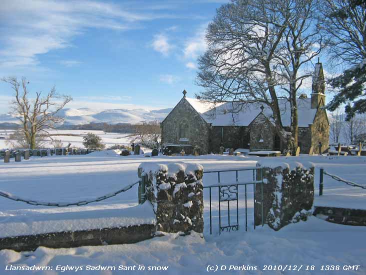 18th: A further 10 cm of snow had accumulated on the snow board since 09 GMT yesterday while lying snow on grass averaged 21 cm. The temperature at was -1.8C and there were occasional flurries of snow. Pressure was a low 998 mb centred near Llansadwrn. The sky started to clear and by 1030 GMT there was bright sunshine with some advection fog developing over the snow in light SW'ly breezes. The scene looked very alpine with powdery snow clinging to trees and bushes through the day and changing little on the ground. The afternoon was mostly sunny with convective clouds seen to the north-west keeping clear. Views across Anglesey and towards the mountains were stunning in the sunshine. Level snow lay up to 23 cm deep on fields in the vicinity, there was no drifting. A salt-gritter made passes on the road and there was a little more traffic, mainly 4x4's. A fuel oil delivery vehicle became stuck on the drive at Gadlys and a farm tractor was deployed to move it. For the second day there were no postal or courier deliveries. As the sun began to set the temperature, that had struggled to reach 1.1C even in sunshine, began to fall rapidly and by 1900 GMT was -4.0C. With 22-0 h below zero it was not quite an ice-day. [Pptn trace mm; Max 1.1 C; Min -2.5C; Grass -6.5C]

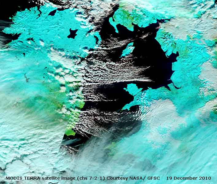 19th: Looking much the same on the ground with 100% snow cover, very cold, but sunny. The 'snow minimum' temperature was -12.2C, lowest in December since before 1985, beating -11.3 recorded in 1985. The air temperature -5.3C was lowest since 1995 (-5.7C), in the frost-hollow of Pentraeth it went down to -9.7C. Some thin cloud around with cumulus seen to the north-east, S of the mountains in the West. There was a light ENE'ly breeze. The temperature under snow at 5 cm is falling slowly, this morning it was 1.2C while at 100 cm deep falling very slowly it was 6.2C. A mostly sunny day in coastal areas bordering the Irish Sea including Anglesey with clouds mainly around the periphery. The MODIS TERRA satellite image (courtesy of RRT: NASA/ GFSC) using channels 7-2-1 shows snow in blue and clouds white. Although sunny it was another ice-day as the temperature failed to rise above freezing inside the Stevenson screen. There was some melting of snow around the house in the sun with icicles dripping, not so in the shade. As the orange coloured sun set diffusely behind cloud in the W the temperature was already down to -3.5C. With a clear sky the nearly full moon illuminated the snow brilliantly. [Pptn trace; Max -1.0C; Min -5.3C; Grass -12.2C]
20th: Clear sky overnight and exceptionally cold with records shattered. Air minimum temperature down to -9.0C, lowest any month since I started recording here in 1979. The 'snow minimum' fell to -13.3C, again lowest of my records. Some cloud at first, with a snow shower brushing NW Anglesey, then clearing to give a sunny but cold day with sub zero temperature (-2.0C). Snow cover still 100%, little change in snow on trees and bushes, some icicles have formed on them and were sparkling in the sunshine. 'Ice diamonds' were glinting on snow surface that, although somewhat compacted, was still powdery and dry. A diffuse orange sunset and a beautiful twilight leading to another cold night with clear sky and a full Moon. Another ice-day. [Pptn 0.1; Max -1.2C; Min -9.0C; Grass -13.3C]
![]() 21st: Cloud encroached during the night and the temperature began to rise reaching a maximum for the past 24-h of -1.2C at 09 GMT. There was no chance of seeing either the Lunar eclipse or the sun rising over the Carneddau on the Winter Solstice. There had been recent falls of star-like ice crystals (similar to those seen on 9th January), snow pellets and very small flaked snow. These could be seen freshly deposited on cleared frozen ground, black buckets and the frost pads. Cover of the still loose 'dry' snow was 100% with an average depth over grass of 13 cm, but the density after settling had increased to 143 kg m-3 . Flurries continued a while then died out, but had resumed by noon, as the temperature reached a maximum of -0.5C, and turned to moderate snow by 1300 GMT, again poorly forecasted by the MO, and by 1500 GMT there was 3 cm of fresh snow accumulated on the snow board. Snow continued to fall reducing towards dusk. Roads were once again reported hazardous including the A55 from Aber to Holyhead, SE Anglesey and around Amlwch. The mountain road to Pen y Pass on Snowdon was blocked. Earlier it was necessary to close the the Penmaenbach Tunnel westbound to remove potentially dangerous icicles that had formed inside. No postal deliveries again here for the 5th day, unprecedented in the last 50 years due to the weather. In Llanfairfechan residents had to collect their accumulated mail on foot from the Town Hall. Further showers of small snow pellets, especially at 1815 GMT which were rolling off the snow covered house roof and piling up on the ground, then continuous light snow during the evening brought the depth of fresh on the snow board to 8 cm at 2200 GMT. Another ice-day temperatures keeping below zero for 24-h. It was still snowing at midnight. [Pptn 14.6 mm; Max -0.5C; Min -7.0C; Grass -12.7C]
21st: Cloud encroached during the night and the temperature began to rise reaching a maximum for the past 24-h of -1.2C at 09 GMT. There was no chance of seeing either the Lunar eclipse or the sun rising over the Carneddau on the Winter Solstice. There had been recent falls of star-like ice crystals (similar to those seen on 9th January), snow pellets and very small flaked snow. These could be seen freshly deposited on cleared frozen ground, black buckets and the frost pads. Cover of the still loose 'dry' snow was 100% with an average depth over grass of 13 cm, but the density after settling had increased to 143 kg m-3 . Flurries continued a while then died out, but had resumed by noon, as the temperature reached a maximum of -0.5C, and turned to moderate snow by 1300 GMT, again poorly forecasted by the MO, and by 1500 GMT there was 3 cm of fresh snow accumulated on the snow board. Snow continued to fall reducing towards dusk. Roads were once again reported hazardous including the A55 from Aber to Holyhead, SE Anglesey and around Amlwch. The mountain road to Pen y Pass on Snowdon was blocked. Earlier it was necessary to close the the Penmaenbach Tunnel westbound to remove potentially dangerous icicles that had formed inside. No postal deliveries again here for the 5th day, unprecedented in the last 50 years due to the weather. In Llanfairfechan residents had to collect their accumulated mail on foot from the Town Hall. Further showers of small snow pellets, especially at 1815 GMT which were rolling off the snow covered house roof and piling up on the ground, then continuous light snow during the evening brought the depth of fresh on the snow board to 8 cm at 2200 GMT. Another ice-day temperatures keeping below zero for 24-h. It was still snowing at midnight. [Pptn 14.6 mm; Max -0.5C; Min -7.0C; Grass -12.7C]
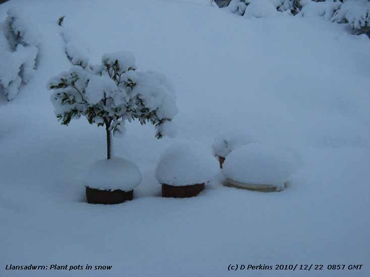
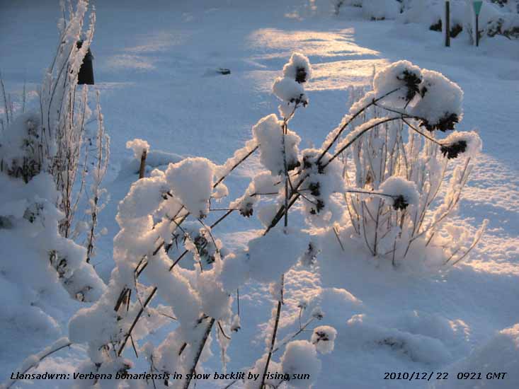 22nd: Snow continued, heavy at times, petering out in the small hours. At dawn the front that brought the snow was moving S and the sky clearing. At 09 GMT equipped again in Arctic gear for the obs - what a sight! On the snow board, that measured snow deposition in the past 24-h, I measured 15 cm (or, 6 in) of 'fluffy' snow, density 97 kg m-3 , while on the grass accumulated lying snow averaged 26.5 cm, up to 32 cm in places, all but covering the standard octapent raingauge the rim of which is 30 cm above ground. Finding and excavating the soil thermometers was a cold job done by hand, and they had to be covered again afterwards to ensure the correct temperature under snow was recorded. Likewise the grass minimum thermometer, now a 'snow minimum' was dug out, but this is replaced just above the snow level. A foot of snow in old money! Familiar things in the garden took on strange forms; plants pots appeared shorter and topped with icing, the Stevenson screen had a thick white 'thatch' roof, plants that were in flower a week or so ago were turned into candy floss. As soon as the sun rose everything looked brilliant, but my dug out paths had been filled in again and would need clearing again. The temperature at 09 GMT was -4.2C so the snow was once again dry and powdery and still no good for making snowballs I was authoritatively told. Icicles hanging from roof gutters were over 2 ft long. It was a sunny morning with advection mist hanging over the snow on some of the adjacent fields and the icicles started dripping. No deliveries again today, the road was snowploughed and gritted, but 80% of salt grit on Anglesey has been already be used. Birds in the garden are quite tame coming up close for food; a female blackbird seeks me out and gets some special titbits away from the up to 7 males that squabble around the main feeding area. A lone redwing was spotted in a cleared ground feeding area. Water put out in trays soon freezes and needs replacing frequently. Sunny until afternoon when a few cumulus clouds moved in off Liverpool Bay, but the temperature kept below zero all day rising to just -1.0C. Before sunset, the sun a deep red colour, the temperature began to fall. [Pptn 0.2 mm; Max 1.0C; Min -4.8C; Grass -7.8C]
23rd: Some showers were moving in off the sea, mainly in the NW of Anglesey and over the Snowdonia Mountains. There were recent slight deposits of small snow pellets and a little snow on the snow board. Snow depth averaged 21.5 cm, cover remained unbroken on grass in fields and there was still some on the roads. Cloud amounts were variable, but the sky was tending to clear leaving fair weather cumulus clouds moving along on the light NE'ly breeze. The temperature at 09 GMT was -0.3C (dewpoint -1.8), but had recently been up to 1.0C taking the maximum for the 22nd. Pressure 1017 mb continued to rise and it was a fine morning with increasing hazy sunshine and the temperature rising to 2.8C about 13 GMT. Darker shower clouds were in the vicinity in the afternoon and Evan reported snow falling in Llanddona. By the end of the afternoon the sky had cleared and the temperature was falling before the sun set. [Pptn trace; Max 2.8C; Min -4.5C; Grass -10.0C]
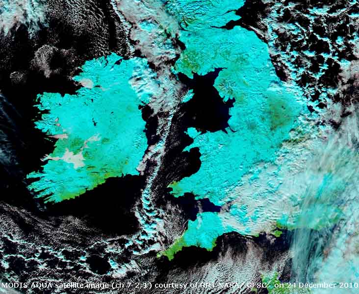 24th: A bright morning with small cumulus clouds in the vicinity clearing to give mostly clear sky. Snow cover was still 100% with an average depth over grass of 18.5 cm (density 138 kg m-3 ) . The MODIS AQUA satellite image with mostly clear skies shows the snow distribution over Britain and Ireland. Apart from the cloudiness in S Britain (white) the snow (shown blue using channels 7-2.1) covers most of the ground surface (green). The 'true colour' image where the snow is white can be seen here
 ![]() . In sunshine the temperature rose to 2.0C so that the icicles were dripping well. Before sunset the temperature was falling again quickly freezing an liquid water. [Pptn 0.0 mm; Max 2.0C; Min -1.5C; Grass -5.5C]
. In sunshine the temperature rose to 2.0C so that the icicles were dripping well. Before sunset the temperature was falling again quickly freezing an liquid water. [Pptn 0.0 mm; Max 2.0C; Min -1.5C; Grass -5.5C]
25th: A cold and frosty Christmas Day with an overnight minimum temperature of -3.5C keeping the snow cover 'crisp and even'. A clear sky at dawn then cloudier towards 09 GMT, as moderately high cloud encroached from the north-west, persisting into the afternoon and dispersing before dusk. Another cold evening and night. [Pptn 0.0 mm; Max 3.1C; Min -3.5C]
26th: With the overnight minimum -3.8C and the 'snow minimum' -9.5C snow cover though reduced in thickness was little changed. Cloud had encroached around 03 GMT and the sky was mostly covered with thin moderately high cloud and good visibility. Cloud thickened through the morning with the S'ly strengthening light to moderate the temperature rising to 3C by 13 GMT changing little in the afternoon. Unidentified ice precipitation was recorded lightly marking the hailometer, the marks were consistent with snow grains or very small snow pellets. Between 2025 and 2100 GMT, Evan observed slight rain. [Pptn 1.5 mm; Max 3.6C; Min -3.8C; Grass -9.5C]
27th: Sleety rain with a fresh to strong S'ly wind from 02 GMT with the temperature still hovering around 3C. There had been no overnight air frost. From 0730 GMT further precipitation as the temperature began to rise to 4.0C (dewpoint 1.2C) at 09 GMT the chance of further ice precipitation had reduced to 30%. Snow cover had reduced in thickness and area, but there was enough remaining locally to record the 11th successive day with snow lying. The remaining snow depth of 8 cm had a density of 296 kg m-3 typical of well settled, melting snow. The sky remaining overcast with showery sleety precipitation from just before noon through the afternoon turned light to moderate after 18 GMT with the temperature on 5C, fell to 4C by 22 GMT before beginning to rise again. [Pptn 10.5 mm; Max 8.3C; Min 0.8C]
28th: The temperature continued to rise slowly to 8C with the rain continuous until about 02 GMT. At 09 GMT the temperature was 8.3C and there was again no overnight frost. The overcast sky was a uniform grey colour, visibility was poor with intermittent fine drizzle. There was remnant snow on the ground and mist had formed over a large patch of snow in an adjacent field. The surface of the bare plot was soft, but grass underfoot still felt hard. The lowest temperature in the profile was 1 .2C at 30 cm deep it having risen to 4.6C at 5 cm and still falling slowly to 5.1C at 100 cm. Pressure 1008 mb was rising. The morning kept dull with occasional fine drizzle, in a light S'ly breeze, and although dying out in the afternoon as the wind died away the sky kept overcast into the evening. [Rain 0.5 mm; Max 9.5C; Min 4.3C; Grass 2.8C]
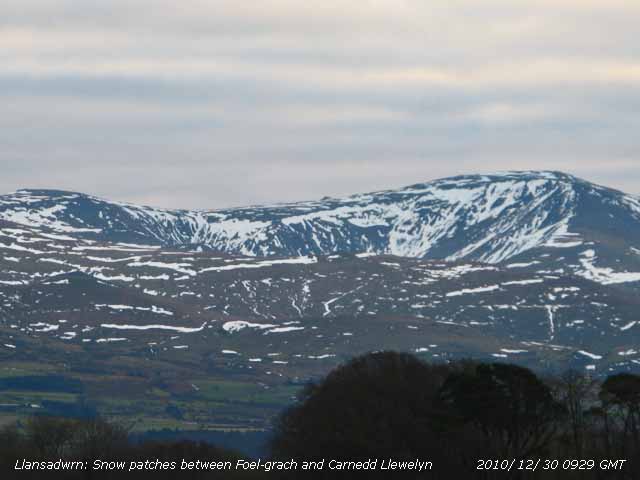 29th: A 'mild' overcast night, the air temperature not falling below 7.2C, the sky showing signs of clearing at 09 GMT. There were still some remnant patches of snow in the filed adjacent to the weather station and in heaped piles of snow on the driveway. The temperature was 8.0C (dewpoint 7.1C) and pressure 1017 mb with a light air from the South. The view of the mountains, with frequent large linear and gully patches of snow, soon turned mistier and cloudier obscuring the tops. The sky eventually became overcast and kept rather dull through the day, but the temperature rose to 9.8C, highest of the month. The evening had some clear spells and there was little or no wind. [Rain 0.2 mm; Max 9.8C; Min 7.2C; Grass 4.5C]
30th: Temperatures again kept above zero overnight in calm weather under a blanket of cloud. Pressure continuing to rise slowly reached 1024 mb the high centred 1025 mb over Scotland. While the weather in some parts was misty and murky here visibility was very good. The cloudbase was well above the mountaintops with all the snow well broken with deep snow in N-facing gullies. Local snow has all melted except for large piles along the nearby road and lanes deposited there by snowploughing. Little in the way of brightness through the sunless day, but the temperature again rose to 9.8C, with yesterday's the highest of the month. I did not see any clear sky during the evening. [Rain 0.0 mm; Max 9.8C; Min 4.6C; Grass 1.5C]
31st: Mostly cloudy at dawn, some breaks started to appear at 09 GMT only to close over again later in the morning. Pressure was 1027 mb within the high established over Britain. A dull afternoon, with no wind once again, the year ending with a sunless day. [Rain 0.7 mm; Max 7.1C; Min 4.7C; Grass 2.3C]
|
|
|
These pages are designed and written by Donald Perkins © 1998 - 2010 Page first dated 7 March 2010 |


