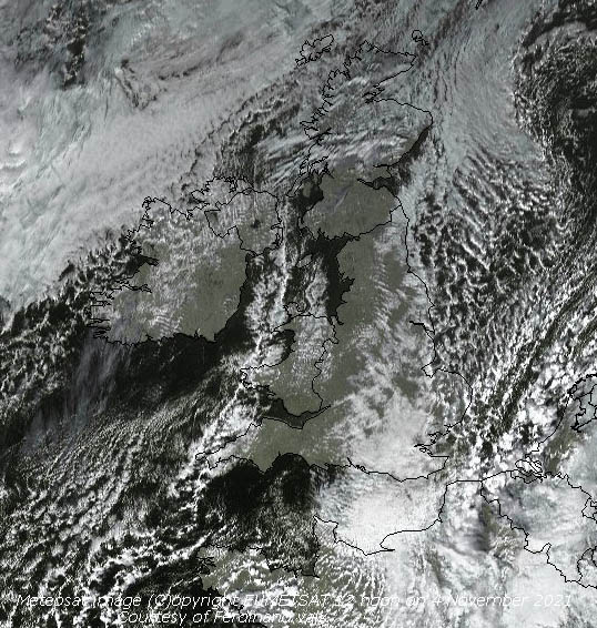
|

Times are GMT (UTC, Z). Observations at this station [ ] are 24-h 09-09 GMT, some others { } occasionally refer to other 24-h periods, extremes (first indications) are given in bold and are usually 21-21 GMT. When averages are referred to (.) compares with the last decade and [.] with the new 30-y climatological average [1991-2020]. All data are subject to verification and amendment. January 2021Wales was under COVID-19 tier four Lockdown. January 1 - It was a bright start to the new year after overnight ground frost (-2.7C on the grass) with a light NNE'ly breeze. The 4.1C temperature at 0900 GMT for the obs did not feel too cold. Decided to continue the observations so here's hoping it will be a drier year than last with plenty of sunshine.
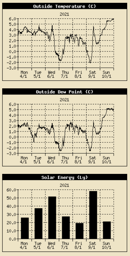
A fair morning on the 3rd with a light NE'ly breeze that strengthened during the morning. Mostly cloudy with not a lot of sunshine, but dry (Scilly 7.3C Scolton 6.5C, Loch Glascarnoch -9.1C Trawsgoed -2.6C, Chillingham Barns 18.2 mm Tredegar 7.2 mm, Tiree 5.9h Aberdaron 4.9h Valley 0.8h) [Max 4.8C Min 1.2C Grass -0.7C Pptn 0.1 m A very fine and bright morning on the 6th with cumulus clouds in the vicinity. Pressure was on 1025 mb with an Atlantic-high 1033 mb lying to the SW with a ridge towards the UK. There had been a light deposition of a coloured dust transported here on the easterly winds. A cold front to the NW was expected to move SE later. A short peak of sunlight 295 W m -2 at 1307 GMT tempted me outside to examine and clean out the bird nesting boxes. There had been 13 nests in the 23 boxes we have in use, 70% of the boxes had been used in some way in the past year. Uses included overnight roosting by bats, and one had a live mouse in residence making use of the nesting material (Ballywatticock 6.7C Scolton 6.0C, Loch Glascarnoch -12.3C Gogerddan -3.1C, Kenley 12.6 mm Libanus 0.4 mm, Aberdaron 7.1h Valley 5.4h) [Max 4.8C Min 1.7C Grass -1.3C Pptn 0.1 mm].
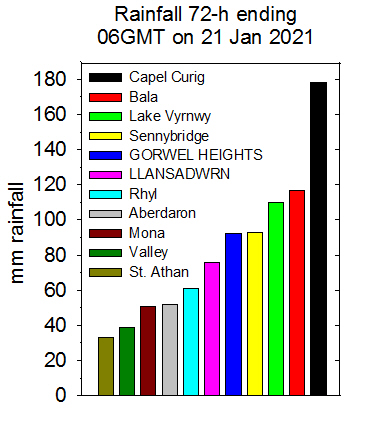
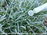
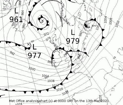
It was a frosty morning on the 7th after clear skies at night with the moon rising over the mountains at 2130 GMT last evening. There had been heavy dew and this had frozen when the temperature on the grass dropped to -9.2C, lowest of the month. The fields were white with frost in the morning. There had been a fall of isolated star-like snow crystals, these evident on various surfaces including ice on water where they had been kept frozen. There was rime on the rims of the copper raingauge. The magic soon disappeared with freezing drizzle turning to slight rain when it all thawed. Snow was lying on the mountains above 1800 ft. We had heavy sleet from 1545 GMT falling at 15 mm/h at 1552 GMT (Scilly 8.0C Mumbles Head 5.8C, Redesdale Camp -9.5C Sennybridge -6.8C, Baltasound 12.6 mm Aberdaron 4.4 mm, Camborne 6.7h St Athan 5.0h Valley 0.2h) [Max 3.2C Min -1.8C Frost 14.7h Grass -9.2C Pptn 9.1 mm]. Dull and overcast on the 8th with poor visibility in rain and sleet. On the 10th snow was lying at 450 ft on the lower slopes of the Carneddau Mountains due SE of the weather station. When clear enough I have a good view 'across the water' or even 'across the river' was an old local expression. Reports from the mountains indicated a 'lot of snow' had fallen Today visibility was moderate with mist, but lifting rapidly so I got a decent view. Warmer at 4.2C, 97% RH, and no ice precipitation of any sort, rising to 6.5C during the day. It was a very dull day with spells of light to heavy drizzle, not amounting to anything in the raingauge (Achnagart 8.7C Hawarden 7.5C, Okehampton -5.8C, Tredegar -5.5C, Resallach 23.8 mm Swyddffynnon 0.6 mm' Waddington 2.9h Hawarden 0.9h) [Max 6.5C Min -1.4C Grass -3.0C Pptn tr]. On the 11th we were into a warmer airstream off the Atlantic. With pressure low 989 mb Norwegian Sea and high 1031 mb off Cap Finisterre a mild SW'ly airflow was the result. Pressure here 1016 mb was falling and we had another dull sunless day. There had been a significant snowmelt in warm rain on the mountains, the snowline raised to 2000 ft. Spots of rain gave way to heavier rain during the afternoon (Leuchars 10.9C Rhyl 10.0C, Baltasound -4.1C Tredegar 2.9C, Achnagart 47.2 mm Bala 17.2 mm, Lerwick 1.4h Hawarden 0.4h) [Max 8.7C Min 4.2C Grass 4.5C Pptn 13.5 mm]. After two sunless days the sky was clearing quickly on the morning of the 12th, brighter and a little colder again. Pressure 1015 mb was rising quickly in a ridge from high 1020 mb Iceland. A low 981 mb over the Baltic had associated cold fronts moving S over the UK. It was sunny to the north and wet to the south A fair day. At 2200 GMT the NE'ly breeze veered SW'ly with falling pressure and rising temperature in warm sector Atlantic air (Exeter 11.1C Cardiff 10.2C, Tulloch Bridge -5.9C Rhyl 4.5C, Okehampton 25.8 mm Swyddffynnon 21.4 mm, Boulmer 6.2h Hawarden 3.8h) [Max 8.2C Min 4.4C Pptn 4.8 mm]. There was continuous light rain from midnight on the 13th through the night to 06 GMT when it became moderate for a while. At 0900 GMT fog had developed and there was light rain the soil saturated. A dull, sunless and the wettest day of the year, so far (Shobdon 12.4C Usk 11.7C , Dalwhinnie -6.4C Capel Curig -0.6C, Ballypatrick Forest 28.4 mm Trawsgoed 21.6 mm, Kirkwall 1.8h Lake Vyrnwy 1.0h) [Max 9.4C Min 1.4C Pptn 21.5 mm]. On the 14th we were still in warm air the temperature at 0900 GMT 7.2C, pressure 1016 mb was rising quickly in a ridge. On the cold side of the frontal system lying over central England it was snowing in Scotland and NE England, From 1130 GMT the temperature began to fall, temperature range today 0.1C Min 7.2C Max 7.3C. At Gorwel Heights the range was, unusually, zero Min 7.3C Max 7.3C (Cardiff 11.9C, Drumnadrochit -1.0C, St Bees Head 31.8 mm, Swyddffynnon 16.8 mm, Thomastown 3.1h St Athan 2.0h Valley 0.5h) [Max 7.3C Min 7.2C Pptn 2.8C]. The first 15-days were on the cool side with the mean temperature 3.6C (-1.9) & [-1.8] and wetter the It was a fine and sunny morning on the 16th after a touch of ground frost. After heavy overnight rain the soil was 'soggy'. The temperature at 0900 GMT was 6.2C and with 97% RH visibility was moderate and misty. By 0930 GMT cumulus clouds were developing, but there were sunny spells into the afternoon. Took advantage of the saturated soil to pull out invasive weeds and brambles from the borders, they come out more easily when the soil is soggy (Gosport 11.4C Usk 10.5C, Redesdale -5.4C Lake Vyrnwy -0.9C, Achnagart 38.2 mm Mumbles Head 26.0 mm, Aberdaron 5.3h Valley 4.5h() [Max 8.7C Min 0.4C Pptn 0.4 mm]. There were showers of snow pellets after midnight and the morning of the 17th was bright with weak sunshine. A touch of ground frost, but no white frost seen. Mostly cloudy with just weak sunshine and a few glimpses of clear sunshine in the afternoon (Scilly 9.8C Milford Haven 9.0C, Aboyne -1.4C, Achnagart 15.6 mm Rhyl 2.8 mm, Shoeburyness 5.6h Hawarden 0.3h) [Max 6.6C Min 2.5C Grass -1.7C Pptn tr]. After a dry night the 18th turned out to be very wet. Slight rain had just started at 0900 GMT. Pressure 1021 mb was falling with Atlantic-lows 991 mb to the SW and NW, there was a cold front lying over northern England. Light rain from noon becoming heavy at 2200 GMT (Scilly 11.1C Gogerddan 10.1C, Frittenden -2.2C, Achnagart 15.4 mm Capel Curig 11.2 mm, Leuchars 4.3h Hawarden 0.3h) [Max 9.1C Min 3.1C Grass 0.3C Pptn 31.5 mm] [Gorwel 29.4 mm]. Rain continued moderate to light through the night and by the morning of the 19th it had turned to intermittent drizzle and had accumulated 31.5 mm at 0900 GMT, the largest fall of the month of 18 h duration At Gorwel in Llanfairfechan 29.4 mm had fallen. A fine and frosty morning on the 22nd, there was a light white covering on grass made up of ice crystals and frozen dewdrops, the grass minimum thermometer read -5C, and there was ice on water, the soil was frozen hard.
On the 29th the sky had been clearing since dawn and it was a fine and bright morning with moderate misty visibility. A pied wagtail put in a brief appearance. The fine start did not last as cloud increased and slight rain and drizzle developed (Gosport 12.1C Cardiff 11.6C, Lerwick -4.6C, Dyce 19.8 mm Capel Curig 14.8 mm, Tiree 6.3h Aberporth 1.9h) [Max 8.6C Min 6.3C Pptn 1.6 mm].
A wintry day on the 30th, it was snowing at 1000 ft at Ogwen and was sleeting here in a strong ENE'ly wind. Light snow was at 500 ft on the mountains and a bit lower by afternoon. There had been a constant roar in the tall trees most of the night, we were somewhat sheltered from it in the garden, but the obs at 0900 GMT was unpleasant. Pressure was on 995 mb with low 974 mb over the Celtic Sea.
The month ended with a total of 180.6 mm of rainfall (169%) & [175%] of the new averages largest since 2008, the 7th wettest in Llansadwrn since 1928. It had been wintry the mean temperature 4.1C lowest since 2010 and the 6th lowest in station records since 1979. It was a dull month, sunshine recorded at RAF Valley was 41.1h (80%) & [73%] of the new averages, lowest since 2019 and 18th lowest on the Anglesey record since 1931, there were 13 sunless days..
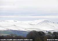
February 2021Wales was under COVID-19 tier four Lockdown... February 1 - grey skies, cold, but fine and dry, and by 10 am becoming a little brighter. Pressure 997 mb was rising with low 991 mb Scilly in a complex chart. I find the MetO analysis charts more complex and difficult to read these days, no doubt the result of super computers and satellite images. At present the weather is complex forecasters contending with rapidly changing alternating cold polar and warm moist Atlantic airflows. It seems a while since we have had settled weather. I needed a dry spell at the beginning of a month to service the lysimeter. For while the percolate has been coloured, and of late the colour has been stronger. I fill it with the local soil that is slightly acidic, and with 2020 the wettest year on record, and a wet January the soil has had enough and become gleyed. Despite spiking through drainage has become impeded. The aim is to keep the soil moist, but the recent conditions the soil has been waterlogged and under the anaerobic conditions iron compounds in the soil became reduced and leached out. So today was lysimeter service day. The grass top was removed and the under layer of gravel removed and washed. Drainage through the outlet at the base and pipe to the receiver was checked before replacing the washed gravel. I cut out a fresh 30 cm diameter nice piece of turf from the lawn, trimmed the depth to size and placed it in the lysimeter tank. It was ready for use again before the end of the day. You can read about how I constructed and set up the lysimeter back in May 1996 here. (Scilly 11.3C Gorwel 7.0C Porthmadog 6.8C Llansadwrn 6.3C, Altnaharra -10.5C Lake Vyrnwy -1.8C, Camborne 9.4 mm Milford Haven 2.2 mm, Waddington 7.8h Aberdaron 4.8h) [Max 8.7C Min -0.1 Grass -3.0C Pptn 7.3 mm]. An overcast day on the 2nd with low cloud and very poor visibility. Pressure 989 mb had fallen with low 973 mb over Shannon, Ireland. There was an occluded front over the Irish Sea and N Wales. The wind had veered E to SE between 04 and 06 GMT. There was a band of rain across the UK with strong winds to the north Malin Head gusting 54 mph and Bridlington 44 mph. The day was sunless (Cardiff 14.2C, Altnaharra -12.1C, Capel Curig 35.6 mm, Lerwick 4.0h St Athan 0.5h) [Max 10.1C Min 1.7C Pptn 9.8 mm]. The 3rd began brighter after heavy rain at 0145 GMT, the sky to the SE looked lighter, but visibility was poor in mist Pressure 992 mb was rising, the slow-moving low near Shannon 981 mb and the occlusion was over the North Channel. Improving through the morning the afternoon was sunny (Rostherne 11.3C Hawarden 10.5C, Altnaharra -3.9C, Ballypatrick Forest 45.6 mm Capel Curig 16.2 mm, Aberdaron 5.6h Valley 3.4h) [Max 8.6C Min 8.1C Pptn 2.8 mm]. The sky was briefly red to the E early on the 4th, at 0900 GMT the temperature was 7.6C and visibility was just good and a little hazy. There had been a little rain overnight, the morning though mostly cloudy had some weak sunshine. The low of yesterday was now 997 mb over N Ireland. Frontal cloud was to the north of here and the afternoon was sunnier as the sky cleared. Mist and fog central and SE England (Porthmadog 11.4C Gorddinog AWS 11.2C, Altnaharra -3.1C, Logan Botanic Garden 51.0 mm Cardiff 7.6 mm, Aberdaron 7.3h Valley 4.4h) [Max 10.9C Min 6.0C Pptn 2.8]. Not much in the way of cloud on the morning of the 5th with a sunny morning. Pressure was on 1005 mb with the filling slow-moving low 1001 mb near Malin Head. Woodpeckers were drumming in the wood and jets from Valley were in the vicinity flying towards the mountains. Again mist and fog central, E and SE England. The afternoon was disappointing, it had turned cloudy and slight rain developed turning heavier by 1430 GMT (Kew Gardens 11.7C Rhyl 9.5C Gadlys Gardens 8.1C, Shawbury -0.3C, Tyndrum 46.6 mm Porthmadog 8.6 mm, Wattisham 5.8h Valley 2.9h) [Max 8.1C Min 4.3C Pptn 15.0 mm]. Rain overnight heavy just after midnight on the 6th and a dull morning with low cloud and mist. Pressure 1009 mb was rising, but the sky was slow to clear. It was a cooler 3.9C at 0900 GMT and there was an ESE'ly breeze. It was later in the afternoon before there was any sunshine () [Max 5.5C Min 2.7C Pptn tr].
A breezy morning on the 7th with a hint that the sky was clearing, the 2.1C at 0900 GMT felt very cold in the E'ly wind. Pressure was on 1012 mb with a high 1041 mb over the Norwegian Sea and Atlantic-low 992 mb lying to the south-west. This was resulting in a blast of Continental/ Polar air across the UK. It was snowing in SE England at Ramsgate, NE England and E Scotland. Here snow showers across the mountains in the afternoon, snow pellets were reported at Gorwel in Llanfairfechan. Some sunshine then turned dull with ice precipitation 'on the wind' later in the afternoon (Scilly 7.2C Pembrey Sands 5.1C, Braemar -2.7C Whitechurch -1.2C, St Catherine's Point 11.4 mm Scolton 6.4 mm, Stornoway 3.9h Aberdaron 2.5h) [Max 3.4C Min 2.0C Pptn tr]. A fine and bright morning on the 8th after light showers of snow pellets around 08 GMT. With 5 oktas of cumulus clouds there were crepuscular rays wen looking towards the mountains. Visibility was moderate with haze, but broken snow could be seen around 2250 ft with snow patches at 2000 ft with remnants even lower. Expected temperature on the summits today -7C with a wind chill of -18C. There is a huge amount of snow on Cairngorm Mountain ski area this year. Currently blown snow is covering the funicular railway track in places even though it is on stilts (currently not used due to structural issues) and ski runs. It is all closed of course, as is Snowdonia, because of coronavirus lockdown regulations. Some sunny spells in the afternoon, showers from the east off Red Wharf Bay reached here at 1710 GMT with a fall of very small snow pellets or graupel that covered the ground. It was loose and powdery as the surface ground temperature was below zero, it did not melt and remained the same until next day (Scilly 4.5C Milford Haven 4.1C, Fyvie Castle -7.8C Lake Vyrnwy -2.6C, Houghton Hall 4.6 mm Scolton 1.0 mm, Dundrennan 7.6h Hawarden 1.6h) [Max 2.4C Min 0.5C Grass -1.3C Pptn 1.0 mm]. A cold morning on the 9th, but bright with not a lot of cloud. Pressure was on 1010 mb, the jetstream is currently well south of us, usually to the north, it was snowing widely in SE England an elsewhere. The E'ly wind was still with us with a severe wind chill effect on the mountains of about -20C. Here at 0900 GMT -0.5C with a wind chill of about -3C soon penetrating my mittens during obs. The loose powdery snow pellets that fell yesterday evening, plus some more were on the ground, nicely crunchy underfoot. There was some lying at sea level in places as well including Rhosneigr beach. Snow pellets, or other forms of hail on the ground even if covering the ground, do not count as snow (lying) recorded at morning observations. It is very light in weight and when melted the volume is small, it also does not mark the hailometer. A red squirrel was at a nearby feeding box not taking a lot of notice of me doing my rounds of the weather station and garden, too busy eating monkey nuts and hazel nuts. Continuing cold, the maximum 1.7C in the afternoon despite the sunshine. Anglesey (Valley 7.9h) had the most sunshine in the UK today. There was a snow shower between 1335 and 1405 GMT and very large flakes fell at 1455 GMT for a while (Scilly 5.3C _Porthmadog 3.9C, Altnaharra -16.7C Tredegar -3.9C, Charsfield 7.2 mm Tredegar 0.6 mm, Valley 7.9h) [Max 1.7C Min -1.5C Grass -4.5C Pptn tr]. A very fine, sunny and cold morning on the 10th with the ground hard and frozen, there were remnants of icy precipitation in shady places. Very little cloud, just 1 okta, mountains and to the NE over Red Wharf Bay. We still had the easterly wind. Pressure 1019 mb was rising quickly with high 1029 mb, between Iceland and Scotland heading for the Norwegian Sea, with ridge to N France. The North Sea was covered with open cell marine convective clouds heading for the east coast. There was snow on the ground from N Scotland to Kent. There was a good covering of snow on the Snowdonia Mountains with cornices developed on cliffs due to the easterly wind (Scilly 5.0C Usk 4.5C, Altnaharra -17.1C Whitechurch -6.2C, Craibstone 4.4 mm St Athan tr, Kirkwall 7.7h Valley 7.1h) [Max 3.5C Min -2.1C Grass -6.5C Pptn tr]. Cloudier on the morning of the 11th, cold with an overnight minimum of -2.6C in the Stevenson Screen, and -7.3C was recorded by the grass minimum thermometer. The temperature under bare soil at 5 cm depth was 0.3C this rising down the profile reaching 6.3C at 100 cm deep, still above the 5.6C (42F) 'plant growth' temperature. Soil at 50 cm deep was 4.8C too low for growth. Conditions are such that plants in the garden soil are suffering physiological wilt, including my leeks and chard. The freeze drying conditions means that fallen leaf material on the ground in the wood is very dry, as must be leaf litter and surface vegetation on mountains and moorlands not covered in snow. There have been fires on Bodmin Moor in recent days and a large one on Dartmoor today. Fires can move on moors very rapidly in wind, usually the vegetation on wet peat will regrow, but in dry summers when the peat is dry it also can burn and for weeks damaging the ecology (Bridgefoot 5.4C Valley 3.2C, Braemar -23.0C Tredegar -6.5C, Balmoral 4.8 mm Llysdinam 0.2 mm, Leeming 8.9h Hawarden 4.5h) [Max 1.8C Min -2.6C Grass -7.3C Pptn nil]. On the 12th extreme downslope winds off the Carneddau overturned a lorry travelling east on the A55 near Aber, the road was closed with traffic diverted. There were gusts of 46 mph at Gorwel Llanfairfechan and David Lees's Gorddinog AWS station 52 mph just after noon, and 58 mph in the evening. At Gorwel slates were blown from roofs. At the weather station the wind was very turbulent at times bringing down a lot of soot from a chimney. A sunny afternoon. Pressure was still high 1045 mb S Norway and with low 952 mb W of Ireland the easterly continued overnight. A change was on the way with frontal systems stacked up to the SW that would introduce much warmer Atlantic air (Scilly 6.7C Valley 5.4C, Kinbrace -15.4C Lake Vyrnwy -4.8C, Leuchars 7.0 mm Wales nil, Kinloss 7.9h Valley 6.5h) [Max 4.5C Min -0.3C Grass -3.3C Pptn tr]. A dull and cold morning on the 13th with air and ground frost overnight. A brief reddish coloured sky early. The surface of bare soil was dry and frozen, there was a shower of snow grains, small angular translucent hard ice grains that could be heard hitting the ground. Later there was a flurry of small snow flakes. It was windy in Llanfairfechan with gusts of 43 mph at 0112 GMT at Gorwel Heights and 58 mpg at 0847 GMT at Gorddinog off the mountains, here a light ESE'ly (Scilly 10.1C Valley 4.7C, Tx Pennerley -3.1C Lake Vrnwy -2.8C, Tn Loch Glascarnoch -6.5C Tredegar -5.6C, Culdrose 11.4 mm Milford haven 4.0 mm, Wattisham 6.7h Aberporth 0.9h) [Max 9.0C Min -1.7C Grass -5.3C Pptn 2.8 mm]. On the 14th the sky was overcast it was very windy and warmer the temperature at 0900 GMT 8.3C. The SSE'ly wind was blowing force 5/6 and there was a fine drizzle with poor visibility. Pressure 1013 mb was falling rapidly with a frontal wave low 976 mb off SW Ireland. With a Norwegian high 1046 mb isobars were tight over Britain, at Gorddinog a gust of 53 mph at 0900 GMT and at South Uist there was a gust of 70 mph. The temperatures in Llanfairfechan at 0143 GMT was 12.1C. The wind strengthened to strong to gale force in the afternoon with gusts of 61 mph at Valley. Wet in S Wales, sunless day (Armagh 13.3C Capel Curig 11.C, Dalwhinnie -4.9C Lake Vyrnwy -2.8C, Whitechurch 40.4 mm, Thomastown 1.9h) [Max 11.9C Min 0.8C Pptn 2.1 mm]. A fair morning on the 15th, bright and breezy with some weak sunshine at first then breaking through the thin cloud some sunny spells.. There was a mild wedge of air off the Atlantic moving eastward. No overnight frost anywhere it seemed, at 0900 GMT 8.7C this rising to 10.8C by 1332 GMT. The moderate visibility improved a little, just good enough to se that most of the mountain snow had disappeared leaving a few snow patches around 2750 ft and at Don's dyke. Temperatures in Llanfairfechan in the afternoon, Gorwel Heights 12.6C 1530 GMT, then Gorddinog AWS 12.8C at 2330 GMT (Kew Gardens 13.9C Hawarden and Gorwel Heights 12.6C Gadlys Gardens 10.8C, Albemarle 0.1C, Wych Cross 14.4 mm Tredegar 4.8 mm, Wellesbourne 5.0h Valley 2.9h) [Max 10.8C Min 7.8C Grass 5.9C Pptn 2.2 mm]. The first 15-days were wintry with a mean temperature 4.2C (-1.7) & [-1.4] of averages. Precipitation (15.0 mm on the 5th), but some hail and snow at times, totalled 43.5 mm (42%) & [48%] of averages. More sunshine that the whole of January. The 16th began again mild, but breezy and fairly dull although there were signs of the cloud breaking up and it was sunny at 10 GMT. A heavy shower of rain and ice pellets at 1452 GMT (Myerscough 13.6C Cardiff 12.5C, Cassley 1.2C, Achnagart 31.6 mm Tredegar 21.8 mm, Kinloss 7.9h Aberdaron 4.9h) [Max 10.7C Min 8.2C Grass 6.4C Pptn 8.1 mm]. A fine, but breezy morning on the 17th as a result the 7.4C temperature at 0900 GMT felt quite chilly. Visibility was poor in haze at first. Some weak sunshine at first, light showers in the middle of the day then some sunny spells in the afternoon. Sparrows were occupying the penthouse nest site on the house and interest being shown in the terrace nest box, looks like they were nest building. There are about 5 pairs here this year. Increasingly windy in the evening strong to gale force from 2300 GMT as the barometer began to fall rapidly (Pershore College 13.3C Cardiff 11.6C, Fyvie Castle -0.7C, Balmoral 32.8 mm Libanus 24.6 mm, Aberdeen 6.5h Valley 3.9h) [Max 10.3C Min 6.7C Pptn 7.8 mm]. It was a rough night with gusts of 48 mph at 0018 GMT, Gorwel Heights recorded 57 mph at 0315 GMT when the temperature had reached 11.8C, and 58 mph recorded at Valley between 02 and 04 GMT. There was heavy rain just before 05 GMT all down to a cold front passing over between 0500 and 0700 GMT. There was a modest temperature drop of 4C to a minimum of 3.9C recorded on the 18th at 0646 GMT. A breezy morning , with some glimpses of sunshine, the duller afternoon had fewer (Shoeburyness 11.6C Cardiff 10.9C, Banagher Caugh Hill 0.7C, Achnagart 37.4 mm Capel Curig 19.4 mm, St Athan 6.2h) [Max 9.2C Min 3.9C Grass 2.8C Pptn 1.4 mm]. The 19th began with strong to gale force S'ly wind and poor visibility in mist and rain. At 0900 GMT pressure 996 mb was falling with a low to the NW 955 mb covering a very large area of the North Atlantic from Nova Scotia to the Canary islands. There was a warm front lying over the Irish Sea the temperature 9.2C. Capel Curig had had a gust of 71 mph and Gorwel Heights 58 mph. There was a MetO amber warning for rain affecting S Wales and several flood alerts had been issued. Light to moderate rain, the wind moderating in the afternoon, turned moderate to heavy in the evening. Wet in S Wales and the Lake District (Edinburgh Botanic Gardens 13.2C Rhyl 12.7C Gadlys Gardens 11.4C, Westonbirt 1.0C, Keswick 65.4 mm Whitechurch 55.4 mm, Kinloss 1.6h Valley nil) [Max 11.4C Min 4.3C Pptn 18.8 mm 16h duration]. Much the same on the 20th, the morning was very wet and the wind that had moderated was strengthening again. Pressure 993 mb was falling quickly with a frontal-wave low 973 mb Shannon. There was a gale warning in force for the Irish Sea and was so just after noon at Valley gale 8 with gusts of 55 mph, the Scilly Isles had 58 mph. The MetO amber warning was still in force, there was flooding in parts of S Wales. The River Towy burst its banks in Carmarthen and the R. Tywi near Capel Dewi. Roads near Lampeter were underwater and the R. Usk had burst its banks in Crickhowell and Llangattock in Powys. At Llyn-y-Fan, Carmarthenshire 127.6 mm was recorded. Gales in the afternoon with gusts of 42 mph here, 63 mph in Llanfairfechan at Gorwel and Gorddinog (St James Park 15.6C Gorwel Heights 13.8C Gorddinog AWS 13.2C Capel Curig 12.8C, Altnaharra -0.3C, Libanus 70.0 mm, Shoeburyness 6.0h Valley nil) [Max 12.5C Min 9.1C Pptn 5.8 mm].
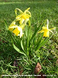
In complete contrast to yesterday the 25th the sky had cleared and the morning was fine and sunny. The temperature was 6.1C with 97% relative humidity visibility was moderate and misty. The ground was very wet and muddy, but in a light WSW'ly it was drying slowly. Pressure had risen to 1025 mb with the ridge from Azores high 1037 mb extended to Cornwall. Soon a few fair weather cumulus clouds developed, the afternoon was sunny with fine views looking N from near the weather station at Gadlys (Pershore 13.4C Cardiff 13.3C, Fyvie Castle 1.7C, Kinlochewe 10.8 mm Capel Curig 2.4 mm, Aberdaron 9.8h Valley 9.5h) [Max 10.3C Min 5.1C Pptn nil]. The 26th was another fine and sunny day making up for the terrible weather we have been having of late. Pressure 1037 mb was rising in the high centred over the SW Approaches. Low pressure now well N 964 mb SE Greenland and 988 mb North Cape. A little cloud over the mountaintops did start increasing for a while, then diminished, the afternoon mostly sunny (Fyvie Castle 14.4C Cardiff 13.0C, Benson -4.7C Swyddffynnon -2.6C, Lerwick 1.8 mm, Weybourne 9.9h Valley 9.7h) [Max 10.8C Min 3.4C Grass -2.2C Pptn trace dew]. Overnight with clear sky the 'snow moon' was very bright casting a white light on the ground. A cloudier morning on the 27th after a heavy dew and ground frost -1.2C on the grass, but no white frost was seen. Pressure was on 1042 mb over the UK and there was a light S'ly breeze. It was warm enough on the rockery bank with flowering heathers for bees to appear with their familiar humming, a sign of better weather to come. There are white, pink and red flowers in various places in the garden, they find the sunniest patch to feed not minding the colour it seems. Did some work in the sheltered 'hidden garden' today where it was quite warm. The first blue flowers of Chinodoxa 'glory-of-the-snow' are appearing, but sadly there is no snow left on the Snowdonia Mountains that I can see from my lockdown position () [Max 10.6C Min 3.8C Grass -1.2C Pptn trace dew]. The 28th of the month and the last day of climatological winter began calm and without a cloud in the sky. There had been a heavy dew and this had frozen into white frost on the grassy fields around the weather station. Visibility was good, but hazy with Saharan dust in the atmosphere, but none was detected deposited at ground level.
The month ended with a total of 146.6 mm of rainfall (143%) & [162%] of averages largest since 2019, the 8th wettest in Llansadwrn since 1928. Although wintry at times the mean temperature 6.1C was (+0.2) & [+0.5] of averages, was lowest since 2018 and ranked 16th highest in station records since 1979. It was a sunny month, sunshine recorded at RAF Valley was 92.8h (114%) & [118%] of averages, 20th highest in February on the Anglesey record since 1931, there were 7 sunless days. Winter was the second wettest on record with 510.6 mm (139%) & [156%] of averages. The mean temperature 5.4C was (-0.7) & [-0.2] of averages, lowest since 2018.
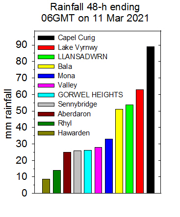
March 2021Wales was under COVID-19 tier four Lockdown... March 1 - a very fine morning without a cloud in the sky, visibility at height was very good, but there was some layered inversion smoke haze along the Menai Straits. Pressure was steady on 1033 mb with out high 1037 mb drifted eastward to be over the North Sea at 0900 GMT, but still covering North Wales. A low 986 mb was over the Atlantic W of Shannon and mist and fog was prevalent in much of central and SE England. No so here, it was sunny all day and we had one of those marvellous aprés sunset skies we get here, peach and azure blue above lasting for about an hour (Porthmadog 14.9C, Shap -4.9C Bala -3.0C, Lerwick 0.8 mm, Aberdaron 10.5h Valley 10.3h) [Max 11.6C Min 3.1C Grass -2.1C Pptn trace dew]. Just a little cloud low in the sky to the E on the 2nd at 0900 GMT. There was a white frost on the grass early with the grass minimum recording -4.3C. A light E'ly breeze, very fine and sunny with bees out on the flowering heathers on the rockery banks. There was no colour in the sky after sunset tonight it looked very grey (Capel Curig 13.3C, Altnaharra -6.6C Capel Curig -4.8C, Scilly 1.4 mm, Morecambe 10.0h Valley 9.5h) [Max 11.6C Min 0.7C Grass -4.3C Pptn nil]. The 3rd seemed a raw damp day when I went out for the obs, very grey with very poor visibility in low cloud. The breeze was NE'ly and I suspect the air was coming off the North Sea so we could call it the haar. The term is used in eastern Scotland and north-east England, its origin is related to Middle Dutch haren. The temperature was 4.3C and the sun was looming through at times was looking white. Pressure was steady on 1028 mb so it was anticyclonic gloom, the jetstream was far north, in fact north of Greenland, Iceland and just on Cap Nord. There was a trough of low pressure 1023 mb over the South West Approaches and most of the UK and Ireland had mist and fog (Camborne 13.5C Bala 10.3C, Dalwhinnie 0.6C, Braemar -7.6C Bala -2.3C, Milford Haven 13.2 mm, Shap 7.6h Aberdaron 2.7h Valley 0.4h) [Max 5.7C Min 1.4C Grass -2.8C Pptn nil]. Another poor day on the 4th and a bit colder 3.7C at 0900 GMT. Little change in pressure with high 1038 mb SE Iceland stretching to the UK. There was a cold front NE Scotland heading southwards. The sun did break through briefly about noon. There was a little rain when the weak cold front passed over between 19 and 20 GMT (Myerscough 10.9C Pembrey Sands 8.3C, Dalwhinnie 2.2C, Shap -2.6C, Bedford 15.4 mm. Tiree 5.8h Valley 0.3h) [Max 5.6C Min 3.1C Rain 0.4 mm]. A much better day on the 5th after a frosty night beginning fine and bright with a few cumulus clouds, but still on the cool side with 3.8C at 0900 GMT. A mostly sunny day the temperature rising to 7.0C just after noon. High 1036 mb was over Scotland and rising here 1034 mb. North Wales had the best of the weather today with the slow moving cold front over the Severn estuary (Porthmadog 8.7C, Lake Vyrnwy 2.9C, Loch Glascarnoch -7.1C Whitechurch -1.7C, Lerwick 2.0 mm, Valley 8.0h) [Max 7.0C Min 1.3C Grass -4.1C Rain nil]. The 6th began brightly after a 'dry frost' well I didn't see any white early on although at 0900 GMT the grass was slightly wet so it could have melted. Measured dew deposition was 0.13 mm and the AWS gauge had tipped recording 0.2 mm. The air temperature had been -0.6C with -6.4C on the grass overnight, there was ice on water too. The temperature now 2.6C rose to 7.3C at 1213 GMT the relative humidity 54% in cold dry air. Pressure was steady on 1037 mb in our own North Wales high. The sky was half cloudy with altocumulus and cumulus clouds and the day fair with sunshine at times, most other places except Cornwall were cloudier today (Gosport 9.4C Trawsgoed 8.5C, Braemar -8.5C Capel Curig -5.8C, Stornoway 5.2 mm, Bude 9.2h Valley 7.9h) [Max 7.3C Min -0.6C Grass -6.4C Pptn nil]. A fine, but dull morning on the 7th feeling cold with a temperature of 3.4C after light air and ground frosts overnight. Dew/ frost deposition was 0.04 mm. Visibility was moderate to good and it was quiet with persistent wood pigeon cooing in the trees. Pressure was still high 1030 over Wales at midnight, the centre had moved to near Gloucester. There was a detached occlusion over Ireland and this was given us the cloudy morning. By 1030 GMT the sky had brightened with sunny spells developing into the afternoon with a maximum temperature of 8.7C at 1539 GMT. Wind strengthened during the evening (Killowen 12.7C Llansadwrn/ Aberdaron 8.7C, Sennybridge -7.7C, Wick 19.0 mm, Camborne 8.1h Valley 5.3h) [Max 8.7C Min -1.0C Grass -6.3C Pptn trace]. Not quite as cold overnight on the 8th being windy and overcast with a little rain around 01 GMT, but a ground frost of -4.2C was recorded by the morning, precipitation on the grass was 0.06 mm with a trace in the rain gauge. Some weak sunshine at 0900 GMT the sky clearing a little. The afternoon was sunny for a while. Traffic on Welsh roads had been 60% higher during the current lockdown. Certainly the traffic past the weather station in afternoon has been more than usual, between 60 and 80 vehicles an hour, up to 100 at times, normally its around 20 to 25 an hour. It is a mystery in the lockdown with only essential journeys allowed and travel for for recreation or taking exercise not allowed, where they have been going. I have not been able to visit any botanical monitoring sites (Murlough 13.2C Usk 12.2C, Lerwick 4.8C Capel Curig 7.1C, Okehampton -5.5C Bala -3.3C, Dunstaffnage 13.6 mm Porthmadog 0.2 mm, Camborne 8.4h Aberporth 7.7h Aberdaron 2.3h) [Max 8.6C Min 1.9C Grass -4.2C Pptn 1.4 mm]. Pressure on the 9th 1019 mb was falling and the dull weather continued with thicker low stratocumulus clouds. The jetstream was strengthening and there was low 994 mb W of Ireland. Our local high pressure system had disappeared, Azores high 1030 mb had a ridge to Brittany and it was sunny in SE England. After a glimpse of bright sunshine around 0830 GMT the cloud had thickened and the rest of the day was sunless. Light to moderate rain with temperature rising from 6.5C in the late evening with the wind strengthening to gale force by midnight (St James Park 14.4C Usk 12.1C, Benson -4.6C Usk -4.4C, Tyndrum 20.6 mm Capel Curig 4.0 mm, East Malling 10.2h St Athan 3.2h) [Max 8.8C Min 5.4C Grass 1.4C Rain 30.0 mm]. On the 10th it was a very wet morning after a rough night, Capel Curig recorded a gust of 86 mph, Aberdaron 84 mph, Valley 58 mph. The jetstream was set up over the UK and there was a low 9599 mb between Iceland and Scotland with another in the wings 968 mb W of Ireland. After the rain and wind storms of the past 48h the 11th dawned fair. The sky was overcast with layered stratiform clouds, but in thinner patches the sun was just visible. Visibility was good albeit hazy. Pressure 990 mb was rising quickly. Deep marine convective clouds were impacted north-west Wales and Scotland during the day. It was still breezy at times, but moderated during the afternoon when between showers of rain, ice pellets and sleet (heaviest 1440 GMT) it was sunny. Fixed a new slate on the roof during one of the better spells. Wind run today was 340 miles (Writtle 13.2C Usk 10.7C, Dalwhinnie 2.1C Lake Vyrnwy 4.6C, Lake Vyrnwy 32.6 mm, Shoeburyness 6.3h Aberdaron 5.2h) [Max 9.0C Min 6.1C Pptn 2.7 mm]. The first 15-days had temperatures a little below normal the mean temperature 5.9C (-0.9) & [-1.1] of averages. Precipitation totalled 82.5 mm (100%) & [105%] of averages with 53.8 mm falling on the 9th and 10th. A dull morning under low cloud with mist and rain early on the 16th, but by 0900 GMT there was some improvement, the rain had stopped and visibility was good. Pressure 1029 mb was rising with high 1035 mb Biscay to W of Ireland. Low 1006 mb E Iceland had associated frontal cloud over the Irish Sea. By 10 GMT the cloud was lifting and breaking up. The afternoon was sunny (Pershore 17.9C Cardiff 17.4C, Baltasound -2.8C, Loch Glascarnoch 14.6 mm Gogerddan 8.8 mm, Tiree 10.2h Lake Vyrnwy 6.5h) [Max 13.6C Min 8.0C Pptn nil]. Another cloudy morning on the 17th, but it was bright and fair with very good visibility. Weak sunshine then a sunnier afternoon (Milford Haven 15.4C, Katesbridge -2.3C Trawsgoed -1.7C, Lerwick 2.8 mm, Camborne 7.9h Aberdaron 6.2h) [Max 13.3C Min 3.0C Pptn 0.3 mm].
A mostly cloudy morning on the 25th after showers of rain overnight, cumulus and lenticular altocumulus clouds. Pressure was steady on 1016 mb with low 979 mb SW Iceland and high 1027 mb over the Pyrenees. The breeze was cold at 0900 GMT, visibility was moderate and there was a little sunshine later. Light showers end of the afternoon (Hull 15.3C Hawarden 14.7C, Bournemouth -1.8C, Capel Curig 20.0 mm, Manston 9.0h Bala 5.6h) [Max 11.1C Min 6.6C Pptn 17.8 mm]. Heavy showery rain after midnight on the 26th with bursts up to 48 mm/h at 05 GMT including wet graupel and 58 mm/h at 0626 GMT that including sleet later about 0830 GMT. Total precipitation recorded at 0900 GMT was 17.8 mm the third largest daily fall of the month. Pressure 1004 mb was rising from 1000 mb at 0616 GMT. A cold front associated with low 973 mb SE Iceland lay across Cape Wrath, Anglesey, Pembrokeshire Islands, Cornwall and Scilly Isles. Scattered clouds with good visibility, snow was seen lying at 2500 ft on the Carneddau Mountains, further wintry showers later in the afternoon (Cavendish 13.9C Usk 11.4C, Lough Fea 0.9C, Achnagart 35.6 mm Sennybridge 14.2 mm, Aberdaron 7.8h Valley 5.7h) [Max 9.4C Min 4.3C Pptn 0.6 mm]. Wintry after midnight on the 27th with some ice precipitation recorded on the hail pad. It was a fine morning with 5 oktas mixed cloud cover and sunny. The strengthening SW'ly wind felt cold the temperature 6.4C. Some further weak sunshine in the afternoon the temperature rising to 10.4C. Warmer in the greenhouse where the Black Hamburg grape had begun to shoot () [Max 10.4C Min 2.3C Pptn 5.8 mm]. It was wet and windy on the 28th, very poor misty visibility at 0900 GMT with moderate rain. There was standing water at the weather station and pools of water had formed again on the old cricket field. There was a cold front over the North channel with low 954 mb SE Greenland. Here pressure 1014 mb was rising after bottoming at 1011 mb at 0326 GMT. A dark sunless day with maximum light level of only 114 W at 1130 GMT. Wind run totalled 450 miles here gusting to 43 mph today compared with 275 miles at Gorwel Heights gusting to 50 mph. Heavy rain up to 20 mm/h fell at 1733 GMT (Normanby Hall 16.2C Hawarden 14.6C, Dalwhinnie 2.3C, Shap 109.4 mm Capel Curig 103.6 mm, Lerwick 6.2h Valley nil) [Max 10.9C Min 6.4C Pptn 13.0 mm]. Another overcast and dull day on the 29th with slight rain and drizzle at 0900 GMT. Visibility was very poor and it was a mild 10.8C with 95% relative humidity. The overnight minimum air temperature was 9.7C the highest of the month. The light level was only 63 W, but it did rise to 132 W in he afternoon. The temperature in Llanfairfechan about 1335 GMT at Gorddinog AWS rose to 15.3C and 15.1C at Gorwel Heights, here it got no higher than the earlier 10.8C (Writtle 20.4C Hawarden 16.0C, Okehampton 6.4C, Achnagart 81.6 mm Capel Curig 21.4 mm, Manston 11.9h Hawarden 10.8h Valley nil) [Max 10.8C Min 9.7C Pptn 0.3 mm]. Another wet month having a total of 124.7 mm of rainfall (151%) & [159%] of averages largest since 2019, the 11th wettest March in Llansadwrn since 1928. Occasionally wintry at times the mean temperature 7.4C was (+0.5) & [+0.4] of averages, was highest since 2019 and ranked 15th in station records since 1979.
April 2021
April 1 - began brightly and very fine with a light and cool ENE'ly breeze. The sky was very milky again and visibility moderate the result of a lot of Saharan dust in the atmosphere mentioned several times by BBC weather forecasters. Cloud was difficult to see. a mixture of cirrus and cumulus. Little dust was deposited here, my daily sample contained just a trace of dust, it was mostly pollen. Pressure 1025 mb was rising with high 1036 mb S Iceland with a remnant cold front lying across N Wales from N Ireland to The Wash. Sunny afternoon (Bude 17.8C Pembrey Sands 17.3C, Loch Glascarnoch -3.0C Bala 4.9C, Dunkeswell 1.4 mm, Loch Glascarnoch 12.2h Valley 8.8h) [Max 12.1C Min 7.5C Pptn nil]. A very fine and sunny morning on the 2nd, but there was a cold felling ENE'ly breeze. Pressure was high 1032 mb and rising within high 1040 mb S Iceland with a ridge extending as far as the southern North Sea and Thanet. With some of the native trees starting to flower the slightly dusty surface samples included yellow/ green pollen. A sunny day though on the cool side, it was nice in sheltered spots out the wind (Derrylin Cornahoule 15.9C Porthmadog 14.8C, Tulloch Bridge -6.1C Hawarden -0.6C, Nosig rain, Thomastown 12.5h Valley 12.2h) [Max 9.7C Min 3.0C Grass -0.6C Pptn nil]. Much the same on the 3rd with good slightly hazy visibility. A slight ground frost -1.8C, but you had to be up early to catch sight of the white frost on grass. Pressure was steady on 1030 mb with high-pressure 1040 mb lying to the north-west encompassing the British Isles. The weather best in the west today. Did some grass management today, the mowers took a bit if starting after winter inactivity. After a sunny afternoon the sky at sunset was an unusual colour perhaps affected by the heavy Saharan dust in the atmosphere The moon was also coloured slightly orangy (Drumnadrochit 17.6C Porthmadog 14.7C, Tulloch Bridge -5.8C Bala -2.4C, No significant rain, Glasgow 12.5h Valley/ Aberdaron 12.3h) [Max 10.7C Min 3,3C Grass -1.8C Pptn nil]. A very fine and sunny morning on the 4th after a touch of ground frost, the breeze felt cold. There were coastal fog patches off the sea early in the day. Pressure was on 1029 mb the high now 1037 mb S Greenland and W of Ireland with ridge to SE England. Low 965 mb Svarlbard and a cold front between Iceland and Scotland was expected to sweep southwards later. Observing the sky at 0900 GMT a small cumulus cloud passed before the sun, nothing else. There was some early sea fog around around north-western coast, but it soon burned off to give another fine sunny and slightly warmer day on the island of Anglesey. Pressure was on 1029 mb the high now 1037 mb S Greenland and W of Ireland with ridge to SE England. Low 965 mb Svarlbard and a cold front between Iceland and Scotland was expected to sweep southwards later (Pershore 17.9C Usk 17.2C, Benson -5.2C Sennybridge -3.7C, Cassley 14.0 mm, Shobdon 12.2h Hawarden 11.9h Valley 11.3h) [Max 13.4C Min 1.1C Grass -2.3C Pptn 0.4 mm]. Winter was not over yet on the 6th with snow falling to low levels in the morning. Snow was lying at 1000 ft at Ogwen and we had a squally shower of snow pellets at 0907 GMT followed by snow at 0915 GMT briefly covering cold surfaces of car and workshop roof. Visibility in the precipitation reduced to very poor, but it soon improved and the day had some sunny spells. Pressure was 1024 mb with convergent cloud formation over the Irish Sea south from the North Channel. Today's maximum temperature joint lowest of the month (Pershore 9.8C Cardiff 9.7C, Eskdalemuir -4.2C Libanus -3.6C, Kinlochewe 12.0 mm Capel Curig 10.0 mm, Prestwick 10.7h Hawarden 8.7h Valley 5.4h) [Max 7.7C Min 0.1C Grass -2.3C Pptn 3.0 mm]. The wintry spell continued on the 7th with showers of ice precipitation including snow pellets, slight snow and at times sleet. The temperature at 0900 GMT was 3.2C, lowest of the month so far. A cold front over the Irish Sea was associated with low 1012 mb Iceland with pressure here 1025 mb between high 1032 mb off SW Ireland and low 972 mb North Cape. Bright with glimpses of sunshine (Holbeach 14.2C Cardiff 12.9C, Fyvie Castle -2.4C, Achnagart 46.8 mm Scolton 2.8 mm, East Malling 7.4h Aberporth 6.6h Valley 0.3h) [Max 7.9C Min 0.7C Grass -1.8C Pptn 1.5 mm].
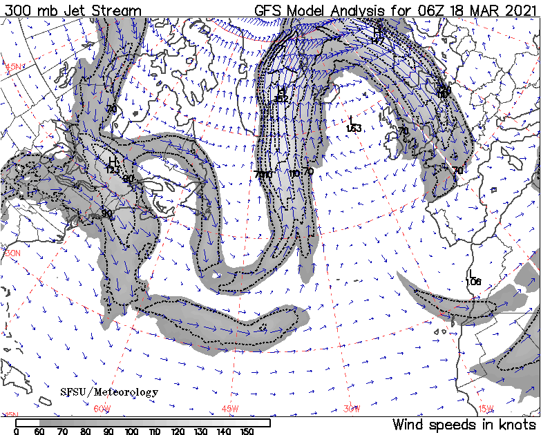
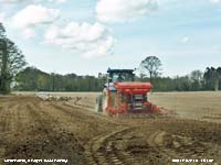
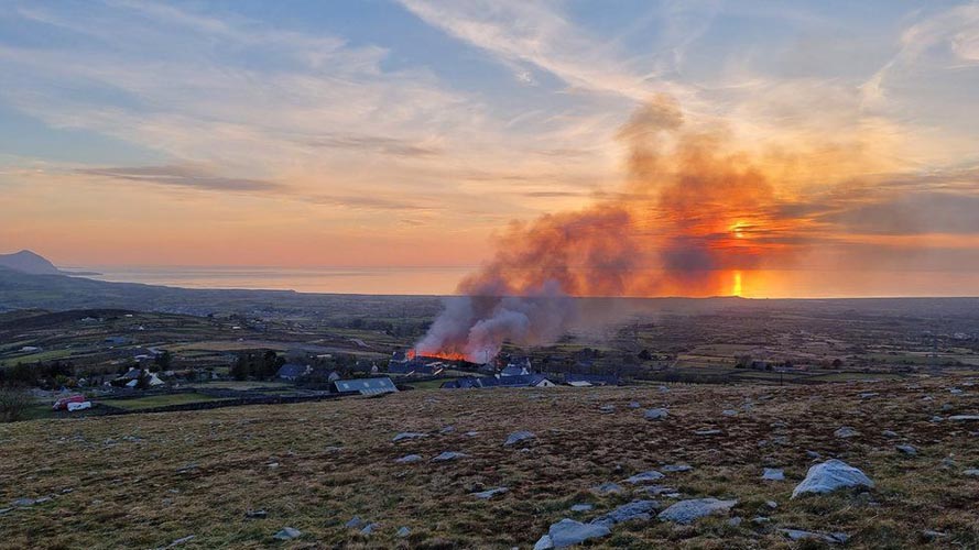
On the 10th we were in a cold plunge from from the Arctic with a sprinkling of snow on the Snowdonia Mountains and snow reported at Manchester Airport and Wilmslow, Cheshire The Jet Stream was strong over Africa, pressure was on 1017 mb with highs 1016 mb S North Sea and Atlantic 1033 mb W of Ireland. The temperature here at 0900 GMT 5.3C and dry and sunny with mountain cumulus and fair weather cumulus overhead, warmer in the S with rain to the SE (Plymouth 13.6C Cardiff 11.9C, Shap -7.8C Trawsgoed -5.1C, Almondsbury 7.4 mm Libanus 3.2 mm, Aberdaron 12.9h Valley 12.0h) [Max 8.4C Min 0.5C Grass -3.7C Pptn nil]. The first 15-days temperatures were well below the monthly average the mean temperature 6.2C (-3.1) & [-2.9]. Equal second lowest with 2013 since 5.9C in first 15-d of 2000 in 43-y station records, since 1979. It was also very dry, precipitation just 10.0 mm (19%) & [15%] of averages. Sunshine had averaged 4.0 h per day (68%) & [74%] of the months average total Very fine and sunny on the 16th with some snow persisting on the mountain summits, very good visibility was slightly hazy. Around noon it was cloudier with classic convective cloud development over SE Anglesey, Llansadwrn and he Carneddau Mountains, due to convergent airflows SW=NE, this cleared away in the afternoon. The field adjacent to the weather station was drilled with seed today again attracting a mass of seagulls (Aboyne 14.9C Hawarden 13.7C, Aboyne -7.3C Sennybridge -5.1C, Wittering 1.6 mm Dundrennan 13.1h Aberdaron 12.3h Valley 11,8h) [Max 11.4C Min 2.4C Grass -3.2 mm Pptn nil]. A fine morning on the 20th with no overnight frosts. Visibility was moderate with thick haze and the sky looked very milky a combination of photochemical smog and a little dust. Although the temperature was 10.9C the NE'ly breeze felt chilly. Pressure was steady on 1019 mb with high 1025 mb to the north-west S of Iceland and W of Scotland. There was a cold front over the North Channel, it was cloudy with some rain in NW Scotland. Fair here, with mostly weak sunshine and not a drop of rain (Pershore 18.6C Usk 18.3C, Fair Isle 8.7C Aberporth 11.5C, Bournemouth -1.7C Sennybridge -0.5C, Aultbea 7.8 mm, Yeovilton 12.0h Hawarden 8.3C Valley 4.8h) [Max 12.9C Min 4.7C Grass 2.6C Pptn nil]. Overnight the 'pink' full moon was very bright. Looking out on the adjacent field I could see a herd of black cattle grazing. The movement of their black shapes against the bright moon looked really weird crossing up and down. The morning of the 25th was again very fine and sunny. An E'ly breeze had picked up and it was a cooler 9.6C than yesterday at 0900 GMT. Pressure was steady on 1030 mb with high 1034 mb S North Sea. With low 997 mb off Iberia isobars were being squeezed a little resulting in strong winds along the English Channel. The breeze moderated in the sunny afternoon when it was very pleasant in the garden, the THSW index was 20.6C, but the screened maximum was 14.2C (Porthmadog/ Castlederg 17.9C, Fair Isle 8.7C, Altnaharra -4.2C, no significant rain, St Athan 13.6h Valley 12.5h) [Max 14.2C Min 4.2C Pptn nil]. The smallest touch of ground frost on the morning of the 26th just -0.1C recorded, there was a slight white frost on grass at 08 GMT. The sky had a covering of cirrostratus and a solar halo was observed at 0900 GMT. Temperature 11.2C light SSE'ly breeze very good visibility. A lot of dust collected today much of it raised as the result of local farming work in nearby fields, but there was a patch of Saharan dust over the UK as well (Armagh 17.5C Bala 16.4C, Fair Isle 7.2C Aberporth 10.8C, Topcliffe -3.6C Bala -2.0C, Fyvie Castle 8.8 mm, Bournemouth 13.6h Aberdaron) [Max 15.6C Min 4.1C Grass -0.1C Pptn 0.2 mm]. A change in the weather on the 27th beginning dull with overcast skies, and damp. The first rain for 12 days, just 0.2 mm measured, it had dampened grass and concrete, but the parched soil still looked dry. Pressure 1010 mb had fallen with a low over S Scotland and an occlusion over the Irish Sea. Dull and cold day brightening up in the afternoon with a glimpse of sunshine at 1545 GMT the temperature struggled to reach 11.5C at 1604 GMT (Wisley 18.6C Cardiff 15.9C, Santon Downham -2.8C Usk -0.6C, Leek 9.6 mm Lake Vyrnwy 6.2 mm, East Malling 12.5h St Athan 4.1h) [Max 11.5C Min 7.6C Pptn 1.4 mm]. The 28th was another dull and for a late April day rather cold. The temperature at 0900 GMT was 7.1C and pressure 1011 mb with shallow low 1003 mb over France and a cold air plunge from the north. A showery day, slight morning and afternoon with a little sunshine in between (Santon Downham 15.0C Porthmadog 13.2C, Altnaharra 3.6C, St Athan 30.0 mm, Weybourne 11.4h Aberdaron 2.9h) [Max 11.8C Min 5.2C Pptn tr]. We still had the cold air from he Arctic on the 29th, but it was fine and sunny with very good visibility in clean air. Snow had fallen overnight and a light covering was lying at 2750 ft. Dry and mostly sunny through the day (Usk 13.5C, Kinbrace 4.5C Trawsgoed -1.1C, Thomastown 6.4 mm Hawarden 5.4 mm, Aberdaron 12.6h Valley 11.1h) [Max 10.9C Min 3.2C Pptn 1.5 mm]. The 30th continued on the cool side with Arctic air coming from the region of the Barents Sea via the North Cape. It had no doubt warmed a little on its way, but the 6.2C at 0900 GMT felt chilly on the E'ly breeze. There were cumulus clouds and cumulonimbus in the vicinity. It was cloudy around noon as convection formed overhead, otherwise it was sunny and dry here. It was the wettest day of the month, rainfall 24-h to 09 GMT on the 1 May was 3.6 mm (Cardinham 13.7C Trawsgoed 12.5C, Tulloch Bridge -4.2°C Pembrey Sands -2.4C, Gringley on The Hill 19.0 mm Milford Haven 5.8 mm, Tiree 14.2h Aberporth 13.1h) [Max 10.9C Min 3.3C Pptn 3.6 mm] A dry month with 16.7 mm rainfall (31%) & [25%] of averages, least since 1980 and ranking 6 in Llansadwrn records since 1828. Wintry at the beginning the mean temperature 7.7C was (+1.6) & [+1.4] of averages, lowest since 2013 and ranked 8 in station records since 1979. It was the sunniest April on record on Anglesey.
May 2021May 1 - began fine and sunny with few clouds, but what cumuli there were were towering over the mainland mountains to the south of the station. There had been a moderate fall of ice pellets around 0315 GMT and the overnight air minimum was 2.7C and -0.8C on the grass. Precipitation was 3.6 mm (credited to the 30th April) and the soil surface looked moist, there was a little snow on the mountaintops. Pressure was on 1018 mb and the day fine and sunny. Two cumulonimbus developed over the mountains in the afternoon. An unseasonable vigorous depression was forecast to develop west of Shannon, Ireland, on the 3rd, the Met Office issued a yellow warning for wind and rain affecting Wales (Gosport 15.0C Usk 14.0C, Shap -5.8C Pembrey Sands -3.1C, Wainfleet 8.6 mm Cardiff 3.0 mm, Manston 13.0h Aberporth 12.6h) [Max 11.9C Min 2.7C Grass -0.8C Pptn 0.1 mm]. Fine and sunny and feeling a little warmer on the 2nd at 0900 GMT. Cannons were firing in the fields today, bird scarers but sounding like from the 1812 overture. Visibility was good, but hazy, I could see no snow on the mountains. Pressure was on 1021 mb within high 1022 mb over the Celtic Sea. Mostly sunny day (Pershore 16.4C Cardiff 15.1C, Tyndrum -4.2C Sennybridge -3.6C, Goudhurst 8.0 mm Rhyl 7.4 mm, Camborne 12.9h St Athan 12.1h Valley 6.4h) [Max 13.9C Min 2.9C Grass -1.3C Pptn 3.3 mm]. The unseasonable vigorous low had arrived on the 3rd, pressure 1009 mb was falling quickly with the deepening low 987 mb W of Malin Head. It was raining and visibility was poor. The SSW'ly soon reached strong to gale-force around the coast Valley f9 and gusting 63 mph, and over high ground Capel Curig 66 mph with 56 mph recorded in Llanfairfechan Gorddinog and 50 mph recorded at Gorwel Heights. Rain was moderate to heavy and very heavy at 1500 GMT falling at a rate of up to 20 mm/h. Rainfall 24-h from 0900 GMT today was 27.5 mm, more in a day that what we had in April. Later the sky cleared and there was a little sunshine before the end of the day (Shoeburyness 14.0C Hawarden 12.1C, Kinbrace -5.9C, Capel Curig 50.8 mm [65.6 mm, most in Europe today] Rhyl [26.0 mm], Kirkwall 7.0h Valley 1.6h) [Max 10.9C Min 6.5C Pptn 27.5 mm]. The morning of the 4th was very wet after 27.5 mm of rain slaking the dry soil of April. Milder, no air frost reported. The ground was covered with shredded leaves and flowers off the horsechestnut trees the result of yesterday's strong winds. The rain soon eased and the sky began to clear. Becoming bright with the wind moderating and a mostly sunny afternoon (Pershore 15.3C Cardiff 13.6C, Dalwinnie 0.7C, Blencathra 33.0 mm Capel Curig 23.4 mm, Kirkwall 9.6h Valley 7.8h) [Max 11.6C Min 5.1C Pptn 2.6 mm].
Showers of ice pellets here after midnight (02 & 06 GMT) on the 5th with snow falling on the mountains, a light cover at 2000 ft with some as low as 1850 ft. We were into another cold plunge from Arctic regions, we were north of he jet stream currently over France, and there was a shower trough over Anglesey. The sky was mostly covered with towering cumulus clouds, a cumulonimbus was in the vicinity. There was a shower of snow pellets at 1108 GMT, conical 4-5 mm diameter. Frequent brief sunny spells and a light shower of rain in the afternoon (Heathrow 14.4C Llansadwrn/ Pembrey Sands 12.0C, Warcop -3.1C, Swyddffynnon 12.6 mm, Morecambe 14.1h Aberdaron 8.1h) [Max 12.0 C Min 2.4C Grass -1.3C Pptn 1.5 mm]. Further showers of ice pellets overnight and on the morning of the 6th at 08 GMT. There had been a fresh fall of snow on the Snowdonia Mountains and was lying lightly at 2000 ft on the northern slopes of the Carneddau and there was some at the head of the Ogwen valley at 1250 ft earlier. A few cumuli and a cumulonimbus at first with showers on the mountains, mostly good visibility and a chilly N'ly breeze. Fine, with cloud developing later with frequent sunny spells (Plymouth 14.3C Usk 14.0C, Eskdalemuir -5.5C Lake Vyrnwy -0.8C, Altnaharra 32.0 mm Gogerddan 6.4 mm, Aberdaron 13.5h) [Max 11.9C Min 0.7C Grass -2.4C Pptn 0.4 mm]. Looking out early on the 7th across the fields I could see a white frost on the grass, the cattle were not happy about that, but it soon melted. Before 0900 GMT there were showers that included small ice pellets. Visibility was moderate to good, there were remnants of snow above 2750 ft on the mountaintops. The morning was mostly cloudy and being north of the jet stream that was over France, we had cooler air. The W'ly breeze backed NE during the day. Frequent sunny spells in the afternoon with a slight shower of rain; a snow shower covered Carnedd Llewelyn completely white (Heathrow 15.7C Cardiff 15.3C, Topcliffe -4.4C Bala -2.6C, Scarborough 9.6 mm Hawarden 1.0 mm, Morecambe 12.8h Aberdaron 11.8h) [Max 12.5C Min 1.2C Grass -2.7C Pptn 16.4 mm]. With the NE'ly backing S'ly and strengthening wind a band of moderate to heavy rain arrived at 0230 GMT on the 8th, heaviest 5 mm/h at 0717 GMT. At 0900 GMT when 16.4 mm was measured it was still raining, visibility was moderate to poor. Dull and wet, one of those days set aside for being indoors. The rain was heaviest 6.2 mm/h at 1015 GMT with the wind peaking at 29 mph about 1239 GMT. The afternoon was dull, but dry (Manston 18.3C Hawarden 15.3C, Tulloch Bridge -4.2C, Libanus 52.2 mm, Kirkwall 4.4h Valley 1.0h) [Max 14.7C Min 4.6C Grass 1.6C Pptn 5.0 mm]. After early fog around he coast the morning of the 9th was fine and bright, but very windy. There were 6 oktas cover of cumulus and cirrus clouds, the S'ly wind blowing force 5/6. Pressure was on 991 mb with filling low 972 mb Shannon. There was a cold front lying along the spine of the Britain pressure was high 1027 mb at the tip of Greenland and over SE Europe (Santon Downham 22.5C Hawarden 17.7C, Tain Range -0.1C, South Uist 19.0 mm Tredegar 186 mm, Weybourne 8.0h Aberdaron 6.4h) [Max 14.4 C Min 9.5C Pptn 1.4 mm]. A fairly mild night the air minimum 9.6C on the 10th and a showery morning. Bright with glimpse of sunshine and light showers of rain. Pressure little changed at 991 mb with the anchored Shannon low 981 mb dominating the weather. Very windy again the SW'ly near gale force with strong gusts in the afternoon, slight showers here, heaviest in Llanfairfechan and across the mountains. The showery airflow was from Arctic regions via the Atlantic so not quite as cold as it might have been (Cromer 17.9C Hawarden 17.4C, Tain Range 3.2C Hawarden 6.5C, Fair Isle 13.8 mm Tredegar 11.8 mm, Shoeburyness 9.8h Hawarden 5.9h) [Max 12.9C Min 9.6C Pptn tr]. Would you believe it? The Shannon low is well anchored and hadn't moved far on the 11th, but filled to 993 mb pressure here 1005 mb was rising. There was a drying S'ly breeze, concrete and grass were dry, the soil surface drying was not quite dry. Fine with good hazy visibility in the morning. The first 15-days temperatures were again well below normal the mean temperature 9.2C (-2.6) & [-2.5]. In contrast to the beginning of April it was very wet with precipitation 72.7 mm (108%) & [107%] of averages. Sunshine had averaged 6.4 h per day, the sunniest day on the 3rd with 12.7h.
The 16th began fair and bright with some weak sunshine. It had recently been calm, nut at 0900 GMT there was a light SSE'ly breeze setting in. It felt warmer, the temperature 12.5C and the soil surface was 15.0C. There were dark looking cumulus clouds nearby and cumulonimbus in the vicinity. Pressure was steady on 996 mb with low 992 mb over the Celtic Sea and detached occlusion charted over the Irish Sea. Since the nice sunny weather at the end of April the barometer has shown unsettling falls within the low-pressure area north of the Jet Stream. There were rain showers over S Britain, heavy over S England, today it was fine and sunny in Scotland. Showers developed in the morning, the afternoon was dry and sunny, but moderate showers fell in Llanfairfechan. Clouds cleared away by evening that was very fine and sunny (Myerscough 18.1C Hawarden 17.1C, Aboyne -0.7C, Okehampton 31.6 mm Libanus 26.0 mm, Tiree 12.8 Aberdaron 10.6h Valley 7.2h) [Max 13.7C Min 7.4C Pptn 1.1 mm]. A bright morning on the 17th after early slight showers of rain, but at 0900 GMT convective cloud was building. Many cumulonimbus clouds developed over England with heavy showers and lightning in places, but here the clouds diminished to fair weather cumuli and we had a fine, dry and sunny afternoon the temperature reached 16.2C highest of the month so far, despite a light sea breeze off Traeth Goch in the afternoon, and clear evening. (Pershore 18.0C Usk 17.1C, Katesbridge -0.9C Bala 2.5C, Wych Cross 16.4 mm Rhyl 5.2 mm, St Athan 11.2h Valley 9.9h) [Max 16.2C Min 7.6C Pptn nil]. It was fine and sunny early on the morning of the 18th, but by 0900 GMT it had become cloudier. Visibility was very good. Later clouds diminished and the afternoon was mostly sunny and the day dry. Grass had grown more in the last week with increased temperatures (still 2 degrees below normal) and more than adequate moisture and had grown at a rate of 5.9 g dry mass m -2 d -1 (59 kg ha -2 d -1 ) , but was still low in comparison to previous years (Hull 17.9C Cardiff 16.3C Llansadwrn 16.2C, Katesbridge -1.1C, Coleshill 22.0 mm Libanus 9.2 mm, Morecambe 13.3h Aberdaron 8.8h) [Max 16.2C Min 7.6C Pptn nil]. The 26th began fine, bright with a cool NNE'ly breeze. There was still a pool of cool air originating in Arctic regions over the North Sea and the UK. Pressure was steady on 1017 mb with low 999 mb Denmark and high 1024 mb Biarritz. Visibility was very good and the sky soon clearing gave a mostly sunny day (Killowen 18.6C Usk 18.2C, Machrihanish 1.0C, Drumalbin 10.6 mm Capel Curig 1.4 mm, Valley 15.4h) [Max 15.1C Min 7.4C Rain nil]. . Very fine and sunny on the morning of the 27th with a veil of cirrus clouds and a few small cumulus over mountains to the south. Visibility was very good and clear, there had been a heavy dew with the grass minimum down to 3.5C. It was warmer with 15.1C at 0900 GMT, it turned cloudy just before and after noon, rising to 18.2C in the afternoon. A solar halo was seen widely in parts Britain. There was light rain before midnight (Wisley 22.0C Hawarden 20.6C, Sennybridge -0.5C, Derrylin Cornahoule 4.2 mm Milford Haven 0.8 mm, Bournemouth 14.7h St Athan 12.9h Valley 11.4h) [Max 18.2C Min 6.1C Grass 3.5C Rain 2.1 mm]. A wet month with 140.3 mm rainfall (208%) & [207%] of averages, most since 2015 ranked 3 in Llansadwrn records since 1828. Wintry at the beginning of the month the mean temperature 10.5C was [(-1.2)] of averages, lowest since 2015 ranked 6 in station records since 1979. Not up to the record sunshine of last May, but one of the 30 sunniest on the Anglesey record since 1931.
June 2021June 1 - warm and mostly sunny the temperature at 0900 GMT 21.2C this rising to 24.2C at 1513 GMT (Cardiff 26.1C, Boulmer 10.9C Lake Vyrnwy 21.1C, Aboyne 3.6C Usk 7.9C, Lerwick 15.6h St Athan 14.0h Valley 9.3h, South Uist 0.8 mm Wales nil) [Max 24.2C Min 12.8C Rain nil].
A cloudier morning on the 2nd the sky a mixture of cirrus, altostratus and lenticular altocumulus, 6 oktas at 0900 GMT. Visibility was good, but very hazy with moderate levels of pollution smoke up to 138 µ per m-3 ozone recorded at at Marchlyn Mawr (Welsh Air Quality Forum), the result of increased traffic due to easing of lockdown and sunny weather. Cloud increased in the afternoon becoming quite dark under thickening clouds. Showery rain from about 15 GMT when gave up working in the garden turning moderately heavy at 1620 GMT (Cardiff 26.1C, Aboyne 3.6C, South Uist 0.8 mm. Lerwick 15.6h St Athan 14.0 Valley 4.2h) [Max 22.9C Min 13.7C Rain 3.2 mm]. The 6th began brightly the sky mostly clear at dawn, but cloud had had increased and by 0900 GMT it was dull. There was a cool feeling NNE'ly breeze and visibility was very good. Pressure was on 1026 mb in a ridge from high 1019 mb over the Atlantic off Iberia, while complex low-pressure 998 mb lay S of Iceland. Some glimpses of sunshine during the morning, cloudier at noon, the sunny spells later. Planted out 4 dozen sweetpea plants raised in the greenhouse (St James Park 23.4C Cardiff 23.0C, Katesbridge 4.0C Whitechurch 6.2C, Llysdinam 13.4 mm, Morecambe 14.8h Valley 10.9h) [Max 17.7C Min 10.3C Rain trace]. Another dull sunless day on the 10th beginning with slight rain and graduation on to intermittent slight rain and drizzle. Cloud was hugging the mountaintops of Snowdonia and visibility was just good in the misty rain. Fog was around coastal areas. Continuing mild the 16.4C 93% RH at 0900 GMT rising to 17.9C at 1437 GMT. There was a partial eclipse of the sun (31%) visible in theory here today beginning around 0915 GMT. Nothing of it was seen here, but folk saw it from clear sky places in England. I had set up a full array of met instruments just in case, they detected little. Very disappointing. In 1999 I had an interesting set of readings on the 11th August for the 91% partial eclipse. Observations showed a 98% fall in solar radiation and a fall in temperature, measured by shielded thermometers within a Stevenson screen, of 2.1C 25 min after maximum partiality. Relative humidity, also measured in the screen, increased from 76% at 0900 GMT to 90% 15 mins after maximum partiality. An unshielded temperature probe exposed at 2.4 m and the grass minimum thermometer at 2 cm above grass registered falls of 4.2C and 7.5C respectively, only 5 mins after maximum partiality. The temperature of the soil in a bare plot at a depth of 5 cm fell 0.3C after 30 min. At this, and some other depths, the normal daily rise in temperature was depressed. Dispersion of cumulus clouds took place during the event and reformed again afterwards. The quality of the light was seen to change and become a bluish white colour. Shadows became sharper and some birds started to sing. Read my account here Eclipse 11 August 1999 (Heathrow 24.7C Hawarden 24.2C, Harris Quidnish 11.0C Aberdaron 11.8C, Capel Curig 15.8 mm, Shoeburyness 12.9h Hawarden 4.8h valley 0.0h) [Max 17.9C Min 13.1C rain 1.3 mm]. The 11th would have been no good to view the eclipse beginning with low cloud, driving drizzle in the force 5 SW'ly and fog at 0900 GMT, occurs rarely at this time here, RAF Valley was on RED since 0720 GMT. The wind moderated through the morning and the afternoon was drier and a little brighter (Heathrow 25.6C Hawarden 21.5C, Stornoway 10.7C Lake Vyrnwy 11.9C, Capel Curig 11.2 mm, Sheffield 7.9h Hawarden 3.4h Valley 0.9h) [Max 16.0C Min 13.0C Rain 0.1 mm]. The first 15-days temperatures were above normal for the first time in a while the mean temperature 19.1C (+1.0) & [+1.2]. In contrast to May it had been dry 14.3 mm (17%) & [19%] of averages. Sunshine at RAF Valley had averaged 6.6 h per day with 15.7h on the 4th. I was hoping for a fine day today the 16th as had been informed by SP Energy that the electricity supply would be off from 0900 BST to perhaps 1630 BST. The electricity went off on the button and it wasn't a fine day so the weather station computers were offline. The automatic station is powered by solar energy with rechargeable battery backup for the hours of darkness so that continued to record the data that was downloaded when the mains supply resumed. A day in the garden would have been good, but the day was cloudy, dull and sunless with slight rain and drizzle. I tended the greenhouse and made do with a few jobs inside, that without lights was quite dark. No watering of the garden required (Heathrow 29.2C Cardiff 24.0C, Exeter 6.8C, Millport 19.0 mm Capel Curig 5.2 mm [4.6 mm], Ross-on-Wye 12.8h St Athan 12.3h Valley nil) [Max 15.9C Min 12.8C Rain 9.4 mm]. The 17th began fine and sunny with a light NNE'ly breeze after clearing overnight sky and a 5.9C on the grass. Pressure was high 1030 near the Azores. Plants had perked up on the herbaceous borders and vegetable plot. Soil was wet, but cracks in the surface of the undisturbed Met plot had not closed. Pressure 1013 mb was rising with low 998 mb SE Iceland. A cold front was situated over central England while an occlusion was over Ireland. A mostly sunny and dry day. Warm and very wet in Thanet (Manston 24.0C Usk 21.7C, South Uist 13.8C Aberporth 14.7C, Katesbridge 3.0C, Manston 47.8 mm Usk 0.8 mm, Valley 15.0h) [Max 19.5C Min 9,8C Rain nil]. Pressure was steady 1020 mb on the 18th with a low 1007 mb over Brittany. Broken cloud at first with good though hazy visibility. There was a light to moderate NNE'ly breeze, but the sun was breaking through and the afternoon with almost clear sky pleasant with the temperature reaching 16.6C and the breeze moderating (Plymouth 23.3C Porthmadog 21.4C, Loch Glascarnoch 1.7C Trawsgoed 3.9C, Otterbourne WW 67.6 mm, Valley 15.1h) [Max 16.6C Min 8.4C Rain trace]. A very dull morning on the 19th with rain in sight and moderate visibility at 0900 GMT. Pressure 1015 mb was falling as deepening low 997 mb W of Shannon tracked SE towards the Celtic Sea 993 mb by 1800 GMT reaching 1010 mb here. A day of sunshine and slight showers of rain or drizzle clearing by late afternoon when sunny (Blackpool 22.4C Porthmadog 21.5C, Katesbridge 0.4C Tredegar 6.7C, Exeter 9.8 mm St Athan 2.8 mm, Leeming 9.4h Bala 5.7h) [Max 19.8C Min 9.8C Rain trace].
On the 20th with the low 98 mb over the Bay of Biscay pressure here was on 1009 mb. The morning was very fine with a cool breeze and with the sky composed on altocumulus and some altostratus clearing it was soon sunny. Visibility was very good and clear. North Irish Sea coastal areas all had a mostly sunny day (Armagh 21.7C Porthmadog 21.0C, Shap 4.7C Lake Vyrnwy 8.1C, Dunstaffnage 14.8 mm Cardiff 12.2 mm, Valley 13.1h) [Max 18.1C Min 12.2C Rain nil]. Much the same on the 25th grey skies, poor visibility and heavy rain at 0900 GMT about 14 mm/h. Pressure was on 1017 mb with low centred near Aberystwyth at noon tracking towards London reaching there at 1800 GMT. A cool overnight minimum of 9.9C, the weather didn't get any better with rain light to moderate at times through the day, maximum reaching 13.2C lowest of the month, and intermittent light rain in the evening before petering out. Rainfall duration was 11 hours (Wisley 23.1C Usk 17.5C, Dalwhinnie 6.9C, Winterbourne 32.4 mm Lake Vyrnwy 21.2 mm, Tiree 11.1h St Athan 1.7h Valley nil) [Max 13.2C Min 9.9C Grass 10.0C Soil 5 cm 15.1C Rain 17.5 mm]. On the morning of the 26th the ground was strewn with green sycamore leaves torn off the trees in the night by a strong NE'ly wind. Mostly cloudy with cumulus clouds decreasing. Visibility was excellent, very clear views of Llyn and Bardsey island. It was fine and dry, but feeling fresh. Outdoor Tumbler tomatoes have several small green tomatoes developed now they need a lot more sunshine (Heathrow 23.6C Usk 22.1C Capel Curig 16.7C Fair Isle 11.1C, Machrihanish 4.1C, Chillingham Barns 17.8 mm Cardiff 5.2 mm, Tiree 12.6h Aberdaron 10.3h) [Max 17.5C Min 9.8C Grass 8.0C Rain nil]. Keeping dry the the 27th began fine and sunny with good hazy visibility. Pressure was steady on 1019 mb with Atlantic-high 1029 mb W of Shannon. There were lows 991 mb Norwegian Sea and 1009 mb Bay of Biscay. It was breezy if not sheltered from the N'ly with a maximum temperature of 18.7C at 1450 GMT. Again there was rain in the S and SE of England the best weather and sunshine in the north. Late in the evening a large group of swallows were feeding over a nearby pasture field grazed by cattle and sheep (Porthmadog 23.4C Fair Isle 12.4C, Loch Glascarnoch 2.4C Bala 7.2C, Scilly 35.4 mm St Athan 1.4 mm, Valley 14.7h) [Max 18.7C Min 11.8C Grass 10.1C rain nil]. After a warm night minimum 13.3C the 28th began with broken clouds comprising cirrus, altocumulus and cumulus, and in moderate haze good visibility. Another dry day, fine and bright to begin then cloudier for a while with a maximum temperature of 19.4C. Low 1009 mb was over the Charente Maritime, France the Atlantic- high 1028 mb W of Shannon having a ridge to northern Britain. There was rain in places in southern Britain (Drumnadrochit 24.8C Porthmadog 22.9C, Tulloch Bridge 2.7C, Otterbourne WW 30.4 mm Mumbles Head 11.2 mm, Altnaharra 14.8h Valley 8.5h) [Max 19.4C Min 13.3C Grass 11.7C rain nil]. Fine, bright with a little weak sunshine early on the 29th with a cool NNE'ly breeze picking up at 0900 GMT. Pressure was on 1017 mb with a low 1011 mb Netherlands and frontal band over Wales and central England. Wet in S England, fine and sunny in Scotland. It was 60-y ago that the first nuclear powered space craft Transit IV-A was successfully deployed by the John Hopkins University. Using plutonium 238 as a fuel generating 2.7W the satellite confirmed that the Earth's equator was elliptical. Record heat in Canada with 49.6C recorded at Lytton. This village was burnt down the next days residents having 10 minutes to evacuate from the flames. Cooling centres were opened in Seattle and in succeeding days 130 fires were sparked in British Columbia by lightning strikes. The heat was caused by high pressure doming to the north and south. Heat spread eastward over the prairies to Saskatchewan where further grass fires were burning (Carlisle 25.3C Porthmadog 24.6C Fair Isle 11.3C, Tulloch Bridge 4.0C, St Catherine's Point 43.0 mm Hawarden 4.2 mm, Prestwick 15.0h Valley 9.7h) [Max 21.2C Min 11.7C Rain nil]. . The 30th began fine and bright, but before 0900 GMT cloud was thickening in a light SW'ly breeze becoming NE'ly at 0945 GMT. It remained mostly cloudy here, but was bright with sunny spells in Llandudno and Llanfairfechan. A warm sand humid day, a little sunshine towards the end of the afternoon before low cloud and fog encroached later in the evening (Cardiff 25.0C Fylingdales 11.6C, Shap 5.6C Sennybridge 7.5C, Manston 2.0 mm, Lerwick 14.6h St Athan 8.2C Valley nil) [Max 19.2C Min 10.7C Rain 0.3 mm]. A dry month with 44.9 mm of rainfall lowest since 2018. Warmer than average the monthly mean 14.7C (+0.5) & [+0.7] of averages equal highest since 1018 ranked 13 in station records since 1979. Despite 6 sunless days at RAF Valley it was a sunny month with 201.3h (96%) & [107%] of averages.
July 2021July 1 - began dull and slightly wet. At 0900 GMT the rain had stopped, but it was still dull and misty with poor visibility. Pressure was high 1022 mb between Iceland and Scotland and 1020 mb over Biscay, and low 1002 mb over the Baltic near Tallin. Despite the rain the soil surface remained dry and cracked. Britain remains north of the jetstream that is positioned over the Med. Did some strimming and planted a row of leeks (Strathallan 24.3C Usk 23.1C Aberdaron 13.2C, Braemar 2.6C, Weybourne 1.2 mm Rhyl 0.4 mm, Tulloch Bridge 14.7h Bala 6.4h) [Max 17.3C Min 11.9C Rain nil]. Pressure was steady on 1019 mb on the 2nd on a fine, close feeling, morning. The temperature was 12.8C with 98% RH. The weather was fair with cloud overhead, but clear sky to the south of the station. It was foggy in many places, but here visibility was good with the cloud clearing by afternoon when sunny and warm (Cambridge Niab 24.9C Hawarden 23.4C, Fair Isle 12.6C Aberdaron 17.4C, Braemar -0.1C, Drumalbin 12.4 mm, Manston 11.5h Aberdaron 9.7h) [Max 21.0C Min 11.9C Rain 1.8 mm]. After midnight on the 3rd there was light to moderate showery rain. In the morning it was mostly cloudy and feeling sticky. It was raining widely across Britain as pressure 1005 mb fell. Low 994 mb was over the Atlantic W of Shannon with a trough extended over Britain where it was showery. Our resident song thrush was singing, the pair nesting nearby must be having its second even third brood. They find plenty of snails in the garden and woodland, and hammer them on favourite stones to break them. Near midnight the tawny owls were vocal close to the house, but brown long-eared bats were out at dusk followed by the pipistrelles (45 kHz) a little later. There are plenty of insects and moths about, sometimes they softly pick moths off lighted window panes (Weybourne 23.8C Usk 22.0C Fair Isle 13.0C Aberdaron 16.1C, Redesdale Camp 8.1C, Waddington 27.4 mm Cardiff 12.4 mm, Stornoway 7.0h St Athan 0.9h Valley 0.6h) [Max 20.2C Min 14.4C Rain 10.6 mm]. Under low cloud on the slopes of the Snowdonia Mountains on the 4th visibility was good. At 0900 GMT with the temperature on 17.3C it felt sticky. There were heavy showers widely across Britain, not the July weather folk would like, but often typical rainfall averages in the 'summer monsoon' already on the up. The thrush was still singing. The temperature rose to 19.4C at 1234 GMT then declining through to 2125 GMT when it was 14.0C. We had one of those heavy showers at 1309 GMT, falling at a rate up to 48.8 mm/h 7.2 mm enough to make he gutters overflow (Leconfield 24.6C Hawarden 21.1C Wick 13.2C Libanus 16.6C, Ravensworth 9.2C, Plymouth 55.4 mm Mumbles Head 19.8 mm) [Max 20.2C Min 14.4C Rain 10.6 mm].
The morning of the 5th began with a fresher feel, fine and breezy with good misty visibility. Pressure was on 1003 mb , the UK was surrounded by a complex of depressions 999 mb at Malin Head at midnight. Showers continued in the north while there were sunny spells in the south we having the southern weather today. The Mars helicopter Ingenuity made its 9th successful flight of 2 mins 46 secs flying 625 m over challenging terrain after software update. The craft navigates itself and needs to correctly interpret the topography, each flight is more challenging this time taking pictures of scientifically interesting craters out of sight of the rover (Tibenham 22.2C Hawarden 20.0C Wick 13.7C Lake Vyrnwy 15.2C, Libanus 9.0C, Achnagart 34.0 mm Gogerddan 17.0 mm, Shoeburyness 8.4h) [Max 18.2C Min 12.3C Rain 5.8 mm]. A fine, but fresh feeling showery morning on the 6th with glimpses of sunshine. A 'could not make up it's mind day', we have been having several of these lately. Pressure 997 mb was rising, however, with a complex low 991 mb over the country filling and arriving off St Abbs Head 994 mb at 1800 GMT. The jet stream remains dipped on the southern side of the UK. A mostly cloudy afternoon with slight showers here, it was wet at Bodelwyddan (Rhyl) [28.8 mm] (Dunstaffnage 21.6C Hawarden 20.2C Spadeadam 13.0C, Katesbridge 4.0C, Alice Holt Lodge 27.8 mm Rhyl 27.2 mm, Tiree 14.4h Valley 3.6h) [Max 17.3C Min 13.4C Rain 0.3 mm]. After a mild night weather was fair on the morning of the 7th as pressure 1008 mb was rising. Low 999 mb was over the N North Sea with a ridge W of Ireland from Azores-high 1026 mb. Frontal cloud over Wales was slow to clear, but in what sunshine there was it felt somewhat warmer. Cloud thickened around noon and there was a heavy shower of rain falling at a rate of up to 34 mm/h at 1330 GMT. Later there was a little more sunshine, but it wasn't as warm (Linton on Ouse 23.6C Usk 21.5C Resallach 14.5C, Shap 4.4C, Dunkeswell 25.8 mm Swyddffynnon 6.3 mm, Dundrennan 13.3h St Athan 7.1h) [Max 18.3 Min 13.4C Rain 6.8 mm]. Pressure 1019 mb was still rising slowly on the 8th with a ridge to the west. Pressure was high 1023 mb Baltic and 1029 mb Azores. The best weather today was in central and eastern England, elsewhere very showery. Here a very dull with low cloud and mist, visibility was poor, turning quite dark under thick cloud from noon until about 16 GMT when it became brighter. The evening was sunny (Cardiff 24.1C Fair Isle 12.8C Aberporth 16.7C, Eskdalemuir 4.9C Sennybridge 8.2C, Tibenham 8.4 mm, Aberporth 11.4h Valley 4.7h) [Max 18.3C Min 12.2C Rain nil]. Early on the morning of the 9th it was fine and fairly bright, but before 0900 GMT cloud was thickening and here was drizzle and slight rain with visibility becoming poor. Pressure was high 1025 mb near Biarritz and 1025 mb over Russia with a weak ridge towards Britain. Here pressure was steady on 1021 mb and with a detached occlusion to the SW the day remained dismally dull (Wisley 24.9C Hawarden 21.8C Sennybridge 16.2C Kirkwall 13.3C, Sennybridge 7.0C, Balmoral 12.4 mm Porthmadog 1.4 mm, Leconfield 8.3h Hawarden 2.0h Valley 1.0h) [Max 17.2C Min 11.4C Rain 0.3 mm]. The 10th was equally not like summer beginning fine and becoming brighter the altocumulus declining , but cumulus clouds were building especially over the Snowdonia Mountains. It was nice with sunshine at Rhosneigr, but misty at Llandudno. A large toad greeted me as I entered the greenhouse this morning, we see them from time to time and in the garden. There was a disturbance over the south-west approaches, warmer at noon when the sun appeared briefly. Wet in SW England (Levens Hall 23.1C Hawarden 20.9C Aberporth 17.1C Fair Isle 14.5C, Altnaharra 8.5C Capel Curig 10.1C, Cardinham 44.4 mm Rhyl 6.0 mm, Aberdaron 12.4h Valley 3.8h) [Max 19.3C Min 12.5C Rain 0.1 mm]. A fine and dry morning on the 11th, mostly cloudy with the mountain summits just covered. Pressure was steady on 1014 mb with a low 1007 mb Shannon and a warm front over the Celtic Sea. It was raining on the far west parts of Cornwall and Pembrokeshire and sunny parts of E coast of England and East Anglia. Light to moderate rain reached here at 1327 GMT, a wet afternoon with little or no wind. Intermittent slight rain in the evening (Kinlochewe 22.7C Hawarden 22.4C Scolton 15.3C Cardinham 14.1C, Sennybridge 8.6C, Altnaharra 23.6 mm Milford haven 16.2 mm, Herstmonceux 5.6h Hawarden 1.0h Valley 0.5h) [Max 18.3C Min 12.1C Grass 7.7C Rain 7.4 mm]. At midnight on the 12th the low 1010 mb was near Cork, Ireland. It was foggy here and at 05 GMT soon thinning and the sun was breaking through by 0900 GMT visibility was good with cloud and fog still on the lower slopes of the mountains. That was the only brightness of the day as the cloud thickened again. A ridge of high-pressure was to the W, but with low 1008 mb over France weather remained disturbed. Mostly cloudy and dry here (Dunstaffnage 23.9C Tredegar 22.1C Aberporth 16.9C Loftus 15.5C, Dalwhinnie 7.7C, Topcliffe 55.0 mm St Athan 18.2 mm, Tiree 7.9h Aberdaron 3.6h Valley 0.9h) [Max 17.9C Min 13.7C Rain 0.1 mm]. Fog again overnight and at 0530 GMT thinning to mist at 0900 GMT on the 13th when visibility was good. Pressure 1018 mb was rising and in the sunshine it felt warmer. Farm spraying of cereals took place on the adjacent field to the NE when the wind speed at 10m was 10 mph. It had been lower earlier and later in the afternoon (Pershore 24.6C Usk 24.5C Aberporth 16.6C Lerwick 15.6C, Kinbrace 6.3C, Bramham 4.0 mm, Valley 12.0h) [Max 20.8C Min 12.2C Rain nil]. A cloudy morning on the 14th, with a temperature of 17.5C at 0900 GMT with good visibility. Cloud was hugging the tops of the Snowdonia Mountains, but began to break up with sunny spells developing. There were a few spots of light rain at 1330 GMT, not enough to wet the ground. Warm in the sunshine later in the afternoon and evening (Gosport 25.5C Cardiff 25.1C Aberporth 17.3C Fair Isle 15.5C, Balmoral 7.1C Sennybridge 8.2C, Morecambe 1.8 mm, Hawarden 14.0h Valley 9.9h) [Max 22.9C Min 12.1C Rain trace]. After a warm night with an air minimum of 14.6C another mostly cloudy start to the 15th low enough to cover the mountaintops with mist on the lower slopes. Here the visibility was good and there was a light NE'ly breeze. Pressure 1026 mb was rising with Atlantic high-pressure 1029 mb to the south-west. There was an occlusion over central England was associated with low 987 mb over the Norwegian Sea. Sunny in the afternoon, over 20 gannets joined a thermal over the weather station. We see them frequently passing over, likely transiting between Red Wharf Bay and Caernarfon Bay in both directions. Catastrophic flash flooding in Germany and parts of Belgium left more than 21 persons dead and extensive damage to property and infrastructure (Castlederg 25.7C Tredegar 25.2C Harris Quidnish 14.1C Aberporth 17.0C, Balmoral 7.8C Sennybridge 9.3C, Machrihanish 0.8 mm, Eskdalemuir 15.3h St Athan 14.6h) [Max 21.6C Min 14.6C Rain nil]. The first 15-days temperatures were close to averages the mean temperature 15.9C (+0.2) & [+0.1]. Rainfall of 34.4 mm was (39%) & [44%] of averages. It was duller than usual sunshine at RAF Valley had averaged 4.7 h per day with 12.0h on the 13th the only day having >10h. The 16th was very fine, sunny and warm with a temperature of 18.6C at 0900 GMT. Pressure was on 1029 mb and it was a mostly sunny day (Coton-in-the-Elms 28.7C Usk 28.4C Aberporth 19.3C Fair Isle 15.6C, Santon Downham 6.4C Bala 7.5C, Stornoway 0.6 mm, Aberdaron 15.0h Valley 13.8h) [Max 23.7C Min 12.0C Rain nil].
There was not a cloud in the sky on the morning of the 17th and though milky visibility was very good. The only part of the UK that had a little cloud was the far N of Scotland, quite rare to see this clarity on the satellite images. There was moderate dew on the grass, but as it was fine and warm it soon began to dry as the NE'ly breeze picked up. The afternoon became hot with the temperature rising to 26.6C at 1439 GMT; the warmth continued into the evening only falling below 20C at 2000 GMT. A very fine morning on the 20th with a milky sky, but a line of small cumuli over mountains to the south. It was warm at 0900 GMT 22.8C dewpoint 18.5C. Fog were reported at Sennybridge (valley) and Valley (coastal) this soon burnt away. A sunny day and it has been a week without significant rainfall, irrigation of the vegetable plot and potted garden plants was necessary. A maximum of 25.9C at 1521 GMT, the THSW index generated by the AWS indicated a felt-like 33.9C in the sun (Heathrow 32.2C Usk 30.9C Aberporth 23.5C Baltasound 12.3C, Altnahinch Filters 6.9C Swyddffynnon 11.2C, Marham 43.8 mm, Almondsbury 14.4h Aberdaron 14.3h) [Max 25.9C Min 16.4C Rain nil]. Much the same on the 21st, no clouds with a milky sky and what was described as a 'heat haze'. Very fine, sunny and hot The temperature recorded at Castlederg 31.3C was the highest recorded in Northern Ireland. There were isolated thunderstorms through the day (Castlederg 31.3C Usk 30.8C Aberporth 23.3C Fair Isle 12.6C, Machrihanish 7.0C, Portglenone 2.4 mm, Valley 14.5h) [Max 27.2C Min 15.6C rain nil]. There were a few clouds on the 22nd, a band of cirrus encroaching from the SW and a few small cumuli over the Snowdonia Mountains. Starting off hot, 26.2C at 0900 GMT, phew! Mist and fog in parts of the NE while sunny in the S of Britain. Pressure was on 1023 mb with high 1026 mb over Scotland. With the sixth day of hot days with maximum of 25C or more, here 28.1C, moderate levels of ozone were recorded in Wales. The temperature at Armagh 31.4C stole yesterday's NI record. Isolated thunderstorms occurred during the evening including near Manchester and the Welsh Marches (Armagh 31.4C Gogerddan 31.2C Mumbles Head 26.0C Fair Isle 12.5C, Tulloch Bridge 5.4C, Sutton Bonington 6.0 mm, Eskdalemuir 14.1h Valley 13.7h) [Max 28.1C Min 16.3C Rain nil].
Pressure was on 1011 mb on the 26th with low 1006 mb over the North sea off Tayside while pressure was high 1016 mb N Italy and 1029 mb Azores. The month ended with a mean temperature 17.2C (+1.5) & [+1.4], highest since 2018 and ranking 7th in station records. Rainfall of 66.2 mm was (76%) & [85%] of averages driest since 2018 ranking 38th in Llansadwrn records since 1928. After a dull start it was a sunny month on Anglesey ranking 8th sunniest since 1931.
August 2021
August 1 - began brightly after dawn with glimpses of sunshine before with cloud thickening the sky was overcast at 0900 GMT. The afternoon was brighter with sunny spells later. There was a slight shower in the evening; it was calm overnight. The beautiful bright pink flowers on self seeded plants of the Deptford pink Dianthus armeria have this year popped up in cracks between patio slabs (photos below left and right). We have conserved it in the garden for some years, this year it has been spectacular. An endangered species that has declined greatly in the past 50 years due to habitat destruction, it has been recorded on Anglesey in the past. It flowers from July to September and is usually found on disturbed ground along tracks, hedgerows and dry pastures (Ross-on-Wye 21.9C Cardiff 21.6C Aberporth 15.5C Loch Glascarnoch 12.1C, Achnagart 6.3C, Frittenden 25.8 mm St Athan 13.4 mm, Glasgow 9.9h Aberdaron/ Valley 9.2h) [Max 19.8C Min 10.9C Rain trace]. Dull with misty on the 6th intermittent slight rain and poor visibility through the day. Pressure 993 mb was rising with lows 990 mb at Malin Head and 988 mb Western Isles, hardly moving. Some early rain had ceased and the morning of the 10th was overcast and misty. Visibility was moderate and at 0900 GMT it was spotting with rain again. It was raining along the western fringes and the north of Scotland. There were sunny spells in the E and SE. Briefly some brief sunshine and there was no more rain. Brighter with a little sunshine at times in the afternoon (Wellesbourne 25.3C Usk 23.4C Aberporth 17.7C Fair Isle 12.8C, Exeter 6.9C, Leuchars 22.8 mm Capel Curig 1.4 mm, Shoeburyness 13.4h St Athan 7.6h Valley 5.2h) [Max 19.8C Min 1.7C Rain 0.1 mm]. The 11th began very dull and dark with only 72W of sunlight at 0900 GMT. It was raining slightly and visibility was poor, it got a little lighter at 1020 GMT when it was 464W. The western fringes and central Scotland were again wet while it was sunny in the east and East Anglia. Pressure was 1014 mb and falling with a frontal wave 1001 mb S Iceland with triple point S Ireland. The Irish Sea was in moist warm sector air; a cold front lay over Ireland. Sicily recorded 48.8C today, the highest temperature ever recorded in Europe. There were many forest fires raging in Sicily and Calabria, as well as the recent fires in Turkey. The wildfires in North America in California and Canada continue with smoke blowing to eastern Atlantic shores. We were dampened down under dark skies by light to moderate rain in the afternoon the cold front reaching Anglesey at 18 GMT. Slurry was put on the adjacent field recently harvested during the day (Cavendish 25.8C Cardiff 22.3C Aberdaron 16.2C Baltasound 14.1C, Kinbrace 5.1C, Dunstaffnage 17.8 mm Whitechurch 8.4 mm, Shoeburyness 11.8h Aberporth 1.3h ) [Max 17.8C Min 13.7C Rain 3.3 mm]. The 12th began fine, bright and breeze with some glimpses of sunshine. Visibility was good with cloud on the mountaintops. The SSW'ly wind was force 5/6 increased to near gale force 7 in the afternoon. The tall trees especially spindly ash were waving about so it was dangerous to go into the wood today. It did not rain so the leaves did not get wet and branches heavy that would have been even more concerning. Pressure 1014 mb was falling with a low 988 mb lying to the NW off Malin Head. Picked some sweet peas. The supplied mixed seed this year contained mainly blue coloured flowers, and a fair amount of white, rather disappointing, but they have a good perfume. The weather had badly affected our outdoor tumbler tomatoes, the hot days followed by cold and wet has left them damaged, leaves and tomatoes that had started to ripen (Holbeach 24.7C Hawarden 21.9C Tredegar 17.1C Fair Isle 15.0C, Kinbrace 2.5C Swyddffynnon 6.3C, Machrihanish 12.2 mm Capel Curig 2.0 mm, Waddington 10.8h Hawarden 9.2h) [Max 18.4C Min 11.4C Rain nil]. After moderating overnight the wind was picking up again on the 13th with the SW'ly force 6. Pressure 1017 mb was rising with low 995 mb near Rockall and high 1026 mb SE Europe. It was windy NW Wales and W Scotland. Sunny, but very windy in the afternoon with it again unsafe in the woods (Coningsby 24.1C Hawarden 21.7C Lake Vyrnwy 16.4C Dalwhinnie 13.9C, Braemar 7.0C, Achnagart 43.6 mm Lake Vyrnwy 3.8 mm, Valley 10.9h) [Max 18.9C Min 13.4C Rain trace]. The 14th began mostly cloudy with spots of rain although the sun was breaking through at times around 0900 GMT. Pressure was on 1019 mb with a low 1002 mb W of Ireland and complex lows 988 mb Barents Sea. There was a low also off SW Ireland 1004 mb associated with low 1017 mb over the Azores unusual for this time of year. High pressure 1024 mb was over the Atlantic S of Greenland and 1025 mb over the Mediterranean. The jetstream remains broken. There was rain along the western fringe while farther east it was mostly sunny. The sky soon became overcast and there was slight rain or drizzle all day and into the night with a heavier spell at 21 GMT (Cavendish 25.6C Cardiff 24.0C Aberdaron 15.8C Fair Isle 15.0C, Katesbridge 6.9C, Achnagart 21.8 mm Valley 7.4 mm, Tiree 10.3h St Athan 4.7h) [Max 16.7C Min 13.7C Rain 3.8 mm Valley 8.4 mm]. The rain and drizzle overnight had not gone away on the morning of the 15th when it was wet with poor visibility. The disturbed synoptic chart is disturbed with pressure here 1011 mb with low 1008 mb SW Ireland and high 1029 mb to the west over the Atlantic. Pressure was also low 992 mb over the Gulf of Bothnia. Less windy today, the trees not looking so threatening just as well as the leaves were wet and heavy (Cavendish 26.4C Usk 20.3C Tredegar 16.7C Lerwick 12.1C, Port Ellen 5.6C, Baltasound 10.0 mm Scolton 7.6 mm, Manston 11.9h Aberdaron 2.8h) [Max 18.1C Min 13.9C Rain 3.8 mm]. The first 15-days temperatures were above the averages the mean temperature 16.4C (+1.0) & [+0.8] although the maxima were nothing of note, highest 21.3C on the 4th the only warm day. Rainfall of 48.4 mm was (50%) & [58%] of averages. Sunshine at RAF Valley averaged 5.2 h per day. The 16th began dull with low cloud and moderate visibility. At 0900 GMT the cloud overhead looked to be thinning, but it was short lived and soon returned to 8/8 and was thick enough at times with the NW'ly Atlantic airflow for the odd spot or two of rain. With pressure high 1030 mb S of Iceland pressure here 1019 mb was rising with lows 999 mb Baltic, 1010 mb Adriatic and 1016 mb Azores on the strange looking synoptic chart. The old cricket field with a crop of cereals was sprayed late afternoon (Strathallan 21.8C Cardiff 20.4C Capel Curig 14.1C Altnahinch Filters 13.0C, Kinbrace 4.9C, Fyvie Castle 5.8 mm Aberdaron 0.6 mm, Kirkwall 10.8h St Athan 2.7h ) [Max 15.9C Min 11.5C Grass 9.4C Rain 0.4 mm]. Another overcast and dull day on the 17th, low cloud mist, poor visibility and slight rain and/ or drizzle throughout. The light level just 53W at 0900 GMT rising to 178 W the maximum at 0952 GMT. The temperature was 13.3C with 98% relative humidity. Pressure steady on 1021 mb with high 1031 over sea area FitzRoy. We had moist warm sector air over the Irish Sea, pressure was low 997 mb over the Baltic. Very dark day under thick cloud with drizzle at times, sunless (Strathallan 23.9C Usk 20.9C Libanus 15.0C Altnahinch 13.6C, Baltasound 7.1C, Altnahinch 10.0 mm Trawsgoed 6.6 mm, Glasgow 8.2h St Athan 2.4h) [Max 16.1C Min 12.5C Rain 0.9 mm]. The 20th had a more promising start being brighter with a little weak sunshine and it felt a little warmer at 17.4C. The low W of Shannon had deepened 997 mb arriving off Malin head at 0900 GMT with pressure here little change at 1013 mb. Pressure was high 1018 mb NE France and Belgium. The early promise was slow to develop the morning remaining dull, but improved a little in the afternoon with a glimpse of sunshine. Rain showers in the evening and rain after midnight (Cavendish 23.8C Hawarden 21.8C Lake Vyrnwy 17.5C Lerwick 12.5C, Tyndrum 6.7C Hawarden 12.8C, Derrylin Cornahoule 10.0 mm Aberporth 2.4 mm, Shoeburyness 8.7h Hawarden 3.6h) Max 20.3C Min 13.9C Rain 12.0 mm]. Light rain after midnight turned heavy at 0507 GMT falling at a rate of up to 14 mm/h. By the morning of the 21st 12.0 mm had fallen, the second largest in the month. Light rain continued for a while then stopped. Pressure was on 1014 mb with a frontal wave 1006 mb over the Irish Sea associated with low 989 mb Greenland. A dull and damp day, sunless (Yeovilton 22.7C Cardiff 20.9C Lake Vyrnwy 16.2C Fair Isle 13.1C, Baltasound 4.0C, Eskdalemuir 39.6 mm Gogerddan 29.0 mm, Camborne 5.7h Aberporth 1.2h) [Max 17.8C Min 14.5C Rain 1.9 mm]. The 22nd began overcast and dull with moderate misty visibility. With little wins currently calm at 0900 GMT all surfaces were wet. Low 1013 mb was off the Western Isles, but pressure 1020 mb was rising rapidly the result of a ridge of high-pressure to the Celtic Sea from Atlantic-high 1025 mb off Cap Finisterre. The morning remained cloudy, but the afternoon brightened up with some sunshine coming along (Bournemouth 24.6C Usk 23.8C Aberporth 17.1C Lerwick 13.3C, Aviemore 9.3C Bala 10.5C, Leek 22.4 mm Trawsgoed 12.0 mm, Tiree 11.3h St Athan 8.5h Valley 4.2h) [Max 20.6C Min 13.5C Rain nil]. The 23rd also began mostly cloudy 5 oktas cover at 0900 GMT with a few cumulus clouds building in the vicinity. Pressure was on 1030 mb and convective development was limited and the afternoon was fine and sunny. We had the electricity supply off from 0730 GMT to about 15 GMT as work was being done on renewing cables and wooden poles nearby (Castlederg 24.3C Hawarden 22.5C Libanus 18.0C Fair Isle 14.3C, Altnaharra 6.1C Sennybridge 6.3C, Pennerley 0.8 mm, Tiree 12.3h Aberporth 9.9h Valley 9.3h) [Max 21.9C Min 12.2C Rain nil]. Visibility was very good and clear on the morning of the 23rd under 5 oktas of cloud, mainly altocumulus and cirrus with some cumuli bubbling up over the Snowdonia Mountains. The afternoon was mainly sunny with the temperature rising to 21.9C the highest of the month (Castlederg 24.3C Hawarden 22.5C Libanus 18.0C Fair Isle 14.3C, Altnaharra 6.1C Sennybridge 6.3C, Pennerley 0.8 mm, Tiree 12.3h Aberporth 9.9h Valley 9.3h) [Max 21.9C Min 12.2C Rain nil]. With pressure high and steady on 1032 mb on the 24th within UK high 1033 mb centred on the Tay estuary it was a very fine sunny day. Sunniest again in the north-west (Strathallan 26.3C Cardiff 23.2C Lake Vyrnwy 15.5C Fair Isle 14.2C, Kinbrace 5.3C Bala 8.2C, Houghton Hall 0.6 mm, Tiree 13.3h Aberdaron 11.9h Valley 11.0h) [Max 20.5C Min 12.3C Rain nil]. On the 25th fog developed after midnight that began to clear after 07 GMT, the morning was rather misty with poor visibility under the stratocumulus/ fog. Pressure was on 1029 mb with high 1032 mb Rockall. There was a cold front over the Norwegian Sea associated with low 997 mb over the Baltic that was affecting north-eastern coastal areas, but here the cloud lifted the morning brightening and it turned out to be a warm sunny afternoon (Tyndrum 27.2C Valley 21.6C Mona 20.6C Libanus 16.4C Fair Isle 13.9C, Shap 6.2C Trawsgoed 7.5C, Weybourne 1.4 mm, Prestwick 12.5h Aberdaron 9.4h Valley 8.3h) [Max 20.9C Min 12.8C Rain nil]. Overnight cloud had encroached and on the morning of the 26th the sky was mostly cloudy. Visibility was moderate in haze and it was calm. The temperature was 17.2C at 0900 GMT. With little rain the undisturbed met plot soil surface was once again nearly dry. Pressure was high 1030 mb N of Scotland and Norwegian Sea and a cold front was lying from the Western Isles to Thanet. Pressure here was 1025 mb in an Omega Block between low 990 mb SE Greenland and low 1000 over the Baltic. The sky cleared around 14 GMT the rest of the afternoon turning sunny and warm. Buzzards were flying through the wood several times today possibly searching for prey (Tyndrum 25.2C Cardiff 24.3C Aberporth 17.3C Fair Isle 13.3C, Swyddffynnon 6.6C, Houghton Hall 1.6 mm, Tiree 12.8h Aberdaron 10.0h) [Max 21.4C Min 12.6C Rain nil]. Clear sky continued overnight so it was a little cooler with an air minimum of 10.8 C and it fell to 7.3C on the grass, lowest of the month, with heavy dew formed. Pressure 1026 mb was rising on the 27th with a few small cumuli over the mountains E of Conwy and S towards Llyn. The cold front was lying from the Celtic Sea over the bay of Biscay to Biarritz. After 5 warm days each >20C today was cooler, but no less sunny (Kinlochewe 24.2C Porthmadog 22.1 C Libanus 15.6C Fair Isle 13.0C, Braemar 1.3C Sennybridge 2.7C, Fylingdales 1.2 mm, Stornoway 12.8h Aberdaron 12.5h) [Max 17.8C Min 10.8C Grass 7.3C Rain nil]. After a cooler night the 28th was very fine feeling warm with pressure steady on 1029 mb within the high stationed over NW British Isles rising to 1031 mb at noon. The air minimum of 10.3C was jointly with the 2nd lowest of the month. A sunny day. The cereal crop in the old cricket field at Gadlys adjacent to the weather station was combined today, by late afternoon all was finished and the straw gathered into big bails (Strathallan 24.4C Usk 22.0C Aberporth 17.5C Fair Isle 14.2C, Shap 1.9C Capel Curig 4.4C, Brooms Barn 1.4 mm, Morecambe 12.5h Valley 12.3h) [Max 19.6C Min 10.3C Rain tr]. The 29th began overcast with drizzle showers either side of 0900 GMT and moderate visibility. Pressure continued high on 1028 mb with high 1032 mb to the NW off W Scotland. By 0920 GMT the cloud and mist lifted with sunny spells and clear sunshine in the afternoon after 1300 GMT (Plymouth 24.1C Pembrey Sands 23.0C Aberporth 17.7C Fair Isle 12.6C, Shap 4.8C Sennybridge 4.9C, Fyvie Castle 1.2 mm, Camborne 12.6h Lake Vyrnwy 9.0h Valley 3.3h) [Max 20.4C Min 11.2C Rain tr]. It was raining in the NE of England this morning of the 30th, but not here. It was fine with a somewhat cool E'ly breeze. Visibility was very good with blue sky to the S of the station. Pressure 1029 mb was rising with high 1034 mb off NW Scotland. The sky cleared by afternoon when it was sunny, Sunniest and warmest in the north-west (Castlederg 21.3C Gogerddan 18.8C Libanus 13.2C, Whitechurch 6.0C, Durham 2.4 mm, Tiree 7.7h Valley 6.1h) [Max 18.4C Min 12.8C Grass 9.5C Rain tr]. The 31st began with some drizzle and overcast with altostratus cloud clear of the western Snowdonia mountaintops, but touching the eastern summits. At 0900 GMT visibility was very good and clear. High pressure 1038 mb was off the W of Scotland and was rising here here 1033 mb. A fine, but dull day and sunless day, the maximum 15.4C second lowest of the month (Tyndrum 20.2C St Athan 18.2C Lake Vyrnwy 13.2C Pennerley 12.9C, Braemar 0.3C Lake Vyrnwy 9.9C, Fylingdales 4.2 mm, Tiree 11.2h Lake Vyrnwy 0.6h) [Max 15.4C Min 12.8C Rain tr]. The month ended with a mean temperature 15.6C (+1.2) & [0.0], lowest since 2017 and ranking 13th warmest in station records since 1979. Rainfall of 69.0 mm was (66%) & [77%] of averages driest since 2018 ranking 27th in Llansadwrn records since 1928.
September 2021
September 1 - was overcast and dull with a cool E'ly breeze and good slightly hazy visibility. Pressure was on 1035 mb with high 1039 mb between NW Scotland and Iceland. The day kept dry and dusty here with some rain in places in the east (Tyndrum 24.6C Hawarden 17.9C Lake Vyrnwy 14.1C Kirkwall 13.4C, Braemar 2.2C Bala 7.5C, Durham 1.0 mm, Tiree 13.1h Abedaron 2.2h) [Max 15.7C Min 10.5C Rain nil].
A fine, but dull morning on the 2nd under overcast sky with moderate to good hazy visibility. Pressure was high on 1032 mb within high 1035 mb off the Western Isles. A very fine and bright morning on the 5th with weak sunshine trough 6 oktas of altocumulus and altostratus clouds. Pressure 1021 mb was rising with high pressure 1028 mb over the Baltic. A low 1005 mb over the Atlantic off Cap Finisterre was moving NE over the Celtic Sea and there was a shower trough off Malin head that did not affect North Wales. A dry day, sea breezes light and intermittent and turning sunny and warm in the afternoon. Dug up the last of the pink fir apple potatoes very good this year (Wiggonholt 27.1C Trawsgoed 25.3C Milford Haven 19.6C Resallach 15.0C, Loch Glascarnoch 4.7C Bala 5.4C, Giants Causeway 15.0 mm, Manston 11.4 Aberdaron 9.4h Valley 4.9h) [Max 23.7C Min 12.2C Grass 8.7C Rain nil]. Further showers came along after midnight on the 10th bringing the rainfall up to 5.5 mm by 0900 GMT. A fine morning with a brightening sky though visibility was moderate with mist and the cloudbase was low on the mountains in the west. Pressure 1008 mm was rising with low 1005 mb Malin Head tracking towards Scotland. There was an occluded frontal system over N Wales and the jet stream remains broken. Rain fell widely across the UK today, wet in Scotland and Snowdonia, here cloudy at noon with slight showers with just glimpses of sunshine morning and later in afternoon (Cranwell 25.0C Hawarden 22.1C Tredegar 17.1C Baltasound 13.5C, Ravensworth 11.3C, Glasgow 22.8 mm Capel Curig 15.0 mm, Manston 3.9h Lake Vyrnwy 1.9h Valley 0.4h) [Max 20.2C Min 15.7C Rain 0.3 mm]. An overcast morning on the 11th with moderate misty visibility after recent slight rain. Pressure 1016 mb was rising with low 1006 mb over the junction of the Norwegian and North Seas. Pressure was high 1021 mb S Spain. Hurricane Larry was near Nova Scotia. Dry with some brightness and a little sunshine in the afternoon, again another rain day in much of the country (Cavendish 24.6C Usk 21.1C Capel Curig 16.2C Lerwick 11.9C, Exeter 9.9C, Stornoway 34.2 mm Porthmadog 4.2 mm, Camborne 9.6h St Athan 6.2h Valley 1.8h) [Max 17.9C Min 14.6C Rain trace]. Much the same on the 12th pressure was still rising with lows 1004 mb S Norwegian Sea and 1006 mb over the Atlantic off Iberia. Overcast here with stratus cumulus cloud low on the Snowdonia Mountains and there were spots of rain at times throughout the day with glimpses of sunshine especially later in the afternoon (Cavendish 23.2C Usk 20.2C Capel Curig 14.6C Balmoral 12.2C, Libanus 6.1C, Whitechurch 10.0 mm, Manston 8.6h St Athan 2.4h) [Max 16.3C Min 13.9C Rain 0.2 mm].
The band of cloud, a trailing warm front associated with Atlantic-low 1004 mb off Iberia, had moved overnight and the morning of the 13th was overcast. It was calm and raining slightly with pressure steady on 1017 mb and the temperature 15.2C with 95% RH. Much the same through the day, slight rain and four brighter periods when the rain stopped, but the day was sunless. Light rain during the evening (Santon Downham 21.9C Llansadwrn 20.2C Lake Vyrnwy 14.5C Spadeadam 12.6C, Redesdale 1.7C, Milford Haven 13.8 mm, Kirkwall 8.4h Valley nil) [Max 16.8C Min 12.8C Rain 8.0 mm]. Light rain turned heavy (12 mm/h) at 0017 GMT then light to moderate at times ceasing on the 14th about 06 GMT. The first 15-days temperatures were well above the averages the mean temperature 16.9C (+3.2) & [+2.9] with the highest maximum 28.2C on the 8th (+5.6). It had been drier than usual with rainfall of 32.0 mm (31%) & [32%] ] of averages. Sunshine at RAF Valley averaged 3.5 h per day. A fine bright morning on the 16th with lingering mist visibility was poor. Soon burning off in the developing sunshine, cumulus clouds were bubbling up over the mountains. Visibility improved in the afternoon with fine views across to Llyn and Bardsey Island from Aberffraw Bay (Shoeburyness 23.7C Cardiff 22.3C Aberdaron 17.5C Fair Isle 13.7C, Libanus 9.0C Katesbridge 4.2C, Kinbrace 6.6 mm, Shoeburyness 10.4h Aberdaron 8.8h Valley 8.0h) [Max 19.4C Min 13.3C Rain nil].
Another bright and fine morning on the 17th with good visibility; cumulus clouds were increasing from the almost clear sky at dawn. Pressure was steady on 1011 mb with low 990 mb Iceland with a trough to S Ireland. There was a S'ly breeze and the day remained mostly fine here with a few spots of rain at times in the afternoon. Rain on a cold front sliding north was falling on Ireland and western part of the Irish Sea, showers Cornwall and and NW Scotland (Blackpool 22.3C Hawarden 21.4C Scolton 16.6C Fair Isle 14.2C, South Newington 6.0C Usk 8.4C, Killylane 15.8 mm Whitechurch 2.2 mm, Leeming 8.4h Hawarden 6.0h Valley 1.9h) [Max 20.1C Min 13.9C Rain tr]. It was very mild overnight with the air minimum temperature 15.9C on the 25th at 0147 GMT. The month ended with a mean temperature 15.9C (+2.1) & [+1.9], highest since 2015 and ranking 2nd highest in September station records. Minima were at a record high, the mean 12.7C [(+2.0)]. Rainfall of 113.7 mm was (109%) & [112%] of averages largest since 2019 ranking 38th in Llansadwrn records since 1928. A duller than average month on Anglesey with 3.9h sunshine per day four sunless and ranked 44th since 1931.
October 2021
October 1 - began fine and bright, but there was a chill in the air of a moderate WSW'ly breeze. Pressure 1005 mb was rising quickly with low 974 mb S Iceland's associated cold fronts were eastward having passed over in the night. Little in the way of clouds to start the day on the 10th, diminishing cumuli over mountains to the south. Visibility was moderate to good, a bit misty still after low-lying mist on fields and in valley bottoms early on. Overnight air temperature 8.9C with 5.5C on the grass. The first 15-days temperatures were above the averages the mean temperature 14.8C (+1.0) & [+0.8]. Rainfall of 56.2 mm was [(44%)] of averages. Sunshine at RAF Valley averaged 3.1 h per day. A fine and dry morning on the 16th with pressure on 1019 mb. Overnight air minimum 6.6C and down to 1.8C on the grass lowest since 8th May (1.6C). A lingering detached frontal band lay over Ireland, Wales and SW England and was thick enough to produce a little rain in a few places, somewhat warmer air was again encroaching from the south. Brighter before noon, a pleasant fine and dry day with some sunshine (Cardiff 18.3C Lake Vyrnwy 13.9C Kielder Castle 7.4C, Capel Curig 2.3C Redesdale -3.6C, Dunstaffnage 13.2 mm, Bournemouth 7.3h St Athan 4.0h Valley 0.6h) [Max 15.3C Min 5.9C Grass 1.8C Rain 4.8 mm]. It was dull and a rather wet morning on the 17th with a moderate S'ly breeze. Slight rain and drizzle resulted in poor visibility. A small depression 1005 mb was lying near Malin Head, pressure here was 1012 mb and here was a frontal band over the Irish Sea. Thick cloud all day, sunless with low solar radiation levels, brightest at 1125 GMT only 54W m -2 (Cardiff 19.5C Lake Vyrnwy 12.5C Lerwick 9.1C, Baltasound 1.0C, Eskdalemuir 25.0 mm Capel Curig 23.2 mm, Stornoway 7.3h St Athan 5.8h) [Max 15.8C Min 11.8C Rain 1.4 mm]. Much the same on the 18th with the warm moist tropical air arriving over the Atlantic from the Gulf of Mexico producing rain in the west. Moderate to heavy rain and a moderate S'ly wind. Pressure was on 1010 mb and with complex Atlantic lows 980 mb S Iceland a series of frontal bands was lined up to give us more wet and windy weather. The temperature at Gorwel Heights enhanced by Föhn wind reached a remarkable 21.1C at 1439 GMT compared with 16.9C here in Llansadwrn Gorddinog AWS reported 20.8C (Gorwel Heights 21.1C Castlederg 19.0C Rhyl 18.5C Tredegar 14.7C Lerwick 11.2C, Wisley 4.4C Llysdinam 7.0C, Plymouth 17.6 mm St Athan 15.0 mm, Boulmer 1.1h Hawarden 0.1h) [Max 16.7C Min 12.8 Rain 8.7 mm]. Very wet and windy on the 19th with moderate fog visibility < 500 m at 0900 GMT. Recent moderate to heavy rain easing through the morning, but heavy again in the middle of the afternoon heaviest 18 mm/h at 1500 GMT. Sunless maximum solar radiation 98 W m -2 at 1052 GMT (Santon Downham 21.0C Hawarden 20.1C Gorwel Heights 19.5C Tredegar 15.2C Lerwick 12.3C, Fyvie Castle 9.2C, Dunstaffnage 45.2 mm Capel Curig 36.0 mm, Shoeburyness 3.1h Hawarden 0.2h Valley 0.0h) [Max 16.4C Min 13.9C Rain 15.3 mm]. Pressure 994 mb was falling quickly on the 20th with low 996 mb over St. George's Channel having an occluded front over Anglesey. Very wet with heavy showers 33 mm/h at 0801 GMT, there was standing water for the first time in a while. There was flash flooding in S Wales at Kidwelly, Gorseinon and Swansea (Heathrow 19.1C Cardiff 17.2C Llansadwrn/ Mona 11.4C Baltasound 7.1C, Katesbridge 3.5C Mona 6.2C, Wiggonholt 52.0 mm Pembrey Sands 29.0 mm, Brize Norton 6.1h St Athan 4.9h Valley 1.1h) [Max 11.4C Min 9.2C Grass 2.5C Rain 11.8 mm]. On the morning of the 21st there was a moderately heavy shower of rain and large ice pellets (4-6 mm diameter) at 0615 GMT that mostly covered the ground and the liquid state fell at a rate of up to 33 mm/h, the solid state took a little while to melt in the AWS gauge with some remaining in house roof gutters till afternoon. Pressure 1011 mb was rising quickly at 0900 GMT when the temperature rising from a minimum of 5.4C lowest of the month, was 7.4C and that rising to 11.4C at 1250 GMT, together with yesterday were the lowest maxima of the month. Frequent showers were heading through the North Channel and reaching Anglesey and the Snowdonia Mountains where, in the afternoon, a sprinkling of snow was seen on Yr Wyddfa and Garnedd Ugain. A cooler fresher showery day than of late (Cardiff 15.1C Lake Vyrnwy 9.6C Lerwick 6.4C, Aviemore -1.4C Sennybridge 1.2C, Charsfield 23.4 mm Capel Curig 9.0 mm, Waddington 9.1h St Athan 9.0C Valley 5.3h hours) [Max 11.4C Min 5.4C Grass 2.5C Pptn 2.1 mm]. A showery day on the 22nd the convective clouds off the sea to the NW continuing. Pressure 1020 mb was rising with a ridge from the Azores to SW Ireland. More cloud and fewer sunny intervals today. A particularly vigorous shower of rain at 1500 GMT resulted in the temperature falling 4.3C from 12.8C the day's maximum to 8.5C (Pershore 15.7C Cardiff 14.6C Libanus 10.2C Lerwick 7.5C, Benson 0.9C Sennybridge 2.4C, West Freugh 6.4 mm Gogerddan 5.8 mm, Leuchars 6.2h Hawarden 4.0h Valley 2.8h) [Max 12.8C Min 6.1C Grass 2.1C Rain 2.1 mm] The unsettled wet theme continued on the 23rd with early showers of rain, there had been no hail. Pressure was on 1020 mb, the ridge had moved over the North Sea and isobars were tightening in the NW between European high 1030 and Icelandic low 978 mb. At 0900 GMT the sky was overcast with a slight shower in progress, it was fairly bright then darkened. Visibility was poor to moderate at times and it was breezy with a moderate to strong WSW'ly. Temperature near midnight was 12.4C (Herstmonceux 15.5C Gorwel Heights 14.3C Rhyl 13.8C Tredegar 9.6C, Aboyne -3.1C Lake Vyrnwy 5.7C, Dunstaffnage 20.2 mm Mona 2.8 mm, Sheffield 1.2h Hawarden 0.4h Valley 0.2h) Max 12.4C Min 8.4C Rain 1.4 mm]. It was a blustery morning on the 24th with slight rain and showers with crepuscular rays lightening the dark sky in places. There was a frontal band over the Irish Sea between low 980 Iceland and high 1035 mb SE Europe. Breezy still, but some sunny spells and drier spells. Gorwel Heights 15.7C Gorddinog 15.6C (Chivenor 17.5C Cardiff 17.1C Lake Vyrnwy 11.8C Fylingdales 10.5C, Alice Holt Lodge 7.0C Lake Vyrnwy 8.2C, Threave 38.4 mm Whitechurch 140 mm, Manston 5.7h Valley 4.3h ) [Max 14.4C Min 10.8C Rain 5.3 mm]. Fine and bright on the morning of the 25th although mostly cloudy with altostratus and cumulus that were increasing. Pressure on 1012 mb was rising with complex low 980 mb in the region of Iceland but cloud was thickening. Sunny spells in the afternoon (St James Park 17.7C Cardiff 16.1C Libanus 12.4C Dalwhinnie 7.9C, Fyvie Castle 4.7C Lake Vyrnwy 7.5C, Achnagart 27.4 mm Cardiff 16.8 mm, Kinloss 7.0h Aberdaron 5.9h) [Max 13.2 C Min 9.1C Rain 1.4 mm]. Pressure 1012 mb was steady on the 26th with low 963 mb SE Greenland. There was an occlusion over the Irish Sea and a warm frontal band over Ireland. It was mild at 0900 GMT 13.2C in warm moist Atlantic air from tropical regions. Breezy with moderate misty visibility and recent light rain. There was a little blue sky overhead and not much in the way of sunshine through the day. The temperature rose to 15.6C after midday thereafter in the warm air hovering around 14.8C through the afternoon and evening (Exeter 17.7C Hawarden 17.4C, Tredegar 12.6C Fair Isle 12.3C, Kielder Castle 2.1C Bala 5.3C, Achnagart 73.4 mm Capel Curig 22.0 mm, Manston 2.7h Valley 1.7h) [Max 15.6C Min 9.3C Rain 6.4 mm]. Wet and windy all day on the 27th beginning with strong to gale SW'ly poor visibility rain and mist. The wind had reached 40 mph in the night and 61 mph in Capel Curig and there was heavy rain at 0526 GMT. Low 962 mb was SW Iceland and with pressure high 1031 mb N Adriatic isobars over the UK were tight with pressure here on 1009 mb falling through the day. Rain continued moderate to heavy until evening when showery into the night (Chillingham Barns 18.4C Hawarden 18.1C Okehampton 12.7C Tredegar 12.9C, Fyvie Castle 6.7C, Shap 69.2 mm Capel Curig 34.6 mm, Shoeburyness 4.4h Hawarden 0.5h) [Max 15.1C Min 13.2C Rain 43.5 mm Capel Curig 46.8 mm]. Wet and windy weather continued on the 28th with pressure 1000 mb still falling. Low 969 mb was S Iceland with a frontal band over the Celtic and Irish Seas delivering pulses of moderate to heavy rain and squally wind. Rain fall in the 24h to 0900 GMT was 43.5 mm, largest daily fall of the month and since 23 February. The strong gusty S'ly wind blew over a large beech tree in the garden at 1145 GMT. By afternoon it had cleared up and was sunny though still windy (Santon Downham 17.3C Cardiff 16.7C Lake Vyrnwy 12.4C Loch Glascarnoch 11.0C, Altnaharra 4.4C, Eskdalemuir 84.8 mm Valley 54.8 mm, Wattisham 8.4h St Athan 0.8h) [Max 14.8C Min 13.4C Rain 35.6 mm Valley 41.0 mm Capel Curig 28.2 mm]. The month ended with a mean temperature 12.0C (+0.8) & [+0.9], highest since 2017 and ranking 10th in station records. Rainfall of 249.1 mm was (196%) & [193%] of averages largest since 2008 ranking 13th in Llansadwrn records since 1928. A sunnier than average month on Anglesey with 2.7h sunshine per day, but 10 sunless days.
November 2021
November 1 - a very dull and overcast morning with light to moderate rain and poor visibility. Pressure 984 mb was rising with low 971 mb near Aberdeen, Scotland. Sunny spells in the afternoon when a red admiral butterfly was seen about the garden (Heathrow 14.9C Usk 13.8C Lake Vyrnwy 8.6C Loch Glascarnoch 6.7C, Fyvie Castle 2.8C, Stonyhurst 47.0 mm Capel Curig 39.2 mm, Wattisham 8.2h St Athan 3.0h) [Max 10.1C Min 7.2C Rain 5.6 mm]. The coldest night for a while and with an almost clear sky at dawn on the 2nd there was a touch of ground frost -0.4C recorded by the grass minimum thermometer. It had been frost-free for 178 days since 7th May (-2.7C). It was cloudier at 0900 GMT and after a recent shower of rain it was misty with moderate visibility. This cleared later and the afternoon was mostly sunny before light to moderate showery rain developed in the evening (Gosport 15.0C Usk 13.8C Libanus 8.4C Loch Glascarnoch 7.5C, Benson -1.8C Usk -0.8C, Kinlochewe 21.2 mm Milford Haven 18.4 mm, Wattisham 8.2h Hawarden 6.2h) [Max 11.8C Min 4.0C Grass -0.4C rain 15.3 mm]. After midnight on the 3rd the showery rain turned heavier (21 mm/h at 0242 GMT) with ice pellets and unidentified ice precipitation later, there were nine showers overnight. In the morning cumulus and cumulonimbus clouds were in the vicinity and there was another heavy shower at 0927 GMT (27 mm/h). The afternoon had some sunshine with the odd shower thrown in (Chivenor 12.9C Usk 12.8C Lake Vyrnwy 7.7C Dalwhinnie 6.3C, Bournemouth -2.5C Usk -1.6C, Aberdaron 27.6 mm, Shoeburyness 7.5h Valley 4.7h) [Max 10.7C Min 6.4C Grass 2.2C Pptn 15.3 mm]. A mostly dull and blustery day on the 6th as pressure 1022 mb fell with low 985 mb S Iceland having associated fronts to the NW of Scotland and Iceland. By 0900 GMT gusts of 52 mph recorded at Malin Head, 46 mph in Capel Curig and 35 mph here. It was a drying breeze, the soil remains wet and there is still a lot of water standing on the Cefni marsh Sunny spells and light showers with a heavy on at 1717 GMT that fell at a rate up to 19 mm/h (Drumnadrochit 15.3C Rhyl 14.2C Tredegar 10.9C Lerwick 10.4C, Benson 4.2C Tredegar 7.5C, Cassley 48.8 mm Capel Curig 8.0 mm, Camborne 2.2h St Athan 0.9h) [Max 12.8C Min 9.1C Rain 4.0 mm]. A more of less clear sky overnight with bright stars and on the morning of the 7th it was fine and bright with a 6 okta covering of cirrus and contrails. It was sunny in NE Scotland, E and S England, and East Anglia to the E. Water remained covering much of the Cefni marsh (Chivenor 13.7C Cardiff 13.3C Lake Vyrnwy 9.4C Dalwhinnie 7.0C, South Newington 3.4C, Tredegar 4.8C, Cassley 16.2 mm, Liscombe 6.5h Valley 5.7h) [Max 12.6C Min 6.7C Rain 0.3 mm]. Overcast and dull on the morning of the 8th with cloud as low as 1500 ft in the west of the Snowdonia range and 2800 ft on the slopes of the Carneddau. Fine at first, there was a smell of burning plastics in the air, by 0930 GMT there was slight drizzle. There was a warm front over the Irish Sea and pressure here 1021 mb was falling. High 1027 mb was over the Atlantic off Cap Finisterre with low 993 was over the Baltic. A glimpse of a red sun in the west under the cloud sheet at sunset (Castlederg 16.7C Hawarden 15.3C Tredegar 11.2C Fylingdales 9.6C, Topcliffe -1.6C Usk 0.4C, Achnagart 29.6 mm Porthmadog 5.2 mm, t Wattisham 5.3h Hawarden 0.3h) [Max 13.4C Min 5.8C Rain 2.0 mm]. Much the same on the 9th overcast and dull with slight rain and drizzle, very poor visibility. It was wet all day, rainfall duration 21h, and sunless. A cold front was charted over Anglesey at noon (Nantwich 17.6C Hawarden 17.3C Tredegar 11.1C Dalwhinnie 9.7C, Aboyne 2.4C, Spadeadam 26.2 mm Capel Curig 21.4 mm, Tibenham 6.1h Hawarden 2.4h) [Max 13.4C Min 10.9C Rain 13.8 mm duration 21h]. The 10th was wet in many places, but by 0900 GMT it had stopped here although the sky didn't clear. The Cefni marsh looked drier today after recent flooding (North Wyke 16.0C Cardiff 15.4C Libanus 10.0C Killylane 7.0C, Balmoral -0.2C, Cardinham 10.6 mm Gogerddan 8.6 mm, Boulmer 4.8h Aberdaron 1.1h) [Max 11.4C Min 8.7C Rain trace]. Another dull day on the 11th, no sign of the sun again. Continuing mild today's maximum 12.6C. At 0900 GMT rain was in sight and there was slight rain by 0920 GMT. Pressure on 1021 mb was falling with lows 973 mb west of Ireland and 987 mb over the Norwegian Sea. A detached warm front lay over the Irish Sea (Kew Gardens 16.1C Cardiff 14.4C Lake Vyrnwy 9.7C Baltasound 7.2C, Kinbrace 1.5C, Lough Fea 10.6 mm Mumbles Head 3.2 mm, Odiham 4.2h Hawarden 0.8h) [Max 12.6C Min 7.3C Rain 5.;6 mm]. A wet and windy day on the 12th, slight rain nothing heavy, but made for a dismal day with poor visibility. There was a train of lows 986 mb off the Western Isles with low 957 mb S of Greenland following (Teddington 15.9C Hawarden 14.5C Tredegar 10.5C Loch Glascarnoch 9.0C Baltasound 4.4C, Tyndrum 40.2 mm Capel Curig 28.8 mm, St Athan 3.3h) [Max 12.6C Min 9.5C Rain 0.8 mm], The 13th began fine and a little bright, even a break in the clouds at 0900 GMT. Pressure 1018 mb was rising with a ridge of high-pressure extended to the UK from high 1023 mb over Spain. There were spits and spots of rain through the day with glimpses of sunshine (Cardiff 16.2C Libanus 10.9C Loch Glascarnoch 9.2C, Mona 8.0C Dalwhinnie 1.6C, Harris Quidnish 5.8 mm, Morecambe 8.0h Hawarden 0.5h) [Max 12.0 C Min 8.8C Rain 0.3 mm]. Slight rain early on the 14th, an overcast, fine and damp morning. Visibility was good the cloud at 2500 ft on the Snowdonia Mountains, but lifting to just above the tops at 1030 GMT. There was a light SSE'ly breeze, another sunless day (Altnaharra 15.8C Cardiff 14.5C Libanus 10.3C Strathallan 8.1C, Braemar -1.7C, Tiree 12.8 mm, Hawarden 7.4h) [Max 12.7C Min 8.9C Rain 0.2 mm]. It was calm at 0900 GMT on the 15th and it had just started to rain. Slight rain morning and afternoon, sunless. There are several red squirrels about the garden at present visiting the feeders and eating nuts or taking them away to bury (Holbeach 14.4C Milford Haven 13.4C Sennybridge 9.8C Fylingdales 8.1C, Rostherne 1.4C, Resallach 11.8 mm Scolton 5.8 mm, Kirkwall 5.3h Aberdaron 0.5h) [Max 12.1C Min 9.4C Rain 4.4 mm]. The first 15-days temperatures were nearly two degrees above averages the mean temperature 9.9C (+1.6) & [+1.9]. Rainfall of 58.6 mm was [(44%)] of averages. Sunshine at RAF Valley averaged 1.5 h per day having 6 sunless days. The 16th continued dull and sunless except a glimpse at sunset when it appeared briefly in the west under the cloud sheet. Pressure was on 1021 mb with complex low 971 mb in the Iceland region. Frontal waves lay to the north-west of Anglesey (Exeter 14.3C Usk 13.2C Lake Vyrnwy 9.2C Dalwhinnie 8.5C, South Farnborough -1.1C, Achnagart 21.6 mm Pembrey Sands 5.4 mm, Wattisham 4.6h Valley nil]) [Max 11.1C Min 8.8C Rain 0.2 mm]. ... 11.3#
|
|||||||||||||||||||||||||||||||||


